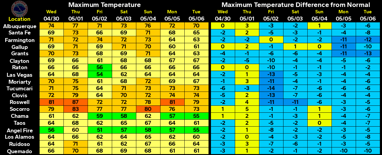
Heavy Snow Possible NE-E NM.
A fast moving upper level storm located in central Arizona early this morning, is forecast to deepen as it swings across NM this afternoon into Friday morning, before exiting the state by Friday night.
A cold front has moved into SE NM early this morning and will continue to push southward with time today. A re-enforcing surge of colder air will arrive tonight. After seeing high temps in the upper 70's yesterday, we are only expecting highs today to be in the mid 50's. Tomorrow will be colder with highs ranging from the mid 40's to the mid 50's across most of SE NM.
| 15 December 2010 | Lat | Lon | ASOS/ COOP | COOP/ WBAN ID* | Record New (8) Tied (3) | Previous Record | Previous Year | Period of Record |
|---|---|---|---|---|---|---|---|---|
| CARLSBAD CAVERNS, NM | 32.18 | -104.44 | COOP | 291480 | 79.0°F | 76.0°F | 1995 | 71 |
| JAL, NM | 32.11 | -103.19 | COOP | 294346 | 79.0°F | 77.0°F | 1996 | 65 |
| ARTESIA 6S, NM | 32.75 | -104.38 | COOP | 290600 | 78.0°F | 78.0°F | 1946 | 100 |
| TATUM, NM | 33.24 | -103.36 | COOP | 298713 | 78.0°F | 75.0°F | 1929 | 83 |
| FT SUMNER, NM | 34.47 | -104.23 | COOP | 293294 | 78.0°F | 73.0°F | 1996 | 91 |
| HOPE, NM | 32.81 | -104.73 | COOP | 294112 | 76.0°F | 73.0°F | 1977 | 62 |
Current thinking and model forecasts are taking the core of approaching winter storm just to our north tonight into tomorrow morning. A Winter Storm Warning is in effect for the Northeastern Plains of New Mexico. A Winter Storm Watch is in effect for the Eastern Plains, including the Santa Rosa, Tucumcari, Clovis and Portales areas.
A mix of light rain showers, light sleet, and light snow is forecast for the Southeastern Plains tonight into tomorrow morning. Current indications are for only light amounts, with a dusting of snow possible in the Guadalupe Mountains, and across the northern sections of Eddy and Lea Counties, as well as Chaves County. Ruidoso and nearby areas may pick up close to an inch of new snow, while the Cloudcroft area may see two- four inches of new snow.
Should the upper level storm now approaching out of Arizona slip just a little further to the south than is currently forecast, then the Sacramento, Capitan, Guadalupe Mountains, and Southeastern Plains would pick up heavier snowfall totals. That isn't looking very promising at this time.
The Truth Is Stranger Than Fiction!


Comments
Post a Comment
Your comments, questions, and feedback on this post/web page are welcome.