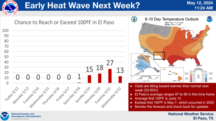
HOT Week Ahead!
Click On The Photo To Enlarge It
Cumulonimbus Mammatus SE Of Carlsbad, NM Mon Aftn.
Did You See The Rainbow?
"Cumulonimbus Mammatus Clouds are: rounded, smooth, sack-like protrusions hanging from the underside of a cloud (usually a thunderstorm anvil). Mammatus clouds often accompany severe thunderstorms, but do not produce severe weather; they may accompany non-severe storms as well."
HOT!
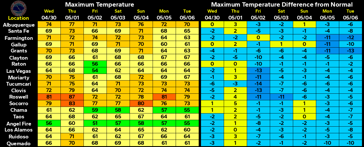
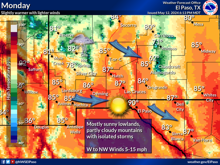
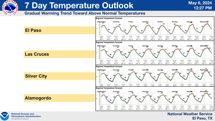
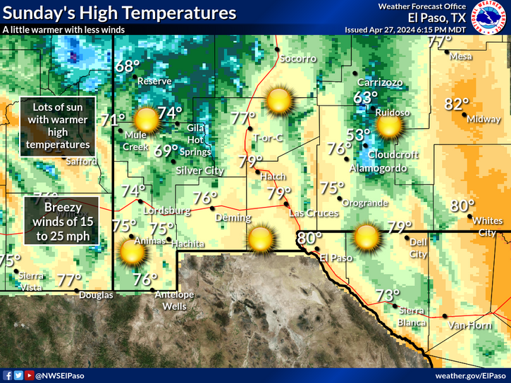
An upper-level ridge of high pressure is anchored over Texas and Mexico and will continue to dominate our local weather for about the next week. Very hot weather is on tap for the area today into the weekend. Afternoon high temps are forecast to range from 100-106 for the rest of this week into the weekend across SE NM. Some daily record high temps may be challenged.
A few scattered high based thunderstorms developed over the east face of the Sacramento Mountains and drifted southeastward out onto the southeastern plains yesterday afternoon and evening. A Severe Thunderstorm Warning was issued by the Midland, Texas NWS Office for Central Eddy County NM from 5:42 - 6:45 PM MDT. So far this morning I have not received any severe weather reports or damage reports concerning this storm.
This is Monsoon Awareness Week in New Mexico. The Albuquerque, El Paso, and the Midland National Weather Service Offices all have links on their web pages with information about this seasonal event that affects our weather to some degree every summer.
Please Click On These Links For Additional Information-
Sunday - Introduction
Monday - Wildfires
Tuesday - Lightning
Wednesday - Flash Floods
Thursday - Downburst Winds & Duststorms
Friday - Heat Stress
Local Rainfall Reports As Of 7:30 AM MDT-
0.9 NE Lakewood .35"
3.4 N Downtown Carlsbad .15"
33.3 WSW Carlsbad - Queen .15"
Dunken Raws .13"
2.6 NNW Downtown Carlsbad .11"
2.1 NNW Downtown Carlsbad .10"
Queen Raws .09"
1.1 NNE Downtown Carlsbad .06"
Ridgecrest Subdivision - Carlsbad .05"
Bat Draw Raws .04"
Paduca Raws .03"
Dark Canyon Raws .01"
Rainfall Totals Are Courtesy Of-
-----------------------------------------------------------------------------
Serpentine Fire Information – 6/6/2011 – 10 pm
Posted on June 6, 2011 by Dan Ware
Start Date & Time: 6/5/2011 0737
Start Location: Near X-Bar Ranch – SW of Carlsbad near Dark Canyon
Cause of Fire: Lightning
Area Vegetation: grass/PJ
Acres Burned: 7984
Ownership(s): majority of acreage on state and private
Incident Commander: Ashley (BLM)
Structures Threatened: 0
Structures Burned: 0
Evacuations (Y or N & #): none
Situation: Fire is actively burning on the east flank. Burn out on around the ranch last night was successful. Resources also burned out along the 137 road. There are 3 miles of unsecure line on the east side of the fire. SEATS are dropping slurry in that area. Thunderheads are building in the area again today and the concern is that the winds will push the fire beyond existing containment lines and further to the east. Decision on whether to put the PEZ type 3 team on the fire will be made at 1400. Continuing to do bucket work on one flank and SEATS are dropping retardant on the opposite flank. In the Serpentine Canyon area there is a slop-over with a possible new start. Additional resources have been ordered and enroute.
PEZ Type 3 team is enroute and will transition at 0800 tomorrow (06-7-11).
% Contained: 0%
% Contained: 0%
Target Containment: unknown
Temperature: 92
Relative Humidity: 15%
Wind Speeds: 14mph
Wind Direction: SSE
Condition of Fire: running
Temperature: 92
Relative Humidity: 15%
Wind Speeds: 14mph
Wind Direction: SSE
Condition of Fire: running
Resources Assigned: Engines- 8 , hand crews- 7, water tenders- 2
Total # of Personnel: 170
Total # of Personnel: 170
The Truth Is Stranger Than Fiction!





Comments
Post a Comment
Your comments, questions, and feedback on this post/web page are welcome.