Warm - Windy - Dry.
Today's Outlook.


A High Wind Warning has been issued for the Guadalupe Mountains until 3 PM MST this afternoon. Southwest-west winds are forecast to be sustained at around 30-45 mph with gusts to near 60 mph. Higher gusts may occur across the higher peaks and ridges.
A Wind Advisory has been issued for Lincoln County until 6 PM MST this evening. Southwest-west winds are forecast to be sustained at around 25-35 mph with gusts near 55 mph.
A Red Flag Warning will go into effect at 10 AM MST for all of SE NM, and will run through 5 PM MST. Today will not be a good day to burn your trash, weeds, fence lines, or ditches.
Another warm and at least breezy day is on tap for us today. A tightening surface pressure gradient, strong winds aloft, and a passing upper-level storm to our north, will help to kick up gusty southwesterly winds in the area later today. Southwesterly winds may gust up to around 30 mph this afternoon. Our afternoon highs today and tomorrow will be mostly in the upper 70's. A few of the normally warmer spots could climb up to around 80.
Monday's Outlook.


A second upper-level storm will sweep across New Mexico Monday and Tuesday. A cold front will move into the area Monday, bringing slightly cooler temps and a chance for a few rain showers and thunderstorms. The best chances for rain will be to our north and east.
A few severe thunderstorms will be possible across parts of west Texas on Monday. Please see the latest outlooks by visiting the Storm Prediction Center's home page.
Thanksgiving Outlook.
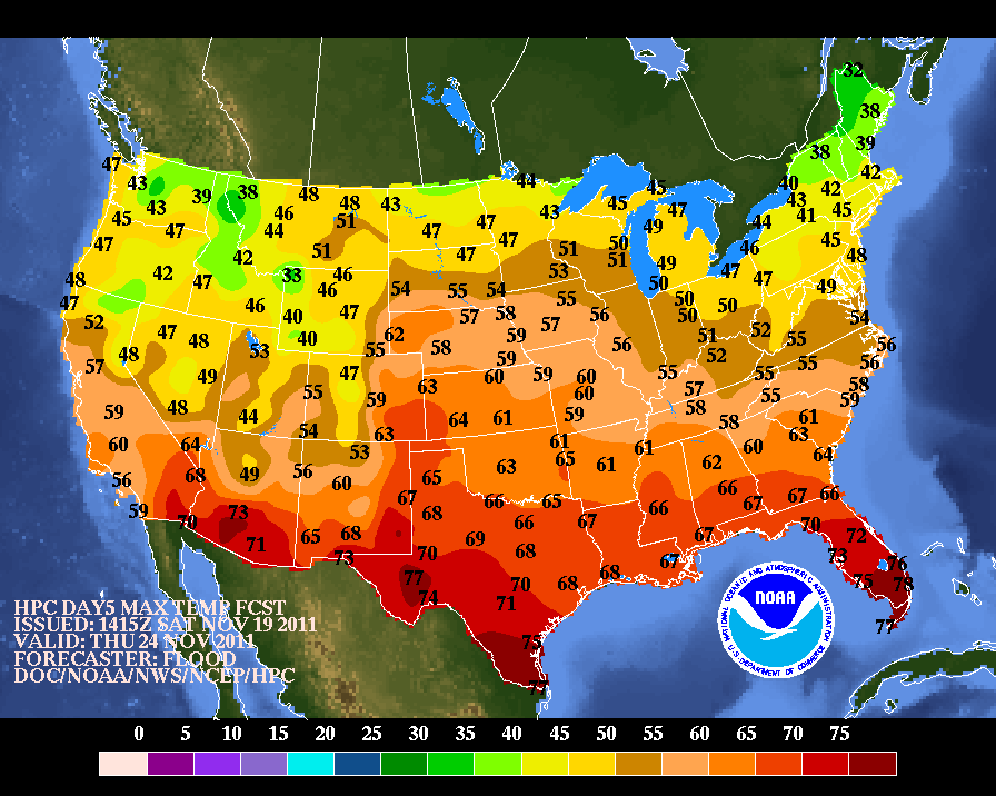
A look ahead to Thanksgiving indicates that we ought to have a fairly nice day weather-wise this year. Forecast models are indicating that an upper-level trough of low pressure will be approaching the Four Corners Region, and this may help to kick up gusty southwesterly winds across SE NM Thursday afternoon. But at this time, it does not appear that we will be dealing with any significant weather problems. It should be warm with highs in the 70's.
The Truth Is Stranger Than Fiction!


Comments
Post a Comment
Your comments, questions, and feedback on this post/web page are welcome.