Windy - Dusty Today!
Winds Will Be On The Increase Throughout The Morning.
Valid From 9 AM - 6 PM MDT.
SW Winds 25-35G50 MPH.
Continues Through 6 PM MDT
SW Winds 35-45G65 MPH.
Continues Through 6 PM MDT.
SW-W Winds 35-45G55-65 MPH.
Continues Through 4 PM MDT.
SW Winds 30-40G55-65 MPH.
Today will be one of those days when I stay inside and out of the wind and dirt. A few mountain rain and snow showers will be possible today across the Sacramento's but nothing significant is anticipated from this storm. We are in a progressive upper level pattern with one storm after another affecting the area about every 3-4 days. Unfortunately these fast moving upper-level storms are dry windbags, and not rain and snow producers for southeastern New Mexico.
A strong upper-level trough of low pressure was entering southwestern New Mexico early this morning. Mid-level winds associated with this trough at the 500 millibar or 18,000' MSL were in the order of 90-100 knots (104-115 mph). At the surface a Pacific cold front was entering western New Mexico, and will sweep eastward into southeastern New Mexico by around noontime.
Southwesterly winds are forecast to increase across the area this morning, and really ramp up by noontime. Southwest winds sustained at around 25-35G50 mph are anticipated across the lower elevations of the southeastern plains. These winds will gradually subside after sunset.
Areas of blowing dust are forecast to develop across southern New Mexico, southeastern New Mexico, as well as west Texas. Sudden drops in the visibility down to less than 1 mile will be possible across the area today, especially over and near freshly exposed or plowed farmlands, fields, lots, and construction sites.
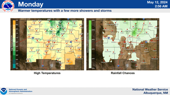
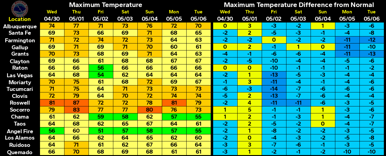
Our afternoon high temperatures will climb up into the low-mid 70's today ahead of the front. Tomorrow will be cooler with highs in the 60's. Our temperatures will rise back up into the 70's on Monday ahead of the second storm poised to affect the Land of Enchantment. We should only be in the 50's by next Tuesday and Wednesday.
The Truth Is Stranger Than Fiction!






Comments
Post a Comment
Your comments, questions, and feedback on this post/web page are welcome.