Back To Hot & Dry.
Blog updated at 12:50 PM MDT.
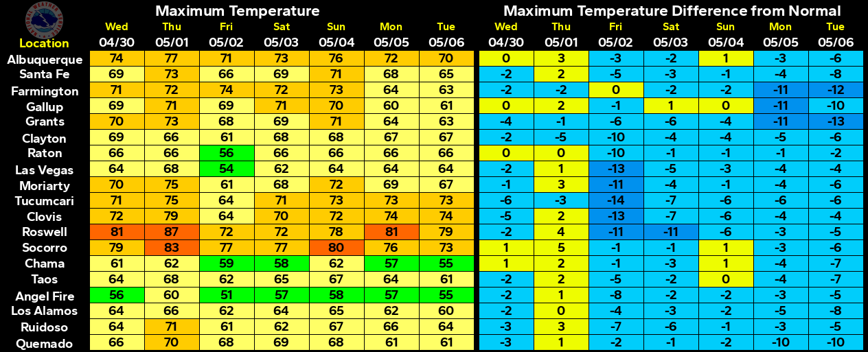
The map above looks more like an early fall temperature
map than an early summer map. Remember that the
meteorological summer begins Fri, June 1st.
Say Goodbye To The Rain.
Scattered thunderstorms fired up late yesterday afternoon. Severe Thunderstorm Watch #301 was issued for NE/E/SE New Mexico and parts of west Texas until 9 PM MDT. As of 9:45 AM MDT this morning there have not been any severe weather reports submitted to our local National Weather Service Offices, at least none that I can find in their storm reports. Some of us did manage to get wet while most of us missed out.
A dry Pacific cold front will swing eastward across the state today, catching up to the dryline in southeastern New Mexico, and shoving our low-level supply of moisture from the Gulf of Mexico off to the east into west Texas by this afternoon.
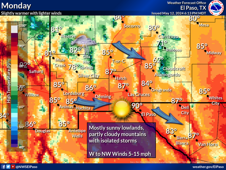
Our afternoon high temperatures today will be in the mid 90's accompanied by southwesterly wind gusts to around 25-30 mph. Highs on Memorial Day will be in the mid-upper 90's. Highs on Tuesday will range from 96 - 100.
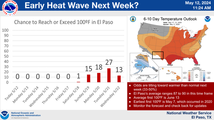
Our next shot of t-storms and cooler temps may occur by the end of next week as the models are forecasting a cold front to move south into the local area. Although there is a great deal of uncertainty at this time, the models are also hinting at the possibility of another Southwestern US storm by the end of next week.
Local rainfall totals.
Paduca Raws - Near The WIPP Site .81"
8.3 SSE Hobbs .58"
33.3 WSW Carlsbad - Queen .40"
Hobbs Airport .30"
South Hobbs .25"
Caprock Raws .16"
Northwest Hobbs - KM5BS .14"
Bowl Raws - North of Guadalupe Peak .12"
6.8 NW Carlsbad .12"
Carlsbad Airport .05"
Queen Raws .05"
Bat Draw Raws - Carlsbad Caverns Visitor Center .04"
Knowles .02"
Dog Canyon - SW of Queen .01"
McKittrick Canyon Raws .01"
2.1 NNW Downtown Carlsbad .01"
Derrick Ranch - W of Lovington .01"
Rainfall Totals Are Courtesy Of-
This mornings update on the massive Whitewater-Baldy Complex Fire continues to indicate that the fire continues to rage out of control in the Gila Mountains of southwestern New Mexico. As of this mornings update the fire has burned 122,388 acres of forest. It was started by lightning on May 16th. The burn continues to burn out of control 15 miles east of Glenwood and is 0% contained.
Firefighters are having a very difficult time trying to fight this fire due to the high winds, steep and rugged terrain, and very dry conditions. There are 604 fire fighters fighting this fire, and it currently is the largest wildfire in the US. To date there have been five injuries from the fire. The historic ghost town of Mogollon has been evacuated. At last count there had been 12 homes lost to the fire, and at least 14 outbuildings. Firefighters managed to save some 30 homes in the Willow Creek area.
The Truth Is Stranger Than Fiction!
My Web Page Is Best Viewed With Google Chrome.


Comments
Post a Comment
Your comments, questions, and feedback on this post/web page are welcome.