HOT This Week!
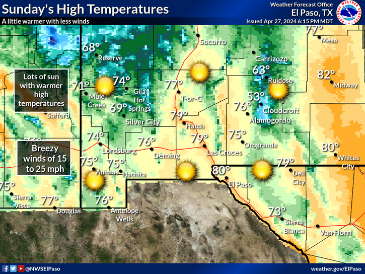
Regional 3 PM MDT Temperature Map.
Local 3 PM MDT Temperatures.
Its hot out there! I do believe that the dog days of summer have arrived. A stubborn upper-level ridge of high pressure was centered over the Texas Panhandle today. For the most part this ridge will pretty much remain parked over the area into the weekend. The close proximity of the ridge has shunted our summer monsoonal flow westward into Arizona, leaving southeastern New Mexico high and dry.
As of 3:30 PM here are some of our local afternoon high temperatures so far this afternoon:
8-Mile Draw Raws - NE of Roswell 104
8-Mile Draw Raws - NE of Roswell 104
Paduca Raws - Near WIPP 100
Carlsbad - NMAQ 100
10 ESE Hagerman 99
2.1 NNW Downtown Carlsbad 99
Carlsbad Airport 99
Roswell Airport 98
Artesia Airport - HCN 98
Hobbs Airport 95
Dunken Raws 93
Smokey Bear Raws - Ruidoso 90
Queen Raws 88
Weed - DRO 87
Mayhill Raws 86
Timberon 82
Cloudcroft Fire Station 80
Cloudcroft - Dry Canyon 79
Sacramento Peak - Sunspot 71
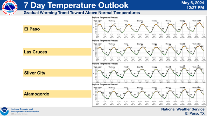
Forecast High Temperatures This Week-
The Rest Of This Week.
No relief is in sight for this week, in fact triple digit temperatures are expected for most of us right on into the weekend. Our overnight lows will be comfortable with a dry airmass in place and will range from the upper 60's to the low 70's this week.
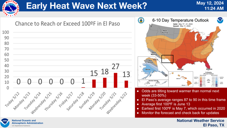
Take a look at the 6-10 day, and the 8-14 day long-range temperature and long-range precipitation forecast probability maps below. August looks like it is going to start off hotter than normal as well as drier than normal.
6-10 Day Outlook.
8-14 Day Outlook.
Tropical Atlantic Becoming Active.
A weak area of low pressure (Invest 99L) associated with a tropical wave was located 900 miles southwest of the Cape Verde Islands today. It is moving west at 10-15 mph. This disturbance is forecast to continue on this course for most of this week. Some slow strengthening is likely in time, but until it gets a little further north away from the weaker surface winds just north of the Equator, little significant strengthening is likely.
The Truth Is Stranger Than Fiction!
My Web Page Is Best Viewed With Google Chrome.


Comments
Post a Comment
Your comments, questions, and feedback on this post/web page are welcome.