Wet Week Ahead & Hot Into Wednesday.
Light Rain Showers In Carlsbad, NM This Morning.
Scattered light rain showers covered the Pecos Valley this morning. As of 7 AM this morning only .01" had been reported at the CoCoRaHS station 3.5 NNE of Artesia. I managed to pick up .02" here at my home in Carlsbad between 7 - 9 AM.
Two people were killed, two remain in critical condition after
a 17 vehicle pileup on I-20 was apparently caused by the
dust storm at 6:45 PM CDT yesterday.
Our afternoons with continue to be seasonably hot with highs ranging from the upper 90's to near 100 today and tomorrow. A slow moving weak cold front is forecast to move into the southeastern plains Wednesday night or early Thursday morning. It will only knock our daytime highs back down into the low-mid 90's Thursday and Friday.
We will see an increase in thunderstorm activity across the area today into Friday. Monsoonal moisture streaming northward from Mexico will increase across the area and interact with the approaching cold front.
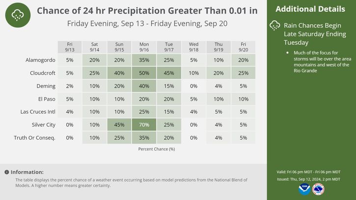
In addition a couple of upper-level disturbances moving westward out of Texas will increase instability and lift in the atmosphere, which will further aide in the development of scattered thunderstorms. Some of these storms may last well into the nighttime hours. Our rain chances across the southeastern plains generally will range from 20% - 30% today into Wednesday, and will increase to 40% by Thursday.
Slow movement of these thunderstorms may produce locally heavy rainfall across the area this week. This may lead to a flash flood threat over southeastern New Mexico later this week. Special concerns will be centered over and below the burn scars in the mountains.
The Truth Is Stranger Than Fiction!
My Web Page Is Best Viewed With Google Chrome.


Comments
Post a Comment
Your comments, questions, and feedback on this post/web page are welcome.