Significant Winter Storm Today Into Friday. Heavy Snow Likely!
Last Nights 06Z/11 PM MST NAM 500 MB Forecast.
Valid At 5 AM MST Friday January 4, 2013.
Last Nights 06Z/11 PM MST NAM 500 MB Forecast.
Valid At 2 PM MST Friday January 4, 2013.
Estimated Using The El Paso NWS Doppler Radar.
El Paso (KEPZ) NWS Dual-Pol Doppler Radar Snapshot At 5:58 AM MST.
Radar Is In The "HHC" Mode.
My SE NM Radar Snapshot At 6:00 AM MST.
Midland NWS Doppler Radar In "Winterize Mode."
My SE NM Radar Snapshot At 6:07 AM MST.
El Paso NWS Doppler Radar In "Winterize Mode."
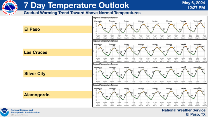
Snow is increasing on area radars across southern New Mexico and northern Mexico early this morning. This activity will increase in coverage and intensity throughout the day today.
A Significant Winter Storm is poised to hammer the local area today into Friday with lots of snow, some of which is going to be heavy. Areas highways are likely to become extremely hazardous!
Last nights computer model runs are pretty much in agreement that a potent closed, or possibly even a cutoff mid-upper level low located to our southwest, in the Baja Region this morning, will slowly drift northeastward today into tomorrow. A secondary piece of upper level energy is forecast to drop into the low later today, thus reenforcing the storm, as well as deepening it over the southern part of the state. This means a slower and stronger winter storm for us. Its currently not forecast to clear the area until Friday night.
Low level moisture has been on the increase across southeastern New Mexico overnight. Mid and high level moisture is also starting to get ingested into the mid-upper level low to our southwest. Cold air is already in place across the area, so now the stage is set for a significant and widespread heavy snow event for southern New Mexico, parts of southeastern New Mexico, and parts of west Texas.
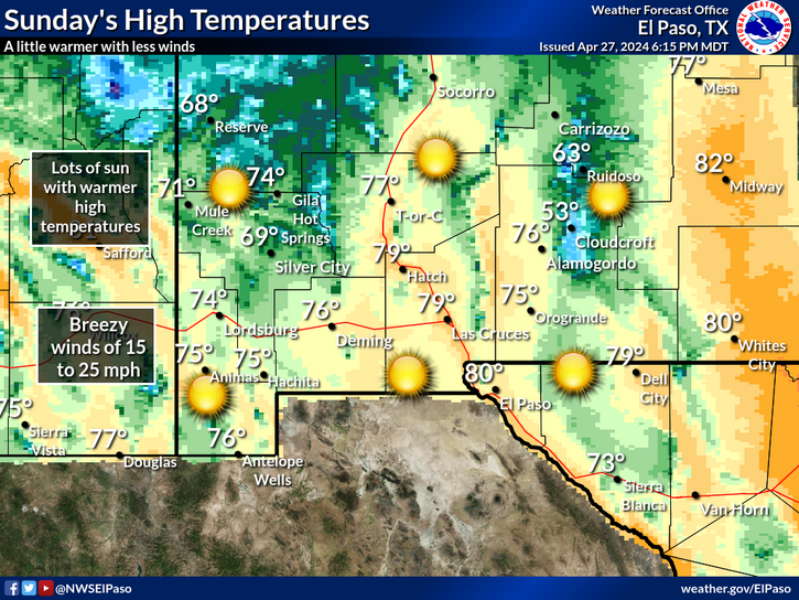
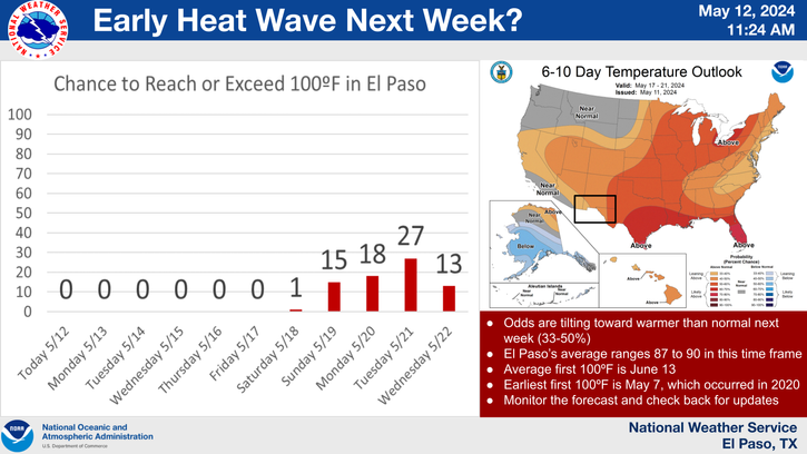
Generally speaking we can expect to see 4" - 6" snowfall accumulations within the first 12 hours of the storm. Storm totals by Friday night are forecast to reach 4" - 8" with isolated 10" totals possible in some locations.
Should this storm stall a little longer than forecast over the southern half of the state, then we may possibly see even greater snowfall totals than these in a few spots. Snowfall totals may vary across the area with some of us getting a lot of snow while others maybe not so much. Just who gets the greatest amounts of snowfall from this storm will be highly dependent upon the exact track of the mid-upper level low as is slowly crawls across the area over the next 24-36 hours.
Please use the graphics and maps posted above with caution and only as a guide. Please visit the following local National Weather Service Web Pages for the very latest on this impending Significant Winter Storm to impact much of the area.
Midland
Midland
Suffice to say that our local roadways are going to become a nightmare today into tomorrow. This will be especially true given the increased traffic from the oil field activities of late. Its entirely possible that we may see some local road closures due to heavy snowfall, areas of blowing and drifting snow, and icy spots on roadways, especially overpasses and bridges. Please visit this link for all of the latest road conditions across the state.
I have some concerns about this being a wet and heavy snow. This would be a good thing for the countryside, since we desperately need the moisture. But if this snow is wet and heavy, then we may see some power outages due to downed power lines from snow laden trees limbs.
The Truth Is Stranger Than Fiction!
My Web Page Is Best Viewed With Google Chrome.


Comments
Post a Comment
Your comments, questions, and feedback on this post/web page are welcome.