High Winds & Blowing Dust Return Wednesday.
A very active week weather-wise in on tap for the area. A powerful upper-level storm, located over the Gulf of Alaska this morning (circled in red on the NAM 500 MB map above), will dive into the Four Corners Region by around sunset Wednesday. New Mexico will get blasted by high winds, blowing dust, and snow from this storm.
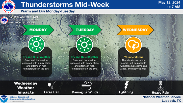
The dryline will set up near the NM/TX state line, which provide the focus for thunderstorms to fire up along and east of it. Some of these may even be severe with surface based cape values of around 1,000 j/kg, lapse rates of 8.0 to 8.5 c/km, and 0 to 6 km bulk shear values forecast to be 60 - 70 knots.
Valid At 5 PM Tuesday.
Valid At 5 AM MST Wednesday.
Valid At 5 PM MST Wednesday.
As this next potent winter storm approaches the state on Wednesday, the surface pressure gradient will rapidly tighten up as the surface low rapidly deepens over the Texas and Oklahoma Panhandles.
A 120 KT/138 mph 500 millibar wind speed max is forecast by this mornings run of the NAM model to be entering the area by around noontime Wednesday. This feature along with the tight surface pressure gradient, and approaching Pacific Cold Front, will all combine to make for one very windy and dusty day across the area.
Strong southwesterly winds may kick up as early as Tuesday afternoon across parts of the local area also. I suspect that we will see gusts of around 50 -65 across the local area on Wednesday.
A High Wind Watch has already been issued for the Guadalupe mountains for Wednesday. Southwesterly winds are forecast to increase to sustained speeds of around 40 - 50 mph with gusts of 70 mph.
A High Wind Watch has been issued for southern New Mexico as well for southwesterly winds that are forecast to increase to sustained speeds of 35 - 45 mph with gusts to around 65 mph on Wednesday.
Areas of blowing dust will likely plaque the area also. Widespread clouds of blowing dust appear possible on Wednesday. As has been the case during this current ongoing drought, the worst conditions will occur over and near open and freshly plowed fields and farmlands, exposed lots and construction sites. Sudden drops in the visibility in these locations of down to near zero with little to no advanced warning will be possible.
Critically Dangerous Fire Weather Conditions will also develop over the area. Any wild fire that may accidentally get started will have the ability to rapidly spread and grow in the high winds. So please refrain from any type of outdoor activity that will involve the use of sparks or flame.
Yet another storm will arrive by Thursday and Friday, with a third due to impact the state late this upcoming weekend.
The Truth Is Stranger Than Fiction!
My Web Page Is Best Viewed With Google Chrome.






Comments
Post a Comment
Your comments, questions, and feedback on this post/web page are welcome.