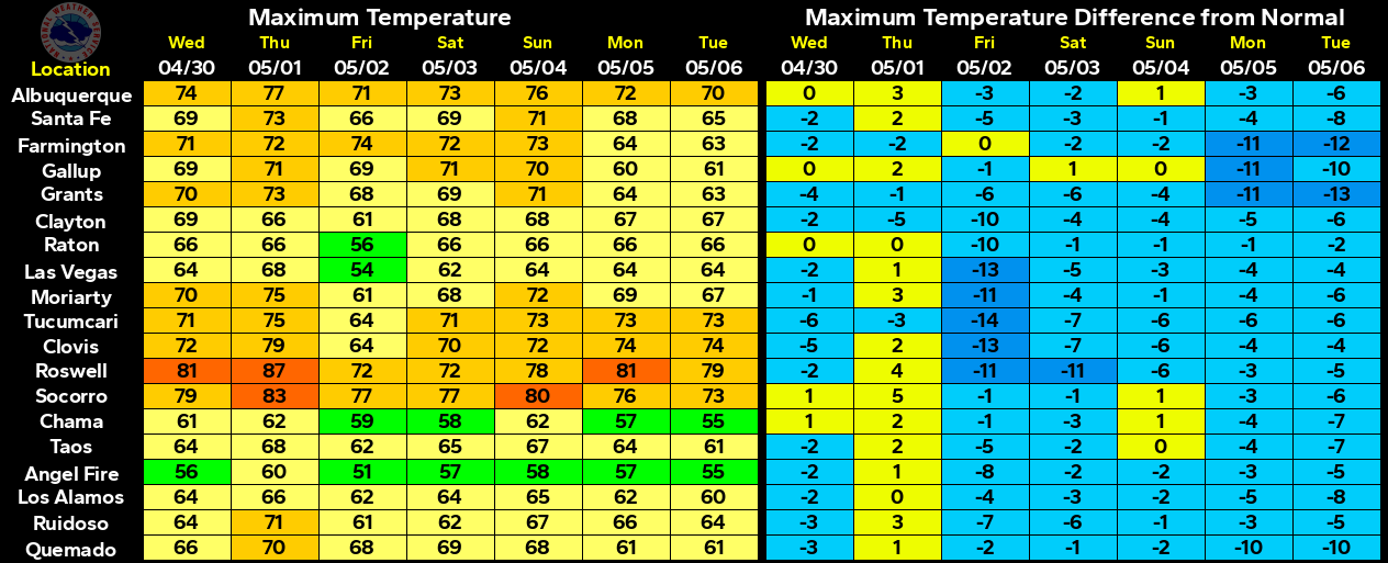
New Daily Record High Temps Possible Today & Saturday.


Apparently we are going to skip spring today and tomorrow, and head straight into summer-like temps.


New near record to record daily high temperatures will be possible today and Saturday across much of New Mexico, including the southeastern plains and surrounding areas. Listed below are some of the local records.


Today= 87 in  2007 & earlier years.
Saturday= 90 in 1908


Today= 88 in 1989.
Saturday= 91 in 1925


Today= 90 in 1908.
Saturday= 92 in 1908.


Today= 86 in 1966.
Saturday= 85 in 2012 & earlier years.


Today= 85 in 1974.
Saturday= 86 in 1989.

The Truth Is Stranger Than Fiction!

 My Web Page Is Best Viewed With Google Chrome.

Comments

Current NWS National Watches/Warnings In Effect

Current NWS National Watches/Warnings In Effect
Click On The Map For The Latest Updates

New Mexico

Current Watches In Effect

SPC Mesoscale Discussions

Storm Prediction Center (SPC) Day 1 Outlook

NWS Regional Radar

NWS Regional Radar

NWS Midland Radar

Cannon AFB Radar

NWS Albuquerque Radar

Holloman AFB Radar

NWS El Paso Radar

NWS Lubbock Radar

GOES-East - Sector view: Southern Rockies - GEOColor

Current US Temps

Current US Wind Chill/Heat Index Temperatures

NWS Midland Regional Forecast

NWS Midland Regional Forecast

NWS Albuquerque Regional Forecast

NWS Albuquerque Regional Forecast

NWS Albuquerque Regional Forecast

NWS Albuquerque Regional Forecast

NWS Albuquerque Regional Forecast

NWS Albuquerque Regional Forecast

NWS El Paso Regional Forecast

NWS Lubbock Regional Forecasts

NWS Lubbock Regional Forecast.

NWS Forecast High Temps Today

NWS Forecast Low Temps Tonight

24-Hour Minimum Wind Chill Forecast

NWS Albuquerque Storm Total Snowfall Forecast

NWS Albuquerque Storm Total Rainfall Forecast

NWS Midland Storm Total Rainfall Forecast

NWS El Paso Storm Total Rainfall Forecast

Average Daily High/Low Temperatures & Rainfall

Average Daily High/Low Temperatures & Rainfall