Severe T-Storms Today - Heavy Rains & A Flash Flood Threat Today Into Thursday At Least.
Early this morning the strong mid-upper level closed low that is responsible for our latest round of active weather was located over southern California. This storm is forecast by the models to continue digging slowly to the southeast and by Thursday it should be located near the El Paso, Texas area. There are concerns that it may linger just south of the US and Mexican border into the weekend, thus agitating our next heavy rain and flash flood event that begins later today and continuing into at least Thursday.
Today's Severe Weather Outlook.
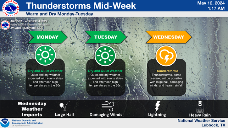
Severe thunderstorms are forecast across southwestern, southern, and parts of southeastern New Mexico as well as parts of far West Texas this afternoon and evening. As of this writing the primary severe weather threats appear to be large hail, damaging thunderstorm wind gusts in excess of 60 mph, frequent deadly cloud to ground lightning, and heavy rainfall that may cause flash flooding. Severe thunderstorms may also affect parts of the local area again on Wednesday.
Valid @ 6 PM MDT Saturday, Oct 10, 2015.
Valid Today Into Friday.
Round two of thunderstorms and heavy rain begin this afternoon and ramp up tonight into at least Thursday. A Flash Flood Watch has been issued for southeastern New Mexico, southern New Mexico, and parts of far West Texas. Additional Flash Flood Watches/Warnings may be issued and extended for the area depending upon the track and speed of the strong storm approaching for the west.
For now it appears that an additional 1" - 2" of rain will fall over and near the watch area with local totals possibly even higher. This on top of the 1" - 4" totals that have already fallen the past several days. Thus we face an enhanced flash flood threat and any heavy rains that fall will quickly lead to flash flooding especially in those areas hardest hit by the recent heavy rains. Personally I think that our storm total rainfall amounts may very well be in the 3" - 6" range with a few spots possibly receiving greater amounts.
I realize that most of us think that our vehicles can swim, especially trucks, and semi's but the sad reality is that they can't! We've experienced several flash flood events here locally over the past five years and it goes without fail that each time this happens, our local officials are out conducting high water rescues. Flash flooding is New Mexico's most dangerous weather threat. Not to minimize our tornado threat and other severe weather threats but more injuries and deaths have occurred from this phenomena than the others.
More lives have been lost in the state from flash flooding than from tornadoes. Most flash flood deaths occur at night when its harder to determine the depth of water of a roadway. Chaves, Eddy, and Culberson Counties are high risk areas because of their location near the Guadalupe, Sacramento, and Capitan Mountains. Runoff from these mountains can flow east down our numerous arroyos for up to 100 miles and affect communities and locals where rain may or may not be falling.
Please folks, never attempt to cross a flooded arroyo either on foot or in a vehicle...there are hundreds of them in southeastern New Mexico and nearby areas. When they flood they fill up quickly with fast flowing muddy water that is filled with all kinds of debris including rattlesnakes. Please avoid flooded intersections and streets if at all possible. Never let your children play in flooded streets and intersections. This goes for Eagle Draw which runs through the heart of Artesia. Rafting in these flood waters is a foolish and extremely dangerous idea also.
Its simple folks. Remember this-
TURN AROUND - DON'T DROWN!
TURN AROUND - DON'T DROWN!
The Truth Is Stranger Than Fiction!






Comments
Post a Comment
Your comments, questions, and feedback on this post/web page are welcome.