A Little Cooler Today - But Heating Back Up Starting Sunday.
Visible Satellite Image Friday Showing New England Snow Cover.
Meanwhile I Recorded A High Temp Of 90ºF Here In Carlsbad, New Mexico. By The Way Boston Is Looking AT 1"-3" Of Additional Snow Tonight Into Sunday Night.
A Little Cooler Today But Heating Back Up Starting Sunday.
Surface Map Analysis @ 6 AM MDT Saturday, March 18, 2017.
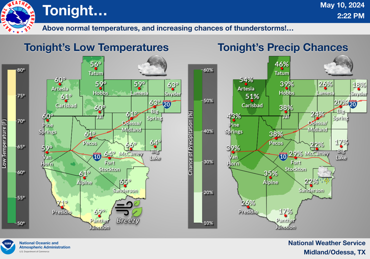
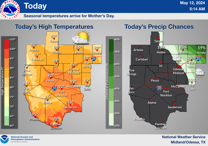
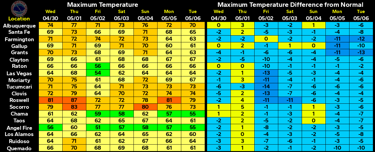
A weak cold front has moved into the local area this morning. Therefore today will be a little cooler compared to the past couple of days. Our afternoon highs are forecast to range from the 60's and 70's in the mountains to the low to mid 80's across the Southeastern Plains and West Texas, and the upper 80's across Southern New Mexico.
Today.
Sunday.
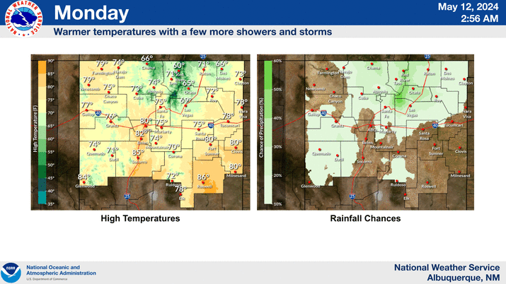
Monday.
For those of you who are loving our 90 degree days, not to worry they will return starting Sunday and we will likely see these temps into Wednesday. Our current forecast high temp in Carlsbad for Monday is 93ºF.
Changes Coming The Middle To End Of Next Week.
Valid @ Noon MDT Thursday, March 23, 2017.
ECMWF 500 MB Forecast.
Valid @ Noon MDT Thursday, March 23, 2017.
Our next weather maker is forecast to arrive by the middle of next week as a strong mid and upper level trough of low pressure digs southeastward into the Desert Southwest. Higher mountain snows and lowland rain showers will be possible over the Western and Northern areas of New Mexico Wednesday into Friday.
It also appears that the dryline will set up along the New Mexico and Texas State line. So there will be at least a chance for severe thunderstorms along and east of it.
Unfortunately the wind machine will crank up again as the storm approaches so Thursday and Friday looks windy and dusty for the local area.
REALLY BLANK SUN: The sun has been blank (no sunspots) for 12 consecutive days. If today ends without a sunspot, the number will increase to 13, matching the longest stretch of blank suns since April of 2010. This is yet another sign that the sunspot cycle is crashing toward a deep minimum expected in 2019-2020. Is space weather coming to an end? On the contrary, now is when things get interesting: Solar Minimum brings extra cosmic rays, pink auroras, and more.
Sunspot number: 0
What is the sunspot number?Updated 18 Mar 2017
Spotless DaysCurrent Stretch: 12 days
2017 total: 24 days (32%)
2016 total: 32 days (9%)
2015 total: 0 days (0%)
2014 total: 1 day (<1%)
2013 total: 0 days (0%)
2012 total: 0 days (0%)
2011 total: 2 days (<1%)
2010 total: 51 days (14%)
2009 total: 260 days (71%)
Updated 17 Mar 2017
The Truth Is Stranger Than Fiction!






Comments
Post a Comment
Your comments, questions, and feedback on this post/web page are welcome.