Hot The Rest Of The Week - Windy & Hot Friday.


Back up to Saturday's forecast for severe thunderstorms across Southeastern New Mexico and parts of West Texas nearby...didn't happen. In fact we didn't even get a thunderstorm much less one that was severe. This even though the National Weather Service Storm Prediction Center (NWS SPC) having placed us in the "Slight Risk Category." This happens from time to time and it won't be the last time either. Just another reminder of just how complicated the atmosphere really is and sometimes no matter how hard forecasters try to get their forecasts right...they will be wrong. Meteorology is and always will be an "inexact science."
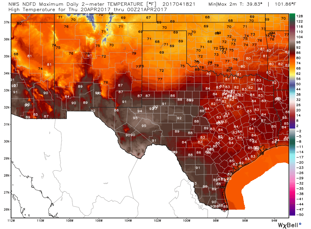
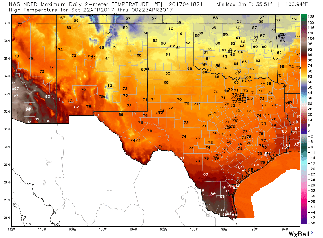
So it was hot again today...94ºF here at our home in Carlsbad. Similar readings are forecast for the local area Wednesday into Friday. By Friday night a strong cold front will sweep across the area knocking our daytime highs down into the 70's for Saturday and Sunday. Maybe even a few 60's in a few spots. Lows Saturday and Sunday morning will be in the 40's.
Hot The Rest Of The Week.
(Windy & Hot Friday).

Valid @ Noon MDT Friday, April 21, 2017.

Valid @ Noon MDT Friday, April 21, 2017.
Surface Dew Point Temperature Forecast.

Valid @ Noon MDT Friday, April 21, 2017.
Next storm in line to barrel southeastward into the Four Corners Area arrives Friday morning. A fairly deep surface low will setup in the Texas Panhandle and combined with strong winds aloft that will work their way down to the surface...Thursday and Friday look to be windy and hot. Friday will be the windiest day with southwesterly winds likely gusting up into the 35-50 mph range if not higher in a few spots.
By noontime Friday the dryline gets shoved east into Central Texas. Very dry air will cover us with surface dew points in the single digits with a few dew point temperatures dropping below zero. Thus relative humidity values locally will be in the single digits. Thus killing any chances of getting wet.
Wednesday.

Thursday.
Friday.

Saturday.
The Truth Is Stranger Than Fiction!


Comments
Post a Comment
Your comments, questions, and feedback on this post/web page are welcome.