T-Storms Increase Tue Night Into Wed Night - Possibly Severe Wednesday!
A simple rule to follow during any thunderstorm whether or not if it is severe or not. "If Thunder Roars - Go Indoors." I've lost track of how many times I have posted this on my blogs, emails, and on social media over the past ten years. Lightning can strike outside of a thunderstorm up to ten miles and some think maybe as far as twenty miles. It does not have to be raining at your location for a lightning strike to occur.
Every spring, summer, and fall many of our local residents come out to celebrate their children, grandchildren, friends, etc who are engaged in outdoor sporting events. At any given time during this time there are thousands of people at baseball fields, football games, track meets, and other sporting events across New Mexico and nearby states. I've also lost track of the number of these events that were allowed to continue during thunderstorms. Campers and hikers are also at a higher risk in our mountains due in part for the fact that more thunderstorms occur over the mountains than over the plains.
We've been blessed, lucky, or both given that we have not had that many lightning strike fatalities, although there have been many injuries over the past fifty years or so.
Notice that the statistics on the chart above indicate that men are more likely to be hit by lightning than women. Why? Research has shown that men are outdoors more when struck, often at work, or playing golf, or fishing. and are more reluctant to seek shelter during a storm. Yes ladies we tend to be stubborn and skeptic during storms. (My opinion only which may not necessarily be yours).
Yesterday I mentioned the possibility of severe thunderstorms from Tuesday night into Thursday. This looks (as of 6:00 PM MDT Monday) a little less likely for Tuesday. However you can never rule out the possibility of severe thunderstorms this time of the year so one or two thunderstorms could possibly become marginally severe Tuesday evening or night.
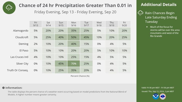
Our chances for rain across Southeastern New Mexico currently (as of 6 PM MDT Monday) range from 30% to 40% Tuesday night to 60% to 70% on Wednesday, and around 40% Wednesday night.
Wednesday is looking more like the better day for severe thunderstorms across the local area. Large hail, damaging winds in excess of 58 mph, locally heavy rainfall, and deadly cloud to ground lightning strikes will be on the increase Wednesday into Wednesday night locally.
Wednesday is looking more like the better day for severe thunderstorms across the local area. Large hail, damaging winds in excess of 58 mph, locally heavy rainfall, and deadly cloud to ground lightning strikes will be on the increase Wednesday into Wednesday night locally.
(6 PM MDT Tonight - 6 PM MDT Thursday).
The Truth Is Stranger Than Fiction!


Comments
Post a Comment
Your comments, questions, and feedback on this post/web page are welcome.