Heat Begets Drought - Drought Begets Heat!
New Mexico Of Late!
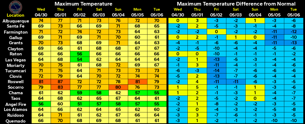
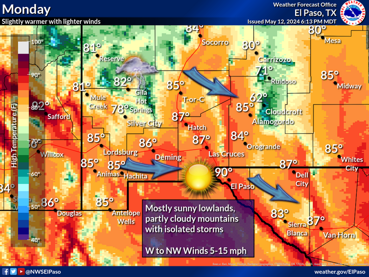
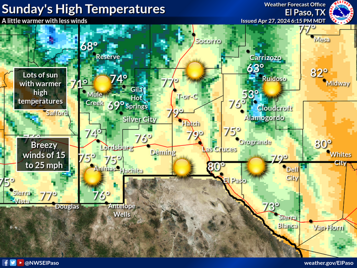
NWS NDFD Forecast High Temperature Anomalies.
(Today - Friday).
Today (Friday, May 11, 2018).
Today (Friday, May 11, 2018).
Today (Friday, May 11, 2018).
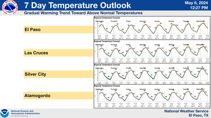
(GEFS Ensemble Forecasts).
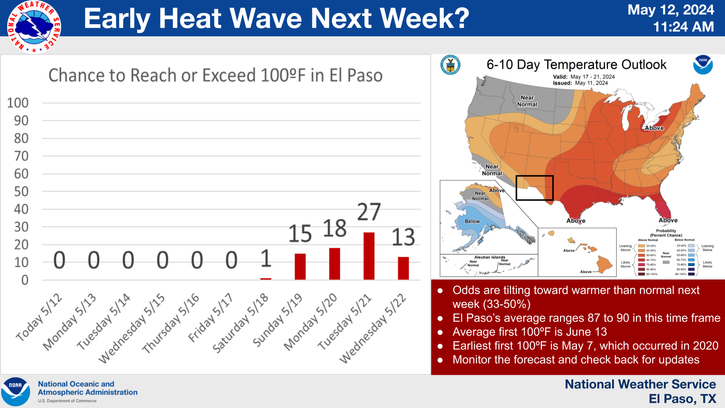
Note: Our High Temps Will Likely Reach Or Top 100ºF Over The Next Week To Ten Days. The Theme Here Is That The Heat Is Here To Stay For The Near Future With Above Normal Temps.
Drought & Heat Drags On.
High Pressure & Low Pressure Systems.
Cyclones Are Low Pressure Systems .
Anticyclones Are High Pressure Systems.
One basic law of meteorology is this...heat begets drought and drought begets heat. Sounds like these two conditions produce or feed off of each other and in a way they do. As the vegetation and soil dries out during a drought, this naturally causes higher air temperatures. Due to less and drier vegetation, and less moisture in the soils and atmosphere, the air temperature gets hotter.
Fifty years ago (I was ten at the time) my granddad taught me this "old farmers forecasting trick". Question: When is it going to rain? Answer: When the west wind quits blowing. Question: When will the west wind quit blowing? Answer: When it rains.
There is a tremendous amount of truth in that. We have two sources of moisture that produce our rain and snow here in Southeastern New Mexico, West Texas, and nearby areas. The Gulf of Mexico from which our low level southeasterly upslope originates. The other source region is the southeastern Pacific Ocean. From which we get our mid level (subtropical) moisture from. This occurs most often during the summer months during our annual monsoon season.
Cutoff or closed mid and upper level lows that drop or form over the Baja Region northeastward to near us draw this moisture northward and northeastward into the area. This can occur any time of the year but is more prominent during the fall, winter, and spring.
During droughts you often find a stout or strong ridge of high pressure in the mid and upper levels of the atmosphere camped over the Desert Southwest or nearby. When the center of these "heat" ridges are located overhead then we often see record breaking high temperatures and often droughts. Heat lows are usually located over the Desert Southwest as well.
In the wintertime strong surface high pressure systems are often associated with very cold air masses. Strong surface and mid and upper level lows in the wintertime produce blizzards, snow storms, and sometimes severe thunderstorms.
The air flows into or upward into areas of low pressure. The air flows out of or downward from high pressure. During the summertime the air descending downward from an overhead heat ridge compresses and warms as it descends. Hot or warm dry downsloping southwesterly winds descending off of our mountains to our southwest and west heat up as they flow from the mountain tops down into and out onto the plains. This also causes compressional heating...basically raising up surface temperatures up higher.
Hot dry southwesterly winds at the surface being drawn up into the area from Mexico and the Chihuahua Desert also are a factor in our droughts and heat waves.
This is a way simplified explanation of some of the factors and conditions that control our weather.
Drought Drags On.
(
The Truth Is Stranger Than Fiction!





Comments
Post a Comment
Your comments, questions, and feedback on this post/web page are welcome.