Our Windy Season Is Upon Us.
Blog Updated At 2:40 PM MST Sunday.
February 1st, 2019.
South Of Artesia, New Mexico,
Virga filled the skies around Southeastern New Mexico on the first day of February. Virga is vertically inclined trails of precipitation (rain, snow, sleet, hail) that falls from the cloud bases but evaporates in the drier air below the clouds before it reaches the ground. Virga is a common sight locally.
Windy Monday & Again On Thursday.
Valid At 11 AM MST Monday.
An upper level trough of low pressure will swing across northern New Mexico on Monday which is forecast to produce windy weather across much of the state. Light snow showers will fall over the higher terrain of the state today into Tuesday but nothing significant as far as snowfall totals are forecast.
Valid At 5 AM MST Monday Morning.
Strong winds aloft will mix down to the surface on Monday. In addition a Pacific cold front is forecast to sweep across the state by Monday afternoon. A tight surface pressure gradient combined with the strong winds aloft will produce a windy day across the area.
With yet another approaching upper-level storm on Thursday it appears that we have even stronger winds and more widespread blowing dust then.
(Eddy & Lea Counties).
(Guadalupe Mountains).
(Chaves County).
(Lincoln County & SW Chaves Counties).
(Otero County).
Strong southwesterly to westerly winds are forecast to develop across the local area Monday morning. Gusts to 55 to 60 mph will be common across the southeastern plains. Stronger gusts of 60 mph will occur in the Sacramento Mountains. Gusts to 80 mph forecast for the Guadalupe Mountains. These winds will shift to the northwest with the frontal passage and abate by around midnight.
Areas of blowing dust will likely develop especially over the more dust prone locations such as: Freshly plowed farmlands, open or exposed fields and lots, construction sites and areas of bare ground without grass cover. Sudden drops in the visibility in and near these areas may occur with little to no advanced warning. Blinding dust storms that may reduce the visibility down to near zero may affect some of our local roadways.
A Red Flag Warning is also in effect for the Southeastern Plains due to the forecast low relative humidity values, strong winds, and very dry conditions. Please avoid or refrain from any outdoor activity that involves the use of sparks or flame. Any accidental fire that may get started will have the ability to quickly spread and grow in the high winds and very dry conditions.
NWS NDFD Forecast High Temp Anomalies Monday.
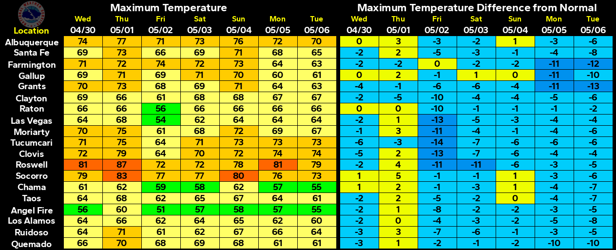
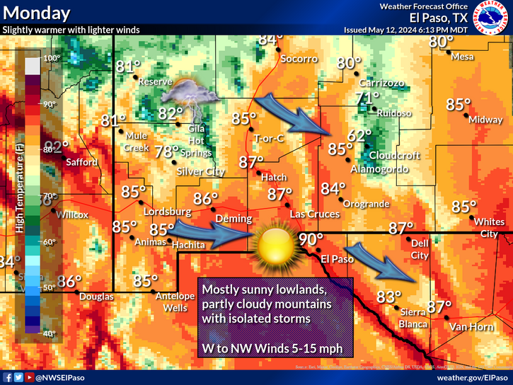
High temperatures on Monday are forecast to range from a little below normal from the mountains westward across the state, to near normal across the Southeastern Plains, and a little above normal for West Texas. Highs today into Tuesday across the Southeastern Plains are forecast to range from near 60 to the low 60's.
Long-range forecasts aren't looking too good as far as significant rainfall or snowfall is concerned locally. We are coming to an end of the meteorological winter (March 1st marks the first day of the meteorological spring) and with the current Modoki El Niño fading towards a Neutral phase or possibly even a developing La Niña later this year, it appears that a dry spring may be coming up.
Seasonal Snowfall Totals.
October= .5"
November= 1.9"
December= 33.0"
January= 1.3"
February= 0"
Total= 36.7"
Ruidoso Climate Co-Op Station
October= 0"
November= Trace
December= 24.9"
January= Missing
February= Missing
Ski Apache= 71.5"
Overall our local snowfall totals for the season both across the Southeastern Plains and in the Sacramento Mountains to date are running below normal.
(Listed By Greatest Totals Oct 1st, 2018- Feb 10th, 2019).
NM CoCoRaHS Winter Precipitation Totals.
(Listed By Greatest Totals Dec 1st, 2018- Feb 10th, 2019).
Although the meteorological winters end is coming soon this does not necessarily mean that winter weather is over for us. While snowfall totals for the meteorological winter (Dec - Feb) have been below normal so far our winter precipitation totals have been a little better but overall below normal.
The Truth Is Stranger Than Fiction - And Sometimes It Hurts!





Comments
Post a Comment
Your comments, questions, and feedback on this post/web page are welcome.