VERY WET THE PAST 30 DAYS!
June 15th - July 14th, 2010
Click On The Map To Enlarge It.
Selected Rainfall Totals For The Past 30 Days-
(From June 15th - July 14th, 2010)
Chaves County NM
Roswell Airport 4.67"
Elk Climate-Between Mayhill & Dunken 3.52"
3.5 WNW Roswell 2.76"
0.3 SSW Roswell 2.66"
8-Mile Draw Raws-18 Miles NE Roswell 2.58"
4.1 NNE Roswell 2.20"
Eddy County NM
Queen Raws-3 Miles East of Queen 8.11"
33.3 WSW Carlsbad-Queen 8.02"
0.9 NE Lakewood 7.45"
3.1 SSE Carlsbad 6.81"
2.1 NNW Downtown Carlsbad 6.66"
Carlsbad Climate-East of the Airport 6.57"
1.1 NNE Carlsbad-Downtown at the OEM Bldg 6.51"
2.0 N Carlsbad 6.43"
1.9 NW Carlsbad 6.32"
Carlsbad Airport-5 Miles SSW Downtown 6.12"
19.8 WNW Carlsbad-Indian Basin Gas Plant 6.03"
15.5 S Artesia 5.88"
Bat Draw Raws-Carlsbad Caverns 5.66"
15.5 NW Carlsbad 4.72"
17.1 NW Carlsbad 4.32"
4.8 SSE Artesia-Atoka 4.20"
Artesia Climate-6 Miles S Artesia 4.08"
Caprock Raws 3.34"
Artesia Airport 2.84"
Lea County NM
8.0 SSE Hobbs 8.23"
0.4 NNE Hobbs 7.66"
Paduca Raws-Near The WIPP Site 7.42"
2.1 SE Hobbs 6.48"
NW Hobbs-KM5BS 6.34"
0.9 NNW Lovington 5.15"
Tatum Climate 3.19"
Hobbs Climate 2.89"
Lincoln County NM
Smokey Bear Raws-Near Ruidoso 4.01"
4.4 NW Ruidoso 3.87"
Ruidoso Climate 3.22"
Sierra Blanca Regional Airport 1.95"
Capitan Climate 1.24"
Otero Climate
4.0 E Cloudcroft 8.49"
4.9 NE Cloudcroft 7.65"
Cloudcroft Climate 7.22"
0.5 NW Cloudcroft 7.07"
0.4 ESE Cloudcroft 6.97"
16 ESE Cloudcroft-Mayhill 6.87"
Mayhill Raws 6.45"
0.07 N Sunspot 4.40"
2.3 S Cloudcroft 4.32"
Mescal Raws-Near Mescalero 3.99"
0.6 S Pinon 3.99"
5.4 W Cloudcroft 2.98"
Culberson County TX
The Bowl Raws-1/2 Mile N Guadalupe Pk 6.28"
McKittrick Raws 5.51"
Dog Canyon Raws 4.98"
Pinery Raws-Pine Springs 3.09"
Guadalupe Pass 1.10"
If you are wondering why I haven't updated my web site in the past couple of weeks, it's because I have been on vacation. We flew to Boston, and visited my wife's family. We also traveled to New Hampshire, Maine, and New York State. We also visited Niagara Falls. We had a great time, but it's really good to be home again.
The past thirty days have been unusually wet in SE NM, and parts of West Texas. Two tropical systems, and a couple of stalled cold fronts, are the main reasons for so much rain across the area. Most of the heavier rainfall totals have occurred between the last week of June, and the second week of this month. Several locations are reporting thirty day rainfall totals of 7.00" - 8.50". Many locations in Eddy, and Lea Counties, and the mountains are reporting 5.00" - 6.00" totals.
Please note that I have no control or input on these rainfall totals. Except of course for my station here in NW Carlsbad, NM. Some of these totals may be incomplete since they have missing data. Overall, these totals are very impressive for the thirty day period, considering that the long term average for most of SE NM at the lower elevations, is between 12" - 15".
Rainfall Totals Are Courtesy Of-
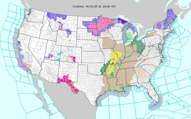
Please click on the NWS Watch/Warning map above for all of the latest NWS Advisories, Watches, Warnings, and Special Weather Statements for our local area.


Comments
Post a Comment
Your comments, questions, and feedback on this post/web page are welcome.