Severe T-Storms Possible Far SE NM & W TX.
Blog updated at 7:47 AM MDT.
Today will be the last day of our string of tranquil spring weather across SE NM. Most of us will see afternoon highs in the mid 80's. Thankfully the wind will not be a problem but this won't last.
Once again the dryline has sloshed back westward into SE NM overnight. Low clouds and fog cover parts of the local area along and east of the dryline, but will burn off later this morning.
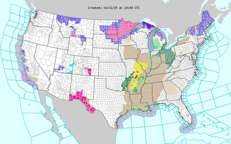
Scattered t-storms are forecast to break out across far SE NM and W TX this afternoon and evening along and east of the dryline. A few of these may become severe and produce large hail and damaging t-storm wind gusts. Although the threat for tornadoes does not appear to be high, an isolated tornado or two will be possible with any supercell t-storm, especially early this evening as the low-level jet cranks up.
Severe t-storms will again be possible over the parts of ta strong Pacific cold front he W TX area on Sunday as the potent mid-upper level storm draws closer, and sweeps eastward into the area.
A cold, and potent late winter storm will take aim on the state this weekend into the first of next week. Strong southerly to southwesterly winds are forecast to crank up over the local area on Saturday at around 25-30G40 mph. Localized areas of blowing dust may be a problem over and near freshly plowed farmlands, open or exposed fields, lots, and construction sites. Remember, the visibility can and often does drop down to zero with little to no advanced warning in these normally dust prone areas.
Critically Dangerous Fire Weather Conditions are forecast for the area Saturday and Sunday. A Fire Weather Watch is in effect for Saturday.
Sunday's winds are forecast to be even stronger with a more widespread threat for blowing dust. High Wind Watches, Warnings, and Wind Advisories may be issued for the area. A strong Pacific cold front is forecast to sweep eastward across the area on Sunday, and cooler air will overspread SE NM &W TX on Monday and Tuesday.
The Truth Is Stranger Than Fiction!
My Web Page Is Best Viewed With Google Chrome.


Comments
Post a Comment
Your comments, questions, and feedback on this post/web page are welcome.