Will Next Week Be Wet For NM?
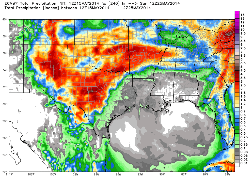
ECMWF 10-Day Total Precipitation Forecast.
Valid Today Through Sunday May 25, 2014.
Ok don't hold your breath or get your hopes up too high but take a look at the European (ECMWF) and the GFS model forecasts. This is their 10-day total precipitation forecasts valid today through Sunday May 25th.
Both models continue to forecast an upper level storm over Arizona and New Mexico by the middle to the end of next week...along with the prospect of some rain. Its always risking business when looking at model forecasts a week to ten days out. But for the first time in a long time both of these models are indicating a change...and a wet one at that.
It appears that our best chances for rain would be late next week. Lets hope!
The Truth Is Stranger Than Fiction!
My Web Page Is Best Viewed With Google Chrome.


Comments
Post a Comment
Your comments, questions, and feedback on this post/web page are welcome.