Posts

Showing posts from June, 2025

Last Week's Rainfall Summary - Monthly & Year--To-Date Totals.

Image
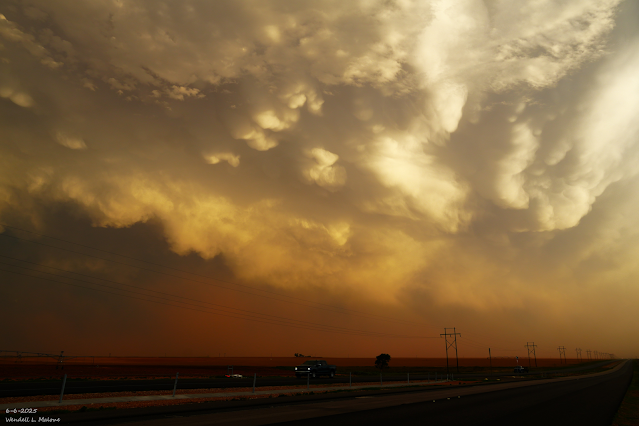
June 6, 2025. Severe T-Storm.  Northwest Of Lubbock, TX. Increasing Chances For T-Storms Sunday Into Next Week. Wow, what a turnaround. After one of the worst springs in recent memory as far as drought and dust storms were concerned, June has turned out to be rather wet for a lot of New Mexico, but not all of it. The Sacramento, the Gila, and northern mountains are still some 2" to 6" below normal.  Last week's rains were impressive in many areas, and the promise for more rain this coming week looks good.  The Roswell Airport ASOS now stands at 3.08" for the month of June, which brings their year-to-date precipitation total to 6.04".  Normal for June is 1.11", and their normal year-to-date is 4.07".  The Artesia NWS Climate Co-Op Station now stands at 3.00" for the month of June, which brings their year-to-date precipitation total to 6.07". Normal for June is 1.23", and their normal year-to-date is 4.22". The Carlsbad Airport ASOS n...

Flash Flood Emergency & Landslide Warnings In The Ruidoso Area - 6-Day Rainfall Totals.

Image
June 6, 2025. Seminole, Texas. Blog Updated Friday, June 27, 2025. We wanted rain and we got it. At least most of the state, anyway. A few isolated corners of far northwestern and southeastern New Mexico have missed out so far. I've included maps of the six-day rainfall totals from around the state as of this morning. These totals do not reflect what is falling today.  My brother has recorded 3.25" of rain so far at his ranch 13 miles south of Artesia or 2 miles north of Lakewood.  My 6-Day storm total here at our home in NW Carlsbad is 1.94", bringing my monthly total to 2.81" and my year-to-date total to 5.49". This is now my second wettest June in the last 19 years so far, topped only by 2021, which had 5.13".   Scattered thunderstorms will remain in our forecasts through the upcoming weekend into next week. Any thunderstorm that produces heavy rainfall in a short period of time will have the potential to also produce localized flash flooding, now that m...

Dangerous Life-Threatening - Possibly Catastrophic Flash Flooding Possible Today Into Thursday!

Image
June 6, 2025. Looking Northwest. Between Brownfield & Lubbock, Tx. Heavy To Very Heavy Rains This Past Weekend. A severe thunderstorm hammered southern Carlsbad and the Otis area this past Saturday afternoon. At 4:53 PM MDT, the Carlsbad Airport ASOS recorded a severe thunderstorm wind gust of 76 mph during a wet microburst . Numerous reports of downed trees, tree limbs, power poles, power lines, and sheds blown down were shared on Social Media pages. I don't have photos of these because I am still locked out of Facebook. I've made several appeals to have my account reinstated, but Facebook isn't responding to my requests.  Record rainfall also fell at the airport, with 2.13" of rain also recorded during this event, which caused bar ditch, field, and street flooding in the area. This set a new daily 24-hour record high rainfall total at the airport that exceeded the previous record of .63" there in 1999. The Carlsbad NWS Climate Co-Op Station recorded 1.00...

Say Hello To The Beginning Of Our Annual Summer Monsoon This Weekend.

Image
June 6, 2025. Cumulonimbus Mammatus. Between Lubbock & Brownfield, TX. Record High Temps Tied & Broken Tuesday. The Roswell Airport ASOS recorded a high temperature of 108, just shy of their record high for the date of 110 set in 2017.  The Artesia NWS Climate Co-Op Station tied its record high of 108, last set in 2008. The Artesia Airport AWOS recorded a high of 108 on Tuesday, tying its record in 2017. The Carlsbad Airport Airport ASOS recorded a high temp on Tuesday of 109, just shy of its record for the date of 110 in 1977. The Carlsbad NWS Climate Co-Op Station reached 110 in 1924 on June 17th.  Here at our home in NW Carlsbad, I topped out at 110 on my Davis Wireless Vantage Pro2 PWS. First Apperance Of Our Summer Monsoon Late This Weekend. Our annual summer monsoon is about to make its presence known across the region late this weekend into next week. A mid-upper level trough of low pressure is forecast to work its way southeastward into the Great Basin Friday i...

Damaging T-Storm Wind Gusts Sunday Afternoon - Excessive Heat Warnings & Heat Advisories For Tuesday.

Image
June 6, 2025. Supercell Thunderstorm. Looking Northeast From East Of Tatum, NM.  Excessive Heat Warnings & Heat Advisories For Tuesday. A line of severe thunderstorms moved southeast off the east slopes of the Sacramento and Guadalupe mountains Sunday afternoon and onto the southeastern plains. The Roswell Airport ASOS clocked a peak wind gust of 67 mph, and the Artesia Airport AWOS 67 mph. A   Personal Weather Station (PWS) located in Otis, 7 miles southeast of Carlsbad, clocked a severe thunderstorm wind gust to 69 mph. A Personal Weather Station (PWS) located on St. Hwy 360 southeast of Loco Hills reported a peak wind gust of 62 mph during yesterday afternoon's line of severe thunderstorms. I received an unconfirmed report of 10 telephone poles blown down in the Cottonwood area north of Artesia, but I have been unable to pinpoint the location of the event.  Radar indicated that nearly 2.50" of rain fell just south of US Hwy 70 northeast of Roswell. Nearly 1.50...

The Rains Are Ending & As The Heat Returns.

Image
June 6, 2025. Developing Supercell. Looking North From Lovington, NM.  Say Goodbye To The Rain & Hello To The Heat. Our recent stretch of wet and relatively cool weather was nice given the time of the year, but this is going away by the weekend.  Overall, high temps across the state will average some 5 to 11 degrees above normal today into the first of next week. Highs across southern New Mexico and the southeastern plains will be in the 100 to 105 range Friday into next Tuesday. Hit and miss thunderstorms will break out over the eastern one-half of the state today and Friday. A few of these may become marginally severe and produce large hail, damaging thunderstorm winds, frequent lightning, and locally heavy rainfall.  From the central mountain chain westward, thunderstorm coverage will be more isolated and of the drier nature.   As we march deeper into our meteorological summer, the overall weather pattern will shift towards a monsoonal one. If lucky, we w...

Severe T-Storm Watch In Effect For Southern NM, Southeastern New Mexico, & Parts Of West Texas!

Image
SEL6 URGENT - IMMEDIATE BROADCAST REQUESTED Severe Thunderstorm Watch Number 406 NWS Storm Prediction Center Norman OK 145 PM CDT Tue Jun 10 2025 The NWS Storm Prediction Center has issued a * Severe Thunderstorm Watch for portions of Southeast New Mexico Far West int West Texas * Effective this Tuesday afternoon and evening from 145 PM until 900 PM CDT. * Primary threats include... Scattered large hail and isolated very large hail events to 2.5 inches in diameter possible Scattered damaging wind gusts to 70 mph possible SUMMARY...Thunderstorm coverage is expected to increase over the next few hours as the airmass continues to destabilize. Steep mid-level lapse rates and moderate deep-layer shear will support supercells, with large to very large hail as the primary hazard. Over time, upscale growth into a convective line is possible, with this line then progressing southeastward into more of west Texas....

Why You Are Not Seeing My Weather Posts On My Facebook Page.

Image
Me..Taken By My Wife On  November 2, 2024. Hello everyone. I just wanted to let you know that my Facebook page was shut down without any warning by Facebook this past Saturday, June 8th. All I was told was that I had violated their community standards. I don't know what triggered that; they didn't tell me. I was told this may be permanent or for six months.  My guess is that it may be because I posted several comments and articles from my Substack page about the riots in LA, and that must have triggered/angered someone, and they complained, thus Facebook shut me down. I don't know this as fact, though. I have appealed this decision, and I'm still waiting for their reply. I have read on X that this has happened to other Facebook users posting about the LA riots as well.  I always share my weather blog posts (that I post here) on my Facebook page and my X page. This included over twelve different New Mexico and West Texas Facebook Community sites. So there are thousands o...

Round Two - Repeat Of Yesterday?

Image
June 5, 2025. Looking Northeast. Carlsbad, New Mexico. Scattered Severe T-Storms & Hot! Wash, rinse, repeat...today's weather will be a whole lot like yesterday's. Another round of severe thunderstorms is forecast across the eastern half of the state this afternoon and evening. Clusters of thunderstorms may form along or near the NM/TX state line this evening as they move eastward into West Texas. Again, the Storm Prediction Center is targeting the area from Tatum north to Clovis and east of Lubbock for the greatest risk of tornadoes...Enhanced Risk Area (Orange shade). A Slight Risk Area (Yellow shade) covers all of northeastern, eastern, and southeastern New < Mexico. Supercell thunderstorms will rule the afternoon and early evening. Tonight, several clusters of multicelluar thunderstorms will be possible.  Once again, all severe weather hazards will be in play in these areas, including: A few tornadoes, some maybe strong, large to very large hail, damaging thunderstor...

Severe T-Storms Today-Friday-Saturday!

Image
June 1, 2025. Mescalero Apache Indian Reservation. Between Ruidoso And Cloudcroft, New Mexico. Blof Updated At 10:49 AM MDT Thursday. Blog Updated At 10:15 AM MDT Thursday. Scattered Severe T-Storms Today Into Tonight! Rich low-level Gulf of America moisture has surged westward across the eastern one-half of New Mexico this morning and is backed up against the east slopes of the mountains. Jal is reporting a dew point temperature of 71F at 7:30 AM, the Artesia Airport 70F, and the rest of southeastern New Mexico has dew point temperatures in the mid to upper 60's. This is about as high as our dew point temperatures get. And yes, it is a very muggy morning.  A surface low was located just east of El Paso, with the dryline extending north and south from it along the east slopes of the mountains. A cold front was draped across far southeastern New Mexico and West Texas, extending southeastward from the surface low.  A shortwave will swing across the region today, aiding in lift a...

NWS Albuquerque Burn Scar Matrix

Current National Weather Service Watches/Warnings In Effect.

New Mexico

Chaves County Plains & Mtn's

Eddy County

Culberson County

Lea County

Lincoln County

Otero County

Current US Temps

Current US Wind Chill/Heat Index Temperatures

WPC 7-Day Precipitation Forecast

Roswell Live EarthCam

Ruidoso Live Webcam

Cloudcroft Live Webcam

NWS Midland 3-Day Precipitation Forecast

NWS Midland High End 3-Day Precipitation Forecast

NWS Midland 3-Day Precipitation Chances

New Mexico 3-Day Precipitation Forecast

New Mexico 3-Day High End Precipitation Forecast

New Mexico Precipitation Chances

NWS El Paso 3-Day Precipitation Forecast

NWS El Paso High End 3-Day Precipitation Forecast

NWS El Paso 3-Day Precipitation Chances

US 24-Hour Precipitation Forecast

US 24-Hour High End Precipitation Forecast

US 24-Hour High End Precipitation Forecast

US 3-Day Precipitation Forecast

US 3-Day High End Precipitation Forecast