Finally It Rained In SE NM - Rainfall Totals & Flash Flood Videos.
Carlsbad, New Mexico.
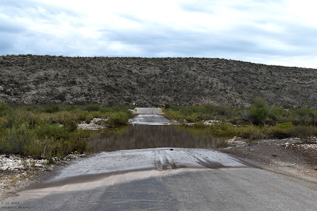
Normally Dry Dark Canyon Arroyo.
August 31, 2024.
West Loop Rd - Carlsbad, NM.
August 31, 2024.
Carlsbad, New Mexico.
Radio Blvd & Boyd Drive.
August 31, 2024.
Carlsbad, New Mexico.
Radio Blvd & Boyd Drive.
August 31, 2024.
Carlsbad, New Mexico.
Radio Blvd & Boyd Drive.
August 31, 2024.
San Jose Drive - Carlsbad, NM.
August 31, 2024.
San Jose Drive - Carlsbad, NM.
Looking East At The Green St. Bridge.
August 31, 2024.
Hidalgo Rd - SW Of Carlsbad, NM.
Normally Dry Dark Canyon Arroyo.
August 31, 2024.
Normally Dry Eagle Draw.
St. Hwy 13 Bridge - North Of Dunken, NM.
August 31, 2024.
Normally Dry Rio Penasco.
Cauhape Ranch Rd - 2 Miles West Of The Chaves/Eddy County Line.
August 31, 2024.
Normally Dry Rio Penasco.
Cahaupe Rd - Chaves/Eddy County Line.
(Saturday Morning August 31, 2024).
(Issued At 3:09 AM MDT Saturday, August 31, 2024).
Ending At 9 AM MDT Sunday, Sept 1st.
Ending At 9 AM MDT Tuesday, Sept 3rd.
New Mexico Mesonet Reported Low Temperatures
(Tuesday Morning Sept 3, 2024).
This is the time of the year when the polar and subtropical jet streams become more active and the Monsoonal high starts to lose its grip on the country. It is a time of transition, a time of change. We lose a little bit more daylight each day as the days become shorter. The sun rises later and sets earlier. Fall is knocking on the door.
Low temperatures Tuesday morning were seasonably cool thanks to last week's cold front, upper-level storm, and rainfall. The Angel Fire Airport Automated Weather Observing Station (AWOS) reported a low temp of 29 Tuesday morning. Locally the Sierra Blanca Snotel site reported a low of 39. Lows across many mountainous communities across the state were in the 40's with a number of northern mountain stations in the 30's.
The Cloudcroft NWS Climate Co-Op Station reported a low of 39 Wednesday morning and 38 this morning. The Ruidoso NWS Climate Co-Op Station reported a low of 42 Wednesday morning and 46 this morning.
(As Of 11 PM MDT, Wednesday, Sept 4, 2024).
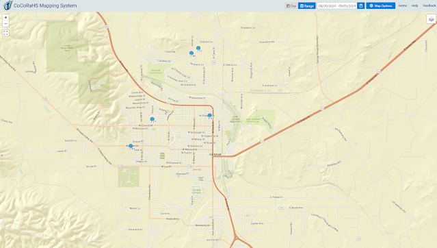
(August 30th - Sept 5th).
My CoCoRaHS Rainfall Data.
Finally, Most Of SE NM Gets A Soaking.
After a long hot and brutally dry summer, it ended with a widespread soaking rain after a cold front entered the area and interacted with a nearly stationary upper-level low parked overhead nearby. These rains commenced late last Friday night and lasted into Saturday.
Local reports from the public across Eddy, Lea, and parts of Chaves Counties indicate that widespread rainfall totals of 1.00" to nearly 2.00" were common. A report of 2.70" was received from the McNew Subdivision area five miles north of Carlsbad on Saturday. The Dayton area south of Artesia, just north of Lakewood saw 2.80" to 3.10". Weather Underground and Davis Weather Link Automated Weather Stations reported totals of 1.00" to 2.00" in and to the west of Artesia. While totals approached 3.00" in northern Hobbs. A 3-day total of 6.00" was received in southwestern Chaves County near Elk.
West Texas in the Midland/Odessa, Snyder, Big Springs, and San Angelo areas just absolutely got hammered by very heavy to excessive rainfall this past Labor Day Weekend and Holiday. Widespread storm totals of 3" to 5" were common with some locals seeing up to 9".
I would have loved to have seen this rainfall in SE NM but we would have washed away. There were three high water rescues in the Carlsbad area due to flash flooding...thankfully all with good results. The flash flooding that we experienced was not a major event by any stretch of the imagination but it served to remind us that we are in the heart of our flash flood season. Which normally occurs during our wettest months of July, August, and September.
The rain was badly needed and very welcomed but we are still a long way from catching up to normal for this time of the year. At this point though we will take what we can get and be thankful.
There Are None So Blind As Those Who "Will - Not" To See...107.


Comments
Post a Comment
Your comments, questions, and feedback on this post/web page are welcome.