Posts

Showing posts from September, 2023

Hello Fall Weather - Glad To see Ya Show Up!

Image
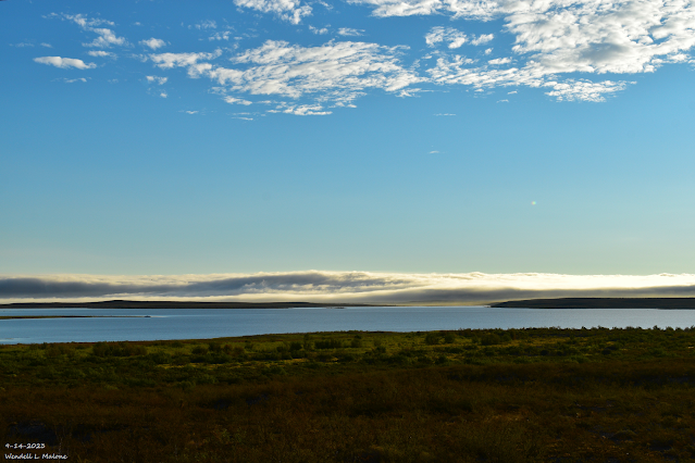
September 14, 2023 Early Morning Fog Bank. Brantley Lake Between Artesia & Carlsbad.  ECMWF 500 Millibar (18,000' MSL) Analysis. Valid At 6 AM MDT This Thursday Morning. ECMWF 500 Millibar (18,000' MSL) Forecast. Valid At 6 PM MDT Saturday, September 30, 2023. ECMWF 500 Millibar (18,000' MSL) Forecast. Valid At 6 AM MDT Tuesday, October 3, 2023. ECMWF 200 Millibar (39,000' MSL) Jet Stream Forecast. Valid At 6 PM MDT Tuesday, October 3, 2023. Surface Map Forecast. Valid Monday, October 1, 2023. ECMWF Storm Total Rainfall Forecast. Valid At 6 AM Tuesday, Oct 3, 2023. ECMWF Storm Total Snowfall Forecast. Valid At 6 AM Tuesday, Oct 3, 2023. NWS El Paso/Santa Teresa Flood Watch. NWS Albuquerque Burn Scar Matrix Forecast. NWS NDFD Forecast High Temperatures. Tuesday, October 3, 203. Wednesday, October 4, 2023. Big Changes In Our Weather Starting This Weekend. Summertime conditions continue to stubbornly hang on but this shall end soon. A strong mid-upper level low diving

Another Round Of Severe T-Storms This Afternoon & Evening!

Image
9-11-2023. Roswell, New Mexico. Truck Bypass Looking Northwest. GFS 500 Millibar (18,000' MSL) Analysis. Valid At 6 AM MDT Friday, Sept 15, 2023. Surface Map Forecast. Valid At 6 PM MDT Friday, Sept 15, 2023. Storm Prediction Center Severe Weather Outlook Today. NWS Midland Severe Weather Outlook Today.  NWS Albuquerque Severe Weather Outlook Today. NWS Albuquerque Burn Scar Matrix Forecast. Weather Prediction Center (WPC)  7-Day Total Rainfall Forecast. Another Round Of Severe T-Storms Today. Finally our unusually strong and persistent mid-level ridge of high pressure has been pretty much wiped out across the region this morning. Zonal flow has taken over at the mid-levels with embedded disturbances zipping across the area from time to time. These will help destabilize the atmosphere later this afternoon into tonight aiding in the development of scattered t-storms across parts of the state and local area.   At the surface a southward moving backdoor cold front will sag down the ea

Increasing Chances For Scattered To Numerous T-Storms - Some Severe Today!

Image
August 23, 2023. Looking West Towards Queen. On The Queen Hwy (Hwy 137). Scattered To Numerous T-Storms - Some Severe This Afternoon & Evening! Storm Prediction Center (SPC). Severe Weather Outlook Today. NWS Midland Severe Weather Outlook Today. NWS Albuquerque Severe Weather Outlook Today. Surface Map Forecast. Valid At 6 PM MDT Today. NWS NDFD Forecast High Temps. Today. Tuesday. NWS Albuquerque Burn Scar Flash Flooding Outlook. National Blend Of Models (NBM) Total Rainfall Forecast. Valid Today Through Sunday, Sept 17, 2023. Weather Prediction Center 7-Day Rainfall Forecast. Valid Today Through Monday, Sept 18, 2023. A Much Anticipated Change In Our Weather Begins Today. Hot Today But a Big Cooldown Starting Tuesday . A much anticipated change in our weather will occur today and continue through the rest of this week. A strong cold front is forecast to move south into southeastern New Mexico and West Texas this afternoon, and will continue to push southward and westward tonigh

Fall Cold Front To Bring A Much Need & Welcomed Change Monday Into Next Week.

Image
August 24, 2023. Sierra Blanca Peak. Looking West From Windy Point Vista. Fall Knocks On Our Front Door Next Week. GFS 500 Millibar (18,000' MSL) Analysis. Valid At 6 AM MDT Thursday, Sept 7, 2023. GFS    500 Millibar (18,000' MSL) Forecast. Valid At 6 PM MDT Wednesday, Sept 13, 2023. WPC Surface Map Forecast. Valid Monday, Sept 11, 2023. NWS Midland Outlook Next Week. NWS Albuquerque Temperature & Precip Chances Forecast. NWS Albuquerque Burn Scar Forecast. NWS NDFD Forecast High Temperatures. Today. Friday. Saturday. Sunday. Monday. Tuesday. Wednesday.  NWS NDFD Forecast Low Temperatures. Tuesday Morning. Wednesday Morning. ECMWF 10-Day Temperature Forecasts. Weather Prediction Center 7-Day Rainfall Forecast. Valid Today Through Thursday, Sept 14, 2023. National Blend Of Models (NBM) Total Rainfall Forecast. Valid Today Through Friday, Sept 15th, 2023. Climate Prediction Center (CPC) 6-10 Day Outlook. Changes Taking Place In The Upper Air Pattern. As we move towards the m

Current NWS National Watches/Warnings In Effect

Current NWS National Watches/Warnings In Effect
Click On The Map For The Latest Updates

New Mexico

Chaves County Plains & Mtn's

Eddy County

Culberson County

Lea County

Lincoln County

Otero County

Current Watches In Effect

SPC Mesoscale Discussions

Storm Prediction Center (SPC) Day 1 Outlook

NWS Regional Radar

NWS Regional Radar

NWS Midland Radar

Cannon AFB Radar

NWS Albuquerque Radar

Holloman AFB Radar

NWS El Paso Radar

NWS Lubbock Radar

GOES-East - Sector view: Southern Rockies - GEOColor

Current US Temps

Current US Wind Chill/Heat Index Temperatures

NWS Midland Regional Forecast

NWS Midland Regional Forecast

NWS Midland Regional Forecast

NWS Albuquerque Regional Forecast

NWS Albuquerque Regional Forecast

NWS Albuquerque Regional Forecast

NWS Albuquerque Regional Forecast

NWS Albuquerque Regional Forecast

NWS Albuquerque Regional Forecast

NWS Albuquerque Regional Forecast

NWS Albuquerque Regional Forecast

NWS El Paso Regional Forecast

NWS El Paso Regional Forecast

NWS Lubbock Regional Forecast.

NWS Lubbock Regional Forecasts

NWS Lubbock Regional Forecast

NWS Lubbock Regional Forecast

NWS Forecast High Temps Today

NWS Forecast Low Temps Tonight

24-Hour Minimum Wind Chill Forecast

NWS Albuquerque Storm Total Snowfall Forecast

NWS Albuquerque Storm Total Rainfall Forecast

NWS Midland Storm Total Rainfall Forecast

NWS El Paso Storm Total Rainfall Forecast

Average Daily High/Low Temperatures & Rainfall

Average Daily High/Low Temperatures & Rainfall