My Current Weather

Friday, February 25, 2022

Colder In SE NM Than Parts Of The Sacramento Mtn's Wed & Thu.

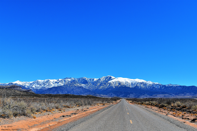
Feb 18, 2022.
Sierra Blanca Peak.
Looking East From Three Rivers, NM.

(Wednesday Morning Feb 23, 2022).


Wednesday Morning Low Temperatures.
(Official & Unofficial Lows).


Smokey Bear Raws - Ruidoso 10
Caprock Raws 11
Mayhill Raws 12
Bell Canyon PWS 13
Dunken Raws 13
Queen Raws 13
Lubbock ASOS 14
Pinery Raws 15
SKP Ranch PWS - Lakewood 15

Hobbs AWOS 16
Paduca Raws Near WIPP 19
Midland/Odessa ASOS 19

Carlsbad ASOS 20

Mescalero Raws 44

Max/Min Temperature And Precipitation Table For
New Mexico
National Weather Service Albuquerque NM
646 PM MST Wed Feb 23 2022

Minimum and maximum temperatures for the last 18 to 24
hours.  Precipitation for the 24 hour period ending at 5PM MST
measured in inches and hundredths of an inch of rain and melted snow.

.BR ABQ 0223 M DH18/TAIRZS/TAIRZI/PPDRZZ/SFDRZZ/SDIRZZ
ABQ  : ABQ Sunport        5351:   44 /  18 /  0.00/   0.0/    0
BRG  : Belen Airport      5194:   63 /  21 /  0.00/      /
CVS  : Cannon AFB         4295:   27 /   6 /  0.00/      /
CAO  : Clayton            4964:   19 /  -5 /  0.00/   0.0/    0
CQC  : Clines Corners     7087:   24 /  -2 /  0.00/      /
CVN  : Clovis Airport     4216:   26 /   6 /  0.00/      /
AEG  : Double Eagle Arpt  5837:   45 /  12 /     M/      /
FMN  : Farmington         5502:   49 /  32 /  0.03/      /
GUP  : Gallup             6473:   48 /  28 /  0.04/      /
GNT  : Grants             6522:   50 /  23 /     M/      /
LVS  : Las Vegas Airport  6877:   23 /  -2 /  0.00/      /
RTN  : Raton Airport      6348:   25 /  -3 /  0.00/      /
ROW  : Roswell            3668:   37 /  17 /  0.00/   0.0/    0
SRR  : Ruidoso Airport    6811:   34 /   7 /  0.00/      /
SAF  : Santa Fe Airport   6348:   36 /   8 /  0.00/      /
SXU  : Santa Rosa         4790:   27 /   4 /  0.00/      /
ONM  : Socorro            4849:   64 /  35 /  0.00/      /
SKX  : Taos Airport       7090:   36 /  16 /  0.00/      /
TCC  : Tucumcari          4065:   27 /   6 /  0.00/      /
.END

.BR ABQ 0223 M DH18/TAIRZX/TAIRZN/PPDRZZ/SFDRZZ/SDIRZZ
EGNN5: Eagle Nest     8280: DH1600/  38 /   2 /  0.00/  0.0/   10
PORN5: Portales       4010: DH1700/  44 /   8 /  0.00/  0.0/    0
TORN5: Torreon Navajo 6700: DH1622/  51 /  16 /  0.00/  0.0/    0
.END

.BR EPZ 0223 MS DH17/TAIRZS/TAIRZI/PPDRZZ/SFDRZZ/SDIRZZ
DMN   :Deming              4314 :  70  /  26  /  0.00  /   M  /   M
ELP   :El Paso Intl Arpt   3917 :  61  /  39  /  0.00  /      /
EPZN5 :Santa Teresa NWS    4108 :  70  /  39  /  0.00  /      /
TCS   :T-or-C Airport      4859 :  66  /  36  /  0.00  /   M  /   M
ALM   :Alamogordo          4196 :  63  /  41  /  0.00
HMN   :Holloman AFB        4095 :  60  /  37  /  0.00
LCSN5 :Jornada Range CRN   4327 :  68  /  37  /  0.00
LRU   :Las Cruces Airport  4455 :  71  /  42  /  0.00
SVC   :Grant County Arpt   5443 :   M  /   M  /  0.00
0A0   :Spaceport America   4597 :  68  /  28  /  0.00
.END

.BR MAF 0223 C DH18/TAIPZS/TAIPZI/PPDPZZ
BATN5: Batdraw RAWS               :  44 /  18 /  0.00
CPPN5: Caprock RAWS               :  37 /  11 /  0.00
MPAN5: Paduca RAWS                :  37 /  19 /  0.00
QENN5: Queen RAWS                 :  45 /  13 /  0.00
HCYN5: Hobbs 5NW Mesonet          :  32 /  15 /  0.00
TTSN5: Tatum Mesonet              :  33 /   9 /  0.00
.END

(Thursday Morning Feb 24, 2022).


Thursday Morning Low Temperatures.
(Official & Unofficial Lows).

Carlsbad Airport ASOS 12
Elk Climate Co-Op Station 13


(Thursday Morning).
Max/Min Temperature And Precipitation Table For
New Mexico
National Weather Service Albuquerque NM
658 PM MST Thu Feb 24 2022

Minimum and maximum temperatures for the last 18 to 24
hours.  Precipitation for the 24 hour period ending at 5PM MST
measured in inches and hundredths of an inch of rain and melted snow.

.BR ABQ 0224 M DH18/TAIRZS/TAIRZI/PPDRZZ/SFDRZZ/SDIRZZ
ABQ  : ABQ Sunport        5351:   42 /  15 /  0.05/   1.5/    2
BRG  : Belen Airport      5194:   44 /  15 /  0.00/      /
CVS  : Cannon AFB         4295:   46 /   6 /    T /      /
CAO  : Clayton            4964:   42 /   1 /  0.00/   0.0/    0
CQC  : Clines Corners     7087:   32 /   6 /  0.05/      /
CVN  : Clovis Airport     4216:   47 /   5 /  0.00/      /
AEG  : Double Eagle Arpt  5837:   39 /   4 /     M/      /
FMN  : Farmington         5502:   36 /  23 /  0.05/      /
GUP  : Gallup             6473:   31 /  18 /  0.04/      /
GNT  : Grants             6522:   36 /  19 /     M/      /
LVS  : Las Vegas Airport  6877:   36 /   7 /  0.00/      /
RTN  : Raton Airport      6348:   40 /   1 /  0.00/      /
ROW  : Roswell            3668:   50 /  15 /  0.00/   0.0/    0
SRR  : Ruidoso Airport    6811:   43 /  25 /  0.00/      /
SAF  : Santa Fe Airport   6348:   36 /   5 /  0.01/      /
SXU  : Santa Rosa         4790:   43 /  10 /  0.00/      /
ONM  : Socorro            4849:   51 /  31 /  0.00/      /
SKX  : Taos Airport       7090:   29 /   9 /  0.03/      /
TCC  : Tucumcari          4065:   50 /   9 /  0.00/      /
.END

.BR ABQ 0224 M DH18/TAIRZX/TAIRZN/PPDRZZ/SFDRZZ/SDIRZZ
EGNN5: Eagle Nest     8280: DH1600/  28 /   8 /  0.18/   3.6/   13
TORN5: Torreon Navajo 6700: DH1630/  39 /   8 /  0.00/      /
.END

.BR EPZ 0224 MS DH17/TAIRZS/TAIRZI/PPDRZZ/SFDRZZ/SDIRZZ
DMN   :Deming              4314 :  52  /  35  /  0.00  /   M  /   M
ELP   :El Paso Intl Arpt   3917 :  58  /  39  /  0.00  /      /
EPZN5 :Santa Teresa NWS    4108 :  55  /  32  /  0.00  /      /
TCS   :T-or-C Airport      4859 :  52  /  32  /  0.00  /   M  /   M
ALM   :Alamogordo          4196 :  52  /  36  /  0.00
HMN   :Holloman AFB        4095 :  51  /  41  /  0.00
LCSN5 :Jornada Range CRN   4327 :  51  /  33  /  0.00
LRU   :Las Cruces Airport  4455 :  54  /  33  /  0.00
SVC   :Grant County Arpt   5443 :   M  /   M  /     M
0A0   :Spaceport America   4597 :  52  /  36  /  0.00
.END

.BR MAF 0224 C DH18/TAIPZS/TAIPZI/PPDPZZ
BATN5: Batdraw RAWS               :  42 /  13 /  0.00
CPPN5: Caprock RAWS               :  48 /  14 /  0.00
MPAN5: Paduca RAWS                :  50 /  16 /  0.00
QENN5: Queen RAWS                 :  54 /  11 /  0.00
HCYN5: Hobbs 5NW Mesonet          :  52 /  15 /  0.00
TTSN5: Tatum Mesonet              :  50 /  14 /  0.00
.END


These data are preliminary and have not undergone final quality
control by the National Climatic Data Center /NCDC/. Therefore...
these data are subject to revision. Final and certified climate data
can be accessed at www.ncdc.noaa.gov.

$$
With an arctic airmass entrenched across eastern and southeastern New Mexico Wednesday and Thursday morning, low temperatures were warmer in parts of the Sacramento Mountains than they were in the Pecos Valley and the rest of southeastern New Mexico. This is not at all an uncommon occurrence with these cold but shallow arctic air masses during the winter.

Windy Day Across Southern New Mexico Wednesday.

(Wednesday, Feb 23, 2022).

Public Information Statement
National Weather Service El Paso TX/Santa Teresa NM
710 PM MST Wed Feb 23 2022

...HIGHEST WIND GUST REPORTS FOR FEB 23 AS OF 7PM...

Location                     Speed     Time/Date       Lat/Lon
San Agustin Pass 1.6 E Organ 77 MPH    0650 PM 02/23   32.43N/106.57W
Chihuahuan Desert Rangeland  71 MPH    0420 PM 02/23   32.53N/106.81W
WSMR EMRE                    69 MPH    0550 PM 02/23   32.47N/106.50W
Condron Field (WSMR)         66 MPH    0600 PM 02/23   32.34N/106.41W
Hachita Valley               64 MPH    0440 PM 02/23   31.70N/108.34W
Lordsburg Playa I10 MP11 (NM 63 MPH    0335 PM 02/23   32.28N/108.88W
Deming ASOS                  62 MPH    0215 PM 02/23   32.27N/107.72W
T-or-C ASOS                  61 MPH    0224 PM 02/23   33.23N/107.27W
WSMR Rad                     61 MPH    0645 PM 02/23   32.80N/106.50W
Burro Mountain RAWS          60 MPH    0559 PM 02/23   32.67N/108.54W
Spaceport America Awos       60 MPH    0315 PM 02/23   32.99N/106.97W
Dripping Springs RAWS        59 MPH    0526 PM 02/23   32.32N/106.59W
Winston (EPZWxNet)           57 MPH    0228 PM 02/23   33.35N/107.65W
WSMR LC-32                   57 MPH    0635 PM 02/23   32.41N/106.40W
Lordsburg Playa I10 MP7 (NMD 55 MPH    0450 PM 02/23   32.25N/108.93W
North Lordsburg Playa        55 MPH    0225 PM 02/23   32.25N/108.95W
Lordsburg Playa I10 MP9 (NMD 54 MPH    0455 PM 02/23   32.27N/108.90W
Las Cruces AWOS              53 MPH    0335 PM 02/23   32.27N/106.92W
Lordsburg Playa I10 MP12 (NM 53 MPH    0425 PM 02/23   32.29N/108.87W
Chiricahua Desert Museum     52 MPH    0520 PM 02/23   31.87N/109.02W
High Rolls                   52 MPH    0659 PM 02/23   32.94N/105.84W
Lordsburg Playa I10 MP13 (NM 52 MPH    0435 PM 02/23   32.32N/108.81W
Silver City - Mountain View  51 MPH    0300 PM 02/23   32.77N/108.26W
Arrey 2N                     50 MPH    0601 PM 02/23   32.88N/107.31W
Organ (DACFC)                50 MPH    0458 PM 02/23   32.42N/106.60W
San Andres RAWS              48 MPH    0501 PM 02/23   32.58N/106.53W
Hanover 5ENE                 47 MPH    0400 PM 02/23   32.82N/108.00W
WSMR C-Station               47 MPH    0630 PM 02/23   32.36N/106.38W
WSMR Salt Creek              47 MPH    0300 PM 02/23   33.12N/106.36W
Mescalero RAWS               46 MPH    0541 PM 02/23   33.16N/105.77W
Santa Teresa NWS RSOIS       46 MPH    0429 PM 02/23   31.87N/106.70W
WSMR Apache                  46 MPH    0235 PM 02/22   32.63N/106.39W
Las Cruces                   45 MPH    0415 PM 02/23   32.36N/106.72W
El Paso International Airpor 45 MPH    0609 PM 02/23   31.82N/106.38W
WSMR Pony                    45 MPH    0355 AM 02/23   32.87N/106.49W
Delta Clipper                45 MPH    0535 PM 02/23   32.90N/106.41W

Observations are collected from a variety of sources with varying
equipment and exposures. We thank all volunteer weather observers
for their dedication. Not all data listed are considered official.

$$

The Truth Is Stranger Than Fiction!

Tuesday, February 22, 2022

How Cold Will It Get With This Arctic Airmass?

Feb 18, 2022.
Church Mountain.
 Southeast Of Carrizozo, NM.

(At 2:30 PM MST Tuesday).


RTMA Apparent (Wind Chill) Temperatures.
(At 2:30 PM MST Tuesday).


(At 11 AM MST Tuesday).


Amazing Temperature Contrasts!

As of 2:30 PM MST this Tuesday afternoon an amazing temperature contrast existed across the arctic cold front draped across the region. Temperatures ranged from 100ĀŗF at Zapata, Texas located in the upper Rio Grande Valley of far south Texas to -10ĀŗF in northern North Dakota where wind chill values are down to -35ĀŗF. That's a difference in actual temperatures of 110-degrees, factor in the wind chill and that's 135-degrees! Temperatures this afternoon in the heart of the coldest air are running some 30-degrees to 40-degrees below normal.


Turning Much Colder Tonight.

As of this writing (3:30 PM MST), my current temperature here at our home in Carlsbad has climbed up to 74ĀŗF. Temperature behind the arctic frontal boundary draped across the eastern New Mexico and Texas border range from 25ĀŗF in Clayton with a 10ĀŗF wind chill, to 45ĀŗF in Clovis, to 32ĀŗF in Amarillo with a wind chill of 18ĀŗF. Denver, Colorado is reporting 9ĀŗF with a wind chill of -5ĀŗF.

The back door arctic cold front will push south and west this evening into tonight moving through the southeastern plains before midnight. Much colder air will overspread the area tonight into Wednesday behind the front.

Current National Weather Service forecasts call for low temperatures tonight into Wednesday morning to drop down to near 10ĀŗF in the Clovis area, near 12ĀŗF in the Lubbock area, near 15ĀŗF in Tatum, near 20ĀŗF in Hobbs, and the low to mid 20's for the Pecos Valley. Forecast lows in the Sacramento Mountains should range from the upper 20's to the low 30's.

It will be colder to much colder across the eastern and southeastern plains and West Texas tonight than in the mountains. The arctic airmass associated with the front is very shallow (only about 1,500' in depth above the surface) so it will have a hard time pushing west across the mountains. 


Wednesday Morning.


Forecast Apparent Temperatures/Wind Chill Temperatures.
(Late Tonight Into Wednesday Morning).


Surface winds will shift around from the southwest to the northeast this evening with the frontal passage, and to the east on Wednesday. These winds will be sustained at around 15-20 mph and gusty tonight into Wednesday morning. Very cold wind chill temperatures will occur with values dropping down to as low as 0ĀŗF to -5ĀŗF from Tatum north to the Clovis and Portales area. Down to -5ĀŗF in the Lubbock area. Hobbs will see wind chill temps down in the single digits with the teens forecast for the Pecos Valley (Roswell, Artesia, and Carlsbad areas). 

NWS NDFD Forecast High Temperatures.

Wednesday.


I'm not so sure that I buy the forecast high temperatures (locally) for Wednesday. Its very common for these arctic air masses to turn out to be colder than the model forecasts them to be, and to hang around longer when they are this cold. Current thinking is that the Pecos Valley will manage to climb up into the upper 40's to near 50ĀŗF. Highs in the Sacramento Mountains should range from the low 40's in the Cloudcroft area to the low 50's for the Ruidoso area. 

If the arctic airmass deepens more than is currently forecast and does not get dislodged by strong southwesterly winds at the surface and aloft, and low clouds manage to develop further westward into the Pecos Valley and not dissipate during the daytime, we won't get this warm. Hobbs is forecast to be in the mid 30's and that could be too warm also.


A strong and cold mid-upper low is forecast to drop southward tonight out of northwestern Nevada to western/northwestern Arizona by sunset Wednesday. Then swing eastward across Arizona and northern New Mexico Wednesday night into Thursday afternoon. With this northern forecast track, we don't stand much of a chance of seeing any snow from this storm. This includes the Sacramento mountains. 

The Truth Is Stranger Than Fiction!

Saturday, February 19, 2022

Storm Summary Feb 16-17, 2022.

February 18, 2022.
Sierra Blanca Peak.


February 16,2022.
Johnson Rd - SE Of Artesia, NM.

Blog Updated At 11:59 AM MST Saturday, February 19, 2022.

Strong southwesterly winds and pockets of blowing dust occurred across Southeastern New Mexico Wednesday., February 16, 2022. Peak wind gusts locally include 63 mph at the Buck Mountain Personal Weather Station (PWS-10,676') west-northwest of Ruidoso, 62 mph at Guadalupe Pass (Guadalupe Mtn's National Park), 57 mph in Jal (Personal Weather Station), a gust to 55 mph at the Paduca Raws near the WIPP site southeast of Carlsbad, 54 mph at the Bat Draw Raws at Carlsbad Caverns, 53 mph at the Roswell Airport, and 51 mph at the Artesia Airport. A gust to 52 mph was clocked at the Carlsbad Airport early Thursday morning. Although it was windy it was far from being one of our really bad wind and dust storms that are common this time of the year. I shot a couple of short videos with my GoPro Black camera...more of a test run for this spring than anything.


Reported Peak Wind Gusts.

(Wednesday, February 16, 2022).


Thursday, February 17, 2022.


Public Information Statement
National Weather Service Albuquerque NM
809 PM MST Wed Feb 16 2022

...HIGHEST WIND REPORTS...

Location                     Speed     Time/Date

...New Mexico...

...Bernalillo County...
Albuquerque Intl Sunport     46 MPH    0316 PM 02/16
Albuquerque 6 W              40 MPH    0338 PM 02/16
Double Eagle II Arpt         40 MPH    0348 PM 02/16

...Chaves County...
Dunken 2 NE (Dunken)         55 MPH    0336 PM 02/16
Roswell Air Center           54 MPH    0101 PM 02/16
Bitter Lake WL Refuge 14 NNE 47 MPH    0237 PM 02/16

...Cibola County...
Mesita 9.2 E (NMDOT)         40 MPH    0314 PM 02/16

...Colfax County...
Raton Crews Airport          45 MPH    1203 PM 02/16

...Curry County...
Clovis                       47 MPH    0318 PM 02/16
Cannon AFB                   45 MPH    0540 PM 02/16
Clovis Muni Airport          41 MPH    0309 PM 02/16

...De Baca County...
Sumner Lake 1 NW             49 MPH    0507 PM 02/16

...Guadalupe County...
Vaughn 3.9 E (UPR)           54 MPH    1011 AM 02/16
Santa Rosa Airport           51 MPH    0335 PM 02/16
Milagro 3 ESE                42 MPH    0530 PM 02/16

...Lincoln County...
Oscuro 7.3 W (WSMR)          63 MPH    0140 PM 02/16
Three Rivers 17.6 W (WSMR)   57 MPH    0145 PM 02/16
NE Oscuro 4.0 (UPR)          57 MPH    0253 PM 02/16
Sierra Blanca Rgnl Arpt      56 MPH    0955 AM 02/16
Ancho 6.0 SW (UPR)           52 MPH    0226 PM 02/16
Oscuro 5.2 SW (WSMR)         51 MPH    0315 PM 02/16
Nogal 5 NW                   50 MPH    1055 AM 02/16
Carrizozo 5.7 NE (UPR)       50 MPH    0327 PM 02/16
Roswell No. 2 Portable       48 MPH    0120 PM 02/16
Ruidoso                      45 MPH    0917 AM 02/16
Oscuro 16.8 W (WSMR)         45 MPH    0320 PM 02/16
Ruidoso 1 NNW (Smokey Bear)  44 MPH    1000 AM 02/16
Carrizozo 1 WNW              42 MPH    0145 PM 02/16

...McKinley County...
Gallup Airport               46 MPH    0119 PM 02/16

...Quay County...
Tucumcari 7 E                79 MPH    0548 PM 02/16
Logan 11.8 NE (UPR)          65 MPH    0614 PM 02/16
Tucumcari 4.4 W (UPR)        46 MPH    0538 PM 02/16

...San Miguel County...
Las Vegas Muni Airport       60 MPH    0523 PM 02/16
Apache Springs 1 NE          46 MPH    0159 PM 02/16

...Sandoval County...
Bernalillo 3 E               48 MPH    0245 PM 02/16

...Santa Fe County...
Stanley                      51 MPH    0335 PM 02/16

...Socorro County...
Bosque del Apache 10.6 SE    59 MPH    0320 PM 02/16
Carrizozo 15 NW (Chupadera)  58 MPH    0139 PM 02/16
Bosque del Apache 21.2 SE    54 MPH    0355 PM 02/16
San Antonio 14.1 SE (WSMR)   53 MPH    0305 PM 02/16
Bingham 9.6 SW (WSMR)        53 MPH    0320 PM 02/16
Bosque del Apache 21.9 SE    51 MPH    0335 PM 02/16
Bingham 9.7 S (WSMR)         48 MPH    0435 PM 02/16
Socorro Airport              45 MPH    0155 PM 02/16
Contreras 1 ESE (Sevilleta)  42 MPH    0111 PM 02/16
Las Nutrias 1 WNW            42 MPH    0300 PM 02/16
Bosque Del Apache 1 NNE (Bos 41 MPH    0250 PM 02/16

...Taos County...
Red River 8 SSW              71 MPH    0230 AM 02/16

...Torrance County...
Clines Corners 1 SSE         59 MPH    0346 PM 02/16
Estancia 2 WSW               52 MPH    0324 PM 02/16
Duran 6.9 SW (UPR)           51 MPH    1028 AM 02/16
Duran 4.2 NE (UPR)           50 MPH    0201 AM 02/16
Moriarty Muni Airport        44 MPH    0415 PM 02/16
Corona 9.3 E (NMCC)          41 MPH    0250 PM 02/16

...Union County...
Clayton Muni Airpark         45 MPH    0518 PM 02/16
Clayton LRC                  45 MPH    0525 PM 02/16

...Valencia County...
Belen Regional Airport       43 MPH    0215 PM 02/16

Observations are collected from a variety of sources with varying
equipment and exposures. We thank all volunteer weather observers
for their dedication. Not all data listed are considered official.

$$
NWS El Paso Peak Wind Gust Reports.
Public Information Statement
National Weather Service El Paso TX/Santa Teresa NM
1024 PM MST Wed Feb 16 2022

...HIGHEST WIND REPORTS...

Location                     Speed     Time/Date

...New Mexico...

...Dona Ana County...
San Agustin Pass 1.6 E Organ 87 MPH    0355 PM 02/16
WSMR Museum                  65 MPH    0335 PM 02/16
WSMR EMRE                    64 MPH    0405 PM 02/16
Las Cruces                   63 MPH    0345 PM 02/16
WSMR Building 1830           58 MPH    0440 PM 02/16
WSMR Rad                     58 MPH    0225 PM 02/16
Delta Clipper                58 MPH    1025 AM 02/16
WSMR Apache                  57 MPH    0420 PM 02/16
Las Cruces - S Fork LC Arroy 56 MPH    0345 PM 02/16
WSMR Pony                    55 MPH    0225 PM 02/16
Brillo West                  55 MPH    0220 PM 02/16
Las Cruces - Little Dam Arro 53 MPH    0345 PM 02/16
Las Cruces AWOS              52 MPH    0215 PM 02/16
Condron Field (WSMR)         52 MPH    0245 PM 02/16
Globe                        52 MPH    0405 PM 02/16
Santa Teresa NWS RSOIS       51 MPH    0354 PM 02/16
Las Cruces - Tierra Grande ( 50 MPH    0400 PM 02/16
WSMR C-Station               50 MPH    0400 PM 02/16
WSMR Main Post               50 MPH    0445 PM 02/16
Afton (DACFC)                49 MPH    0347 PM 02/16
Butterfield Trail Ranch      49 MPH    0344 PM 02/16
Las Cruces - East Mesa       49 MPH    0346 PM 02/16
Santa Teresa AWOS            49 MPH    0435 PM 02/16
Dripping Springs RAWS        49 MPH    0426 PM 02/16
Chihuahuan Desert Rangeland  48 MPH    0225 PM 02/16
WSMR LC-32                   48 MPH    0435 PM 02/16
Organ (DACFC)                47 MPH    0358 PM 02/16
Las Cruces - High Ridge (DAC 45 MPH    0346 PM 02/16
Las Cruces - N Fork LC Arroy 45 MPH    0358 PM 02/16
San Andres RAWS              45 MPH    0501 PM 02/16
Las Cruces                   43 MPH    0208 PM 02/16
Dona Ana County Fairgrounds  43 MPH    0206 PM 02/16
La Union                     43 MPH    1200 PM 02/16
Las Cruces - Fabian Garcia ( 41 MPH    0345 PM 02/16
Las Cruces DAC Gov Center (D 40 MPH    0341 PM 02/16
Chaparral Fire Station (DACF 39 MPH    0443 PM 02/16
NMSU Main Campus (NMCC)      39 MPH    0345 PM 02/16
Las Cruces - Las Colinas     38 MPH    0348 PM 02/16
Alamogordo - La Mesa Drive   38 MPH    0346 PM 02/16
Radium Springs               38 MPH    0216 PM 02/16
Talavera (DACFC)             38 MPH    0345 PM 02/16
High Valley (DACFC)          37 MPH    0417 PM 02/16
Las Cruces - Moreno Arroyo N 37 MPH    0242 PM 02/16
Mesilla Hills Lower Bilbo Po 37 MPH    0225 PM 02/16
Chihuahuan Desert Nature Par 36 MPH    0229 PM 02/16
Las Cruces - County Club Par 36 MPH    0245 PM 02/16
La Union (DACFC)             36 MPH    0452 PM 02/16
Williams Ranch (DACFC)       35 MPH    0144 PM 02/16
Las Cruces E - Baylor Pk Roa 34 MPH    1226 PM 02/16
Leyendecker PSRC (NMCC)      34 MPH    0430 PM 02/16
3 W Santa Teresa             33 MPH    0415 PM 02/16
Santa Teresa Fire Station (D 33 MPH    0508 PM 02/16
Las Cruces - Downtown (DACFC 31 MPH    0458 PM 02/16
Jornada Exp Range            30 MPH    0300 PM 02/16

...Grant County...
Grant County Airport AWOS    40 MPH    0515 PM 02/16
Hanover 5ENE                 37 MPH    0100 PM 02/16
Burro Mountain RAWS          35 MPH    0259 PM 02/16
Silver City - Mountain View  34 MPH    0245 PM 02/16

...Hidalgo County...
Hachita Valley               53 MPH    0140 PM 02/16
Chiricahua Desert Museum     48 MPH    0110 PM 02/16
Lordsburg Playa I10 MP11 (NM 45 MPH    0155 PM 02/16
Lordsburg Playa I10 MP12 (NM 45 MPH    0200 PM 02/16
Lordsburg Playa I10 MP13 (NM 44 MPH    0155 PM 02/16
Lordsburg Playa I10 MP9 (NMD 43 MPH    0120 PM 02/16
Lordsburg Playa I10 MP7 (NMD 42 MPH    0120 PM 02/16
North Lordsburg Playa        40 MPH    0340 PM 02/16
Animas                       34 MPH    0231 PM 02/16

...Luna County...
Deming ASOS                  54 MPH    0303 PM 02/16

...Otero County...
High Rolls                   60 MPH    0340 PM 02/16
WSMR Frequency               57 MPH    0420 PM 02/16
McGregor Range RAWS          56 MPH    0337 PM 02/16
Lc-35 North                  53 MPH    0455 PM 02/16
Holloman AFB AWOS            52 MPH    0418 PM 02/16
WSMR LC-36                   51 MPH    0500 PM 02/16
WSMR ABC-1                   49 MPH    0235 PM 02/16
Alamogordo AWOS              48 MPH    0215 PM 02/16
Orogrande Gate (WSMR)        48 MPH    0430 PM 02/16
Malone                       47 MPH    0120 PM 02/16
WSMR Tula                    45 MPH    0250 PM 02/16
WSMR Tula Airstrip           45 MPH    0230 PM 02/16
WSMR Cad                     44 MPH    0445 PM 02/16
Russ                         44 MPH    0125 PM 02/16
Mayhill RAWS                 42 MPH    0101 PM 02/16
Mescalero RAWS               42 MPH    0441 PM 02/16
Mayhill - Dimension Point Ob 39 MPH    0446 PM 02/16
WSMR Rita                    37 MPH    0420 PM 02/16
Timberon                     36 MPH    0545 PM 02/16
Alamogordo SE                35 MPH    0205 PM 02/16
Alamogordo                   34 MPH    0101 PM 02/16
Cloudcroft                   33 MPH    1201 PM 02/16

...Sierra County...
WSMR Jallen Hawk 40          60 MPH    0135 PM 02/16
WSMR Denver WIT              58 MPH    0150 PM 02/16
T-or-C ASOS                  55 MPH    0202 PM 02/16
WSMR Salt Creek              52 MPH    0210 PM 02/16
Spaceport America Awos       48 MPH    1205 PM 02/16
WSMR Rob                     45 MPH    0350 PM 02/16
WSMR Alt Shist               45 MPH    0225 PM 02/16
Winston (EPZWxNet)           36 MPH    1033 AM 02/16
Arrey 2N                     36 MPH    0231 PM 02/16
Elephant Butte - Lakeshore H 35 MPH    0116 PM 02/16

...Texas...

...El Paso County...
El Paso International Airpor 59 MPH    0513 PM 02/16
South Franklin Peak          53 MPH    1004 PM 02/16
Biggs Field AWOS             52 MPH    0437 PM 02/16
El Paso NE - K5IA            48 MPH    0457 PM 02/16
El Paso NE - KB5HPT          43 MPH    0445 PM 02/16
El Paso NE - Powell ES       33 MPH    0510 PM 02/16
El Paso East - Marty Robbins 33 MPH    1245 PM 02/16
El Paso Ctr - TTUSHC         32 MPH    0520 PM 02/16
El Paso - Chaparral Park N   30 MPH    0430 PM 02/16
El Paso W - TTUHSC TransMtn  30 MPH    0110 PM 02/16

...Hudspeth County...
Sierra Blanca (TTU/WTM)      56 MPH    0228 PM 02/16
Dell City (TTU/WTM)          49 MPH    0614 PM 02/16
PX Well RAWS                 42 MPH    0353 PM 02/16
Salt Flat                    35 MPH    0248 PM 02/16

Observations are collected from a variety of sources with varying
equipment and exposures. We thank all volunteer weather observers
for their dedication. Not all data listed are considered official.

$$
NWS Albuquerque Storm Total Snowfall Amounts.
Public Information Statement
National Weather Service Albuquerque NM
1047 AM MST Fri Feb 18 2022

...SNOWFALL REPORTS...

Location                     Amount    Time/Date

...New Mexico...

...Bernalillo County...
Sandia Park 0.5 S            8.0 in    0900 AM 02/18
Sedillo 1 WSW                6.7 in    0800 AM 02/17
Sedillo 1 S                  6.2 in    0700 AM 02/18
Sedillo 1 ESE                6.0 in    0700 AM 02/18
Cedar Crest 3.0 NNE          5.7 in    0700 AM 02/18
Sedillo                      5.5 in    1125 AM 02/17
Sedillo 2 NW                 5.2 in    0700 AM 02/18
Cedar Crest 0.5 NNW          5.0 in    0700 AM 02/17
Tijeras                      5.0 in    1257 PM 02/17
Sedillo 2 ESE                4.6 in    0800 AM 02/18
Chilili 2 N                  4.5 in    0700 AM 02/18
Ponderosa 1 WSW              4.5 in    0700 AM 02/18
Ponderosa 3 ENE              4.5 in    0700 AM 02/18
9 NE Albuquerque             4.0 in    0104 PM 02/17
Albuquerque 9.5 ENE          4.0 in    0600 AM 02/18
Edgewood 4.4 W               4.0 in    0800 AM 02/17
Miera 2 ESE                  4.0 in    0800 AM 02/18
North Valley                 4.0 in    1150 AM 02/17
Sandia Park 4.9 ESE          3.8 in    0700 AM 02/17
South Valley                 3.8 in    1232 PM 02/17
Ponderosa 2 WNW              3.6 in    0700 AM 02/18
2 W Ponderosa Pines          3.5 in    1142 AM 02/17
Sandia Park 3.7 ESE          3.5 in    0700 AM 02/18
Ponderosa 2 W                3.4 in    0700 AM 02/18
Sandia Park                  3.3 in    0700 AM 02/17
Sandia Park 3.6 ESE          3.3 in    0700 AM 02/17
Albuquerque 4 NE             3.1 in    0700 AM 02/18
3 ESE North Valley           3.1 in    1007 AM 02/17
2 ESE Albuquerque            3.0 in    0935 AM 02/17
Albuquerque 2.9 W            3.0 in    0700 AM 02/18
Albuquerque 3.5 NNE          3.0 in    0700 AM 02/18
Albuquerque 8 SW             3.0 in    0700 AM 02/18
Albuquerque 3.8 SSE          2.9 in    0700 AM 02/18
Albuquerque 5.9 NE           2.6 in    0800 AM 02/18
2 SSW Albuquerque            2.5 in    0842 AM 02/17
Albuquerque 1.2 SSE          2.5 in    0700 AM 02/18
Albuquerque 3.3 WNW          2.5 in    0700 AM 02/18
Albuquerque 4.7 W            2.5 in    0900 AM 02/17
Albuquerque 5.0 WSW          2.5 in    0500 AM 02/18
Albuquerque 6.3 NNW          2.5 in    0700 AM 02/18
6 NE Albuquerque             2.3 in    1127 AM 02/17
Albuquerque 2.1 S            2.3 in    0825 AM 02/18
Albuquerque 4.0 NW           2.3 in    0834 AM 02/18
3 SE North Valley            2.3 in    1146 AM 02/17
5 NE Albuquerque             2.2 in    0927 AM 02/17
Albuquerque 8 NE             2.1 in    0700 AM 02/18
Albuquerque NWS Office       2.1 in    0700 AM 02/18
1 ENE Albuquerque            2.0 in    0830 AM 02/17
Albuquerque 4.0 W            2.0 in    0915 AM 02/17
Albuquerque 8.7 SE           2.0 in    0700 AM 02/18
1 SSE Paradise Hills         2.0 in    0811 AM 02/17
1 SE Paradise Hills          2.0 in    0848 AM 02/17
1 ENE Paradise Hills         2.0 in    0942 AM 02/17
4 WSW Sandia Heights         2.0 in    0930 AM 02/17
Albuquerque 8.1 ESE          1.9 in    0730 AM 02/17
Albuquerque 7.4 ENE          1.8 in    0700 AM 02/18
Albuquerque 4.6 E            1.5 in    0800 AM 02/17
Sandia Heights 0.5 S         1.5 in    1125 AM 02/17
Albuquerque 3.3 ESE          1.3 in    0719 AM 02/18
Albuquerque 5.0 NE           1.3 in    0800 AM 02/18
2 SSW Petroglyph National Mo 1.1 in    1118 AM 02/17
Albuquerque 4.9 ESE          1.0 in    0800 AM 02/18
Albuquerque 7.7 ENE          1.0 in    0700 AM 02/17
Albuquerque 7.8 E            1.0 in    0800 AM 02/17
Albuquerque 8.7 NE           1.0 in    0700 AM 02/17
Albuquerque 8.9 NW           1.0 in    0800 AM 02/17
1 NNW Paradise Hills         1.0 in    0925 AM 02/17
1 NNW Petroglyph National Mo 1.0 in    0805 AM 02/17
2 SSE Rio Rancho Intel Area  1.0 in    1151 AM 02/17
Albuquerque 8.1 ESE          0.9 in    0700 AM 02/18
Albuquerque 4.5 NE           0.8 in    0700 AM 02/18
Albuquerque 4.7 E            0.8 in    0600 AM 02/18
Albuquerque 4.1 ENE          0.7 in    0700 AM 02/17
Albuquerque 4.8 ESE          0.7 in    0700 AM 02/17
Albuquerque 7.7 ENE          0.7 in    0800 AM 02/17
Albuquerque 8.1 ENE          0.7 in    0700 AM 02/18
Albuquerque 8.2 ENE          0.7 in    0800 AM 02/17
Albuquerque 3.0 ENE          0.6 in    0700 AM 02/18
Albuquerque 3.7 SSE          0.6 in    0700 AM 02/17
Albuquerque 7.8 ESE          0.6 in    0700 AM 02/18
8 NW Albuquerque             0.5 in    1130 AM 02/17
Albuquerque 2.6 E            0.5 in    0700 AM 02/17
Albuquerque 6.6 E            0.5 in    0750 AM 02/18
Albuquerque 8.0 ESE          0.5 in    0700 AM 02/18
Albuquerque 9.3 NW           0.5 in    0830 AM 02/17
3 WNW Petroglyph National Mo 0.5 in    1020 AM 02/17
Sandia Heights 4.0 S         0.5 in    0700 AM 02/17
Albuquerque 4.5 E            0.4 in    0700 AM 02/17
Albuquerque 5.0 ESE          0.3 in    0700 AM 02/18
Albuquerque 7.8 ENE          0.3 in    0700 AM 02/17
Albuquerque 3.0 WNW          0.2 in    0700 AM 02/17
Albuquerque 5.3 E            0.2 in    0630 AM 02/18
Los Ranchos 2.1 SW           0.2 in    0700 AM 02/18

...Catron County...
Quemado 8.0 NE               2.0 in    0800 AM 02/18
Pie Town 0.1 WNW             1.6 in    0700 AM 02/18
Datil 2.0 W                  0.5 in    0700 AM 02/18

...Cibola County...
9 WSW Bluewater Lake State P 4.0 in    0800 AM 02/17
Grants 1.0 W                 1.4 in    0700 AM 02/18
Grants 1.6 NE                1.4 in    0700 AM 02/17
Bluewater 0.3 E              1.0 in    0700 AM 02/18
McCartys                     0.9 in    0700 AM 02/18

...Colfax County...
3 E Angel Fire               3.0 in    0536 AM 02/18
3 N Sugarite                 2.0 in    0207 PM 02/17
Angel Fire 10.2 SSE          1.3 in    0700 AM 02/18
Eagle Nest                   1.2 in    0400 PM 02/17
Angel Fire 0.2 SSE           1.1 in    0700 AM 02/18
3 E Angel Fire               1.0 in    0550 AM 02/17
2 WNW Angel Fire             1.0 in    0800 AM 02/17
6 WNW Sugarite Canyon State  1.0 in    0530 AM 02/17

...Lincoln County...
Nogal 4.6 SSE                3.8 in    0700 AM 02/18
Alto 0.3 N                   2.0 in    0700 AM 02/18
Ruidoso 2.9 SW               2.0 in    0700 AM 02/18
Capitan 4.3 WSW              1.3 in    0700 AM 02/17
Ruidoso 2 SSW                1.0 in    0700 AM 02/18
Ruidoso 1.4 SSW              0.5 in    0800 AM 02/17
Ruidoso 5.6 NNE              0.5 in    0700 AM 02/18

...Los Alamos County...
6 W Los Alamos               9.0 in    0415 AM 02/18
Los Alamos                   4.0 in    0841 AM 02/17
Los Alamos 1.4 E             3.6 in    0700 AM 02/18
Los Alamos 2.5 WSW           3.0 in    0800 AM 02/18
White Rock 1.5 NNE           2.5 in    0800 AM 02/17
Los Alamos 6.1 SE            2.2 in    0800 AM 02/17
White Rock 1.4 NE            2.0 in    0700 AM 02/17
Los Alamos 7.1 SE            1.5 in    0800 AM 02/17

...McKinley County...
Gallup 3.5 E                 2.5 in    0700 AM 02/17
Ramah 0.4 NW                 1.8 in    0640 AM 02/18
Milan 14.4 NW                1.3 in    0730 AM 02/17
Prewitt 5.5 NNE              1.3 in    0800 AM 02/17
Thoreau 1.1 NNW              1.2 in    0915 AM 02/17

...Mora County...
Chacon 2.1 ENE               3.3 in    0700 AM 02/18

...Rio Arriba County...
7 E Canjilon                 8.0 in    1000 AM 02/18
Truchas 1.4 ESE              6.8 in    0700 AM 02/18
El Rito 2.3 NW               6.5 in    0700 AM 02/17
9 E Cuba                     6.0 in    0800 AM 02/17
Alcalde 19 N                 4.0 in    0700 AM 02/18
Alcalde 5.9 NE               4.0 in    0700 AM 02/18
Chama 12.3 SSE               4.0 in    0700 AM 02/17
11 NNW Canon Plaza           3.0 in    0800 AM 02/17
5 NW Chama                   3.0 in    0800 AM 02/17
7 ESE Cuba                   3.0 in    0800 AM 02/17
Youngsville 5.4 NE           3.0 in    0700 AM 02/17
Alcalde                      2.0 in    0730 AM 02/17
1 E Chama                    1.5 in    0919 AM 02/17
Espanola 5.4 WNW             1.3 in    0700 AM 02/18

...San Juan County...
5 SSW Toadlena               3.0 in    0800 AM 02/17
Farmington 3.0 NE            2.9 in    0600 AM 02/17
Aztec 2.3 WSW                2.4 in    0800 AM 02/18
Aztec 5.2 E                  2.3 in    0700 AM 02/18
Aztec 9.9 NE                 2.0 in    0746 AM 02/17
Farmington 2.7 SSW           2.0 in    0715 AM 02/18
Aztec 1.0 ESE                1.8 in    0700 AM 02/18
Aztec 0.9 E                  1.5 in    0700 AM 02/18
Bloomfield 1.7 N             1.5 in    0400 AM 02/18
Farmington 2.8 S             1.5 in    0800 AM 02/18
Navajo Dam                   1.5 in    0700 AM 02/18
Farmington 1.4 WSW           1.3 in    0700 AM 02/17
Farmington 1.3 WNW           1.2 in    0700 AM 02/18
Farmington ASC               0.8 in    0700 AM 02/18
Farmington 4.1 E             0.6 in    0700 AM 02/18

...San Miguel County...
Pecos 2.1 SW                 4.0 in    0700 AM 02/18
Rowe 2.7 NNW                 3.8 in    0700 AM 02/17
Ilfeld 0.7 NE                1.4 in    0800 AM 02/18
Ribera 1.7 SW                1.3 in    0900 AM 02/17
San Pablo 2 E                1.0 in    0700 AM 02/18
Mineral Hill                 0.5 in    0447 AM 02/17

...Sandoval County...
Placitas 3.8 ENE             5.0 in    0700 AM 02/18
Bernalillo 1.8 NE            3.5 in    0700 AM 02/18
Rio Rancho 3.3 ENE           3.5 in    0700 AM 02/18
Bernalillo 2.7 WSW           3.4 in    0700 AM 02/18
Rio Rancho                   3.0 in    0630 AM 02/18
Rio Rancho 1.3 E             3.0 in    0700 AM 02/18
Rio Rancho 1.9 SE            3.0 in    0630 AM 02/18
Sandia Park 4.2 NNE          3.0 in    1000 AM 02/17
3 ENE Vista Hills            3.0 in    1125 AM 02/17
Placitas 2.6 W               2.8 in    1200 PM 02/17
Rio Rancho 1.4 E             2.6 in    0800 AM 02/18
Rio Rancho 4.5 ENE           2.5 in    0930 AM 02/17
Rio Rancho 5.4 NNE           2.5 in    0645 AM 02/18
Rio Rancho 5.6 NE            2.5 in    0700 AM 02/18
Rio Rancho 0.8 S             2.3 in    0800 AM 02/18
Rio Rancho 6.0 NNW           2.1 in    0700 AM 02/18
Rio Rancho 2.9 SSW           1.9 in    0800 AM 02/18
1 WNW Vista Hills            1.8 in    1123 AM 02/17
1 N Cabezon                  1.5 in    0200 PM 02/17
Rio Rancho 3.7 SW            1.2 in    0800 AM 02/18
Jemez Pueblo 5.7 NNW         1.0 in    0630 AM 02/18
Rio Rancho 3.0 WSW           0.9 in    0700 AM 02/18
Rio Rancho 4.1 WSW           0.6 in    0600 AM 02/18
Bernalillo 0.9 WSW           0.2 in    0800 AM 02/18

...Santa Fe County...
7 E Chupadero                8.0 in    0439 PM 02/17
4 E Golden                   7.0 in    0600 AM 02/17
Los Cerrillos 3 NE           6.8 in    0700 AM 02/18
Glorieta 2.4 E               6.1 in    0700 AM 02/18
Los Cerrillos 3 NNE          5.8 in    0700 AM 02/18
Golden                       5.3 in    0900 AM 02/17
7 E Chupadero                5.0 in    0812 AM 02/17
Los Cerrillos 5 ENE          5.0 in    0800 AM 02/17
Madrid 0.6 SSW               5.0 in    0700 AM 02/18
Madrid 1.9 SE                5.0 in    0700 AM 02/17
2 SE Madrid                  4.5 in    0723 AM 02/17
Edgewood 2.1 WNW             4.0 in    0500 AM 02/18
Edgewood 3.7 WSW             4.0 in    0805 AM 02/18
Edgewood 5 NW                4.0 in    0700 AM 02/17
Santa Fe 10.3 SSE            4.0 in    0735 AM 02/17
Santa Fe 9.6 S               4.0 in    0800 AM 02/17
Edgewood 2.7 W               3.8 in    0700 AM 02/18
Lamy 5 NW                    3.7 in    0715 AM 02/17
Santa Fe 10.2 S              3.6 in    0730 AM 02/18
Santa Fe 6.9 WNW             3.6 in    0800 AM 02/17
2 WSW Agua Fria              3.5 in    0845 AM 02/17
1 SW Agua Fria               3.5 in    0951 AM 02/17
Santa Fe 5.5 SSE             3.5 in    0900 AM 02/17
Santa Fe 6.6 SSW             3.5 in    0800 AM 02/17
Santa Fe 7 SW                3.5 in    0700 AM 02/18
Santa Fe 6.2 SSE             3.4 in    0800 AM 02/17
Santa Fe 5.3 WSW             3.0 in    0700 AM 02/17
Santa Fe 11.4 SSE            2.9 in    0700 AM 02/18
Santa Fe 10.4 SSE            2.8 in    0800 AM 02/18
Santa Fe 4.3 SW              2.7 in    0730 AM 02/18
5 SSE Santa Fe               2.6 in    0833 AM 02/17
Santa Fe 10.6 SSE            2.6 in    0700 AM 02/18
Santa Fe Seton               2.6 in    0630 AM 02/17
Santa Fe 1.3 WSW             2.5 in    0700 AM 02/18
Stanley 5.9 NW               2.4 in    0900 AM 02/17
Eldorado At Santa Fe 0.5 E   2.1 in    0800 AM 02/18
Santa Fe 2.3 SE              2.1 in    0800 AM 02/17
Lamy                         2.0 in    0950 AM 02/17
Santa Fe 0.7 E               2.0 in    0712 AM 02/18
Santa Fe 2.3 NE              2.0 in    0700 AM 02/18
Santa Fe 2.4 N               2.0 in    0700 AM 02/17
Santa Fe 2.9 ENE             2.0 in    0700 AM 02/18
Santa Fe 3.3 WNW             2.0 in    0800 AM 02/17
Santa Fe 3.6 ENE             2.0 in    0738 AM 02/17
Santa Fe 0.7 ESE             1.8 in    0700 AM 02/17
Santa Fe 8.5 S               1.8 in    0730 AM 02/17
Santa Fe 0.7 S               1.5 in    0800 AM 02/18
Santa Fe 3.6 WNW             1.2 in    0800 AM 02/18
Stanley 4.9 SSE              1.0 in    0700 AM 02/17
Santa Cruz 0.7 WNW           0.8 in    0716 AM 02/18
Pojoaque 5.0 W               0.5 in    0700 AM 02/18
Pojoaque 0.7 N               0.3 in    0700 AM 02/18
Santa Fe 2.7 SE              0.2 in    0703 AM 02/18

...Socorro County...
Abo 10 SW                    0.1 in    0700 AM 02/18

...Taos County...
Arroyo Seco 2.3 SW           9.2 in    0700 AM 02/17
5 SSE Llano Largo            8.0 in    1000 AM 02/18
3 NW Tres Ritos              7.5 in    0454 AM 02/18
5 SSE Llano Largo            6.0 in    0800 AM 02/17
8 SW Red River               6.0 in    0608 AM 02/18
1 SSW Taos Ski Valley        5.0 in    1000 AM 02/18
4 NNW Tres Ritos             5.0 in    1000 AM 02/18
Ranchos De Taos 2.4 W        4.2 in    0700 AM 02/18
11 ENE Amalia                4.0 in    0800 AM 02/17
1 SSW Taos Ski Valley        4.0 in    0800 AM 02/17
4 NNW Tres Ritos             4.0 in    0800 AM 02/17
Arroyo Hondo 1.5 S           3.5 in    0800 AM 02/17
3 NW Tres Ritos              3.5 in    0625 AM 02/17
San Cristobal 0.1 NE         2.5 in    0700 AM 02/17
Arroyo Hondo 4.8 WSW         2.0 in    0900 AM 02/17
Red River                    2.0 in    0759 AM 02/18
Taos 1.6 SE                  1.5 in    0900 AM 02/18

...Torrance County...
Estancia 9.4 NW              3.7 in    0700 AM 02/18
Moriarty 1 NE                3.2 in    0700 AM 02/18
Edgewood 3.2 S               3.0 in    0600 AM 02/17
Moriarty 1.0 SSW             3.0 in    0644 AM 02/18
Encino 6 W                   2.8 in    0700 AM 02/18
Mountainair 8 NW             1.5 in    0700 AM 02/18
Estancia 6.4 WSW             1.0 in    0700 AM 02/18
Estancia 6.4 WSW (No. 2)     1.0 in    0915 AM 02/17
Estancia 7.1 WSW             1.0 in    1030 AM 02/17
Moriarty 0.2 NNE             0.7 in    0700 AM 02/18
1 E Manzano Mountain State P 0.5 in    0639 AM 02/17

...Union County...
Capulin                      1.2 in    0600 PM 02/17
1 NE Capulin                 1.0 in    1053 AM 02/17
Folsom                       1.0 in    1054 AM 02/17
6 NE Folsom                  1.0 in    1057 AM 02/17
Clayton 1.1 W                0.3 in    0900 AM 02/18

Observations are collected from a variety of sources with varying
equipment and exposures. We thank all volunteer weather observers
for their dedication. Not all data listed are considered official.

$$

34
The Truth Is Stranger Than Fiction!

Wednesday, February 16, 2022

High Winds/Blowing Dust/Critically Dangerous Fire Weather Conditions Today!


Valid At 5 PM MST Today.

Valid At 11 PM MST Tonight.

Valid At 5 AM MST Thursday.


At 11 PM MST Tuesday.

GFS 500 MB (18,000') Forecast.

Valid At 5 PM MST Today.


Nasty Weather Today Into This Evening.

Today is going to be one of those days most of us have learned to dread weather-wise here in southeastern and southern New Mexico as well as parts of West Texas. If you have been suffering from allergy and sinus issues lately, then today will only make you more miserable.

As of midnight, last night a strong closed mid-upper level low was centered near San Diego, California. This winter storm will move southeast into New Mexico today, and by sunset, it is forecast to be located just west or northwest of El Paso. It is then forecast to continue opening up into a trough of low pressure as it swings northeast into the Texas Panhandle by sunrise on Thursday. A second lobe of energy (short wave trough of low pressure) will then move southeast across New Mexico Thursday into Friday morning.

At the surface, a Pacific cold front will move from west to east across New Mexico today. By sunset, this front should be moving east out of southeastern New Mexico into West Texas. As it does so this evening it is forecast to catch up to the dryline over the Permian Basin of West Texas. Late tonight into Thursday morning a backdoor cold front will move south and west through the eastern one-half of New Mexico and across West Texas. 

Low-level southeasterly upslope flow from the Gulf of Mexico has worked its way into parts of the Edwards Plateau and Trans Pecos region of West Texas this morning. Scattered thunderstorms are forecast to erupt ahead of the front and dryline this evening from the central Permian Basin eastward. Some may become severe over the eastern Permian Basin tonight and produce large hail and damaging thunderstorm wind gusts.

High Winds/Blowing Dust/Critically Dangerous Fire Weather Conditions Today!


Critically Dangerous Fire Weather Conditions Today.

Another day of very high danger conditions is forecast today. Single-digit relative humidity values combined with the ongoing drought and high winds will combine to make for a potentially dangerous situation today.

Avoid any outdoor activity that involves the use of sparks or flame. Any wildland, grassland, or forest fire will have the ability to rapidly spread and grow in the high winds. Fast-moving fires could if they develop threaten life and property. 


High Wind Event Today!

High Wind Warnings and Wind Advisories remain in effect today into this evening for parts of southern New Mexico, the south-central mountains, the southeastern plains, and parts of West Texas and far West Texas. 

A High Wind Warning remains in effect today into 5 AM MST Thursday morning for the Guadalupe Mountains of New Mexico and West Texas. West winds are forecast to increase to 40-60 mph with gusts near 80 mph. Travel may become difficult and dangerous through Guadalupe Pass due to these high winds, blowing dust, and low visibilities. Sometimes during these high wind events, the Texas Department of Public Safety will close US Hwy 62/180 through the Pass...and this possibly could happen today. 

Southwesterly to westerly winds are forecast to rake the region today into tonight.

Across southern New Mexico including the El Paso, Las Cruces, and Alamogordo areas these winds are forecast to become sustained at around 30-40 mph with gusts around 65 mph. 

Across the south-central mountains of New Mexico including the Ruidoso, Capitan, Hondo, Mescalero, Cloudcroft, Mayhill, Sacramento/Weed/Pinon, and Timberon areas these winds are forecast to become sustained at around 25-40 mph with gusts around 50-65 mph. 

Across southeastern New Mexico including the Guadalupe Mountains of Eddy County as well as the rest of Eddy County these winds are forecast to become sustained at around 35-45 mph with gusts around 65 mph after 11 AM this morning. 

Chaves County and Lea County as well as most of West Texas are under Wind Advisories for southwest to west winds sustained at around 25-35 mph with gusts to 45-55 mph.

There is the possibility that in some locations during the highest wind gusts (60 mph or higher) than damage could occur. This may include power lines, utility lines, trees, sheds, fences, roofs, barns, west faces windows, and agricultural sprinkler farm equipment.

Widespread Blowing Dust Today Into Tonight.


April 8, 2015.
Red Hills Gas Plant - Agave Energy.
18 Miles WNW Of Jal, New Mexico.

Be aware that mid-level moisture is forecast to increase somewhat over the area this today along with the possibility of high-based rain showers or virga. A few virga bombs will be possible. It's not out of the question for an isolated dry thunderstorm to occur which will enhance this weather phenomenon should they occur and where they occur. Virga is precipitation (rain, snow, hail) that falls from the cloud bases but evaporates before it reaches the ground. This pocket of evaporating moisture then cools as it descends from the clouds. When this pocket of dry colder air slams into the ground it fans out in the form of strong gusty winds. These wind gusts have been known to reach or exceed 100 mph. During dry conditions (especially droughts like we are currently experiencing) virga bombs are common at times in the winter and spring. Thus when these pockets of very strong winds hit the ground and fan out they often stir up a lot of blowing dust...thus the nickname in the weather world of virga bombs.

A Blowing Dust Advisory remains in effect today for the Tularosa Basin, El Paso Metro, and Far West Texas including El Paso, Hudspeth, Otero, and southern Dona Ana Counties.

Widespread blowing dust will likely develop from the high plateau deserts of northern Mexico south and southwest of El Paso, northeastward across southern New Mexico, southeastern New Mexico, and parts of far West Texas and West Texas. Widespread visibility drops down to less than 3 miles is possible today into tonight in these areas in the blowing dust.

Sudden drops in the visibility down to near zero will also be possible during the highest wind gusts (60 mph or higher). This will be especially true in our normally dust-prone locations such as: Freshly plowed or cultivated farmlands, open fields, lots, and highway construction sites. Traveling upon some local highways and roads may become dangerous at times should these conditions occur. It's not out of the question that a few of these roads may become closed for awhile during these intense localized blinding dust storms. 


This incoming winter storm is moisture-starved therefore only light snowfall amounts are currently being forecast for the Sacramento and Capitan Mountains tonight into Thursday Elevations above 6,000' may see some accumulating snowfall with 1"-3" possible in the Ruidoso and Cloudcroft areas. 

The Truth Is Stranger Than Fiction!

NWS Albuquerque Burn Scar Matrix Forecast

Current NWS Watches/Warnings In Effect

New Mexico

Eddy County

Chaves County Plains & Mtn's

Culberson County

Lea County

Lincoln County

Otero County

Current US Temps

Current US Wind Chill/Heat Index Temperatures

NWS Midland Forecast

NWS Albuquerque Forecast

NWS Albuquerque Forecast

NWS El Paso Forecast

NWS Lubbock Forecast

NWS Lubbock Forecast

Average Daily High/Low Temperatures & Rainfall

Average Daily High/Low Temperatures & Rainfall