My Current Weather

Tuesday, June 30, 2015

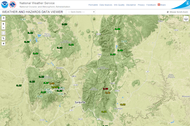
Wet Microburst Causes Tree Damage In Carlsbad, NM Monday 6-29-2015.


My youngest daughter took this picture of the "Lucy's Restaurant Sign" that
was blown over around 6:30 PM MDT. 

Late Monday afternoon at around 6:25 PM MDT a severe thunderstorm rolled into Carlsbad, New Mexico from the northeast, moving to the southwest. This may seem odd, but its not at all that uncommon in the summertime to see thunderstorms moving south, southwest, or southeast.

Tuesday, June 23, 2015

A Day Trip To White Sands.


My wife and I visited the White Sands National Monument yesterday. Of course we picked one of the hottest days of the year to do so with an afternoon high of 105°F. Never mind the heat we had a blast. We plan on going back this fall when its cooler and can stay for the evening show/walk among the dunes. 

The Truth Is Stranger Than Fiction!

Monday, June 22, 2015

Some Pretty Crazy Temperature Swings In The Western US The Past Couple Of Days.


Extreme ranges in temperatures are fairly common in the Southwestern and Western US. This is due to a number of factors but dry air plays a key role especially in the Desert Regions. Such was the case Sunday. Death Valley (NWS Climate Co-Op Station elevation -19' below sea level) reported a high temperature of 122°F. This mornings low temp was 86°F. Interestingly enough Mt. Charleston (NWS Climate Co-OP Station elevation 7,402' above sea level) reported a low temperature of 30°F Sunday morning. Mt Charleston is 60 miles southeast of Death Valley (as the crow flies) and 25 miles west of downtown Las Vegas, Nevada. So that's a 92° temperature change in less than 75 miles, during the normal heating and cooling cycle of a 24-hour day.

 I was unable to find a listing of the Mt. Charleston daily climate co-op data on the Las Vegas, NV Daily Climate Page to verify if this low temperature was correct. When checking the Western Region Climate Data Base temperature records I found that the previous daily low temperature for June 21st is listed as 41°F in 2003. The long term (1949-2015) average daily low temperature for Mt. Charleston is 47° for June 21st. The map above shows that at 4 PM MDT Sunday they were in the mid 70's on the mountain. 


This mornings low temperature (listed below) is reported to be 32°F at Truckee, CA (NWS Climate Co-Op Station elevation 6,002 above sea level) some 225 miles northwest of Death Valley (as the crow flies). With a stout upper level ridge of high pressure overhead across the Western US, very dry air in place, clear skies, its no wonder we often see these large temperature swings. 

On average July is the hottest month of the year in Death Valley as far as daily high temperatures are concerned. Mid July to the end of July typically sees an average daily high temperature of 117°F with overnight lows in the upper 80's. 

Death Valley is not only the hottest place in the US but also one of the hottest in the world. Consider some of the famous facts about its weather below:

Death Valley is famous as the hottest place on earth and driest place in North America. The world record highest air temperature of 134°F (57°C) was recorded at Furnace Creek on July 10, 1913. Summer temperatures often top 120°F (49°C) in the shade with overnight lows dipping into the 90s°F (mid-30s°C.) Average rainfall is less than 2 inches (5 cm), a fraction of what most deserts receive. Occasional thunderstorms, especially in late summer, can cause flash floods.

In contrast to the extremes of summertime, winter and spring are very pleasant. Winter daytime temperatures are mild in the low elevations, with cool nights that only occasionally reach freezing. Higher elevations are cooler than the low valley. Temperatures drop 3 to 5°F (2 to 3°C) with every thousand vertical feet (approx. 300m). Sunny skies are the norm in Death Valley, but winter storms and summer monsoons can bring cloud cover and rain. Wind is common in the desert, especially in the spring. Dust storms can suddenly blow up with approaching cold fronts. 

 
National High and Low Temperature 
(for the contiguous United States)
 
(Caution: Version displayed is not the latest version. - Issued 0600Z Jun 22, 2015)
 
Version Selection
Versions back from latest:  0   1   2   3   4   5   6   7   8   9   10   

National High and Low Temperature (for the contiguous United States)
NWS Weather Prediction Center, College Park, MD
Issued 2 am EDT Monday, June 22, 2015

High Temperature for Sunday, June 21, 2015
(as received by 2 am EDT June 22)
122 at Death Valley, CA

Low Temperature for Sunday, June 21, 2015
(as received by 2 am EDT June 22)
30 at Charleston, NV

National High and Low Temperature 
(for the contiguous United States)
 
(Latest Product - Issued 1200Z Jun 22, 2015)
 
Version Selection
Versions back from latest:  0   1   2   3   4   5   6   7   8   9   10   

National High and Low Temperature (for the contiguous United States)
NWS Weather Prediction Center, College Park, MD
Issued 8 am EDT Monday, June 22, 2015

High Temperature for Sunday, June 21, 2015
(as received by 8 am EDT June 22)
122 at Death Valley, CA

Low Temperature for Monday, June 22, 2015
(as received by 8 am EDT June 22)
32 at Truckee, CA
32 at West Yellowstone, MT

The Truth Is Stranger Than Fiction!

Sunday, June 21, 2015

Typically Hot Temps For Late June - Rain Returns In About A Week?.


We've undergone a transition recently as the jet stream has relaxed and pulled back to the north in Canada, This is allowing our summer time mid-upper level ridge of high pressure to settle in over the Western US. This has allowed the atmosphere to stabilize therefore effectively shutting down our crop of thunderstorms seen recently.

 Our next best chance for rainfall over the southeastern plains will occur by the end of next weekend into the first of the following week (7-10 days from now). A few hit and miss afternoon thunderstorms will pop up over the Guadalupe, Sacramento, and Capitan Mountains from time to time. Until then we will see typical daytime high temps for late June in the mid-upper 90's with a few days topping the century mark next week. 

The Truth Is Stranger Than Fiction!

Monday, June 15, 2015

First Chase Of 2015 - Shelf Cloud.

Blog Updated 5:35 PM MDT Tue June 16, 2015.


Edna Troublefield Washburn posted these two pictures of downed power lines on my FaceBook Page today. The damage occurred Saturday afternoon, June 13, 2015. About 5 miles west of Lakewood on Rock Daisy Rd. This is the same severe t-storm that I shot my photos of on White Pine Rd, south of this location.

My Time Lapse Video Of The Shelf Cloud.

Finally I got to go out and chase a storm this past Saturday, June 13, 2015. I only had to go 20 miles to the northwest of Carlsbad, NM and ended up on White Pine Rd. I shot the five shelf cloud photos in "Raw Format" using my Cannon EOS Rebel T3i camera. But using this mode I was unable to edit the photos and time stamp them with paint on my computer. Much sharper and better quality images than when using the auto modes. I'm still learning new tricks with this camera. 

On my way back home after my encounter with the shelf cloud and the 60 mph downdraft winds and blowing dust it produced I came upon these three poles that had been blown down about 1/2 of a mile north of the Ford Dealership on the north side of Carlsbad. There were actually two of these road signs that were also blown over by an apparent wet microburst. I'll post a time lapse video to YouTube of this event in a couple of days.

As a line of thunderstorms was exiting southeastern New Mexico into West Texas yesterday afternoon I was lucky enough to get a shot of this double rainbow. I was at work at the Gas Plant where I am employed and saw this beauty popping up to my east. 

The Truth Is Stranger Than Fiction!

NWS Albuquerque Burn Scar Matrix Forecast

Current NWS Watches/Warnings In Effect

New Mexico

Eddy County

Chaves County Plains & Mtn's

Culberson County

Lea County

Lincoln County

Otero County

Current US Temps

Current US Wind Chill/Heat Index Temperatures

NWS Midland Forecast

NWS Albuquerque Forecast

NWS Albuquerque Forecast

NWS El Paso Forecast

NWS Lubbock Forecast

NWS Lubbock Forecast

Average Daily High/Low Temperatures & Rainfall

Average Daily High/Low Temperatures & Rainfall