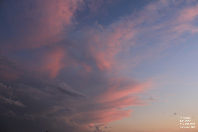
Went Chasing Today.
Click On The Photos To Enlarge Them.
Shot Between Seven Rivers & Carlsbad, New Mexico.
Rain Foot 20 Miles WSW Of Lakewood, NM.
Scud Clouds Being Sucked Up Into The Rain Free Base.
Blue-Green Tint. Radar Indicated Large Hail.
After The Storm.
Sunset.
Following Photos By Jim Morrison Of Hobbs, NM.
(Added To Blog At 3:10 PM MDT Today)
Following Photos By Jim Morrison Of Hobbs, NM.
(Added To Blog At 3:10 PM MDT Today)
Jim says- "This shot was taken at the NM/TX state line south of Jal looking west at an approaching severe thunderstorm. This shelf or roll cloud had formed as the storm approached the Jal area. The storm was elongated N-S, with the upper level blow off going NE, but storm motion was east. This put the core updraft on the SE edge, pretty much along the leading edge rather than at the normal rear of the storm. We see this often with right movers around here."
4:45 PM CDT- 2" to 2.5" Diameter Hail (Lime to Tennis Ball Size)
Along With 60 MPH Winds35 Miles West Of Pecos, Texas In Culberson County.
6:57 PM MDT- 2.5" Diameter Hail (Tennis Ball Size) 8 Miles West Of Crossroads, In Lea County, NM, Along With 60-70 MPH Wind Gusts.
7:05 PM MDT- 2.75" Diameter Hail (Baseball Size) In Crossroads, In Lea County, NM Along With 60-70 MPH Winds.
6:44 PM MDT- 2.5" Diameter Hail (Tennis Ball Size) 5 Miles Southeast Of Crossroads, In Lea County, NM.
7:49 PM MDT- 4:00" Diameter Hail (Grapefruit Size) 10 Miles Southeast Of Crossroads, In Lea County, NM.
The Truth Is Stranger Than Fiction!
My Web Page Is Best Viewed With Google Chrome.


.JPG)


Nice scenes, and I hope you all got some rain, but I bet nothing in Carlsbad...too far W?
ReplyDeleteI went storm chasing last in April or May of 1991, when I moved back to Denver...drove all the way to Goodland KS, but an inactive dryline. Only to move to Abq, where weather is rather benign in comparison.
I picked up .31" here at the house yesterday afternoon. The storms were pretty scattered in nature. But hey, its a start, and I am just happy to see t-storms return to southeastern New Mexico.
ReplyDelete