My Current Weather

Thursday, January 31, 2013

January Ends & February Begins Really Quiet.
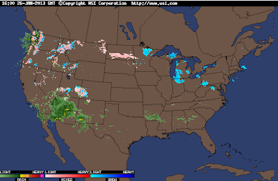
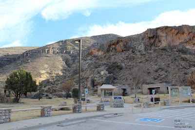
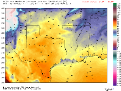


Carlsbad, NM. 

 Roswell, NM.

Long-range model forecasts indicate that there is absolutely nothing happening with our local weather over the next week to ten days. Boring appears to be the theme. Our latest National Weather Service forecasts for Roswell, Artesia, Carlsbad, and Hobbs call for high temps in the low 60's today, the upper 60's to near 70 Friday, the low 60's Saturday, the upper 60's Sunday, and the low-mid 70's Monday into next Wednesday.

Wednesday, January 30, 2013

Peak Wind Gusts Reported Tuesday, 1-29-2013.


Our local National Weather Service forecasts were calling for westerly winds to gust up to between 60 - 70 mph yesterday, this failed to materialize over most of the local area, and thankfully so. A deck of mid-level clouds combined with the early arrival of the cold front yesterday morning prevented the stronger winds aloft from mixing down to the surface. Not that I'm complaining though because the dust was bad enough as it was.

Tuesday, January 29, 2013

Damaging Winds Today!


 We are going to pay a price for our beautiful and tranquil weather that we have been experiencing recently. A powerful upper-level trough of low pressure will swing across the state today, and drag a cold front eastward with it. This is going to result in a very windy and dusty day across the area. The fire danger will be very high today due to the continued dry conditions and the high winds. Please refrain from any type of outdoor burning or the use of fire or sparks.

Damaging winds will be a possibility in some locations today. Westerly winds are forecast to increase to sustained speeds of 30 - 50 mph with gusts around 60 -70 mph across the southeastern plains of New Mexico today. Gusts in the Guadalupe mountains are forecast to reach at least 80 mph.

Damage from these winds may occur to the following-

Fences. 
Power lines.
Roofs & Shingles.
West facing windows.
Irrigation sprinkler systems.
 Small trees may be blown down.
Large tree branches may be blown down.
Small Barns & Sheds may be blown down.

A Blowing Dust Advisory will be in effect from 11 AM - 5 PM MST. Wide spread areas of blowing dust may reduce the visibility down to less than one mile at times. The visibility will suddenly drop down to near zero with little to no advanced warning In the more dust prone locations such as- open or freshly plowed or open fields, lots, and construction sites. Travel may be significantly affected on some of our local roadways today due to the blowing dust across the lower elevations, and the blowing snow in the Sacramento mountains.

 Today and tomorrow will be cooler with highs near 50 to 55.

Monday, January 28, 2013

Warm & Windy Today - Cooler Windy Tuesday.


Valid At 11 AM MST Tuesday.


Windy weather returns to southeastern New Mexico today into tomorrow as our next upper-level storm moves across the state. Southwesterly winds are forecast to increase to sustained speeds of 20 - 30 mph today with gusts around 40 mph. These winds will become westerly and increase to sustained speeds of 30 - 35 mph with gusts near 55 mph on Tuesday. 

Its already been pretty windy in the Guadalupe mountains. Overnight gusts so far include 60 mph measured at the Bowl Raws which is located just north of Guadalupe Peak, and 56 mph at Guadalupe Pass. The Sierra Blanca Regional Airport located near Ruidoso has clocked a gust to 52 mph as of 5 AM MST this morning.

Areas of blowing dust may become a problem in some of our more dust prone locations, especially tomorrow during the higher gusts. Today will be warm with our afternoon highs ranging from the upper 60's to the mid 70's. A cold front will knock our highs back down into the 50's on Tuesday.

Sunday, January 27, 2013

Guadalupe Mountains Rim Road Drive. 1-26-2013.


My wife (Diane) and I, and our three dogs left Carlsbad, NM at noon yesterday, and took a drive down the Guadalupe Mountains "Rim Road", or "Forest Road #67." It is a 67 mile drive down this road along the spine of the Guadalupe Mountains from southwest of Queen, where we started, to just east of the Bullis Springs Ranch, southwest of Hope.

 We saw some Virga, mule deer, and a double rainbow at the end of our drive. Not to mention some fantastic scenery. Our journey ended up being 186 miles long. It had been years since I had driven this route, and I had forgotten how much I enjoy this drive.

Saturday, January 26, 2013

Maybe Some Rain Today...Perhaps Even A T-Storm.

Lots Of Radar Echoes This Morning To Our West.


At 9:03 AM MST This Morning.
 
Lots of rain falling across Arizona, and parts of southwestern New Mexico this morning.This is courtesy of an upper level storm that is currently approaching from southern California.

Friday, January 25, 2013

Still A Chance Of Getting Wet.


Two storms are going to affect the area over the next week. The first storm which is located southwest of San Diego, California early this morning will give us a slight chance of some light rain showers, and perhaps even a few isolated thunderstorms tonight into Saturday evening.

What happens next week with the second storm is a much harder question to answer. Neither of the long-range models (the GFS or the ECMWF) seem to have a good handle on what next weeks storm is going to do.

Thursday, January 24, 2013

Wednesday, January 23, 2013

Spring-Like Temps Today & Tomorrow.


00Z/5 PM MST NAM Forecast High Temps.

 GFS Forecast Temp Anomalies Today.

Balmy temps for late January are forecast to continue today into the weekend. Our National Weather Service forecast high temps today for Artesia, Carlsbad, Hobbs, and Roswell are expected to be in the low-mid 70's.  

Tuesday, January 22, 2013

Sitting Bull Falls In January.


My wife and I took our three dogs (Harmony, Lightning, Thunder) for a drive yesterday. We went down Dark Canyon Road and ended up at Sitting Bull Falls, which is located southwest of Carlsbad, at the base of the Guadalupe mountains. I've never been to the falls in the winter and it was cool to see the ice on the cliffs from the waterfall.

Monday, January 21, 2013

Warming Up This Week.

First of all I have made some changes to my blog layout. I have introduced the "page break" feature which allows me to present a brief preview or snippet of my daily blogs on my main web page instead of the whole blog. Not to worry, because you will still be able to view my entire daily blogs in their full content. Simply click on the "read more" link at the bottom left hand column of each daily blog snippet, and this will re-direct you to the full blog of that day. This will also allow me to keep the last 10 blogs or so visible that I have posted on my main web page. 

Take a look at the "Blog Archive" section located in the right hand side bar located near the bottom of the main web page. I have changed the layout of this section also. Now you can click on any of the dates listed to view the blog or blogs that I posted for that particular date. 

For those of you who are only interested in daily blogs, and not the full web page, you can view them via these links-


I started this blog in the fall of 2007. From 2007 until June 1, 2010 I had 157,000 views of my web page according to sitemeter. On June 1, 2010 I added the blogger visitor tracker, and as of this 10:50 AM this morning, I have had 210,462 views of my web page since June 1, 2010. So I've had 367,462 views of my web page since I first started it in the fall of 2007. That's pretty cool. Thank you for your visits and views...I appreciate your interest in what I am posting!

Wednesday, January 16, 2013

Its Been Cold - But Nothing Compared To The Past.

Click On The Charts To Enlarge Them.

Historical Climate Records For SE NM.
(Top=  All-Time Lowest High Temps.)
(Bottom= All-Time Lowest Temp.)


Thursday, January 10, 2013

Guadalupe Mtn's Today - 1-10-2013.


Rain Ends - Winds Howl Friday!

(As of 5 AM MST.) 


Widespread moderate to heavy rain fell across parts of the southeastern plains of New Mexico and across parts of west Texas yesterday into last night. I measured a storm total (as of 5 AM MST) of .59" here at my home in Carlsbad, NM. This brings my January and Year To Date total up to 1.08", which is rare for January. Additional local rainfall totals can be found on the CoCoRAHS web page, and via this link from the Albuquerque National Weather Service Office.


Last Nights 06Z/11 PM MST NAM 500 MB Analysis.

 NAM 500 MB Forecast.
Valid At 11 AM MST Friday.


One storm departs the area today as another takes aim on the state for Friday. Unfortunately this next storm is going to track across Wyoming and Colorado, taking the northerly route. This means we get sideswiped here in southeastern New Mexico and west Texas with the base of the upper-level trough of low pressure.

 Forecast winds aloft on Friday are going to be in the 115 knot or 132 mph range at 500 millibars, or roughly 18,000' above sea level over the area. Winds at the 700 millibar or 10,000' above sea level are forecast to be around 90 knots, or 104 mph. This is bad news for us because as the surface pressure gradient tightens up as the surface low deepens to our north, and these high winds aloft begin to mix downward with the daytime heating, the end result will be another high wind event for the area.

Southwesterly to westerly winds are forecast to increase to sustained speeds of 25 - 45 mph with gusts near 65 mph on Friday across the eastern plains, the east facing slopes of the northern Sacramento mountains, and across Chaves County. Later in the day these winds are forecast to increase even further to sustained speeds at 35 - 45 mph with gusts near 70 mph

Across Eddy and northern Lea Counties southwesterly to westerly winds are forecast to increase to sustained speeds of 35 - 45 mph with gusts near 60 mph on Friday. Across the Guadalupe mountains westerly winds are forecast to increase to sustained speeds of 40 - 50 mph with gusts near 75 mph! Travel through Guadalupe Pass may become dangerous due to these high cross winds.

Areas of blowing dust may develop in those locations that not receive any rain or snow from this latest storm. As always in the more dust prone locations such as- exposed or freshly plowed farmlands, fields, open lots, and construction sites, sudden drops in the visibility will occur.
 
 Colder Weather Coming.


A turn to colder weather across the state is forecast beginning Friday night. As the next upper-level trough of low pressure sweeps east of the state on Friday it will kick a strong cold front across the state. Highs across southeastern New Mexico will warm into the 60's today and tomorrow. By Saturday we start the downward trend into the 30's and 40's which will continue into much of next week.


Albuquerque, NM

 Roswell, NM.

Artesia, NM.

Carlsbad, NM.

Hobbs, NM.

Ruidoso, NM.

 Note: When using the graphs above please use some caution here. These graphs were made off last night's 00Z/5 PM MST run of the GFS computer forecast model. As I have mentioned before a new model run comes out every six hours, and when it does its forecast changes. These charts give you a pretty good indicator of the trend over the next week. But the daily details will change from day to day.

Timeline explained-

 00/10= 00Z/5 PM MST On Wednesday Jan 9th.
12/10= 12Z/5 AM MST On Thursday Jan 10th.
00/11= 00Z/5 PM MST On Thursday Jan 10th.
12/11= 12Z/5 AM MST On Friday Jan 11th.


ECMWF 500 MB Forecast.
Valid At 5 PM MST Monday Jan 14, 2013.

We are entering a periord of unsettled weather along with a stretch of colder temps. Last nights run of the European model (map above) is forecasting yet another strong cutoff mid-upper level low to drop into northwestern Mexico early next week. If this forecast is correct then we may see a more widespread snow event impact a larger swath of the area, since a colder air mass will be in place when this storm arrives...if it arrives. Stay tuned.

The Truth Is Stranger Than Fiction! 

My Web Page Is Best Viewed With Google Chrome.

NWS Albuquerque Burn Scar Matrix Forecast

Current NWS Watches/Warnings In Effect

New Mexico

Eddy County

Chaves County Plains & Mtn's

Culberson County

Lea County

Lincoln County

Otero County

Current US Temps

Current US Wind Chill/Heat Index Temperatures

NWS Midland Forecast

NWS Albuquerque Forecast

NWS Albuquerque Forecast

NWS El Paso Forecast

NWS Lubbock Forecast

NWS Lubbock Forecast

Average Daily High/Low Temperatures & Rainfall

Average Daily High/Low Temperatures & Rainfall