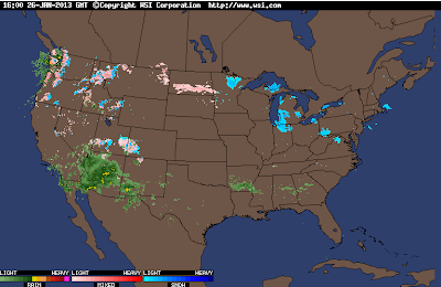
Maybe Some Rain Today...Perhaps Even A T-Storm.
Lots Of Radar Echoes This Morning To Our West.
At 9:03 AM MST This Morning.
Lots of rain falling across Arizona, and parts of southwestern New Mexico this morning.This is courtesy of an upper level storm that is currently approaching from southern California.
Satellite Images Of The Storm.
NAM 500 MB Forecast At 5 PM MST This Afternoon.
Although there is a lot of moisture and clouds headed our way, this mornings forecast models indicate that this storm approaching from the west, will pretty much wash out over Arizona by tonight.
Radar has indicated a few light rain showers over southeastern New Mexico this morning and we may see more of this activity today. We may even see an isolated thunderstorm or two but overall our chances for getting measurable rainfall are not all that great. Roswell has a 20% chance today into tonight, Artesia, Carlsbad, and Hobbs have a 20% - 30% chance of getting wet.
Sunday will be warm and windy with southwesterly winds kicking up at around 20 - 30 mph with higher gusts, especially in the afternoon. More spring-like temperatures are expected today and tomorrow with our highs ranging from the low 70's to the low 80's.
GFS 500 MB Forecast At 5 PM MST Sunday.
GFS 500 MB Forecast At 5 PM MST Monday.
GFS 500 MB Forecast At 5 PM MST Tuesday.
No sooner than we get done with one storm then yet another will fast be approaching upon its heels. This second storm is forecast by this mornings 12Z/5 AM MST U.S. GFS model run to sweep across New Mexico Monday night into Tuesday night.
(Temp Departures From Normal).
GFS Temp Anomalies Forecast At 5 PM MST Today.
GFS Forecast Temp Anomalies At 5 PM MST Sunday.
GFS Forecast Temp Anomalies At 5 PM MST Monday.
GFS Forecast Temp Anomalies At 5 PM MST Tuesday.
GFS Forecast Temp Anomalies At 5 PM MST Wednesday.
GFS Temp Forecasts At 5 PM MST Today.
GFS Temp Forecast At 5 PM MST Sunday.
GFS Temp Forecast At 5 PM MST Monday.
GFS Temp Forecast At 5 PM MST Tuesday.
GFS Temp Forecast At 5 PM MST Wednesday.
This storm will drag a cold front east across the state on Tuesday. Colder air will move in behind the cold front Tuesday night into Wednesday. After seeing highs in the 70's and 80's this past week, the 40's and 50's are currently being forecast for Tuesday and Wednesday, will hep send our thermometers back into more normal values for the end of January.
The Truth Is Stranger Than Fiction!
My Web Page Is Best Viewed With Google Chrome.


Comments
Post a Comment
Your comments, questions, and feedback on this post/web page are welcome.