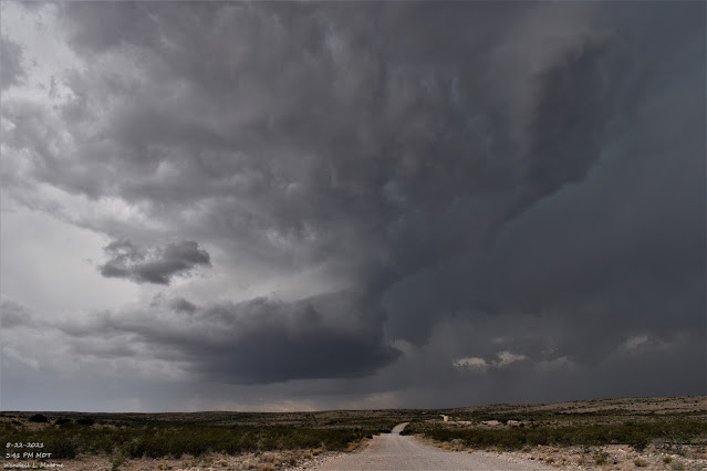
Lakewood, NM Storm Chase - Saturday, May 22, 2021.
3:41 PM MDT, Saturday, May 22, 2021.
23 Miles West Of Lakewood, New Mexico.
Supercell thunderstorm 29 miles west of Lakewood, New Mexico at 3:41 PM MDT, Saturday, May 22, 2021. My wife and I were 16 miles west of Lakewood and this storm was 13 miles southwest of us. This rotating storm was just inside the Eddy/Otero County line (on the Eddy County side). This is the same storm my wife and I chased in my YouTube video.
My wife and I chased this Supercell on Saturday afternoon. We were 16 miles west of Lakewood on Eddy County Road #23 (Rock Daisy Road) when I first started filming. The storm was 13 miles to our southwest and I filmed it until it was only 8 miles to our west-southwest. At the height of the storm during the most intense rotation, the storm was about 12-10 miles south of Hope.
Nice rotation noted within the storm. At one point it was radar warned for golf ball size hail. At the end, storms to its south and southwest cut off the inflow and it became rain-wrapped and downdraft dominated. Notice the small wet microburst crashing down just immediately to the right of the updraft in the middle of the video. It spread out to the left (south) and right (north). We also saw a couple of rain foots with this storm.
All of the videos were shot with my GoPro Max from inside of our truck.
(As Of Noon MDT Sunday Morning).
A combination of radar and satellite estimates indicate that 4.50" of rain fell from the Supercell thunderstorm my wife and I chased Saturday afternoon. Some 12-10 miles south of Hope or 23 miles west of Lakewood, New Mexico in far western Eddy County. At one point the storm was radar warned for golf ball size hail so I suspect this rainfall total may be a tad high due to hail contamination.
(As Of Noon MDT Sunday Morning).
(As Of Noon MDT Sunday Morning).
(From Saturday, May 22, 2021).
The Truth Is Stranger Than Fiction!


Great to see the rain falling there and also what looked like a beavers tail feeding into the super cell. We really need a lot of rain in El Paso and all of New Mexico.
ReplyDelete