Posts

Showing posts from May, 2021

Why Are My Weather Posts Missing From Facebook.

Hello everyone. I just wanted to let you know that my Facebook page was shut down without any warning by Facebook this past Saturday, June 8th. All I was told was that I had violated their community standards. I don't know what triggered that; they didn't tell me. I was told this may be permanent or for six months.
My guess is that it may be because I posted several comments and articles from my Substack page about the riots in LA, and that must have triggered/angered someone, and they complained, thus Facebook shut me down. I don't know this as fact, though. I have appealed this decision, and I'm still waiting for their reply. I have read on X that this has happened to other Facebook users posting about the LA riots as well.
I always share my weather blog posts (that I post here) on my Facebook page and my X page. This included over twelve different New Mexico and West Texas Facebook Community sites. So there are thousands of you out there (based on my views and shares of those posts) who will no longer see those posts. My Facebook page may or may not be restored.
This is another good reason (as the National Weather Service often reminds us) to have multiple ways of receiving severe weather alerts when severe weather threatens your location. My weather web page is one of those ways, and I really appreciate all of you who have and still do use it. Thank you so much!!!
If my Facebook page is restored, I will continue to share my weather blog posts and some of the NWS Watches and Warnings...as I have been doing for years now.

Jackson Road Funnel Clouds - May 28, 2021.

Image
8:03 PM MDT. Friday, May 28, 2021. My wife and I were storm chasing late Friday afternoon when I shot the two photos above of funnel clouds. We were sitting on north Joy RD northwest of Artesia, New Mexico (black circle with the red dot) looking to the northeast. Two funnel clouds developed and lasted a couple of minutes. Based on our location and the direction we were watching the funnel clouds I have circled the likely location of the funnels on the map above. Right over Jackson Rd just inside Chaves County or about 4 miles southwest of Lake Arthur.  My YouTube Time Lapse Video. My YouTube Time Lapse Video. Due to the resolution its a little hard to pick out the smaller funnel cloud to the left of the larger one. No enhancements were made to this video. The colors are untouched. It was shot with my GoPro Max from inside of our truck. The Truth Is Stranger Than Fiction!

Severe Weather This Memorial Day Weekend!

Image
Blog Updated At 11:49 AM MDT. 5-25-2021 4-Miles North Of Orla, Texas. Apparent Lightning Strike Damage? Severe Weather This Memorial Day Weekend! And just like that, we have been upgraded to an ENHANCED risk (orange area). The main concern in this area will be VERY LARGE HAIL but a tornado and/or damaging winds will definitely be possible . Keep your eyes on the weather this afternoon and tonight! #txwx #nmwx . Storm Prediction Center.  Day 1 Severe Weather Outlook. (Friday, May 28, 2021). SPC Day 1 Outlook (Today) Update. (As of 10:27 AM MDT). Valid 281630Z - 291200Z ...THERE IS AN ENHANCED RISK OF SEVERE THUNDERSTORMS OVER PORTIONS OF CENTRAL AND SOUTHWEST TEXAS... ...SUMMARY... Scattered severe thunderstorms with very large hail, damaging winds, and a couple tornadoes are possible across parts of west and central Texas into eastern New Mexico, mainly this afternoon and evening. ...TX... A very moist and potentially unstable air mass is in place today ...

Another Round Of Severe Thunderstorms Today.

Image
7:46 PM MDT. Sunday, May 23, 2021. Looking Southwest From C-Hill In Carlsbad, New Mexico. 8:05 PM MDT. Sunday, May 23, 2021. Looking South From C-Hill In Carlsbad, New Mexico. 7:47 PM MDT. Sunday, May 23, 2021. Looking Northwest From C-Hill In Carlsbad, New Mexico. A Low Precipitation (LP) Supercell thunderstorm formed south of Whites City Sunday afternoon. It moved north then split in two with the southern storm nearly stalling near Whites City. The northern storm (photos above) then took a right turn and started moving to the northeast towards Carlsbad. Slow rotation was noted in the storm. It passed over the southern end of the city as it was dissipating. The storms were radar warned for half dollar size hail. Another Round Of Severe Thunderstorms Today. Storm Prediction Center Day 1 Severe Weather Outlook. (This Outlook Will Be Updated By 7 AM MDT). (Click On The Link Above For The Latest Outlook.) Another round of severe thunderstorms is in our local forecast for today. Some of th...

Lakewood, NM Storm Chase - Saturday, May 22, 2021.

Image
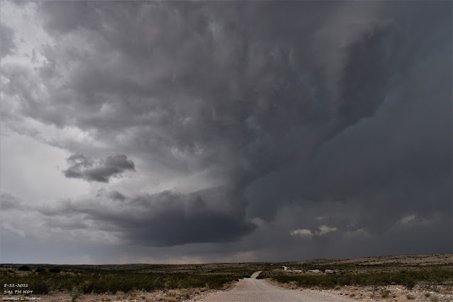
5-22-2021 3:41 PM MDT, Saturday, May 22, 2021. 23 Miles West Of Lakewood, New Mexico. Supercell thunderstorm 29 miles west of Lakewood, New Mexico at 3:41 PM MDT, Saturday, May 22, 2021. My wife and I were 16 miles west of Lakewood and this storm was 13 miles southwest of us. This rotating storm was just inside the Eddy/Otero County line (on the Eddy County side). This is the same storm my wife and I chased in my YouTube video . My wife and I chased this Supercell on Saturday afternoon. We were 16 miles west of Lakewood on Eddy County Road #23 (Rock Daisy Road) when I first started filming. The storm was 13 miles to our southwest and I filmed it until it was only 8 miles to our west-southwest. At the height of the storm during the most intense rotation, the storm was about 12-10 miles south of Hope. Nice rotation noted within the storm. At one point it was radar warned for golf ball size hail. At the end, storms to its south and southwest cut off the inflow and it became rain-wrapped a...

Significant Risk For Severe Thunderstorms In SE New Mexico Today Into Tonight.

Image
5-15-2021 A Steel Tower & A Cumlonimbus Tower. Looking Southwest From Lakewood Towards Carlsbad Caverns. Storm Prediction Center.  Day 1 (Today) Severe Weather Outlook. Severe Thunderstorms Today Into Tonight. All of the necessary parameters for severe thunderstorms to erupt over Southeastern New Mexico and nearby areas today into tonight are in place. Scattered thunderstorms will develop by around noontime (if not before in some areas) and increase in coverage and intensity as the afternoon wears on. Some of them will be severe. Low level southeasterly upslope flow has imported rich Gulf of Mexico moisture (dew points in the 60's locally) into the area overnight. Mid-level lapse rates are forecast to be around 7.5 c/km to 8.5 c/km, surface-based cape values are forecast to be around 2500 to 3000 j/kg, bulk wind shear values (surface to 6km) are forecast to be around 40 to 50 knots, thus the atmosphere over the local area will be very unstable today into tonight. Supercell thun...

Slow Moving Thunderstorm Dumps On Artesia, NM 5-15-2021.

Image
5-15-2021 Artesia, New Mexico. Artesia, New Mexico Street Flooding. Carlsbad-Lakewood-Artesia, New Mexico. (Time Lapse). 5-15-2021. Artesia, New Mexico. Normally Dry Eagle Draw   MRMS 24-Hour Rainfall Totals. (As Of Noon MDT Sunday, May 16, 2021). 24-Hour New Mexico MesoNet Rainfall Totals. (As Of Noon MDT Sunday, May 16, 2021). Thunderstorms Dump On Eastern & Southeastern New Mexico. A slow-moving thunderstorm dumped around an inch of rain in twenty minutes on Artesia Saturday afternoon. This caused street flooding in the city which in turn ran off into normally dry Eagel Draw and caused it to flood. See my first YouTube video above. Other thunderstorms dumped very heavy rains in the Portales area also causing flash flooding and at least one high water rescue of children from a flooded car. For those of you who follow me on Facebook, I have that video on my TimeLine. Radar estimated that up to two inches of rain fell immediately to the northwest of Artesia Saturday afternoon. ...

Round Two Today - More Severe Thunderstorms!

Image
5-14-2021. Carlsbad, New Mexico. Radio Blvd & Boyd Dr - Dark Canyon Arroyo. Once again the rains have returned. And what is so common or typical in this area is that when they do, they are often heavy. Such was the case last night southwest - west of Carlsbad where several Severe Thunderstorms developed. Several Severe thunderstorm warnings were issued for these storms by the Midland National Weather Service Office. Radar estimated hail anywhere from golf ball up to lime size (2" in diameter). MRMS estimates (combination of satellite, radar, and actual reported rainfall totals) indicated that 3.50" to 4.00" of rain fell some 5-10 miles southwest - west of Carlsbad from these thunderstorms.  Notice below on the estimated and reported rainfall total maps how isolated the heaviest of the storms were. Again highly typical. Heavy to very rains can fall miles from your location and produce flash flooding at your location without a drop of rain ever falling on you. See my b...

NWS Albuquerque Burn Scar Matrix

Current National Weather Service Watches/Warnings In Effect.

New Mexico

Chaves County Plains & Mtn's

Eddy County

Culberson County

Lea County

Lincoln County

Otero County

Current US Temps

Current US Wind Chill/Heat Index Temperatures

WPC 7-Day Precipitation Forecast

Roswell Live EarthCam

Ruidoso Live Webcam

Cloudcroft Live Webcam

NWS Midland 3-Day Precipitation Forecast

NWS Midland High End 3-Day Precipitation Forecast

NWS Midland 3-Day Precipitation Chances

New Mexico 3-Day Precipitation Forecast

New Mexico 3-Day High End Precipitation Forecast

New Mexico Precipitation Chances

NWS El Paso 3-Day Precipitation Forecast

NWS El Paso High End 3-Day Precipitation Forecast

NWS El Paso 3-Day Precipitation Chances

US 24-Hour Precipitation Forecast

US 24-Hour High End Precipitation Forecast

US 24-Hour High End Precipitation Forecast

US 3-Day Precipitation Forecast

US 3-Day High End Precipitation Forecast