My Current Weather

Sunday, November 29, 2020

Cold First Week Of The Meteorological Winter.


Valid At 5 AM MST Tuesday, December 1, 2020.

Meteorological Beginning Of Winter Ushers In A Cold Week.


Valid At 11 AM MST Sunday Morning.


Chilly Day Sunday In NM - The Week Ahead Will Be Too!

Sunday's high temperatures across New Mexico and nearby areas were some 10º to 15º below normal for the date. This trend will continue for the upcoming post-holiday work week (except for Tuesday). A weak cold front entered the Southeastern Plains this morning and pushed southward out of the area through the day. A second stronger cold front is forecast to drop southward into New Mexico Tuesday and Tuesday night bringing even colder temperatures behind it. 


Valid At 5 PM MST Tuesday, December 1, 2020.


Monday.


Tuesday.


Wednesday.


Thursday. 


Friday.


Monday Morning.


Tuesday Morning.


Wednesday Morning.


Thursday Morning.


Friday Morning.


With the jet stream diving straight south into the southern Rockies early this week, cold air will continue to funnel southward out of Canada and into the area all week long. Tuesday we get somewhat of a break with our local high temperatures near normal for the date ahead of the next southward moving cold front. Locally (SE NM) our high temperatures will average some 10º to 20º below normal for most of the week ahead. If this morning's Canadian (GEM) forecast model is correct our temps will be even than colder than indicated above. 

Mid-Upper Level Storm Cuts Off From Jet Stream Mid-Week.


Valid At 5 PM MST Wednesday, December 2, 2020.

Model mayhem rules the day again concerning our next mid-upper level closed/cutoff low to affect the area by mid-week and later. The models are all over the place with the strength and location of this next winter storm. Parts of New Mexico will see snow this week but how much and where is up in the air tonight.


Valid At 11 AM MST Thursday, December 3, 2020.

Both the European and Canadian models produce the most widespread snow from our mid-week storm but keep it on the light side. The point is don't get too hung up on the forecast map above because it will change once the models sort out the details or our next storm and its impacts hopefully by Tuesday. 


This morning's run of the Canadian (GEM) model was the coldest so our temperatures may or may not get as cold as is shown above this week. Some areas will be close though.

The Truth Is Stranger Than Fiction!

Friday, November 27, 2020

Colder Today & Saturday - Light To Moderate Snowfall In The Mountains.


Valid At 5 AM MST Friday Morning.

NAM 3 KM 500 MB (18,000') Forecast.

Valid At 3 PM MST Saturday.


Valid At 7:16 AM MST Friday Morning.

Strong But Moisture Starved Winter Storm Headed To New Mexico.

Mid and upper-level dynamics associated with our approaching closed low are still impressive this morning. Unfortunately, this storm lacks deep low-mid level moisture to work with therefore snowfall totals will be lower than could be. This system is forecast to crawl across Central New Mexico today into tonight then lift northeastward into the Texas Panhandle Saturday afternoon. 

At 8 AM MST Friday Morning.


Valid At 8:30 AM MST Friday Morning.

Colder Today With Snow Developing From West To East Across New Mexico.

Colder air overspread the state overnight behind yesterday afternoon and evening's cold front. It's a tad chilly across the Land of Enchantment this morning. Highs today in SE NM will be in the upper 40's to the mid 50's. Highs on Saturday will be in the 40's with some spots near 50.

Note the purple shaded areas on the temperature map above denote Winter Weather Advisories which are now in effect from this morning through Saturday morning. Locally in the Ruidoso area, new snowfall totals are currently (as of 8 AM MST Friday) to be in the 1" to 3" range by Saturday morning. 


Today.


Saturday.


Sunday.


Valid Today Through 5 AM MST Monday.


NWS NDFD Rainfall Forecast Totals.

Valid Today Through 5 AM MST Monday.

Light rain and snow showers are forecast to increase in aerial coverage across western and northern New Mexico today and spread eastward and southward. Current forecasts indicate that a couple of inches of snow will accumulate in the Ruidoso and Cloudcroft areas by Saturday evening. The higher peaks of the Sacramento and Capitan Mountains could pick up 3" to 6" of fresh snow. This is good news for Ski Cloudcroft and Ski Apache both of which hope to open soon. Ski Apache is scheduled to open on December 17th. 

Light rain may change over to light snow tonight and continue into Saturday morning in the Clovis, Portales, and Roswell areas. Current thinking is that accumulations will be less than one inch. We could see a few light rain showers and snow showers tonight into Saturday morning but no significant accumulations are currently forecast (as of 8 AM MST Friday). 

The Truth Is Stranger Than Fiction!

Thursday, November 26, 2020

Beautiful Thanksgiving Weather - Snow Black Friday Night Into Saturday?


Beautiful Thanksgiving Weather!


Thanksgiving Day.


Sunny skies, light winds, and afternoon high temperatures in the upper 60's to mid 70's are forecast across the Southeastern Plains of New Mexico today. Average high/low temperatures for Nov 26th range from the upper 60's across the lower elevations, to the mid 50's and mid 40's in the mountains. Lows in the mountains average in the 20's and plains.

Thanksgiving weather just does not get much better than this unless of course, you like the cold and snow like me. Enjoy New Mexico's holiday weather today because this too shall change starting tonight.


 Cold Front Arrives This Evening.


Valid At 5 PM MST Thanksgiving Evening.

Valid At 5 AM MST Saturday.

A backdoor cold front will move south and west down the eastern side of New Mexico today arriving in the Pecos Valley around sunset. Temperatures will be some 15º colder behind the front on Friday. Low level easterly to southeasterly upslope flow will develop over the area Friday night into Saturday.  


Friday.


Saturday.


Sunday.


Valid At Midnight Wednesday Night.

GFS 500 MB/18,000' Forecast.

Valid At 5 PM MST Friday.

Normally when I talk about the mid-upper level storms that affect our area I post snapshots of the 500 millibar (18,000' level) pressure chart anomalies. These charts depict the pressure gradient at the 18,000' level of the atmosphere. Both high-pressure systems and low-pressure systems. This morning I chose to show the heights and vorticity map instead. 

A strong short wave trough of low pressure at 18,000' was centered over northern Nevada last night at midnight. This short wave trough of low pressure is forecast to move slowly southeast today into Friday. By Friday at sunset, the GFS forecast model places a closed low over western New Mexico at the 18,000' level. The 500 millibar or 18,000' level charts are roughly halfway up in the atmosphere between the surface and about 40,000. Remember the jet stream normally is located between about 17,000' and 40,000' so these mid-upper levels storms usually form (but not always) just below the jet stream. 

This next inbound storm to affect New Mexico's weather Friday into Saturday will be somewhat moisture starved at the mid and upper levels. It will be a strong and cold storm but will have limited moisture to work with. Weak easterly to southeasterly low-level upslope flow will develop behind the cold front Friday and Saturday and this will provide limited moisture for the storm to ingest or work with. 

I chose the vorticity chart because it gives a clearer picture of the dynamics of the storm. Strong PVA or positive vorticity advection will be located over southern and western New Mexico Friday into Saturday at the mid-upper levels of the atmosphere. This lifting or upward forcing motion will help produce snow over parts of the Land of Enchantment Friday into Saturday. 


NWS Albuquerque Snowfall Forecast.


Storm For Black Friday Into Saturday?

Given the current computer models forecast track of our next incoming winter storm, current forecasts indicate that snowfall totals across New Mexico will be on the light side with the heaviest snows falling in the mountains. As is the case so many times with these storms the exact track, speed, and location of this one will determine where the snow falls or doesn't. If it slips further south and slows down some more then the totals depicted on the charts above will be higher than currently forecast. 

And this storm will produce bands of snow which will mean that some locations could get several inches of snow, while just a few miles away, others get next to nothing. We saw a great example of this with our October 25th, 26th storm. Carlsbad got 11/2" to 2", Artesia flurries to patchy ground cover, Hobbs flurries, Roswell 6" to 10", Cloudcroft 1"-3", Mayhill 6", Ruidoso area 6" to 9". A CoCoRAHS Station located 25 miles north of Roswell got clobbered with 17". Snow bands are extremely difficult to predict even in the short term forecast window and even more so when these narrow bands of moderate to heavy snow are convective in nature. 

Snow will start falling across northern and western New Mexico on Friday and will spread eastward and southward Friday night into Saturday.


The Truth Is Stranger Than Fiction!

NWS Albuquerque Burn Scar Matrix Forecast

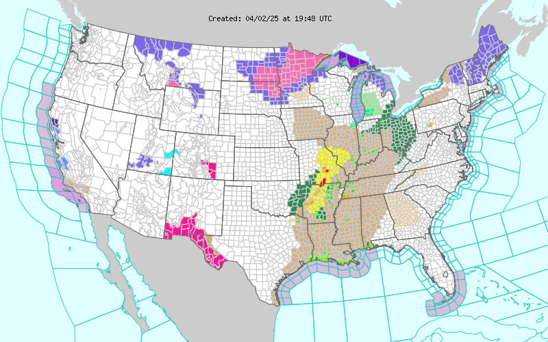
Current NWS Watches/Warnings In Effect

New Mexico

Eddy County

Chaves County Plains & Mtn's

Culberson County

Lea County

Lincoln County

Otero County

Current US Temps

Current US Wind Chill/Heat Index Temperatures

NWS Midland Forecast

NWS Midland Forecast

NWS Albuquerque Forecast

NWS Albuquerque Forecast

NWS El Paso Forecast

NWS El Paso Forecast

NWS El Paso Forecast

NWS Lubbock Forecast

NWS Lubbock Forecast

NWS Lubbock Forecast

Average Daily High/Low Temperatures & Rainfall

Average Daily High/Low Temperatures & Rainfall