My Current Weather

Wednesday, November 30, 2011

Latest Update This Afternoon On Our Winter Storm.

Good morning everyone (Thursday morning @ 8:20 AM). I am still working on today's blog update. Lots going on and will have it posted in an hour or so. Thanks for stopping by. 


I sat in on a special conference call and web briefing hosted by the Albuquerque National Weather Service Office this afternoon, concerning the Major Winter Storm that is going to impact most of New Mexico tomorrow into this weekend. Here are some of the forecasters thoughts on this significant event.

Northern 2/3rd's Of New Mexico.

As the arctic cold front races southward down the eastern plains tomorrow, it will dam up against the central mountain chain of the state. It looks like this is going to be one of those rare occasions to where not only are these areas facing a potentially damaging gap high wind event, (strong northeasterly-easterly winds pushes westward through the mountain passes) but also a over-topping high wind event as well.

The depth of the arctic air should be deep enough by around sunset tomorrow evening to over-top the Sandia and Manznao mountains, and spill down the western slopes into the northeastern heights of Albuquerque and nearby areas. These winds have the potential to reach speeds of 70 mph, and could very well produce some damage. As these powerful wind gusts spill over the tops of the mountains, they will blow snow off of the mountain tops and into the northeast heights of Albuquerque.

A High Wind Warning is now in effect for the Central Mountain Chain, and the Rio Grande Valley from 11 AM tomorrow morning through 5 AM Friday morning. A Wind Advisory for east to northeast winds of 30-40G55 mph is now in effect for northeastern and eastern New Mexico, as well as parts of central New Mexico.

The upper-level low now located over southern Nevada, will continue its plunge southward into southwestern Arizona where it will stall through Friday. By Friday night the upper-level low will begin to eject east and northeast towards the state. Widespread snows should develop across much of New Mexico on Friday. By Friday night a significant frontogenetical band of heavy snow should develop somewhere near a Carrizozo-Santa Rosa-Clayton line. There is the potential for significant heavy snowfall totals across the eastern plains of the state. Just where this band of heavy snow sets up is still a little in question and will be dependent upon the exact track of the upper level low.

Bands of heavy snow are forecast to develop across the northeastern and eastern plains of New Mexico Friday night into Saturday. Blowing and drifting snow will be a problem in some of these areas with near whiteout conditions possible. Travel across I-25 and I-40 will be significantly impacted in these areas, and road closures are possible not on just the interstates but also across many secondary roads in these areas. Travel problems are also anticipated across the western areas of the state due to heavy snow and blowing and drifting snow.

A second surge of arctic air is forecast to move southward down the eastern plains on Saturday. Wind chill values to drop down into the single digits and teens across many areas of the state tomorrow night into Friday.

A secondary upper-level low is forecast to dive rapidly southward across Utah on Saturday, and this will help to kick the secondary surge or arctic air southward down the eastern plains. This second upper-level low is forecast to meander slowly eastward across New Mexico Sunday night into Monday. These two features may produce round two of winter weather across the state. Cold air will continue to grip the state into next week.

Southeastern New Mexico-

Not much has changed on the timing of the arrival of the arctic cold front in SE NM tomorrow. Gusty northerly winds of 20-30 mph with higher gusts will accompany the frontal passage, along with rapidly falling temperatures. Our afternoon highs are in the mid-upper 60's today...by Friday and Saturday we will be looking at high temperatures in the low-upper 30's. A High Wind Watch remains in effect for the Guadalupe Pass area for tomorrow afternoon into tomorrow night for northeasterly winds of 30-50G60 mph.

A complicated weather pattern will develop across SE NM Thursday night into Friday. A pocket of warmer moist laded air located roughly between about 5,000' to 10,000' will override the shallow arctic airmass near the surface. This will help to produce a mixed bag of wintry precipitation of drizzle, freezing drizzle, rain, light freezing rain, sleet, and snow across the local area late Thursday night into Friday morning.

Things get even more complicated Friday night. A surface low may form over the south plains of West Texas, and this will keep the warm air advection pattern ongoing, actually increasing it somewhat. Elevated instability could help to produce a few thunderstorms across the area Friday night.

Heavy snow may be a possibility across parts of Chaves County depending upon the track of the upper-level storm. A Winter Storm Watch has been posted for Chaves and Lincoln Counties, from Friday afternoon through Saturday afternoon. The higher areas of the Sacramento and Capitan mountains could receive over a foot of snow. The lower elevations across eastern and parts of southeastern New Mexico could receive over 6 inches of snow.

Travel problems could become widespread across areas of the state from tomorrow night into Sunday. Please visit the New Mexico Road web site for current road conditions across the state.

The Truth Is Stranger Than Fiction!

Arctic Air Comes Knocking Tomorrow.

Potential For An Ice Storm Tomorrow
 Night Into Friday Morning.


What a mess this storm is going to be. To start out with a High Wind Watch has been issued for the Guadalupe Pass area for tomorrow into tomorrow night. Northeasterly winds at around 30-50 mph with gust up to near 60 mph are expected . A High Wind Watch is also in effect for the Central Mountain Chain, and the Rio Grande Valley for tomorrow morning into late tomorrow night. Easterly canyon (gap winds) at around 35-45 mph will gust up to near 65 mph. There is the potential for damage from the strong gap winds.

A cold modified arctic airmass is forecast to arrive in SE NM tomorrow. Current forecasts have the front arriving in the Roswell area by around noontime, and into the rest of SE NM by dark. Strong northerly to northeasterly winds will accompany the front passage at around 25-35 mph with higher gusts. Temperatures will fall rapidly behind the front, with wind chill values falling down to the single digits and teens late tomorrow night into Friday morning. Our high temperatures are only forecast to be in the 30's Friday and Saturday.

A light ice storm looks possibly across SE NM tomorrow night into Friday morning. A mix of light freezing drizzle, and light freezing rain along with areas of ice fog is expected across most of SE NM into parts of West Texas to our east. A wintry mix of rain, freezing rain, sleet, and snow is forecast for the area Friday into Saturday. Area roadways could become a slippery mess late tomorrow night into Saturday. Please visit this site for the latest road conditions across the state.

Heavy snow is forecast to fall over the Sacramento and Capitan mountains above 7,000' Friday and Saturday. Snowfall totals in these areas are expected to be around 6" - 10". I expect to see the higher elevations to potentially pick up much more...especially Ski Apache.

Just how much snow accumulates on the ground across the lower elevations of SE NM is still difficult to figure out. I think we may see anywhere from a dusting up to a couple of inches in places by Saturday. This could very well change depending upon the track and speed of the upper-level storm to our west.

 The models continue to struggle with the details of this storm. The NAM/WRF forecasts are the fastest, and the furthest to the north with the upper-level low, the GFS forecasts are in the middle of the road so to speak, and the ECMWF closes the upper-level low off, and hangs it back over the Baja Region through next Monday or Tuesday. 

A Special Weather Statement has been issued by the Midland NWS Office concerning this storm. The Lubbock NWS Office has also issued a Special Weather Statement, and a Special Web Briefing  detailing their concerns with this storm. A Special Weather Statement has also been issued by the  Albuquerque NWS Office, and the El Paso NWS Office..."Special Weather Statement." A Special Weather Video Briefing has also been issued by the Albuquerque NWS Office.

At this time there still remains some uncertainty concerning the exact details of this impending potentially Major Winter Storm. I will have the latest details posted on my blog as they become available.

The Truth Is Stranger Than Fiction!

Tuesday, November 29, 2011

Major Winter Storm To Impact NM & W TX.

Blog updated at 8:20 PM.

New Mexico The Time To Prepare Is Now!


Upper-Level Storm Entering The Pacific Northwest At
2PM MST This Afternoon. This Is Our Potentially Major
Winter Storm That Will Impact Our Weather Into Sun.

5-Day Precipitation Total Forecast. Tue-Sun.

NE Winds 35-50G65 MPH.
Thursday Into Thursday Night.


Arctic Front Arrives Thursday. Turning Much Colder.
A Wintry Mix Of Rain, Freezing Rain, Sleet, Snow Late
Thursday Into Saturday Across SE NM And West TX.
High Temps Friday And Saturday In The 30's.


A Combination Of Freezing Rain, Drizzle, Sleet, And Snow
Expected Across West Texas Thursday Into The Weekend.


Potential For A Major Winter Storm To Impact New Mexico
Thursday Into The Weekend. High Wind Warning Across The
Central Mountain Chain, And The Albuquerque Metro Area
Thursday Night. Damaging Winds Will Be Possible. East
Winds At 40-50G70 MPH.

Potential For Heavy Snowfall Across Parts Of The State
Especially Across The Mountains. Accumulating Snows
May Also Fall Across Southern And Southeastern New
Mexico, Eastern New Mexico, And Parts Of West Texas.
There Could Be Some Significant Travel Problems Across
The Entire Area Thursday Into The Weekend.

----------------------------------------------------------------------------------

As I have been mentioning for the past couple of days, this impending potentially Major Winter Storm is going to be a complicated mess. It is now forecast to drop a wide swath of precipitation from Arizona into Texas Thursday into the weekend. Once again, its just about impossible to try and nail down just who gets the the heaviest snowfall across the lower elevations of New Mexico and surrounding West Texas. The mountains certainly have the potential to pick up some very heavy snowfall totals, especially across the higher elevations.

This storm may deliver two punches to the state and surrounding areas.The first punch comes Thursday night into Friday, and the second once Saturday into possibly Sunday. A second surge of arctic air may work its way southward down the eastern plains, and into southeastern New Mexico on Saturday.

My next update on this storm will be tomorrow morning.Thanks for stopping by.

The Truth Is Stranger Than Fiction!

Meteorological Winter Starts Thursday - It Will Feel Like It.

Blog updated at 8:45 AM MST.

Winter Storm Shaping Up For The End Of The Week.


Arctic Air Arrives Thursday.


A modified surge of arctic air is forecast to arrive in southeastern New Mexico on Thursday. The timing of the arrival of the front is still a little uncertain this morning. This mornings forecast high temperatures for Thursday (courtesy of the Albuquerque and Midland NWS Offices) range from 45 in Clovis, 49 in Tatum, 56 in Roswell, 58 in Artesia, 59 in Carlsbad, to 53 in Hobbs. If the front arrives Thursday morning then these temperatures will be colder than what is being forecast. If the front is a little slower and arrives Thursday afternoon or evening then these temperatures may be a little too cool.

Temperatures will fall fairly rapidly once this arctic cold front arrives in the area. Gusty northerly winds at around 20 - 30 mph will accompany the frontal passage and will persists into Friday. Wind chill values over the area will dive into at least the teens (if not colder in a few places) Thursday night into Friday morning.

One thing is for certain this morning and that is that much colder air is going to invade not only southeastern New Mexico, but much of New Mexico as well. Current forecasts are calling for daytime high temperatures on Friday in the low-mid 30's. This colder airmass is forecast to hang around into the weekend, and hang around into at least the first of next week. Most of the area will not get out of the 30's and 40's during this time frame, and it may even be colder than this in places.

Potential For Major Winter Storm.

Valid At 5 PM MST Thursday.

A strong short wave trough of low pressure will enter the Pacific Northwest today, and then dive southward through the Great Basin, and into southern California on Thursday. The latest model trends indicate that there still remains some uncertainty concerning the forecast track, and speed of this potentially strong mid-upper level winter storm. The GFS moves the upper-level storm across the state on Sunday, while the WRF/NAM is faster in moving the storm out of the state.

Last nights 00Z/5 PM MST run of the ECMWF model, was trying to throw a kink in the forecasts by developing a second lobe of energy on the backside of the upper-level low, then digging the storm further to the south, while stalling it south of southern California into next Tuesday at least.

5-Day Precipitation Forecast Today - Sunday.

Valid At 5 PM MST Saturday.

I still think that this is going to turn out to be a messy storm for us. A mixed bag of sloppy precipitation is anticipated from Thursday night into at least Saturday. Light freezing drizzle, or perhaps light freezing rain, may develop over E/SE NM and parts of west Texas Thursday night into Friday morning. A mix of rain, or freezing rain and sleet, and snow looks possible across SE NM on Friday. For now our chances of seeing measurable precipitation are in the 30% - 40% range.

How much snow is going to fall locally is still a very tough question to answer this morning. The models keep changing their tune with each new run that comes out every six hours. Some of the models yesterday, and last night, were hammering eastern New Mexico with 6" - 10" of snow. I still think its too early to try and nail down any exact totals. I do believe that we have a decent shot of getting some of the white stuff on the ground, I am just not sure of the totals yet.

This winter storm looks like it will be a classic setup for the mountains of the state to receive some heavy snowfall totals. If the storm takes the southerly track and stalls, then the states southern areas, and especially the mountains, would be favored for heavy snowfall.

This mornings Area Forecast Discussion (AFD) from the El Paso National Weather Service Office, discusses the possibility of the Gila Mountains getting 10" - 15"of snow out of this storm, and the Sacramento's picking up around 10". Ski Apache, and Ski Cloudcroft, both could do very well as far as snowfall totals are concerned with this storm.

Current forecast model trends indicate that the lowlands of southern New Mexico as well as southeastern New Mexico may at least pick up a couple of inches of the white stuff. This is not written in stone yet and could easily change.

Thursday is the start of our meteorological winter and it will certainly feel like winter by nightfall. As I have mentioned several times over the past couple of days there remains a lot of unknowns concerning this potentially major winter storm that is due to impact the state. Please check back here often, and I will keep you up to date on the very latest details concerning this impending winter storm. Or visit our local National Weather Service Forecast Office web pages via the links listed below.


The Truth Is Stranger Than Fiction!

Monday, November 28, 2011

Warming Up Into The 70's Today...Big Storm Late Week.

Today Across New Mexico.


Sunny skies and much warmer temperatures will be our weather story for the day. Most of SE NM should climb up into the low-mid 70's this afternoon. Today will likely be the warmest day that we see over the next week...its going to be awhile before we see the mid 70's again after today.

Tuesday Across New Mexico.


Cold Front Arrives Late Tonight.


A cold front will arrive in SE NM late tonight. This will be the first cold front to affect our local weather, with a much stronger cold front arriving on Thursday. This second cold front will bring cold arctic air to the region. Our high temps are forecast to only be in the low-mid 50's tomorrow, and the mid 60's on Wednesday.

Potential For A Strong Winter Storm
Late This Week Into The Weekend.


Strong Storm In The Mid-Upper Levels Of The Atmosphere.

Valid At 5 AM MST Thursday.

For a week now, the US GFS forecast model has been indicating that a strong cutoff upper-level storm will dive southward out of the Pacific Northwest, and into the Desert Southwest by the end of the week. This is the easy part of this weeks weather forecast. The models continue to struggle with what happens with this storm after Thursday.

The GFS continues to deepen the storm, as well as digging it a little further south with time. It also wants to slow the storms eastward progression down, not clearing the state until possibly as late as Sunday. It wants to keep the mid-upper level low as a cutoff low until it crosses over southern New Mexico this weekend, then begins to open the storm up, while weakening it as it moves into West Texas by late Sunday. Meanwhile the European (ECMWF), and the Canadian (CMC) models, open the mid-upper level low up, and move it across the state in a faster and weaker mode by Saturday.

This is nothing new, the models typically struggle with cutoff upper level lows. And given the fact that the blocking pattern that has been prevalent this fall, is showing signs of breaking down, just further complicates the forecasts.

Cold Arctic Air May Stick Around For Awhile.


A cold dome of arctic air will arrive in SE NM sometime on Thursday. If the cold front arrives early enough Thursday morning, our daytime high temps will be colder than forecast. Likewise, if it is a little slower in getting here, then our highs will be warmer than current forecasts indicate. Typically the models also struggle with the arrival times of these arctic fronts.

Either way it appears that we are headed for colder temperatures. There is the possibility that cold air could get entrenched over the area from Thursday into the first of next week. Just how cold it will get is the question. For now it appears that we are looking at daytime high temperatures of at least in the 30's and 40's, if not colder. If we get enough snow on the ground then our nighttime lows during this period could be really interesting too.

Will It Snow...And How Much If It Does?


Now the hard part of this discussion. Will it snow in SE NM and nearby areas? The safe answer at this time is the easy one, maybe. This is going to be a complicated storm to deal with to say the least. Everything depends upon how far south the upper-level digs, how fast to the east that it moves and when, as well as how much low-level upslope flow gets ingested into the storm, and how cold will the arctic airmass be and for how long.

My thinking for now is that this is going to be a messy storm so to speak. A pocket of warm air at around the 850-700 millibar level, or 5,000 to 10,000' MSL, may get pulled over the top of the arctic air at the surface Friday and Saturday. This could really complicate the forecast. For one, it could help to modify the arctic air to where it would not be as cold as some of the models are forecasting. It could also help produce a mixed bag of precipitation across the area. We could see a combination of drizzle, rain, freezing rain, sleet, and snow.

As always when trying to forecast our local weather the devil is in the details. Its just too early yet to try and call this one. There is the potential for snow across the area, and some of the mountains of the state could get hammered with heavy snow. If the upper-level storm opens up and moves eastward faster than the models indicate, then we would more than likely just get some colder weather and wind. More on this potentially significant winter storm later.

The Truth Is Stranger Than Fiction!

Sunday, November 27, 2011

First Significant Winter Storm The End Of The Week?

Preliminary Low Temps This AM.


Brrrrrr. Its a tad chilly out there this Sunday morning. My low temp here at my home in Carlsbad has been 21. The coldest reading that I can find has been the 8 at the Fort Stanton Raws. Close behind is the 12 recorded at the automated station located 10 miles ESE of Hagerman. The Mayhill Raws isn't far behind with a low of 14.

Today will be a little warmer than yesterday with our afternoon high temps rising up into the upper 50's. Highs on Monday will be even warmer with readings near 70. Another dry cold front will enter the area Monday night and this will knock our highs back down into the 50's on Tuesday. Wednesday will be warmer with highs in the mid 60's.

New Mexico Outlook End Of This Week.


Valid At 5 PM MST Thu Dec 1, 2011.


There has been little run to run consistency with the models concerning the seasons first potentially significant winter storm for the state. The ensembles are all over the place as well. So we are just going to have to wait several more days for the models to settle down, before we can get a clear picture of what this storm is going to do.

Colder weather is definitely on the way by the end of the week. Arctic air could arrive as early as Thursday here in SE NM. Just how cold it will get and for how long is still questionable. It appears that we will at least drop down into the 30's and 40's for highs by Friday, and into the weekend. It could even be a little colder than this over parts of the local area.

Are we going to get any snow, and if so, how much? That's a tough question to answer this morning. Its still a possibility from Thursday into the weekend. There is the potential for the mountains to receive some heavy snowfall totals with this storm.

A strong cutoff mid-upper level low is forecast to drop southward into Arizona by around Thursday. Some of the models are dropping this storm further to the south with time, others are not. Some of them are dragging this storm slowly across the state from Friday into the first of the following week. A key factor for how much rain/snow falls across SE NM and nearby areas will be how much low-level easterly upslope flow develops across the area.

The Truth Is Stranger Than Fiction!

Friday, November 25, 2011

Windy - Cooler Saturday.

Recap Of Today's Rainfall.

It did rain today...but our local rainfall totals were disappointing to say the least across the southeastern plains. Listed below are some of the rainfall totals reported today across SE NM and nearby areas.

High Roll CW5738 .68"
Sierra Blanca Snotel .50"
Carrizozo Airport .48"
Timberon CW7724 .38"
8-Mile Draw Raws .35"
Mescal Raws - Near Mescalero .32"
Cloudcroft DW7382 .25"
Mayhill CW9878 .24"
5.0 Miles SSE of Carlsbad .24"
Smokey Bear Raws - Near Ruidoso .22"
Hossman Observatory Mayhill .16"
Ruidoso - Midtown .14"
NW Hobbs - KM5BS .05"
Carlsbad Airport ASOS .05
2.1 Miles NNW of Downtown Carlsbad .04"
Roswell Airport ASOS .01"

Rainfall Totals Are Courtesy Of-


Saturday's Weather.


A strong cold front will push south through the southeastern plains Saturday morning. Gusty northerly winds will accompany this frontal passage. Sustained speeds will be around 25-35 mph with gusts near 50 mph.

A Wind Advisory has been issued for Lea County and surrounding counties in West Texas where the winds are forecast to be the strongest. Areas of blowing dust will occur with the stronger wind gusts.

High temperatures on Saturday are forecast to be in the 50's. Sunday will see highs in the low 60's. Sunday morning will be seasonably cold with low temperatures in the low-mid 20's. As always, a few of the normally colder spots will drop down a little lower, perhaps down to around 20. The upper teens in a few of these colder spots will also be possible.

Next Week Is Going To Be Interesting.

Monday will be warmer with afternoon highs in the low-mid 70's. A cold front will move into the area Monday night, therefore dropping our high temperatures on Tuesday back down into the mid 50's. This will be a dry front so no precipitation is forecast with this system.

Arctic Blast By The End Of The Week?


A strong arctic cold front is forecast to enter SE NM by around next Thursday. Its early yet, so the exact timing of this frontal passage is questionable. However, it appears that the coldest airmass of the season is about to give us our first taste of winter.

Depending upon the timing of the arctic front, our high temperatures may not get out the 20's and 30's Thursday into Sunday. How about low temperatures during this time period in the teens or colder? Get ready...its looking like this is going to be our first serious storm of the season.

Tonight's 5 PM MST run of the US GFS forecast model, is forecasting a strong closed 500 millibar low to drop southward into the Four Corners by Thursday, and then slowly move eastward across southern New Mexico Friday into Sunday. And to make life really interesting, its forecasting a good low-level upslope flow situation, combined with a decent slug of moisture at the mid levels of the atmosphere. Liquid equivalent totals for the area are in the .25" to .50" range on Saturday. Translation, snow and maybe lots of it.

All of this depends upon whether or not this model forecast verify's of course. Its more speculation than anything at this early stage in the game, but definitely worth watching. This potential storm could be a news maker for us, or it could just easily be a flop. If nothing else, we are more than likely to see the coldest airmass of the season invade us by the end of this week into the weekend.

The Truth Is Stranger Than Fiction!

NWS Albuquerque Burn Scar Matrix Forecast

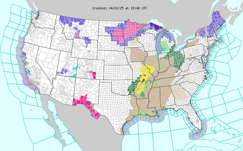
Current NWS Watches/Warnings In Effect

New Mexico

Eddy County

Chaves County Plains & Mtn's

Culberson County

Lea County

Lincoln County

Otero County

Current US Temps

Current US Wind Chill/Heat Index Temperatures

NWS Midland Forecast

NWS Albuquerque Forecast

NWS Albuquerque Forecast

NWS El Paso Forecast

NWS Lubbock Forecast

NWS Lubbock Forecast

Average Daily High/Low Temperatures & Rainfall

Average Daily High/Low Temperatures & Rainfall