My Current Weather

Sunday, July 23, 2023


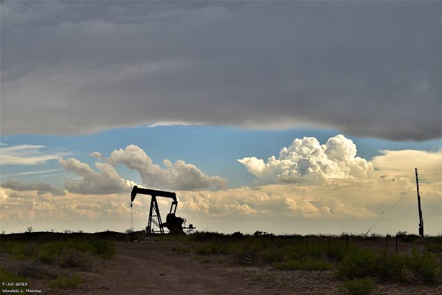
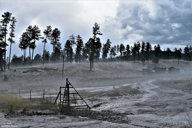
July 22, 2023.
Ground Fog And Hail Drifts.
St Hwy 244 - Mescalero Apache Indian Reservation.
17 Miles NE of The Junction Of US Hwy 82 & St Hwy 244.
Pea - Dime Size Hail With A Few Penny Size Stones At The Silver Lake Campground.

(As Of 10 AM MDT Sunday July 23, 2023).

(As Of 10 AM MDT Sunday July 23, 2023).


(As Of 10 AM MDT Sunday July 23, 2023).


GRLevelX Radar & CoCoRaHS 24-Hour Rainfall Totals.
(As Of 10 AM MDT Sunday July 23, 2023).


Public Information Statement
National Weather Service Albuquerque NM
957 AM MDT Sun Jul 23 2023

...HAIL REPORTS...

Location                     Size      Time/Date

...New Mexico...

...Harding County...
2 SSE Roy                    0.88 in   0525 PM 07/22

...Lincoln County...
1 NNE Alto                   0.70 in   0449 PM 07/22
2 ESE Alto                   0.25 in   0445 PM 07/22

...Torrance County...
3 SSW Encino                 0.25 in   0522 PM 07/22

...HIGHEST WIND REPORTS...

Location                     Speed     Time/Date

...New Mexico...

...Chaves County...
Roswell Air Center           44 MPH    1026 PM 07/22
Dexter                       40 MPH    1030 PM 07/22
Bitter Lake WL Refuge 14 NNE 40 MPH    1037 PM 07/22

...Cibola County...
I-40 At Sr6                  46 MPH    0649 PM 07/22

...De Baca County...
East Fort Sumner             49 MPH    0825 PM 07/22
South Ft Sumner              44 MPH    0830 PM 07/22

...Guadalupe County...
Puerto De Luna 3.3e          54 MPH    0750 PM 07/22
Santa Rosa Airport           53 MPH    0735 PM 07/22
Thompson Cattle              40 MPH    0520 PM 07/22

...Harding County...
Mills 4 WSW (Mills Canyon)   58 MPH    0505 PM 07/22

...Lincoln County...
Phillips Hill (WSMR)         55 MPH    1025 PM 07/22
Oscura Range Camp (WSMR)     41 MPH    0700 PM 07/22
Shist (WSMR)                 41 MPH    0720 PM 07/22

...Los Alamos County...
Los Alamos 5 SSW (LANL)      57 MPH    1245 AM 07/23
Los Alamos 3 ESE (LANL)      44 MPH    1245 AM 07/23

...Roosevelt County...
Tolar 13 SE (Melrose Range)  40 MPH    1014 PM 07/22

...Sandoval County...
Frijoles (Tower)             40 MPH    0608 PM 07/22

...Santa Fe County...
Santa Fe Muni Airport        49 MPH    0527 PM 07/22

...Socorro County...
Little Burro (WSMR)          55 MPH    1035 PM 07/22
Stallion Runway (WSMR)       45 MPH    0700 PM 07/22
North Oscura Peak (WSMR)     44 MPH    0950 PM 07/22
Tower 6 (WSMR)               41 MPH    0730 PM 07/22
Sulf (WSMR)                  41 MPH    0830 PM 07/22
Mine (WSMR)                  41 MPH    0945 PM 07/22
Harry (WSMR)                 40 MPH    0720 PM 07/22

...Taos County...
Taos Pueblo Raws             45 MPH    0513 PM 07/22

...Torrance County...
Estancia 2 WSW               45 MPH    0642 PM 07/22
Estancia 7 SSW               43 MPH    0645 PM 07/22

...PRECIPITATION REPORTS...

Location                     Amount    Time/Date

...New Mexico...

...Bernalillo County...
ALBUQUERQUE                  0.31 in   0935 AM 07/23

...Catron County...
Gila Qd2                     0.48 in   0907 AM 07/23
Pleasanton 2.0 S             0.39 in   1226 AM 07/23
Datil 2.0 W                  0.25 in   0600 AM 07/23
Datil 17.8 SSW               0.25 in   0700 AM 07/23
10.3 SE Cruzville (JE-FULLER 0.12 in   1041 PM 07/22
Datil 11 NNE (Datil)         0.10 in   0911 AM 07/23

...Chaves County...
Bitter Lake WL Refuge 14 NNE 0.26 in   0937 AM 07/23
Roswell 6.0 NNW              0.11 in   0700 AM 07/23

...Cibola County...
11 WSW Bluewater Lake (SNOTE 0.10 in   0700 AM 07/23

...Colfax County...
Angel Fire 4.1 NNW           0.11 in   0700 AM 07/23

...Guadalupe County...
Santa Rosa Airport           0.40 in   0935 AM 07/23
Santa Rosa 16.6 SE           0.20 in   0900 AM 07/23
Santa Rosa 12.1 SE           0.15 in   0700 AM 07/23

...Harding County...
Mills 4 WSW (Mills Canyon)   0.29 in   0905 AM 07/23

...Lincoln County...
2 ESE Alto                   0.72 in   0521 PM 07/22
Ruidoso 1 NNW (Smokey Bear)  0.54 in   0900 AM 07/23
Alto 0.3 N                   0.43 in   0700 AM 07/23
Alto 1 E                     0.41 in   0945 AM 07/23
Lincoln 1.4 ESE              0.26 in   0700 AM 07/23
Capitan 1.3 WSW              0.21 in   0815 AM 07/23
Alto 7.4 W                   0.20 in   0700 AM 07/23
Alto 4.8 NE                  0.20 in   0700 AM 07/23

...Los Alamos County...
Los Alamos 6.1 SE            0.17 in   0800 AM 07/23
White Rock                   0.10 in   0800 AM 07/23

...Mora County...
Wagon Mound 3.2 WNW          0.35 in   0700 AM 07/23

...Rio Arriba County...
Coyote 7 SSW (Coyote)        0.15 in   0848 AM 07/23

...San Miguel County...
Villanueva 0.5 SW            0.44 in   0800 AM 07/23
Lower Colonias 5 E (Pecos)   0.31 in   0914 AM 07/23
San Pablo 2 E                0.17 in   0700 AM 07/23

...Sandoval County...
Los Posos (DRI)              0.34 in   0900 AM 07/23
La Cueva 2 SSE (Jemez)       0.23 in   0908 AM 07/23
Jemez Springs 7.9 NNE        0.22 in   0800 AM 07/23
Jemez Springs (DRI)          0.22 in   0900 AM 07/23
VALLES CALDERA LOS ALAMOS 13 0.21 in   0500 AM 07/23
VALLES CALDERA LOS ALAMOS 13 0.18 in   0915 AM 07/23
San Antonio (DRI)            0.16 in   0900 AM 07/23
Jemez Springs                0.13 in   0930 AM 07/23
Valle Toledo (DRI)           0.10 in   0900 AM 07/23

...Socorro County...
Magdalena 28.1 WSW           0.28 in   0700 AM 07/23
Carrizozo 15 NW (Chupadera)  0.26 in   0939 AM 07/23
VLA 16 SSE (Magdalena)       0.23 in   0903 AM 07/23

...Torrance County...
Encino 6 W                   0.98 in   0700 AM 07/23
McIntosh 4.4 ESE             0.28 in   0800 AM 07/23
Clines Corners 1 SSE         0.13 in   0853 AM 07/23
&&


Observations are collected from a variety of sources with varying
equipment and exposures. We thank all volunteer weather observers
for their dedication. Not all data listed are considered official.

$$
NWS El Paso Storm Report.
Preliminary Local Storm Report
National Weather Service El Paso TX/Santa Teresa NM
317 PM MDT Sat Jul 22 2023

..TIME...   ...EVENT...      ...CITY LOCATION...     ...LAT.LON...
..DATE...   ....MAG....      ..COUNTY LOCATION..ST.. ...SOURCE....
            ..REMARKS..

0145 PM     Hail             8 NE Cloudcroft         33.02N 105.63W
07/22/2023  E0.75 inch       Otero              NM   Trained Spotter


JG
There Are None So Blind As Those Who "Will - Not" To See...107.

Thursday, July 20, 2023

Reported High Temperatures Wednesday, July 19, 2023.


JUly 10, 2023.
South Of Loco Hills On St Hwy 360.

Blog Updated Friday, July 21, 2023 @ 6:50 AM MDT.


(Wednesday, July 19, 2023).


Reported Official/Unofficial High Temps Wednesday:
Roswell Airport 112. (Second time this year...also on 6-27-2023).

8-Mile Draw Raws NE of Roswell 111.
Our Home In NW Carlsbad 111.
El Paso, TX Airport 111.
Hagerman ZiaNet Stn 110.
NW Carlsbad ZiaNet Stn 110.
Carlsbad Airport 110.
PWS Lakewood 110.
Seven Rivers ZiaNet 110.
Las Cruces Airport 110.
Artesia Airport ZiaNet 109.
Artesia Airport 109
Malaga ZiaNet Stn 109.
Loving ZiaNet Stn 109.
Paduca Raws Near WIPP 109.
Dexter ZiaNet 108.
Alamogordo Airport 108.
Holloman AFB 107.
Jal ZiaNet Stn 107.
Hope 4.9 W 106.
Hobbs Airport 106.
Bat Draw Raws Carlsbad Caverns 106.
Tatum MesoNet 103.
Carrizozo 1 W ZiaNet (5,371') 103.
Guadalupe Pass (5,449') 103.
Dunken Raws (5,431') 103.
Queen Raws (5,605') 102.
Pinon 8 SSE ZiaNet (5,469') 101.
Weed PWS (6,998') 99.
Mayhill Raws (6,471') 99.
Smokey Bear Raws Ruidoso (7,090') 95.
Timberon PWS (7,001) 92.
Cosmic Raws - Sunspot (9,082') 91.
Sierra Blanca Regional Airport (6,759') 91.
Sacramento PWS Myers Cabin (8,800') 88.
Cloudcroft PWS Cloudcroft WWS (8,829') 87.
Cloudcroft PWS New Village Hardware (8,868') 86.
Cloudcroft NWS Climate Co-Op Stn (8,723') 83.
Buck Mtn PWS - (10, 676') 77.

There Are None So Blind As Those Who "Will - Not" To See...107.

Wednesday, July 19, 2023

Relief From This Excessive Heatwave Comes In Small Doses.

July 8, 2023.
Sunset In Atoka .
 6 Miles South Of Artesia, New Mexico.

On & On It Goes - Our Excessive Heatwave.

(6-10 & 8-14 Day Outlooks).


Valid At 3 PM MDT Friday, July 21, 2023.


Valid At 6 AM MDT Friday, July 21, 2023.


Valid Today - Wednesday, July 26, 2023.

NWS NDFD Forecast High Temps Today.


NWS NDFD Forecast High Temp Anomalies Today.


Friday.


NWS NDFD Forecast High Temp Anomalies Friday.


Relief From This Heat Comes In Small Doses.

Good news...sorta of. Today will be the last day that our high temperatures here in southeastern New Mexico approach or exceed 110Āŗ. So far here at our home in northwest Carlsbad I have recorded five days that have had high temps of 110Āŗ. I topped out yesterday at 111...my highest (unofficial) reading of the summer. 

We get somewhat of a break on Friday as the "death ridge of high pressure" slides westward and recenters over Arizona and a cold front approaches from the north.

A weak shallow cold front is forecast to enter northeastern New Mexico Friday and sag southward and westward through the rest of the eastern and southeastern plains Friday afternoon. Our forecast highs Friday are currently projected to be near 100Āŗ across the southeastern plains. How about the mid 90's on Saturday? 

Southeastern Plains.

Scattered thunderstorms are forecast to develop ahead of and behind the approaching cold front Friday and Saturday. Our chances for measurable rainfall across the southeastern plains currently stands at 20% to 30%.

Now the bad news that is not going to make you happy. By Sunday we will once again climb back up into the 100Āŗ range for high temperatures. With highs in the low 100's forecast for the beginning of next week and beyond.

Guadalupe Mountains.

Queen is forecast to climb up to 101Āŗ this afternoon. The mid 90's are forecast for Thursday and Friday. Saturday the mid 80's. You have a 20% to 30% chance of scattered thunderstorms Friday night and again on Saturday.

Sacramento & Capitan Mountains.

Scattered afternoon thunderstorms are once again in your forecast. Aided by a weak surge of monsoonal moisture from northern Mexico and the approaching weak cold front Friday and Saturday. 

Your chances for measurable rainfall are generally in the 20% to 40% range today into the upcoming weekend. The chances for measurable rainfall jumps up into the 50% to 60% range on Saturday.

Locally heavy rainfall and even localized flash flooding will be possible with the stronger of these scattered thunderstorms. It's also that a few of these could also approach severe levels or become severe. 

Your high temperatures are forecast to range from upper 90's to 100Āŗ today in the Dunken, Elk, Pinon, and Hondo areas. The low to mid 90's the Mayhill, Timberon, High Rolls/Mountain Park, and Capitan areas.

Highs in the Ruidoso, Ruidoso Downs, and the Sacramento/Weed areas today are expected to be in the low 90's.

The Cloudcroft area the low 80's today and a high Saturday of 72Āŗ.

Your high temperatures will gradually cool day by day starting on Thursday going into the weekend across the Sacramento mountains. By the weekend you will see your average high temps some ten degrees cooler than today.

Reported Official/Unofficial High Temps Sunday:
Roswell Airport 111.
8-Mile Draw Raws NE of Roswell 110.
NW Carlsbad ZiaNet Stn 110.
El Paso, TX Airport 109.
Hagerman ZiaNet Stn 109.
Carlsbad Airport 109.
Artesia Airport 108.
Malaga ZuaNet Stn 108.
Padu a Raws Near WIPP 108.
Loving ZiaNet Stn 107.
Hobbs Airport 106.
Alamogordo Airport 106.
Holloman AFB 106.
Jal ZiaNet Stn 106.
Bat Draw Raws Carlsbad Caverns 105.
Guadalupe Pass 101.
Dunken Raws 101.
Queen Raws 100.
Mayhill Raws 95.
Smokey Bear Raws Ruidoso 95.
Timberon unofficial 92.
Cloudcroft NWS Climate Co-Op Stn 83.
My high (unofficial) at our home in NW Carlsbad 111.

Number Of Days To-Date With High Temps 100Āŗ Or Higher.
(April 1st - July 17, 2023).

Roswell Airport ASOS (1948 -2023) 30.
Max # of days 65 in 2020. (1893 - 2023).

Carlsbad Airport ASOS (1930 - 2023) 29.  
Max # of days 75 in 2011.

Carlsbad NWS Climate Co-Op Station (1900 -2020)  M. Station is no longer in service.
Max # of days 80 in 1934. (1900 - 2020).

Artesia Airport AWOS (2009 - 2023) 24.  
Max # of days 41 in 2011.

Brantley Dam NWS Climate Co-Op Station 27.
Max # of days 67 in 2011.

Artesia Climate NWS Co-Op Station (1905 - 2023) 24.
Max # of days 73 in 1934.

Alamogordo White Sands Regional Airport AWOS (2009 - 2023) 22.
Max # of days 28 in 2020. 
Max # days 46 in 1951 at the Alamogordo Climate Co-Op Station (1913-2008).

Hobbs Airport AWOS (1941 - 2023) 19.
Max # of days 27 in 2020.

Caprock NWS Climate Co-Op Station (2007 - 2023) 19.
Max # of days 56 in 2022.

Hope Climate NWS Co-Op Station (1919 - 2023) 10.
Max # of days 67 in 2011. 

Bitter Lakes Wildlife Refuge NWS Climate Co-Op Station (1951 - 2023) 7.
Max # of days 56 in 1980.

Our home in NW Carlsbad (2007 - 2023) 32
Max # of days 75 in 2011.


Number Of Days To-Date With High Temps 90Āŗ Or Higher.
(April 1st - July 17, 2023).

Elk Climate NWS Co-Op Station (1895 - 2023). 23.
Max # of days 50 in 1900.

Ruidoso Climate NWS Co-Op Station (1942 - 2023). 9.
Max # of days 25 in 1951.

Mountain Park NWS Climate Co-Op Station (1894 - 2023) 7.
Max # of days 31 in 1969.

Number Of Days To-Date With High Temps 80Āŗ Or Higher.
(April 1st - July 17, 2023).

Cloudcroft NWS Climate Co-Op Station (1900 - 2023) 11
Max # of days 33 in 1918.

Note: This data is preliminary as of Sunday, July 18, 2023. Some stations may have had more occurences than currently listed due to the lack of availability of data online. Updated info on this data will be provided at a later date.

There Are None So Blind As Those Who "Will - Not" To See...107.

Friday, July 14, 2023

Will This Heatwave Ever End?

July 8, 2023.
Pumpjack Sunset.
 Near Lakewood, NM.

(As Of 1:30 PM MDT Friday, July 14, 203).

(July 1st - July 13th, 2023).


(Carlsbad, New Mexico).


6-10 Day Temperature/Rainfall Outlook.


8-14 Day Temperature/Rainfall Outlook.


Public Information Statement
National Weather Service Albuquerque NM
1045 AM MDT Fri Jul 14 2023

...HAIL AND WIND REPORTS...

Location                     Speed     Time/Date

...New Mexico...

...Chaves County...
Roswell Air Center           45 MPH    0435 PM 07/13

...Colfax County...
Raton Crews Airport          67 MPH    1011 PM 07/13

...Lincoln County...
Shist (WSMR)                 62 MPH    0550 PM 07/13

...Socorro County...
Carrizozo 15 NW (Chupadera)  40 MPH    0539 PM 07/13

...HAIL REPORTS...

Location                     Size      Time/Date

...New Mexico...

...Colfax County...
2 WNW Springer               1.75 in   1130 PM 07/13
3 NNE Raton Crews Airport    0.50 in   1000 PM 07/13

...Union County...
Des Moines                   1.00 in   1100 PM 07/13
&&

**METADATA**
:7/13/2023,0435 PM, NM, Chaves, Roswell Air Center, , , 33.3, -104.5, PKGUST, 45, mph, ASOS, Peak Wind Gust,
:7/13/2023,1011 PM, NM, Colfax, Raton Crews Airport, , , 36.733, -104.5, PKGUST, 67, mph, ASOS, Peak Wind Gust,
:7/13/2023,0550 PM, NM, Lincoln, Shist (WSMR), , , 33.5345, -106.3385, PKGUST, 62, mph, MESOWEST, Peak Wind Gust,
:7/13/2023,0539 PM, NM, Socorro, Carrizozo 15 NW (Chupadera), , , 33.7729, -106.0986, PKGUST, 40, mph, RAWS, Peak Wind Gust,

Observations are collected from a variety of sources with varying
equipment and exposures. We thank all volunteer weather observers
for their dedication. Not all data listed are considered official.

$$
There Are None So Blind As Those Who "Will - Not" To See...107.

NWS Albuquerque Burn Scar Matrix Forecast

Current NWS Watches/Warnings In Effect

New Mexico

Eddy County

Chaves County Plains & Mtn's

Culberson County

Lea County

Lincoln County

Otero County

Current US Temps

Current US Wind Chill/Heat Index Temperatures

NWS Midland Forecast

NWS Albuquerque Forecast

NWS Albuquerque Forecast

NWS El Paso Forecast

NWS Lubbock Forecast

NWS Lubbock Forecast

Average Daily High/Low Temperatures & Rainfall

Average Daily High/Low Temperatures & Rainfall