Hot With Scattered T-Storms - Some Severe!
Capitan Mountains.
Hot With Severe T-Storms!
A few thunderstorms dot the countryside across northern Lea County and south of Roswell. Along with a few light rain showers over the eastern slopes and foothills of the Sacramento mountains as of 8:30 AM MDT this Monday morning.
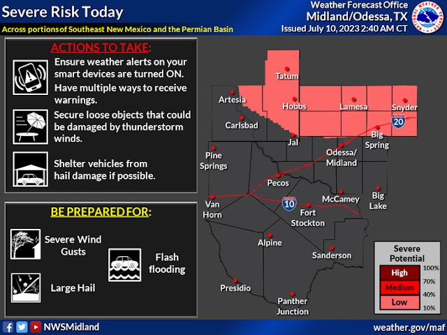
A shortwave rotating around the top of mid-upper level ridge of high pressure over northern New Mexico today into this evening will aide in the development of scattered thunderstorms. Once again some of these are forecast to become severe across the northeastern, eastern, and southeastern plains of New Mexico and eastward into West Texas.
Damaging thunderstorm wind gusts in excess of 58 mph, large hail, frequent cloud to ground lightning, locally heavy rainfall and localized flash flooding will occur with the strongest storms this afternoon into tonight. Our chances of seeing measurable rainfall in southeastern New Mexico range from 50% in the Roswell area to 20% in the Artesia, Carlsbad, and Hobbs areas.
Please Make It Stop _ We Are Tired Of This Heat!
That's the cry of many thus far this summer. Poor El Paso just can't catch a break either. El Paso , TX breaks 100 degree streak record yesterday (Sunday)! Today was our 24th consecutive 100 degree day, beating the 23 day streak back in 1993. The actual highs are in yellow...the next 7 days forecast highs are in white. The streak will keep on keeping on!
Our forecast high temperatures this week in southeastern New Mexico will remain torrid with highs ranging from the low 100's to 105º today, and 106º to 108º for the rest of the week. Outside of our chances of getting wet today they rest of the week looks dry.
If you want relief go to the mountains where daily rounds of thunderstorm will keep the heat in check.
Ruidoso is looking at high temps this week ranging from the upper 80's to the low 90's. Scattered afternoon thunderstorms are expected each day.
Cloudcroft is expecting highs ranging from the upper 70's to near 80º. Scattered afternoon thunderstorms are expected each day.
Cloudcroft is expecting highs ranging from the upper 70's to near 80º. Scattered afternoon thunderstorms are expected each day.
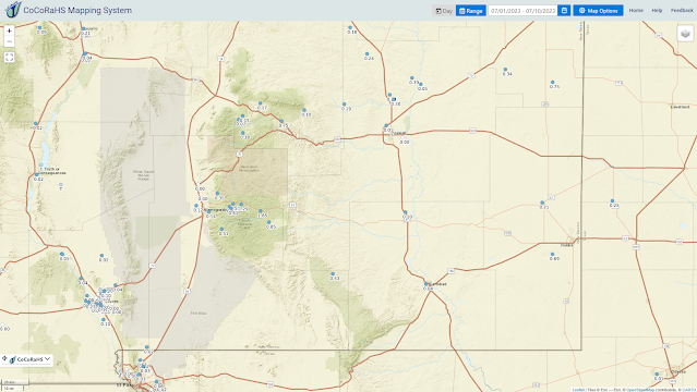
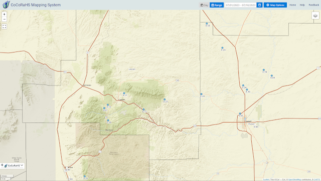
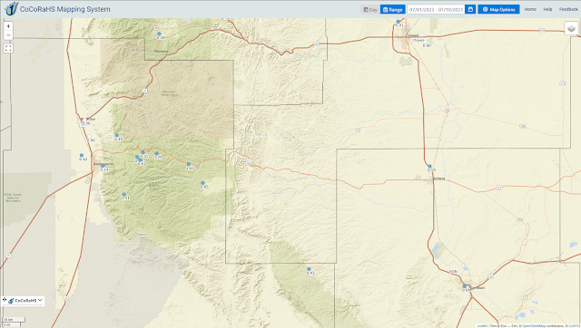
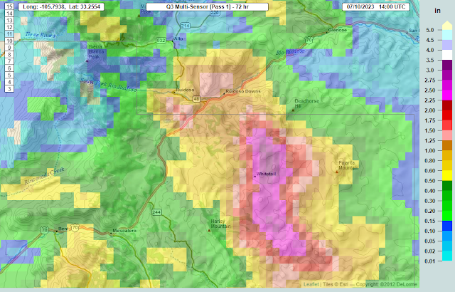
A Wet Weekend In The Sacramento Mountains.
(As Of 8 AM MDT Monday, July 10, 2023).
Note that most of the Personal Weather Stations (PWS) including Weather Underground and Davis WeatherLink do not belong to the CoCoRaHS volunteer rainfall reporting network. So that explains the difference between the CoCoRaHS and PWS rainfall differences. If you are interested in getting your rainfall totals reported publicly and on the maps above then consider signing up via this link.
Several locations in the Sacrament mountains picked up some heavy rainfall this past weekend. With a couple spots southeast of Ruidoso and southeast of Cloudcroft picking up over two inches.
There Are None So Blind As Those Who "Will - Not" To See...107.








The récord in El Paso goes back to 1994
ReplyDelete