My Current Weather

Sunday, March 31, 2013

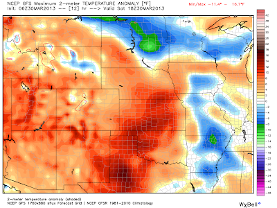
Happy Easter - Colder & Maybe Wet By Tuesday.
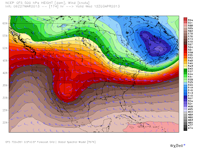

Valid @ Noon MDT Tuesday, April 2, 2013.

This Mornings 12Z/6 AM MDT NAM 60-Hour Precipitation Total Forecast.
Valid @ 6 PM MDT Wednesday, April 3, 2013.

This Mornings 12Z/6 AM MDT NAM Temperature Forecast.
Valid @ 6 PM MDT Tuesday, April 2, 2013.

Timing differences are showing up in the models concerning the arrival time of a strong cold front and associated upper-level storm in the area Monday night into Wednesday. The latest trends are heading towards a slower arrival time of the front, by sometime Tuesday, maybe even early Tuesday evening.

Should the upper-level storm that will be approaching from the west slow down, and dig further south, then the front will be delayed. But if this happens more moisture may get pulled further westward into the local area. Lots of unknowns yet on all of this. At this time only light precipitation is expected.

But make no mistake a big change is coming by Tuesday into Wednesday. Colder temps will be headed our way along with gusty northerly winds, overcast and dreary skies, and possibly some light rain. Depending upon the arrival time of the cold front, high temps on Tuesday could range from the 40's to the 70's. 

The Truth Is Stranger Than Fiction! 

 My Web Page Is Best Viewed With Google Chrome.

Saturday, March 30, 2013

Russian Scientist Warns Earth Is Heading For Another Little Ice Age!


"Incredibly, British Summer Time officially starts tomorrow but millions of brassed off Brits pining for warmth will have to endure freezing temperatures and biting winds until May.The misery will continue with daytime temperatures struggling to reach a bracing 5C (41F). The only ray of sunshine, forecasters said, is that it will stay dry.

As if the outlook wasn’t bleak enough already, meteorologists believe the shivering start to 2013 has been the coldest in more than 200 years.

More worryingly, the combination of sub-zero temperatures and heavy snow experienced across much of the country recently could be the prelude to a new Ice Age that will begin next year and last for 200 years.

Russian scientist Dr Habibullo Abdussamatov, of the St Petersburg Pulkovo Astronomical Observatory, painted the Doomsday scenario saying the recent inclement weather simply proved we were heading towards a frozen planet.

Dr Abdussamatov believes Earth was on an “unavoidable advance towards a deep temperature drop”. The last big freeze, known as the Little Ice Age, was between 1650 and 1850.

Today he said: “The last global decrease of temperature (the most cold phase of the Little Ice Age) was observed in Europe, North America and Greenland.

“All channels in the Netherlands were frozen, glaciers were on the advance in Greenland and people were forced to leave their settlements, inhabited for several centuries.

“The Thames river in London and Seine in Paris were frozen over every year. Humanity has always been prospering during the warm periods and suffering during the cold ones. The climate has never been and will never be stable.

The Truth Is Stranger Than Fiction! 

 My Web Page Is Best Viewed With Google Chrome.

90 For Today - 40's On Tuesday!


This Easter is going to be a warm one. Carlsbad's forecast high temp today is 90F. Easter Sunday's high temps across SE NM will range from the upper 70's to the low 80's. Monday will be hot again with highs in the mid 80's to near 90. Then the bottom falls out...

Friday, March 29, 2013

Lea County, NM Sunrise.


No filters were used, all nature colors. Shot on Hwy 128 in Lea County, New Mexico.

The Truth Is Stranger Than Fiction! 

My Web Page Is Best Viewed With Google Chrome.

Wednesday, March 27, 2013

Snow For The First Week Of April - Say What?


Vaqlid @ 6 AM MDT Wednesday April 3, 2013.

GFS Max Temperature Anomaly Forecast.
Valid @ 6 PM MDT Tuesday, April 2, 2013.

So you thought winter was over hum? Well maybe not...

Sunday, March 24, 2013

Yesterday's Winds & This Mornings Lows.


High winds raked southeastern New Mexico and nearby locals yesterday. Some of the peak wind gusts reported are listed above. Guadalupe Pass peaked out at 72 mph. Blinding clouds of blowing dust knocked the visibility down to a 1/2 of a mile less at times in some locals. Additional peak wind gusts can viewed here.

 As was expected our overnight low temps cratered this morning. Check these out...

Saturday, March 23, 2013

March Will Live Up To Its Ugly Reputation Today.


NWS Fort Worth, TX Radar Snapshot @ 8:16 MDT.
GRLevel3 2.00 Dual Pol Image.

So close but oh so far away. Thunderstorms are breaking out across north Texas this morning. They are being fueled by a supply of low-level moisture from off the Gulf of Mexico. This is indicated by the low clouds on the visible satellite image above. Severe thunderstorms will be possible across northern and eastern Texas eastward to northern Florida today.

I'll give you three guesses what our weather in southeastern New Mexico will be like today...

Friday, March 22, 2013

A Little Less Wind Today...But Saturday Will Make Up For It.


GFS 500 MB Forecast @ 6 PM MDT Saturday.

Most peak wind gusts across southeastern New Mexico were measured in the 40-50 mph range yesterday. Today is expected to be less windy but this won't last long. Saturday's will be another very windy and dusty day.

Tuesday, March 19, 2013

Lubbock, TX Haboob. 3-17-2013.


6:07 PM CDT.

6:07 PM CDT.

6:08 PM CDT.

6:10 PM CDT.

6:11 PM CDT.

6:11 PM CDT.

6:11 PM CDT.

6:12 PM CDT.

Radar at 5:58 PM CDT.

A line of  very light rain showers and a few isolated thunderstorms moved southeastward out of eastern New Mexico and into west Texas Sunday afternoon, ahead of an approaching weak upper-level disturbance. Most of this activity (show above on the radar snapshot) was virga.

As this line of showers and virga moved into the Lubbock, Texas area Sunday evening, it formed a haboob that rolled across the city. My wife and I had just arrived at our hotel as the haboob rolled into Lubbock. I shot the photos above from out hotel on the south 289 Loop, looking back west towards the Marsha Sharp Freeway. In five minutes time the visibility dropped down to less than one quarter of a mile in blowing dust and sand.

Please click on this link to view more photos of the haboob courtesy of the Lubbock, Texas National Weather Service Office.
 
The Truth Is Stranger Than Fiction! 

My Web Page Is Best Viewed With Google Chrome.

Sunday, March 17, 2013

Dust At Sunrise.


No its not fog but it sure looks like it. I was headed to work down Hwy 128 Friday morning when I snapped this. Dust is trapped in the small valley by an inversion. Oilfield traffic on the dirt roads near the highway created this cloud of dust. This happens quiet often out here during calm stable conditions. 
 
The Truth Is Stranger Than Fiction! 

My Web Page Is Best Viewed With Google Chrome.

Saturday, March 16, 2013

new Daily Record High Temps - Friday, March 15, 2013.


Its not all that uncommon to see some pretty wild temperature spreads this time of the year. This is a result of  our dry climate with very low humidity values, high altitudes (3,158' MSL at my home), and usually clear skies. I started the day out with a low of 39 and ended up with a high of 92 yesterday

Today's forecast high temps are expected to be near or a couple of degrees above yesterday's readings, so we may once again see some additional daily record high temp records fall by the way side. 

 New daily record high temps were set across the state yesterday. See this by clicking on the "Read more" link.

Monday, March 11, 2013

Mother Nature Takes A Chill Pill This Week.


All winter long I've been talking about upper-level troughs of low pressure, closed lows, and occasionally cut off lows. These systems are what help produce our winter weather across the state. Mother nature is taking a chill pill this week. None of these for awhile.

 A ridge of high pressure is forecast to gradually build eastward into northern Mexico and the Desert Southwest this week. This ridge will shove the jet stream as well as the storm track well to the north of our area, and the result will be sunny skies with highs mostly in the 70's all week long. By the end of the week we will be back in the 80's, and its possible that some of us may be flirting with the 90-degree mark by next weekend.

Sunday, March 10, 2013

Fires & Our Spring Winds Are A Bad Mix.


Fires, of any kind, when occurring during our spring winds are always a bad combination. I shot these photos (see more photos by clicking on the Read more link below) of a Mobile Home Trailer Park fire on south National Parks Highway in Carlsbad yesterday afternoon.

Saturday, March 9, 2013

Snowy March Afternoon In Cloudcroft, NM.


Cloudcroft, New Mexico @ 3:15 PM MST This Afternoon.

The Truth Is Stranger Than Fiction!

 My Web Page Is Best Viewed With Google Chrome.

Typical March Weather Today - Windy & Dusty.


GRLevel3 2.00 Doppler Radar Composite Reflectivity.
Holloman AFB Doppler Radar @ 5:07 PM MST. 

Southern New Mexico's first Severe Thunderstorm Warning of the year was issued by the El Paso National Weather Service Office at 5:04 PM MST yesterday. A cluster of thunderstorms moved northeastward through the Tularosa Basin at around 50 mph while producing damaging winds.

The highest wind gust noted was at San Augustin Pass, where a gust to 78 mph was recorded. The Warning was allowed to expire at 5:45 PM. As this cluster of thunderstorms moved through the Carrizozo area at 5:45 PM MST, damage to the Carrizozo Market (pictures above) occurred from high winds. Additional wind, rain, and snow reports across the state can be viewed by visiting this link.

 This proves that severe weather can occur just about anywhere in New Mexico, at any time, and not necessarily across the eastern or southeastern plains where it is most common.

Friday, March 8, 2013

Slight Chance For T-Storms This Evening - A Few May Be Severe.


Cloudy skies blanket most of southeastern New Mexico early this morning as mid-level moisture is funneled northeastward ahead of an approaching upper-level storm to our west. Radar has been showing an area of light rain showers over the area for the last couple of hours, although most of this activity is more than likely virga, and not reaching the ground. I had a few sprinkles here at my home in Carlsbad at 5:20 AM. 

NWS Albuquerque Burn Scar Matrix Forecast

Current NWS Watches/Warnings In Effect

New Mexico

Eddy County

Chaves County Plains & Mtn's

Culberson County

Lea County

Lincoln County

Otero County

Current US Temps

Current US Wind Chill/Heat Index Temperatures

NWS Midland Forecast

NWS Albuquerque Forecast

NWS Albuquerque Forecast

NWS El Paso Forecast

NWS Lubbock Forecast

NWS Lubbock Forecast

Average Daily High/Low Temperatures & Rainfall

Average Daily High/Low Temperatures & Rainfall