


My Storm Chase May 1, 2022 (Lovington, NM To Wellman, TX).
Lovington, New Mexico Supercell Thunderstorm.
(And Damaging Hail Event).
My YouTube Video Of My Chase.

2:57 PM MDT.
Midland National Weather Service Doppler Radar.
GR2Analyst 3 Base Reflectivity & Storm Relative Velocity Snapshots.Initially, a thunderstorm developed some 25 miles southwest of Lovington near Buckey in northern Lea County. It became strong by around 2:15 PM MDT. At 2:57 PM MDT the Midland National Weather Service Office issued the first Severe Thunderstorm Warning on this storm. It was moving north at 40 mph and was capable of producing ping pong ball size hail and 70 mph wind gusts.
This storm quickly exhibited supercell characteristics over the next thirty minutes as it began to move to the northeast. As it rolled over the top of Lovington it continued its turn more to the right and started moving to the east. A right-moving destructive supercell thunderstorm.
I followed along beside it from Lovington to Denver City Texas and on into Seagraves, Tx. This prolific "hailer" laid down a lot of large to very large hail. I spotted and measured hail ranging from quarters to baseballs from south of Lovington to northeast of Seagraves.
The largest hailstone I measured was the hockey puck-size hailstone (3.0" in diameter) 2 miles south of Lovington. Keep in mind that I did not punch or drive into the main hail core of the storm and was measuring these hailstones along the side of the road as I trailed along behind or parallel to the storm.

3:32 PM MDT
2 Miles South Of Lovington, New Mexico (Hwy 483).
Ping Pong Ball To Hen Egg Size Hail On The Ground.

3:36 PM MDT
2 Miles South Of Lovington, New Mexico (Hwy 483).
Radar Indicated This Hail Fell Around 3:16 PM MDT.
Baseball Size Hail (2.75"" In Diameter) On The Ground.

3:36 PM MDT
2 Miles South Of Lovington, New Mexico (Hwy 483).
Radar Indicated This Hail Fell Around 3:16 PM MDT.
Hockey Puck Size Hail (3.0" In Diameter) On The Ground.
Some Melting Had Occurred By The Time I Arrived So The Hail May Have Been Larger.

3:16 PM MDT.
Midland National Weather Service Doppler Radar.
GR2Analyst 3 Base Reflectivity & Storm Relative Velocity Snapshots.
3:30PM MDT.
Midland National Weather Service Doppler Radar.
GR2Analyst 3 Base Reflectivity & Storm Relative Velocity Snapshots.
3:35 PM MDT.
Midland National Weather Service Doppler Radar.
GR2Analyst 3 Base Reflectivity & Storm Relative Velocity Snapshots.
Wall Cloud Forming.
Looking To The Southeast.
From Hwy 483 3 Miles South Of Lovington.

3:42 PM MDT.
Looking To The West-Southwest.
South Side Of Lovington, New Mexico.
At The Junction Of County Rd 97 & Hwy 483.

3:42 PM MDT.
Looking To The North.
South Side Of Lovington, New Mexico.
At The Junction Of County Rd 97 & Hwy 483.

3:42 PM MDT.
Looking To The West.
South Side Of Lovington, New Mexico.
At The Junction Of County Rd 97 & Hwy 483.

3:54 PM MDT.
Looking To The Northeast On Hwy 83.
From Just East Of Lovington, New Mexico.
3:53 PM MDT.
Midland National Weather Service Doppler Radar.
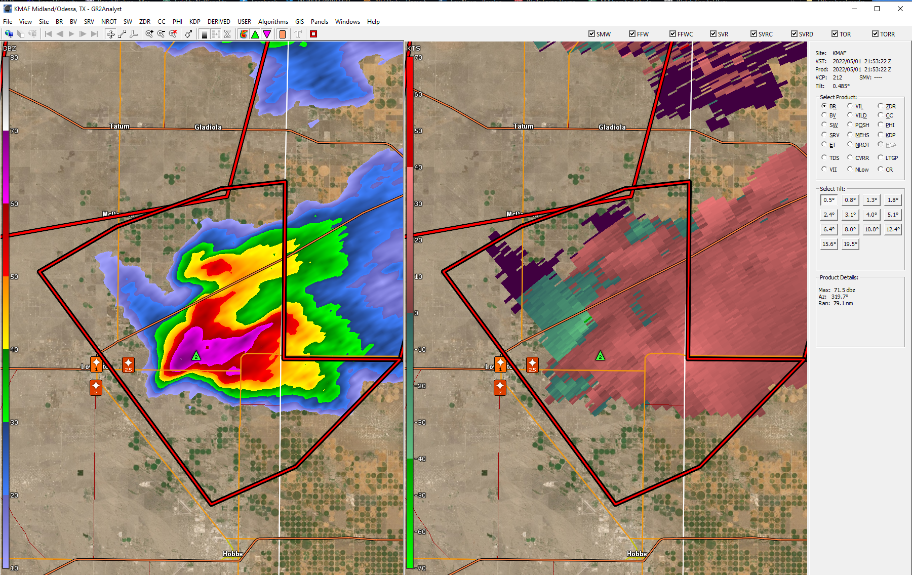
GR2Analyst 3 Base Reflectivity & Storm Relative Velocity Snapshots.Denver City, Texas.

East Of Denver City, Texas.
This Ragged Wall Cloud Tried To Wrap Up But Didn't Make It.

5:17 PM MDT/6:17 CDT.
Midland National Weather Service Doppler Radar.
GR2Analyst 3 Base Reflectivity & Storm Relative Velocity Snapshots.This storm had several rotating wall clouds form on it but I never did see a funnel cloud or tornado develop from them. In my YouTube video, you can clearly see the rotation in the low-hanging ragged wall cloud west of Denver City.

6:01 PM MDT/7:01 PM CDT.
Just North Of Seagraves, Tx.

6:11 PM MDT/7:11 PM CDT.
Northeast Of Seagraves, Tx.

6:20 PM MDT/7:20 CDT.
Northeast Of Seagraves, Tx.

6:21 PM MDT/7:21 CDT.
Northeast Of Seagraves, Tx.

6:21 PM MDT/7:21 CDT.
Northeast Of Seagraves, Tx.
The four photos above were shot north and northeast of Seagraves, Texas on Hwy 62. I picked these hailstones up off the ground after the storm had passed by. So again some melting had already occurred and it's likely they were slightly bigger before I arrived.

6:57 PM MDT/7:57 PM CDT.
I Was Headed Back Home Between Wellman And Seagraves, Tx.
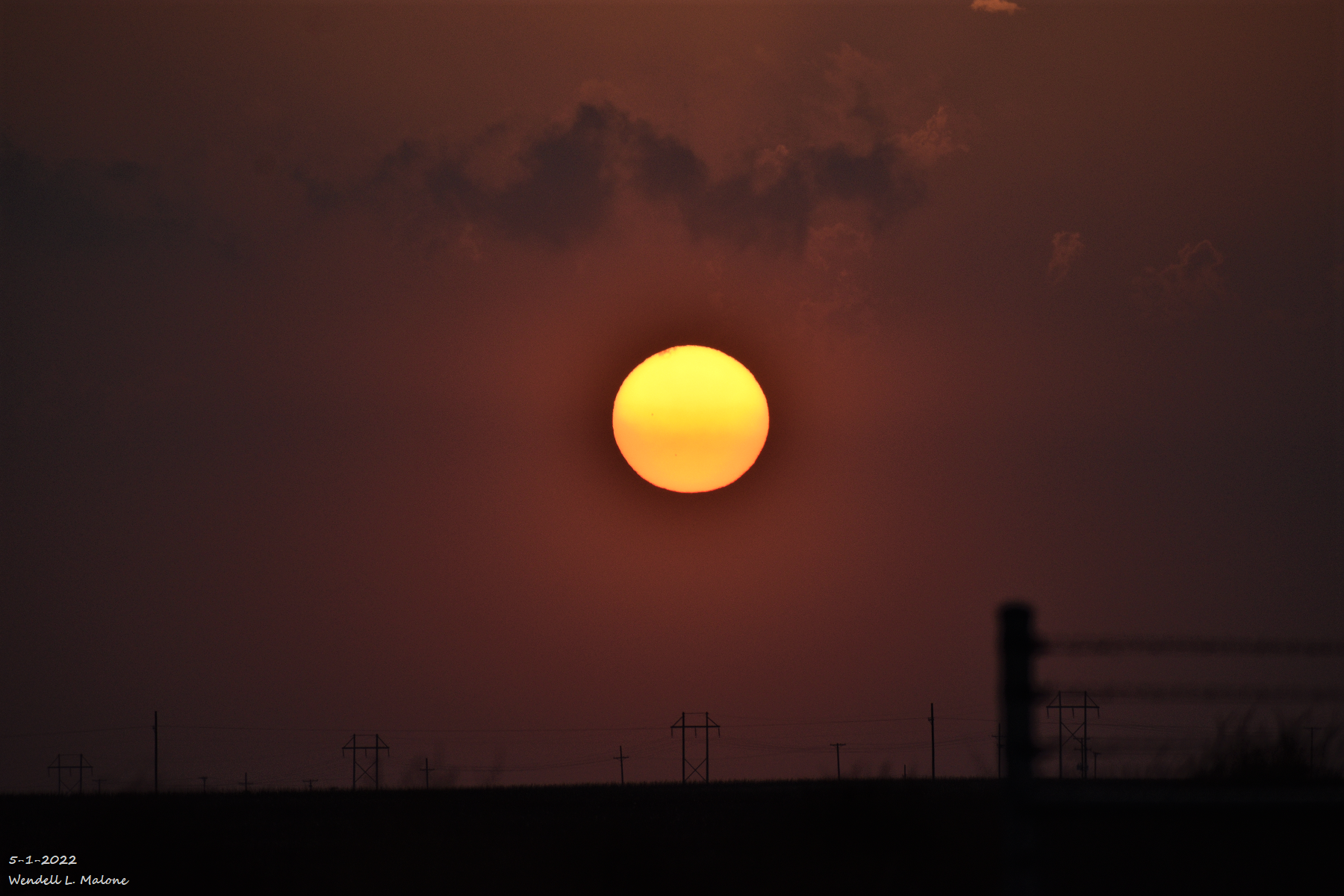
Hazy Sunset West Of Seminole, Texas.

Looking East At The Storm From The NM/TX State Line East Of Hobbs.

Hail Damage In Lovington, New Mexico.
Photos Are Courtesy Of Grant Tosterud @granttosterudwx - Twitter.


There Are None So Blind As Those Who "Will - Not" To See.


Comments
Post a Comment
Your comments, questions, and feedback on this post/web page are welcome.