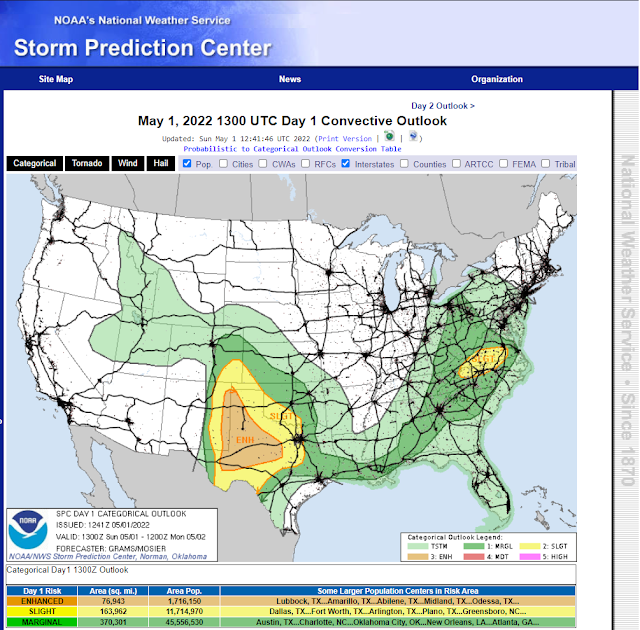
Seasons First Widespread Severe Weather Outbreak Today.
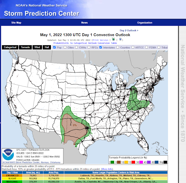
Probability Of Tornadoes Today.
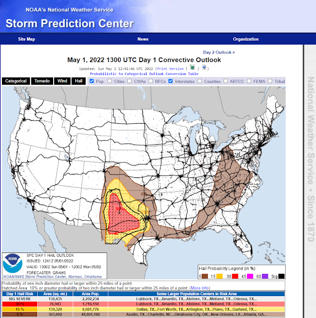
Probability Of Hail Today.
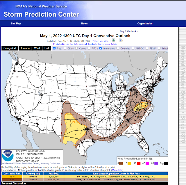
Probability Of Damaging Thunderstorm Wind Gusts In Excess Of 58 MPH Today.

Seasons First Widespread Severe Weather Outbreak Today.
Scattered thunderstorms are forecast to fire up along and east of the dryline by around noontime today. The dryline will set up along the east slopes of the Guadalupe, Sacramento, and Capitan mountains today and mix slowly eastward this afternoon. Tonight it is forecast to surge back west to the mountains.
Surface dew point temperatures as of 8:30 AM MDT this Sunday morning are already climbing up into the mid 50's across far southeastern Lea County this morning. Dew point temperatures will climb up into the 60's later today across the area east of the dryline.
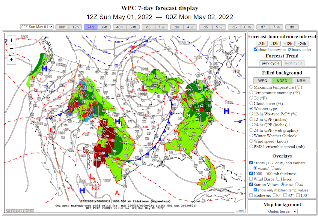
Meanwhile, a stationary front was draped across central Texas and is forecast to start moving northward as a warm front today. A quasi-triple point is forecast to set up somewhere between Portales and Lovington this afternoon.
A mid-upper level short wave trough of low pressure will be approaching the Four Corners Region by sunset.
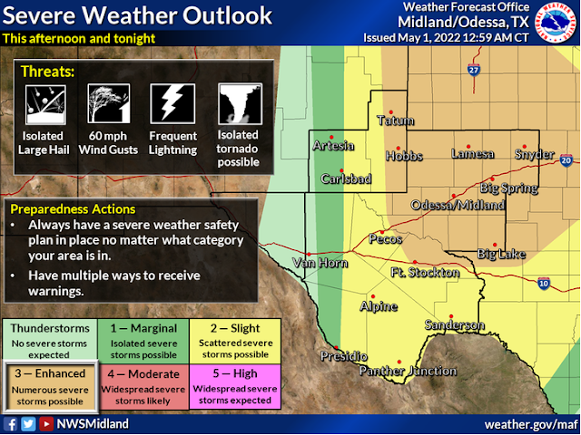
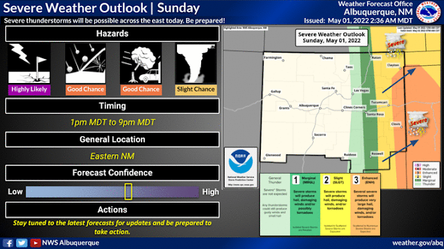
Severe weather parameters will be coming together today to produce severe thunderstorms across Southeastern, Eastern, and Northeastern New Mexico...eastward into West Texas and the Texas Panhandle.
Thunderstorm initiation may develop by around noontime. Severe thunderstorms are forecast to impact some areas into tonight. Not everyone will get rain today or tonight but those lucky few who do may see storm totals of 1"-3".
Supercell thunderstorms are likely to form and will be capable of producing all severe weather hazards including Large to very large hail (up to baseball size or larger is possible), damaging thunderstorm wind gusts in excess of 58 mph, frequent deadly cloud to ground lightning, locally heavy rain that may produce localized flash flooding, and a few tornadoes.
Supercell thunderstorms are likely to form and will be capable of producing all severe weather hazards including Large to very large hail (up to baseball size or larger is possible), damaging thunderstorm wind gusts in excess of 58 mph, frequent deadly cloud to ground lightning, locally heavy rain that may produce localized flash flooding, and a few tornadoes.
Today is one of those days that you should remain weather aware and be ready to seek shelter if and when severe weather threatens your area. Tornado Watches and Warnings are possible today into tonight. As well as Severe Thunderstorm Watches and Warnings.
Storm motion today is forecast to be from west to east and southwest to northeast. A few of the stronger supercell thunderstorms may become right movers and turn to the southeast. Left splitting supercells are also possible.
Forecast Severe Weather Parameters Today Across The Area Outlined Above:
Surface-based cape values of up to 3,000 j/kg.
Mixed layer cape values of 1,500 to 2,500 j/kg.
0-6 km bulk wind shear generally 40-50 knots.
Lapse rates of 7.5 to 9.0 c/km.
Max storm-relative helicity (SRH) are forecast to climb as high as 300 m2/2 over some locations later this afternoon and evening. Long clockwise hodograph curvatures are also forecast east of the dryline, especially near the NM/TX state line. As the low-level jet ramps up after sunset, this may keep some supercells going for a while tonight.
There Are None So Blind As Those Who Will "Not" To See.



Comments
Post a Comment
Your comments, questions, and feedback on this post/web page are welcome.