Blast Furnace Weather Today!
Northwest Of Lakewood, NM.
Smoke From A Flare Trapped By A Temperature Inversion.
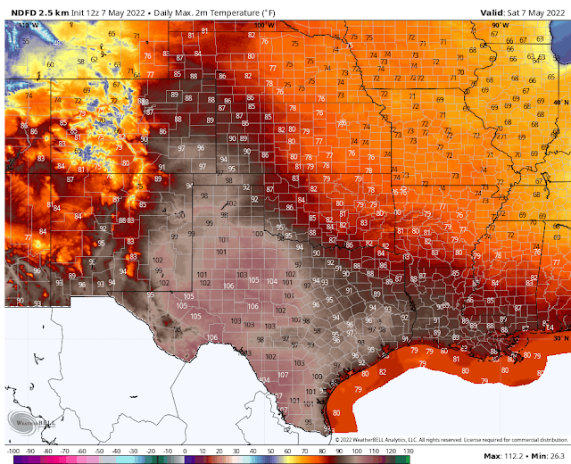
Today.
Sunday.
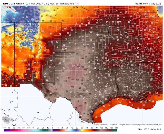
Monday.
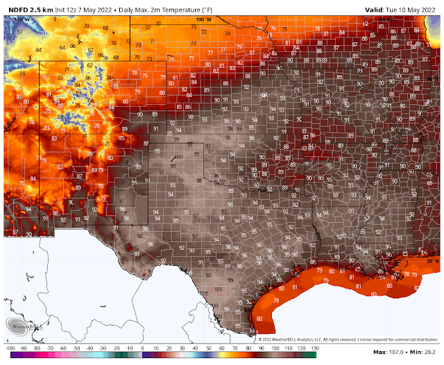
Tuesday.
Blog Updated At 4:52 PM MDT Saturday.
Our first blast furnace weather of the season will occur today as our afternoon high temperatures across Southeastern New Mexico soar up into the 100º to 103º range. Parts of West Texas around the Wink-Kermit, Pecos, and Fort Stockton areas will climb up to 105º today.
Record high temperatures for May 7th include:
Roswell 102º in 2020.
Roswell 102º in 2020.
Artesia 102º in 1916
Carlsbad Climate 100º in 1934
Carlsbad Airport 105º in 2009
Hobbs 104º in 2000
Tatum 97º in 2000
Elk 91º in 2009
Elk 91º in 2009
Picacho 95º in 2009
Ruidoso 85º in 2009
Cloudcroft 77º in 1956
Mountain Park 86º in 1940
Alamogordo 97º in 2020
Southwesterly winds are forecast to become sustained at around 15-25 mph with gusts near 35-45 mph today and Sunday across the Southeastern Plains.
Southwesterly winds are forecast to become sustained at around 20-30 mph with gusts near 45-55 mph across the Capitan and Sacramento Mountains today.
A High Wind Warning is in effect for today and Sunday for the Guadalupe Mountains. Westerly winds are forecast to become sustained at around 40-50 mph with gusts near 65 mph.
Wind Advisories are in effect for southern New Mexico and the southern Sacramento Mountains Sunday. Southwest winds sustained around 25-30 mph will gust up to near 50 mph.
A High Wind Warning is in effect for Lincoln County Sunday from 2 AM MDT Sunday morning through 6 AM MDT Monday. Southwest winds sustained from 25 to 40 mph will gust up to around 60 mph.
Localized areas of blowing dust will develop during the highest sustained winds and wind gusts. Especially over our dust-prone areas such as: Freshly plowed or exposed farmlands, open fields and lots, and highway construction sites. Sudden drops in the visibility down to near zero will be possible in these areas at times with little to no advanced warning.
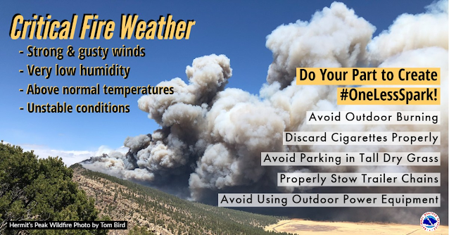
Single-digit daytime relative humidity values are forecast areawide today into early next week. Combine this with the record heat, ongoing extreme to exceptional drought, and the strong winds then you have a recipe for disaster. In fact in Thursday's Special Weather Briefing (see the YouTube video above) the Albuquerque NWS Office used the phrase Potentially Historic Fire Weather Conditions from today into Tuesday. Sunday will see the highest wind gusts across the state.
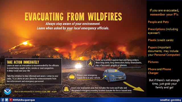
Critically Dangerous to Extremely Dangerous Fire Weather Conditions will continue to grip New Mexico today into next week. Red Flag Warnings and Fire Weather Watches continue in effect for the state and will continue into next week. Any fire that develops will have the potential to rapidly spread and grow threatening life and property in these conditions. Have a plan and be ready to evacuate at a moment's notice if told to do so should a fire break out in your location.
Forecast models continue to hint at another possible dryline severe thunderstorm event Tuesday or Wednesday across parts of Eastern and Southeastern New Mexico. Even if thunderstorms do develop they will be scattered in nature and will not provide widespread drought relief.
New Mexico Fire Information can be found via this link.
New Mexico Fire Information can be found via this link.
Area Forecast Discussion
National Weather Service Albuquerque NM
345 PM MDT Sat May 7 2022


...HIGH WINDS RESULTING IN DANGEROUS AND EXTREME FIRE WEATHER
CONDITIONS ARE EXPECTED SUNDAY...

...A DANGEROUS, LONG DURATION AND POTENTIALLY HISTORIC CRITICAL FIRE
WEATHER EVENT TO CONTINUE THROUGH MUCH OF NEXT WEEK...

.SYNOPSIS...

The bottom line is that the forecast is not on track for a dangerous and
prolonged fire weather event. Tonight winds will not decrease much if
any at all and humidity levels will not increase much overnight. This
means any fires could potentially grow overnight. It also means that
any residents near the Hermit`s Peak/Calf Canyon Fire, Cerro Pelado
Fire and Bear Trap Fire need to be ready to go if evacuation orders
are made. These next several days are not good days to do any outdoor
work which may create a spark igniting a fire. Sunday extremely
critical fire weather conditions are forecast for areas from
Albuquerque to Raton eastward to Santa Rosa and Tucumcari. This
includes the Sangre de Cristo Mountains and adjacent Highlands as
well as the Sandia and Manzano Mountains. There is a high chance of
sustained winds of 30-50 mph with gusts reaching 70 mph especially in
the higher terrain and mountain gaps. High wind gusts will also be
expected over the Four Corners, Continental Divide and Tusas
Mountains. Winds decrease some on Monday but not enough to even rule
out the potential for extreme fire weather conditions. Winds do look
to decrease Tuesday through Thursday in the coming week but again,
red flag warnings will likely be needed.
There Are None So Blind As Those Who "Will - Not" To See.





Comments
Post a Comment
Your comments, questions, and feedback on this post/web page are welcome.