My Current Weather

Friday, November 30, 2018

Snow For The Sac's - High Winds & Blowing Dust For The Rest Of Us!


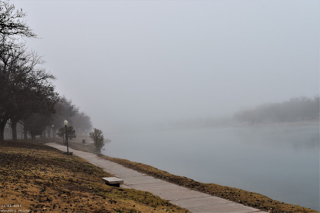
11-22-2018.
Carlsbad, NM Thanksgiving Morning.

Fast Moving Storm Means High Winds - Blowing Dust Today.


Valid At 11 PM MST Thursday Night.

GFS 500 MB (18,000' MSL) Forecast.

Valid At 5 PM MST Friday Evening.

Taking a look at the upper air charts we find that a digging negatively tilted mid-upper level trough of low pressure was approaching Western New Mexico as of 3 AM MST this Friday morning. This fast moving winter storm will be centered in Northeastern New Mexico by sunset this afternoon. 


Valid At 11 PM MST Thursday Evening.

Surface Map Forecast.

Valid At 5 AM MST Friday Morning.

Valid At 11 AM MST Friday Morning.

Valid At 5 PM MST Friday Evening.

 A fast moving Pacific cold front was located in central Arizona around midnight. This cold front will blast eastward today and by sunrise it will be located in Southeastern New Mexico. By sunset it is forecast to be approaching the Dallas-Fort Worth area . 

Fast Moving Winter Storm Produce High Winds Locally.


We've Been Lucky So Far This Fall - Few High Wind Events.

This changes today with our first widespread high wind event...oh joy right? In fact at 2:20 AM MST this morning the automated weather station located on Salinas Peak in the Organ Mountains was reporting a southwest wind at 43 mph gusting to 75 mph. That's never a good sign to see the winds cranking this high before sunrise.

Strong southwesterly to westerly winds are forecast to rake the local area today as this fast moving winter storm blows through the state today. High Wind Warnings are in effect for the Guadalupe Mountains of Southeastern New Mexico and West Texas into Saturday morning. These winds are forecast to increase to sustained speeds of 40 to 60 mph with gusts near 85 mph. This could possibly lead to U.S. Highway 62/180 being closed temporarily in the Pine Springs and Guadalupe Pass area. For local road conditions visit my Winter Weather Page

Wind Advisories are in effect for the local area today as well. Southwesterly to westerly winds are forecast to increase this morning to sustained speeds of 30-40 mph with gusts near 55 mph. Localized areas of blowing dust will also occur. This will be problematic over and near the following areas today: Freshly plowed or exposed farmlands and fields. Construction sites and open large lots and other bare areas of ground void of grasses and vegetation. Sudden drops in the visibility down to zero with little to no advanced warning will be possible in some of these areas during the strong gusts.

The fire danger will be high today also so it would be a good idea to refrain from any outdoor activity that involves the use of sparks or flame. Any wildfire that may start will have the ability to quickly grow and spread in the very dry conditions and high wind gusts.


(Issued At 3 AM MST Friday).

Valid At 5 PM MST Sunday.

Today's storm will drop 2" to 5" of snow on the higher peaks of the Sacramento and Capitan Mountains. A Winter Weather Advisory is in effect for the southern Sac's today. Winter Weather Advisories have been issued for parts of Western and Northern New Mexico also. A second trough of low pressure aloft is forecast to impact the state on Sunday bringing additional snowfall and colder temps.

I recorded a high temp of 78º here at our home in Carlsbad Thursday afternoon. You can say goodbye to those readings starting today and continuing into next week. Progressively colder weather is on tap for the area as these two winter storm clear the state by the first of the week and leave a colder air mass in place in their wake.


Today.


Saturday.


Sunday.


Monday.


(As Of Thursday, November 29, 2018).


Its not even winter yet and already this season is off with a bang as far as snowfall is concerned. We've pretty much missed out so far here in the Southeastern Plains of New Mexico. Although we did see some light snow flurries a couple of weeks ago. Not to worry I still think this is going to change. Our snowiest month of the year is December. 

The Truth Is Stranger Than Fiction - And Sometimes It Hurts!

Wednesday, November 28, 2018

Our Decent Weather Break Is Over - Winter To Return.


11-22-2018.
Thanksgiving Morning In Carlsbad, NM.

Winter Makes A Return To NM This Weekend.


Valid At 5 PM MST Friday.

Valid At 11 AM MST Sunday.

(New Mexico Impacts Friday - Sunday).

Two upper level storms are forecast to impact New Mexico and nearby areas beginning tomorrow night. Both of which are expected to dump varying amounts of snow to parts of the state. The first storm arrives in the form of a negatively tilted short wave trough of low pressure moving across New Mexico Thursday night into Friday night. The second short wave appears to be a little stronger and colder than Friday's storm and it will have the potential to dump larger snowfall totals over the mountains and parts of northern and central New Mexico on Sunday. A widespread significant winter storm is possible Saturday night into Sunday for northern and central New Mexico. 


Valid At 5 PM MST Friday.

Valid At 5 PM MST Sunday.

A mix of rain and snow will begin over western and northwestern New Mexico Thursday evening and spread eastward during the day on Friday. The heaviest snows are forecast to fall in the mountains. Heavier and more widespread snowfall will be possible on Sunday.


GFS Forecast.

Valid At 5 PM MST Friday.

Valid At 5 PM MST Sunday.

WPC Forecast.

Valid At 5 AM MST Saturday.

NWS NDFD Total Snowfall Forecast.

Valid At 11 AM MST Saturday.

Locally the models hint that around and inch or two of new snow will fall in the Sacramento Mountains Friday into Friday night. With the stronger storm affecting the state on Sunday another 1" to 4" could fall over the Sac's. These forecast snowfall amounts more than likely will change especially on Sunday with the stronger storm approaching. If it digs further south into the state than is currently forecast then more widespread and heavier snowfall will occur. 


Southeastern New Mexico basked in the low to mid 70's today while the mountains saw the 50's and 60's for afternoon highs. Another repeat of this is in store for Thursday. A couple of cold fronts will knock our temperatures back down below normal beginning Friday and continuing into mid next week. Should a further south storm track develop Sunday into Monday then our temperatures will be even colder than those indicated below. 


High Winds Return - Tis The Season.


A High Wind Watch has been issued for the Guadalupe Mountains from Thursday afternoon through Friday. Southwesterly to westerly winds are forecast to increase to sustained speeds of 40 to 50 mph with gusts near 75 mph!

Strong southwesterly winds are forecast to develop across the southeastern plains Friday with gusts up to 40 to 50 mph Friday afternoon. Localized areas of blowing dust will also be possible. 

This upcoming weekend promises to be stormy with colder temperatures and snowfall expected over many parts of the state. The storm track is not 100% certain at this time so be prepared for changes in not only our local weather forecast here in Southeastern New Mexico but elsewhere across the state.

Check out my Regional Forecast Page and my Winter Weather Page for the latest updates, watches, and warnings.

The Truth Is Stranger Than Fiction - And Sometimes It Hurts!

Sunday, November 18, 2018

Overcast & Cold Today. Warming Up For Thanksgiving.

(At 10:30 AM MST Sunday).


RTMA Wind Chill Temperatures.
(At 10:30 AM MST Sunday).


(At 11 AM MST Sunday).


Cold air has dammed up against the east slopes of the Capitan, Sacramento, and Guadalupe Mountains as of 11 AM MST this morning. It was warmer in the mountains (40's) than it was across the Southeastern Plains where most of us were still in the 30's. This just means that the colder air mass entrenched over us is rather shallow and unable to penetrate much further west than the east slopes. Note too the 50's in the Tularosa Basin and in the Las Cruces and El Paso areas.

What's really wild is when shallow very cold arctic air masses are banked up against the east slopes of the mountains (December, January, February) with temps across the Southeastern Plains in the teens while the mountains are in the 50's and locations west of the mountains are in the 70's. 

On rare occasions those arctic fronts will hang up over the local area and we can and have seen temps in the 70's and 80's in the Pecos Valley while the Clovis and Portales area and points northward are in the single digits and teens.

11 AM MST Temps.

Mescalero (6,227') 49º
Timberon (7,001') 49º
Cloudcroft (8,698') 47º
Smokey Bear Raws - Ruidoso (7,090') 43º
Cosmic - Near Sunspot (9,082') 43º
16 Springs Canyon (7, 376') 41º

(At 11:32 AM MST).


Low clouds can clearly be seen in the latest visible satellite image above. Notice how the end right along the spine of the Central Mountain chain running north to south through New Mexico. That pretty much indicates where the cold front lies too.

(Blended Model Forecast).


The Truth Is Stranger Than Fiction - And Sometimes It Hurts!

Saturday, November 17, 2018

Turning Colder Tonight Into Sunday. Beautiful Weather For Thanksgiving.


(At 1:30 PM MST Saturday Afternoon).


RTMA Temps & Wind Chills.
(At 1:30 PM MST Saturday Afternoon).


(At 2 PM MST Saturday Afternoon).


Regional Wind Chill Temps.
(At 2 PM MST Saturday Afternoon).
 

(At 11 AM MST Saturday Afternoon).


What a beautiful Saturday afternoon unless of course you are in not in Southeastern New Mexico where it is a pleasant 61º at 2:25 PM. A strong cold front has oozed into the local area as of 2 PM with the coldest air back to our north and northeast lagging behind the frontal boundary. Amarillo was reporting 30º with a wind chill of 17º. Clovis was reporting 37º with a wind chill of 28º. El Paso was reporting 70º.

One year ago today Roswell set a new daily record high temperature for November 17th with a reading of 89º. On November 6th, 1894 they set their all-time record high for November with a reading of 94º. Contrast this with the record low for November 17th of in 2014. 


NWS NDFD Forecast High Temp Anomalies.


High temperatures on Sunday will be some 20º below normal for the date with most locations east of the mountains seeing highs only in the 40's.

NWS NDFD Forecast High Temp Anomalies.
(Thanksgiving Day).


Thanksgiving Outlook.

Our weather for Thanksgiving this year will be quiet with seasonal temperatures. A fast moving disturbance may produce a few scattered light rain showers over the local area Tuesday night as it zips by overhead. But it won't be anything to write home about if in fact it does occur. 


Our next best chance for a winter storm appears to be coming down the road in about a week from now. The European model digs a strong short wave trough of low pressure into the region and briefly closes it off around Sunday, November 25th. As is usually the case this is still eight days away so expect to see changes in the model forecasts between now and the next upcoming holiday weekend.

The Truth Is Stranger Than Fiction - And Sometimes It Hurts!

NWS Albuquerque Burn Scar Matrix Forecast

Current NWS Watches/Warnings In Effect

New Mexico

Eddy County

Chaves County Plains & Mtn's

Culberson County

Lea County

Lincoln County

Otero County

Current US Temps

Current US Wind Chill/Heat Index Temperatures

NWS Midland Forecast

NWS Albuquerque Forecast

NWS Albuquerque Forecast

NWS El Paso Forecast

NWS Lubbock Forecast

NWS Lubbock Forecast

Average Daily High/Low Temperatures & Rainfall

Average Daily High/Low Temperatures & Rainfall