My Current Weather

Tuesday, September 27, 2022

Update On Hurricane Ian At 10:40 AM MDT Tuesday, Sept 27, 2022.
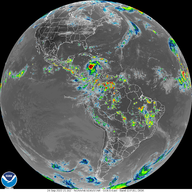
At 8:51 AM MDT Tuesday, Sept 27, 2022.

Hurricane Ian GeoColor Satellite Image.

At 9:16 AM MDT Tuesday, Sept 27, 2022.

 National Hurricane Center (NHC) Discussion.


Dangerous Hurricane Ian.

Updated at 11:24 AM MDT Tuesday, Sept 24th, 2022.
Updated at 11:43 AM MDT Tuesday, Sept 24th, 2022.


Hurricane Ian will be a large and dangerous Hurricane as he makes landfall near the Tampa Bay, Florida area Wednesday night. Current forecasts (as of 10 AM MDT Tuesday, Sept 27, 2022) indicate that he will make landfall as a Category 3 hurricane with sustained winds of 130 mph with gusts near 160 mph. Storm surge in the Tampa Bay area will be 8'-12' and he will drop 12" to 24" of rainfall over parts of Florida.

Caution. This is all subject to potential change. There are some model disagreements on the exact track and strength of Ian when he makes landfall. So if you live in that area or anywhere along the western coast of Florida, or have family and friends who do, please keep abreast of all of the latest local National Weather Service Watches, Warnings, and statements that are being issued on Ian.


Tampa Bay, Florida has not been hit by a major hurricane since 1921. Some in that area are saying they are not going to evacuate. We see this with every hurricane that makes landfall. I don't live there but I wouldn't risk my life unnecessarily if I lived in that area.
So you have several generations of people living in that area who for the most part have no idea what they may be facing in my humble opinion. Some may have the knowledge of what hurricanes can do but most of them have never actually lived through a direct strike by a major hurricane.
I just pray that this isn't going to be another major disaster in the making.
The Tampa Bay hurricane of 1921 (also known as the 1921 Tarpon Springs hurricane) was the most recent major hurricane to strike the Tampa Bay area and the second latest major hurricane to strike the continental United States in the calendar year on record, behind Hurricane Zeta in 2020.
The eleventh tropical cyclone, sixth tropical storm, and fifth hurricane of the season, the storm developed from a trough in the southwestern Caribbean Sea on October 20. Initially a tropical storm, the system moved northwestward and intensified into a hurricane on October 22 and a major hurricane by October 23.
Later that day, the hurricane peaked as a Category 4 on the modern day Saffir–Simpson scale with maximum sustained winds of 140 mph (220 km/h).
After entering the Gulf of Mexico, the hurricane gradually curved northeastward and weakened to a Category 3 before making landfall near Tarpon Springs, Florida, late on October 25, becoming the first major hurricane to hit the area since a hurricane in 1848.

There Are None So Blind As Those Who "Will - Not" To See...107.

Saturday, September 24, 2022

Tropical Storm Ian - 3 PM MDT Saturday, Sept 24, 2022.


(At 3:10 PM MDT Saturday, Sept 24, 2022).


NHC Forecast Track.


ATCF.


U.S. GEFS.


European (ECMWF).


Canadian (CMC).


Tropical Storm Ian continues to slowly strengthen this Saturday afternoon. He is moving to the west at 16 mph and will make a turn to the northwest over the next few days. By Monday night or Tuesday Ian will likely strengthen into a Major Hurricane south of the western tip of Cuba.

There is some uncertainty in the computer forecast models concerning Ian's future track as he heads towards the Gulf of Mexico next week. For now, there are no indications that Ian will have any direct influence on our weather here in New Mexico and West Texas.

There Are None So Blind As Those Who "Will - Not" To See...107.

Tuesday, September 20, 2022

One More Day Of T-Storms Then The Monsoon Gets Shutdown Again.

September 1, 2022.
Near Sitting Bull Falls.
Southwest Of Carlsbad, NM.

NWS Albuquerque Fall Equinox Feature.

New Mexico is no stranger to active fall weather. The transition from summer to winter brings delightful relief to the blistering heatwaves of summer. The fall transition is also associated with a wide variety of weather as the jet stream starts visiting the region from the north. Cold blasts, damaging wind storms, severe thunderstorms, heavy snow, and flash flooding can all occur during the fall months, sometimes all on the same day! Fall also brings a glorious display of changing foliage to many areas of the state.


As Of 8 AM MDT 
Tuesday, September 20, 2022.

MRMS 72-Hour Rainfall Totals.


As Of 8 AM MDT 


As Of 8 AM MDT 
Tuesday, September 20, 2022.

Weather Underground 72-Hour Rainfall Totals.


As Of 8 AM MDT 
Tuesday, September 20, 2022.

New Mexico CoCoRaHS 72-Hour Rainfall Totals.
(As Of 8 AM MDT Tuesday, Sept 20, 2022).


As Of 8 AM MDT 
Tuesday, September 20, 2022.

(As Of 8 AM MDT Tuesday, Sept 20, 2022).


Decent Rainfall For Some The Past Three Days.

Scattered to numerous thunderstorms have dotted the landscape across the southern desert, Tularosa Basin, and the Sacramento mountains the past three days. Some of the heavier three-day totals include: 

Lincoln CoCoRaHS Station located 1.4 miles east-southeast 2.92".
Mayhill - Cool Pines RV Park Personal Weather Station (PWS) northwest of Mayhill 2.32".
Ruidoso Downs Personal Weather Station (PWS) located southeast of Ruidoso Downs 2.10".
Bell Canyon Personal Weather Station (PWS) located northwest of Mayhill 2.09".
High Rolls Personal Weather Station (PWS) southeast of High Rolls 2.03"
Cloudcroft CoCoRaHS Station located 4.0 miles east 2.01"

Mayhill - Lazy Day Cabins Personal Weather Station (PWS) 1.83"
Cloudcroft NWS Climate Co-Op Station 1.83".
Dunken Raws 1.38".
Ruidoso - Forrest Service Rd 120 HADS 1.20"
Timberon Personal Weather Station (PWS) 1.51"
Alto CoCoRaHS Station located 0.3 miles north 1.50".

Cloudcroft CoCoRaHS Station located 0.4 miles east-southeast 1.35".
Arabella CoCoRaHS Station located 2.5 miles south-southwest 1.27".
Ruidoso CoCoRaHS Station located 1.4 miles south-southwest 1.24".


At 6 AM MDT Tuesday Morning.

We Dry Out & Stay Warm Until Sunday.

Our recent round of thunderstorms will come to an abrupt end after today. Our persistent stubborn mid-upper level ridge of high pressure depicted above will shift a little further to the west thus shutting down our monsoonal flow from Mexico.

The forecast for the rest of the week calls for high temps a little above seasonal normals today into the upcoming weekend. Highs will range from the low to mid 90's across the southeastern plains and the southern deserts to the upper 70's in the Ruidoso area and the upper 60's in the Cloudcroft area.

A seasonally fall-like cold front will arrive in the local area this coming Sunday. Although it won't bring significant cooling to the local area it will drop our daytime highs and nighttime lows down to slightly below normal by the beginning of next week. 

Watching The Gulf.


A tropical wave has developed a few hundred miles east of the Windward Islands. This system has an 80% chance of developing into a Tropical Storm over the next five days. We will have to keep an eye on its potential track and strength to see whether or not it ends up in the Gulf of Mexico as a Hurricane by the end of the weekend or next week. 

There Are None So Blind As Those Who "Will - Not" To See...107.

Friday, September 16, 2022

New Mexico Rainfall Update & Long-Range Outlooks.

September 1, 2022.
Near Sitting Bull Falls.
Southwest Of Carlsbad, NM.

(Sept 1st - Sept 14th, 2022).


(Jan 1st - Sept 15th, 2022).


(Sept 1st - Sept 15th, 2022).

(Sept 1st - Sept 15, 2022).

(Jan 1st- Sept 15th, 2022).


(Sept 1st - Sept 15th, 2022).


September has seen for the most part above average rainfall for the state to date. As always is the case some places are above normal while others are below normal. The northern, western, and central mountains have faired the best to date with above-average rainfall. The southeastern plains are lagging behind as is the Four Corners Region. 

A CoCoRaHS Station (Cloudcroft) located 0.5 miles north-northwest has already recorded 33.03" of precipitation to date (Jan 1st - Sept 15th) for the wettest spot in the state. The Cloudcroft NWS Climate Co-Op Station has recorded 29.50". The Nogal CoCoRaHS Station located 4.6 miles south-southeast has recorded 21.07". 

The Taos Powderhorn Snotel Station at 11,057' has recorded 29.90" of precipitation to date. The Sierra Blanca Snotel at 10,280' has recorded 27.50".

Meanwhile, the southeastern plains continue in drought although in varying stages. The Carlsbad Airport ASOS (Automated Surface Observing System) has only recorded 4.21" of precipitation all year long compared to an average year-to-date total of 9.05". And the Hobbs Airport AWOS (Automated Weather Observing System) only 3.71". And the Las Cruces Airport AWOS has only recorded 2.83". 

Looking Ahead.


As Of  6 AM MDT This Friday Morning.

GFS 500 MB (18,000' MSL) Forecast.

As Of  6 PM MDT Next Monday Afternoon.


New Mexico Forecast Rainfall Chances.


Above-average temperatures with fairly quiet weather will dominate New Mexico's weather this weekend. A mid-level trough of low pressure will to deepen and sink southward out of the Pacific Northwest over the weekend. By Monday a deep closed low is forecast to have developed west of Oregon. While a stout mid-level high-pressure ridge develops and becomes centered over northeastern Texas.

Forecast models generally agree that our monsoonal flow will return to the western areas of the state by the first of next week. This trend should continue into the end of next week with the western and northern half of the state favored to get more rain. 


We will need to watch Tropical Storm Lester next week to see if he will affect New Mexico's weather. Current model forecasts aren't too excited about this happening. 


Long-Range temperature and precipitation outlooks keep New Mexico warmer than average and slightly wetter than average for the next two weeks.

There Are None So Blind As Those Who "Will - Not" To See...107.

NWS Albuquerque Burn Scar Matrix Forecast

Current NWS Watches/Warnings In Effect

New Mexico

Eddy County

Chaves County Plains & Mtn's

Culberson County

Lea County

Lincoln County

Otero County

Current US Temps

Current US Wind Chill/Heat Index Temperatures

NWS Midland Forecast

NWS Albuquerque Forecast

NWS Albuquerque Forecast

NWS El Paso Forecast

NWS Lubbock Forecast

NWS Lubbock Forecast

Average Daily High/Low Temperatures & Rainfall

Average Daily High/Low Temperatures & Rainfall