

New Mexico Rainfall Update & Long-Range Outlooks.
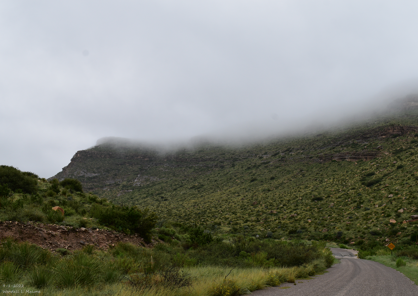
Near Sitting Bull Falls.
Southwest Of Carlsbad, NM.
(Sept 1st - Sept 14th, 2022).

(Jan 1st - Sept 15th, 2022).
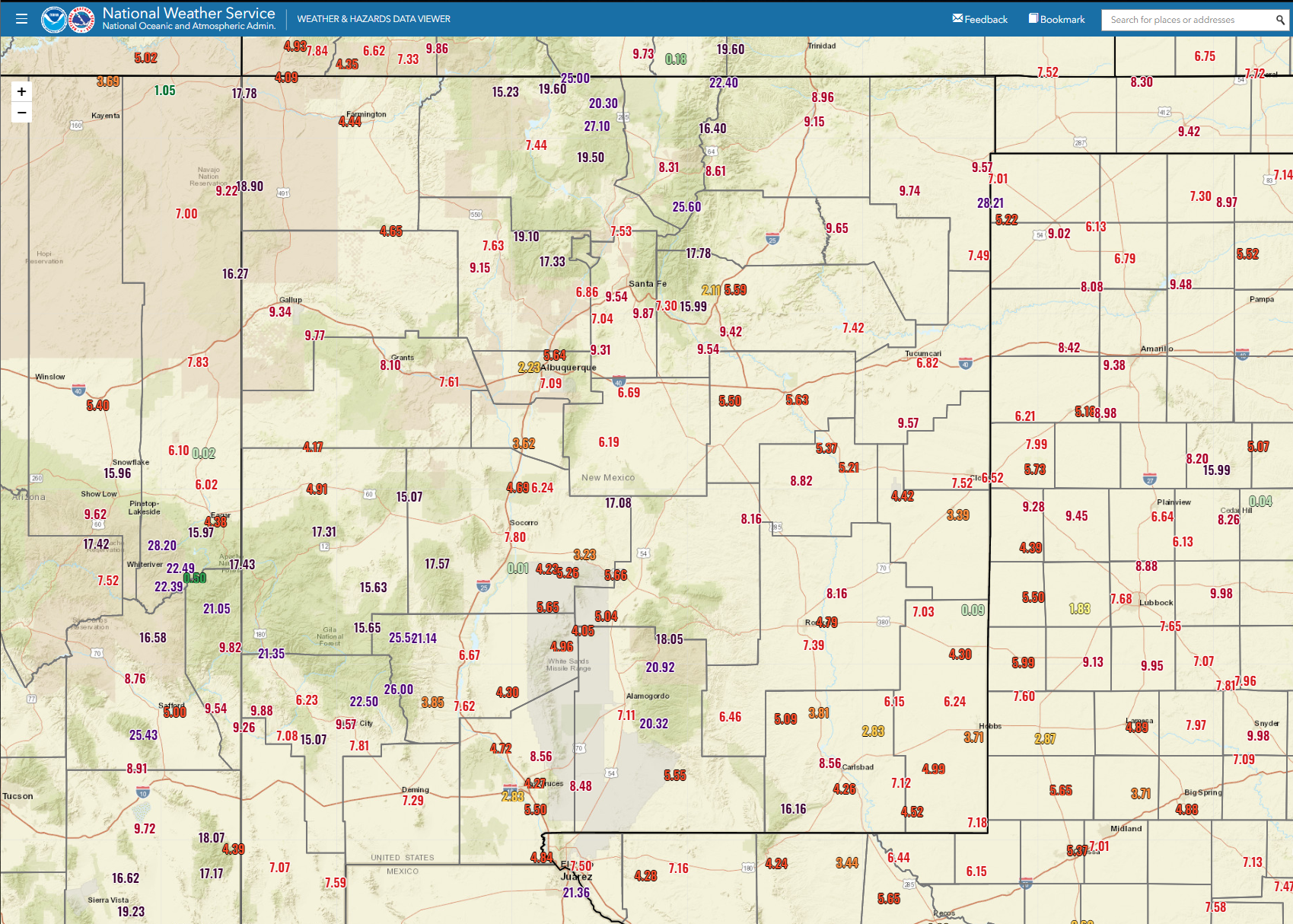

(Sept 1st - Sept 15th, 2022).


(Sept 1st - Sept 15, 2022).


(Jan 1st- Sept 15th, 2022).

(Sept 1st - Sept 15th, 2022).

September has seen for the most part above average rainfall for the state to date. As always is the case some places are above normal while others are below normal. The northern, western, and central mountains have faired the best to date with above-average rainfall. The southeastern plains are lagging behind as is the Four Corners Region.
A CoCoRaHS Station (Cloudcroft) located 0.5 miles north-northwest has already recorded 33.03" of precipitation to date (Jan 1st - Sept 15th) for the wettest spot in the state. The Cloudcroft NWS Climate Co-Op Station has recorded 29.50". The Nogal CoCoRaHS Station located 4.6 miles south-southeast has recorded 21.07".
The Taos Powderhorn Snotel Station at 11,057' has recorded 29.90" of precipitation to date. The Sierra Blanca Snotel at 10,280' has recorded 27.50".
The Taos Powderhorn Snotel Station at 11,057' has recorded 29.90" of precipitation to date. The Sierra Blanca Snotel at 10,280' has recorded 27.50".
Meanwhile, the southeastern plains continue in drought although in varying stages. The Carlsbad Airport ASOS (Automated Surface Observing System) has only recorded 4.21" of precipitation all year long compared to an average year-to-date total of 9.05". And the Hobbs Airport AWOS (Automated Weather Observing System) only 3.71". And the Las Cruces Airport AWOS has only recorded 2.83".
Looking Ahead.

As Of 6 AM MDT This Friday Morning.
GFS 500 MB (18,000' MSL) Forecast.

As Of 6 PM MDT Next Monday Afternoon.

New Mexico Forecast Rainfall Chances.

Above-average temperatures with fairly quiet weather will dominate New Mexico's weather this weekend. A mid-level trough of low pressure will to deepen and sink southward out of the Pacific Northwest over the weekend. By Monday a deep closed low is forecast to have developed west of Oregon. While a stout mid-level high-pressure ridge develops and becomes centered over northeastern Texas.
Forecast models generally agree that our monsoonal flow will return to the western areas of the state by the first of next week. This trend should continue into the end of next week with the western and northern half of the state favored to get more rain.


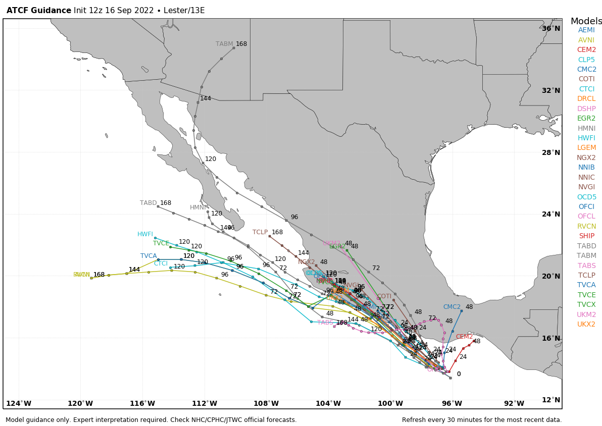
We will need to watch Tropical Storm Lester next week to see if he will affect New Mexico's weather. Current model forecasts aren't too excited about this happening.


Long-Range temperature and precipitation outlooks keep New Mexico warmer than average and slightly wetter than average for the next two weeks.
There Are None So Blind As Those Who "Will - Not" To See...107.


Comments
Post a Comment
Your comments, questions, and feedback on this post/web page are welcome.