My Current Weather

Monday, April 17, 2023

Isolated T-Storm Possible Today.
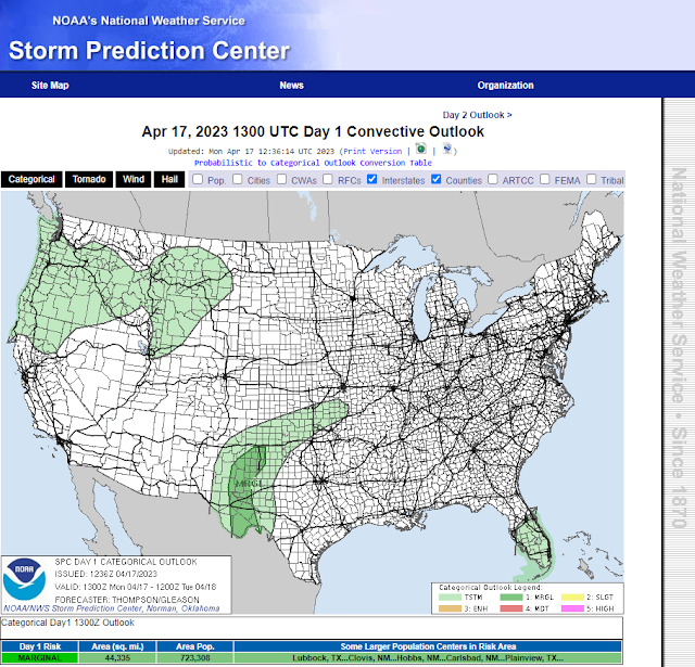

Isolated T- Storms Possible Today.


Limited low-level moisture and instability combined with a shortwave traversing the area will combine with afternoon heating to produce a few isolated to widely scattered thunderstorms this afternoon and evening across the southeastern plains. Downdraft cape values (DCAPE) in excess of 1,000 j/kg suggest that the main severe weather threat from these thunderstorms will be strong wind gusts in excess of 58 mph. Small hail could also occur with the strongest storms perhaps up to around nickel size. A few of the strongest storms may produce moderate to locally heavy rainfall. Overall most of us will not get wet. Of concern will be any dry lightning strikes that may start a few wildfires. 

Strong West Winds Return.


Valid At 6 PM MDT Wednesday.

NWS El Paso Peak Wind Gust Forecast.


Southwesterly winds will begin to pick up Tuesday afternoon ahead of a strong mid/upper-level storm swinging east across the central Rockies Tuesday and Wednesday. These gusts will be in the 30-40 mph range Tuesday afternoon.

Wednesday will be the windiest day with southwesterly winds gusting up to around 30-40 mph across the lower valleys and plains Wednesday. With a few higher gusts possible. The mountains will see these winds gusting up into the 45-60 mph range. 

Localized areas of blowing dust will be possible especially in and near our noramlly dust prones locations during the strongest gusts.


Today.


Tuesday.


Wednesday.


Thursday.


Friday.


Our afternoon high temperatures will average some 5º to 10º above normal this week.

A strong cold front will drop southward through the local area Friday night dropping our temps slightly below normal for the weekend by some 5º to 10º. Overall our dry spring pattern shows little hope of breaking anytime soon.

On This Day In History - April 17th, 1970.


1970 (17th-18th): A very rare nighttime outbreak of tornadoes struck populated centers in the Texas Panhandle and South Plains region causing extensive damage and claiming the lives of 23 people. What made this nighttime outbreak so unusual was that some of the tornadoes occurred during fog, at times dense, and were accompanied by very little lightning making
nighttime spotting almost impossible.

The weather for much of the afternoon over the region did not immediately suggest a
pattern that was favorable for such a historic event as abundant fog and low clouds prevailed with temperatures only in the 50s and 60s. However, observations in central Texas revealed unusually moist air for late April with dewpoints near 70° channeling northwest into West Texas on gusty southeasterly winds. An east-west oriented warm front began surging north into the South Plains by late afternoon at which point a dryline in southeast New Mexico erupted with scattered supercells.

Although additional weather data is sparse for this event, it is believed that at least one of these supercells tracked northeast all the way into the southern South Plains after sunset at which point the first violent tornado touched down in Whiteface before striking Whitharral. The Witharral Postmaster said "The tornado was not the usual funnel shape, but more like a rain cloud. It hit Whitharral like a ball of fire, lighting the entire town with electricity picked up when it hit power lines". This half-mile wide F4 tornado caused 20 injuries and $2M in damage
in Whiteface alone with four injuries and $700,000 damage reported in Whitharral. A testament to the instability and wind shear in place, this tornadic storm also produced giant hail to four inches in diameter. 

Additional significant tornadic supercells developed late in the night near Lazbuddie, Cotton Center and Tulia. All of these were recorded as long-tracked F4 tornadoes with the Lazbuddie tornado perhaps the most significant of them all (from a meteorological perspective) in
that it was on the ground for just over two hours from Lazbuddie all the way into the northeast Texas Panhandle where the city of Pampa suffered 10 injuries and damage to 20 homes. In reality, this tornado may have been comprised of a series of dissipating and developing tornadoes throughout its lengthy path; however, more recent outbreaks have confirmed that such long-lived single tornadoes are indeed possible. 

The Cotton Center tornado was observed to feature a companion tornado one-to-two miles away near the start of its path. This F4 tornado caused considerable damage to the southwest and northeast areas of Plainview where nearly every structure was leveled with some homes swept clean leaving only a concrete slab. Forty people were injured and two killed in Plainview alone. This tornado followed a nearly perfect straight line northeast into Silverton where a 14 year-old girl was killed. Interestingly, eyewitness accounts in Plainview stated that
there was little noise associated with this tornado when it struck and that it was completely hidden from view due to thick fog and little lightning. 

Near Silverton, this tornado deposited two 50-foot tall tanks of grain 1/4 mile from their origin and a massive 1.5 million bushel tank was moved 50 feet. Farther north, the Tulia tornado fortunately began northeast of the city; however, in similar fashion to the other tornadoes, this cyclone moved northeast in a straight line passing northwest of Clarendon before dissipating north of McLean. Tragically, 15 people were killed west-northwest of Clarendon, most of whom lived in mobile homes at the Sherwood Shores resort community at the Green Belt Reservoir. 

Here alone, 172 mobile homes were completely destroyed. This tornado also blew several tank cars off the railroad tracks near I-40. The exact number of tornadoes from this outbreak is unknown; largely due to the unusual time of this event and the lack of comprehensive storm damage surveys at the time. Considering the magnitude of this outbreak, it is likely that
several more tornadoes occurred than only the four recorded in the official 1970 Storm Data publication. Interestingly, on more than one occasion eyewitnesses reported multiple funnel clouds in the vicinity of some of the main tornadoes; however, it was never determined if any of these funnels became tornadic. Not adjusting for inflation, this entire outbreak exceeded $10M in property losses. Just three weeks later, another violent nighttime tornado would occur on the South Plains; this time in the city of Lubbock. Much of the significance of the April 17th outbreak would soon be overshadowed by the Lubbock F5 tornado.

There Are None So Blind As Those Who "Will - Not" To See...107.

Tuesday, April 11, 2023

Warming Up Today & Wednesday.

April 9, 2023.
Virga North Of Carlsbad, NM.

A Few Got Wet Easter Sunday Night.


(As Of 7:30 AM MDT Monday Morning).

Cannon AFB GRLevel3 Estimated 24-Hour Rainfall.

(As Of 7:30 AM MDT Monday Morning).


(As Of 7:00 AM MDT Monday Morning).

(As Of 7:00 AM MDT Monday Morning).

New Mexico MesoWest 24-Hour Rainfall Totals.

(As Of 7:00 AM MDT Monday Morning).


(As Of 7:00 AM MDT Monday Morning).


(As Of 7:00 AM MDT Monday Morning).

Warming Up Today & Wednesday.

A few widely scattered thunderstorms developed across Southeastern New Mexico Easter Sunday afternoon and again later that night. Radar estimated that several of these thunderstorms Sunday night produced moderate to heavy rainfall with estimates ranging from .50" to 1.50". As is often the case the heaviest of these rains missed any online reporting rain gauges. 

Warm today and Wednesday with afternoon high temps across the southeastern plains in the upper 80's to near 90º. The Ruidoso, Capitan, 16-Springs, Mayhill, High Rolls/Mountain Park, Sacramento/Weed, and Timberon areas will see their highs range from near 70º to the mid 70's. The Cloudcroft, Sunspot, and Silver Lake areas will see their highs range from near 60º to the low 60.

A few isolated high based dry thunderstorms are possible across the Sacramento mountains this afternoon. Very little rainfall is expected to fall if any. These may turn out to be mostly virga storms.

As mid/upper-level trough of low pressure is forecast to swing across the state Thursday and Friday. A Pacific cold front will sweep in from the west on Friday with a backdoor cold front approaching on Saturday. Strong southwesterly winds are forecast to plaque the area Thursday and Friday with gusts in the 40-50 mph range likely. Along with areas of blowing dust. 

Next Monday a few of the forecast models are calling for the dry line to back west to the Sacramento, Capitan, and Guadalupe mountains. Perhaps a chance for thunderstorms next Monday afternoon and evening.

Selected Local 24-Hour Rainfall Totals.

Monument CoCoRaHS 1.2 Miles West .93"
Jackson Farm East of Lake Arthur .86"


Elida CoCoRaHS 9.1 Miles South .56"
Roswell CoCoRaHS 40.5 Miles Northeast .50"

Jal NWS Climate Co-Op Station .35"
Causey CoCoRaHS 13.4 Miles Southwest .27"
Hobbs Airport AWOS .25"

Lakewood PWS .07"
Brantley Dam NWS Climate Co-Op Station .02"

There Are None So Blind As Those Who "Will - Not" To See...107.

Sunday, April 9, 2023

A Few Strong To Severe T-Storms Possible This Afternoon & Evening!


Valid From 7 AM MDT Sunday - 6 AM MDT Monday.


Valid Today - 8 AM MDT Monday.

Marginal Risk For Severe T-Storms.

Happy Easter everyone. Our first risk (marginal) of this spring for a few severe thunderstorms this afternoon and evening is shaping up. Enough low-level moisture, instability, and wind shear will aide in the development of isolated to scattered thunderstorms as a shortwave mid-level trough of low pressure swings southeast across the area.

These thunderstorms will develop first across eastern New Mexico this afternoon as they continue moving to the southeast into this evening. Here in southeastern New Mexico we may also see a few isolated to widely scattered thunderstorms with the best window for these to impact the local area between 6 PM MDT and Midnight tonight.

Any thunderstorm that develops will be capable of producing hail, gusty winds, and frequent deadly cloud to ground lightning. The stronger storms may become severe and produce hail the size of quarters and wind gusts over 58 mph. Locally moderate to heavy rainfall may also occur with a few of the stronger storms.

There Are None So Blind As Those Who "Will - Not" To See...107.

Wednesday, April 5, 2023

Storm Summary - Wednesday, April 5, 2023.

April 4, 2023.
Blowing Dust Obscuring Guadalupe Peak.
Looking South From Hwy 137 - Southwest Of Queen.

Blog updated at 12:10 PM MDT.

(Tuesday, April 4, 2023).


(Tuesday, April 4, 2023).

Local Reported Peak Wind Gusts Tuesday.

Salinas Peak Raws 96 mph.
Pine Springs W TX Mesonet Station- Guadalupe Mtn's Natl Park 93 mph.

San Augustin Pass - East of Las Cruces 82 mph.

Pine Springs Raws - Guadalupe Mtn's Natl Park 74 mph.
Roswell Airport ASOS 72 mph.
Bowl Raws - North of Guadalupe Peak 72 mph.
3 Cross PWS - Near the Flying H Ranch North of Dunken 71 mph.

Clovis PWS 68 mph.
Portales PWS 66 mph.
Sierra Blanca Regional Airport 66 mph.
Tatum Mesonet Station 63 mph.
Clovis Aiprot AWOS 63 mph.
Dunken Raws 63 mph.
Caprock Raws 62 mph.
Carlsbad KOA PWS - Seven Rivers 61 mph.
Dexter Mesonet Station 60 mph.
Cosmic Raws - Near Sunspot 60 mph.
Carrizozo PWS 60 mph.

Carlsbad Airport ASOS 59 mph.
Mescal Raws - Near Mescalero 58 mph.
Malaga Mesonet Station 57 mph.
Bat Draw Raws 55 mph.
Hobbs Airport AWOS 53 mph.


Public Information Statement
National Weather Service Albuquerque NM
745 PM MDT Tue Apr 4 2023

...HIGHEST WIND GUST REPORTS FOR THE LAST 18 HRS...

Location                     Speed     Time/Date

...New Mexico...

...Bernalillo County...
Albuquerque Intl Sunport     60 MPH    0352 PM 04/04

...Chaves County...
Roswell Air Center           72 MPH    0351 PM 04/04
Dunken 2 NE (Dunken)         63 MPH    0536 PM 04/04
Dexter                       60 MPH    0335 PM 04/04
Hagerman                     51 MPH    0925 AM 04/04

...Colfax County...
Raton Crews Airport          60 MPH    1253 PM 04/04

...Curry County...
Clovis                       68 MPH    0137 PM 04/04
Cannon AFB                   60 MPH    0136 PM 04/04
Clovis Muni Airport          58 MPH    0131 PM 04/04

...De Baca County...
1 S Sumner Lake State Park   60 MPH    0145 PM 04/04
2 E Fort Sumner              54 MPH    0250 PM 04/04

...Guadalupe County...
11 SE Vaughn                 67 MPH    0910 AM 04/04
Se Vaughn                    67 MPH    1110 AM 04/04
Puerto De Luna 3.3e          57 MPH    0915 AM 04/04
Vaughn 4 E (UPR)             54 MPH    0834 AM 04/04
Thompson Cattle              51 MPH    0525 AM 04/04

...Lincoln County...
Sierra Blanca Rgnl Arpt      66 MPH    0755 AM 04/04
2 S Fort Stanton             59 MPH    0855 AM 04/04
Nogal 5 NW                   57 MPH    0755 AM 04/04
Roswell No. 2 Portable       53 MPH    0820 AM 04/04
Ancho 6 SW (UPR)             51 MPH    1133 AM 04/04
Phillips Hill (WSMR)         50 MPH    0850 AM 04/04
Shist (WSMR)                 50 MPH    1125 AM 04/04

...Los Alamos County...
Los Alamos 3 ESE (LANL)      57 MPH    1100 AM 04/04
Los Alamos 5 SSW (LANL)      55 MPH    1100 AM 04/04
Los Alamos 2 E               53 MPH    0255 AM 04/04
Los Alamos Airport           51 MPH    0317 AM 04/04

...Quay County...
Tucumcari Muni Airport       63 MPH    0153 PM 04/04
Endee 2 SW                   52 MPH    1120 AM 04/04

...Roosevelt County...
6 NNW Dora                   64 MPH    0100 PM 04/04
Dora 2 SW                    59 MPH    0945 AM 04/04

...San Miguel County...
Las Vegas Muni Airport       60 MPH    1053 AM 04/04
6 E Storrie Lake State Park  58 MPH    0953 AM 04/04

...Sandoval County...
Valles Caldera HQ (DRI)      57 MPH    1010 AM 04/04

...Santa Fe County...
2 NE Edgewood                58 MPH    0134 PM 04/04

...Socorro County...
10 SSE Magdalena             74 MPH    1234 AM 04/04
3 ENE Magdalena              58 MPH    1229 PM 04/04
Magdalena 3 ENE              57 MPH    1047 AM 04/04
Carrizozo 15 NW (Chupadera)  50 MPH    1139 AM 04/04

...Taos County...
8 S Red River                77 MPH    0400 AM 04/04
Taos Swcd                    53 MPH    0135 AM 04/04
Lama 4 NW (Wild Rivers)      53 MPH    0949 AM 04/04

...Torrance County...
Clines Corners 1 SSE         66 MPH    0453 PM 04/04
Clines Corners 1 SSE         63 MPH    0242 PM 04/04
7 WSW Duran                  60 MPH    0100 PM 04/04
Estancia 7 SSW               52 MPH    1030 AM 04/04

...Union County...
Clayton Muni Airpark         58 MPH    1243 PM 04/04
Sedan                        56 MPH    1055 AM 04/04
Amistad                      54 MPH    1100 AM 04/04
Sw Clayton                   50 MPH    0945 AM 04/04

Observations are collected from a variety of sources with varying
equipment and exposures. We thank all volunteer weather observers
for their dedication. Not all data listed are considered official.
NWS El Paso Reported Peak Wind Gusts.
Public Information Statement
National Weather Service El Paso TX/Santa Teresa NM
942 PM MDT Tue Apr 4 2023

...HIGHEST WIND REPORTS...

Location                     Speed     Time/Date       Lat/Lon/Elev (ft.)

...New Mexico...

...Dona Ana County...
San Agustin Pass 1.6 E Organ 82 MPH    0230 PM 04/04   32.43N/106.57W/5901
WSMR Pony                    70 MPH    0100 PM 04/04   32.87N/106.49W/4039
WSMR Main Post               69 MPH    0755 PM 04/04   32.37N/106.49W/4274
Delta Clipper                68 MPH    0640 AM 04/04   32.90N/106.41W/3910
Brillo West                  67 MPH    0120 PM 04/04   32.96N/106.54W/4117
WSMR Building 1830           65 MPH    0720 AM 04/04   32.37N/106.47W/4189
WSMR Museum                  63 MPH    0245 AM 04/04   32.38N/106.48W/4238
WSMR LC-32                   63 MPH    0815 AM 04/04   32.41N/106.40W/3955
Globe                        61 MPH    0845 AM 04/04   32.38N/106.47W/4187
Condron Field (WSMR)         60 MPH    0505 PM 04/04   32.34N/106.41W/3914
WSMR Apache                  59 MPH    0220 PM 04/04   32.63N/106.39W/3951
WSMR C-Station               58 MPH    0650 PM 04/04   32.36N/106.38W/4005
WSMR Rad                     57 MPH    0745 AM 04/04   32.80N/106.50W/4320
Cdrrc Camp Location          54 MPH    0530 PM 04/04   32.58N/106.87W/4400
WSMR EMRE                    53 MPH    0740 AM 04/04   32.47N/106.50W/5045
Las Cruces AWOS              52 MPH    0635 PM 04/04   32.27N/106.92W/4403
San Andres RAWS              51 MPH    0501 PM 04/04   32.58N/106.53W/6138
Butterfield Trail Ranch      49 MPH    0244 PM 04/04   32.26N/107.24W/4328
Santa Teresa NWS RSOIS       49 MPH    0325 PM 04/04   31.87N/106.70W/4115
Santa Teresa AWOS            47 MPH    0235 PM 04/04   31.88N/106.70W/4110
Chihuahuan Desert Rangeland  47 MPH    0300 PM 04/04   32.53N/106.81W/4353
South Radium Springs         45 MPH    0110 PM 04/04   32.48N/106.90W/3954
Santa Teresa Fire Station (D 45 MPH    0326 PM 04/04   31.86N/106.64W/3825
Dripping Springs RAWS        44 MPH    0426 PM 04/04   32.32N/106.59W/5885
Las Cruces - Las Colinas     42 MPH    0218 PM 04/04   32.38N/106.74W/4320
Las Cruces                   42 MPH    0445 PM 04/04   32.35N/106.73W/4268
Las Cruces                   42 MPH    0205 PM 04/04   32.36N/106.72W/4314
Dona Ana County Fairgrounds  40 MPH    0646 PM 04/04   32.26N/106.97W/4432
Las Cruces - High Ridge (DAC 38 MPH    0218 PM 04/04   32.38N/106.74W/4324
Las Cruces                   37 MPH    1255 PM 04/04   32.27N/106.91W/4376
Uscrn Site At Jornada Usda H 37 MPH    0100 PM 04/04   32.61N/106.74W/4313
Las Cruces - Tierra Grande ( 37 MPH    0301 PM 04/04   32.39N/106.67W/4550
Organ (DACFC)                37 MPH    0613 PM 04/04   32.42N/106.60W/5173
Williams Ranch (DACFC)       37 MPH    0228 PM 04/04   32.10N/107.09W/4302
Chaparral Fire Station (DACF 36 MPH    0359 AM 04/04   32.04N/106.39W/4079
Las Cruces - East Mesa       36 MPH    0146 PM 04/04   32.40N/106.68W/4474
High Valley (DACFC)          36 MPH    0401 PM 04/04   32.14N/106.59W/4210
Las Cruces - S Fork LC Arroy 36 MPH    0330 PM 04/04   32.34N/106.71W/4325
Afton (DACFC)                35 MPH    0254 PM 04/04   32.11N/106.85W/4238
La Union                     35 MPH    0300 PM 04/04   31.96N/106.65W/3280
Las Cruces - N Fork LC Arroy 35 MPH    0342 PM 04/04   32.35N/106.70W/4406
Radium Springs               35 MPH    0603 PM 04/04   32.52N/106.90W/4294

...Grant County...
Grant County Airport AWOS    51 MPH    0935 AM 04/04   32.63N/108.15W/5377
Hanover 5ENE                 47 MPH    0819 AM 04/04   32.82N/108.00W/6902
Silver City - Mountain View  47 MPH    0930 AM 04/04   32.77N/108.26W/6105
Burro Mountain RAWS          44 MPH    0659 PM 04/04   32.67N/108.54W/6964
Silver City - Viento Ridge   40 MPH    0859 AM 04/04   32.77N/108.33W/6361
Pinos Altos                  38 MPH    1000 AM 04/04   32.85N/108.23W/6834
Silver City                  35 MPH    0310 PM 04/04   32.78N/108.28W/5908

...Hidalgo County...
Hachita Valley               73 MPH    0640 AM 04/04   31.70N/108.34W/4291
Lordsburg Playa I10 MP9 (NMD 62 MPH    1135 AM 04/04   32.27N/108.90W/4152
Lordsburg Playa I10 MP12 (NM 57 MPH    1210 PM 04/04   32.29N/108.87W/4147
Lordsburg Playa I10 MP7 (NMD 56 MPH    1155 AM 04/04   32.25N/108.93W/4158
North Lordsburg Playa        55 MPH    1145 AM 04/04   32.25N/108.95W/4166
Lordsburg Playa I10 MP13 (NM 52 MPH    0255 PM 04/04   32.32N/108.81W/4265
Chiricahua Desert Museum     46 MPH    0600 AM 04/04   31.87N/109.02W/4088
Rodeo                        45 MPH    1235 PM 04/04   31.80N/109.02W/4249

...Luna County...
Deming ASOS                  59 MPH    0535 PM 04/04   32.27N/107.72W/4303

...Otero County...
High Rolls                   64 MPH    0419 PM 04/04   32.94N/105.84W/6840
Mescalero RAWS               58 MPH    0241 PM 04/04   33.16N/105.77W/6227
WSMR Tula Airstrip           56 MPH    0430 PM 04/04   33.06N/106.15W/4151
Mayhill - Dimension Point Ob 55 MPH    0330 PM 04/04   32.91N/105.53W/7181
Holloman AFB AWOS            53 MPH    0149 PM 04/04   32.85N/106.08W/4083
Mayhill RAWS                 52 MPH    1101 AM 04/04   32.91N/105.47W/6471
WSMR ABC-1                   52 MPH    0250 PM 04/04   33.16N/106.33W/4024
McGregor Range RAWS          51 MPH    0137 PM 04/04   32.43N/105.62W/4886
WSMR Frequency               51 MPH    0110 PM 04/04   32.82N/106.15W/4062
WSMR Tula                    51 MPH    0435 PM 04/04   33.07N/106.18W/4104
Lc-35 North                  51 MPH    0600 PM 04/04   32.44N/106.34W/3999
Malone                       48 MPH    1040 AM 04/04   32.90N/106.10W/4104
Alamogordo AWOS              46 MPH    0235 PM 04/04   32.82N/105.97W/4144
Lincoln Portable             46 MPH    0630 PM 04/04   32.75N/105.49W/7120
WSMR LC-36                   46 MPH    0455 PM 04/04   32.42N/106.32W/4040
Weed - Dark Ridge Obs        45 MPH    0100 PM 04/04   32.80N/105.47W/6988
Orogrande Gate (WSMR)        44 MPH    0400 PM 04/04   32.41N/106.15W/4183
WSMR Cad                     41 MPH    0340 PM 04/04   32.37N/106.34W/4028
Cloudcroft                   38 MPH    0500 PM 04/04   32.88N/105.79W/9438
Mayhill - Red Shift Obs      36 MPH    0100 PM 04/04   32.91N/105.53W/7148
Alamogordo                   35 MPH    0231 PM 04/04   32.75N/105.98W/4048
Bell Canyon                  35 MPH    1158 AM 04/04   32.97N/105.55W/7549

...Sierra County...
Salinas Peak (WSMR)          96 MPH    0600 AM 04/04   33.30N/106.53W/8933
WSMR Jallen Hawk 40          63 MPH    1250 PM 04/04   33.17N/106.49W/4058
T-or-C ASOS                  59 MPH    0843 AM 04/04   33.23N/107.27W/4813
WSMR Alt Shist               59 MPH    0100 PM 04/04   33.44N/106.41W/4679
WSMR Denver WIT              55 MPH    0205 PM 04/04   33.24N/106.36W/4084
WSMR Salt Creek              53 MPH    0200 PM 04/04   33.12N/106.36W/4055
Arrey 2N                     47 MPH    1145 AM 04/04   32.88N/107.31W/4174
WSMR Rob                     47 MPH    0255 PM 04/04   33.39N/106.66W/5124
Hillsboro                    40 MPH    0405 PM 04/04   32.92N/107.57W/5270

...Texas...

...El Paso County...
South Franklin Peak          70 MPH    0244 PM 04/04   31.86N/106.49W/6791
El Paso International Airpor 63 MPH    0401 PM 04/04   31.82N/106.38W/3926
Biggs Field AWOS             56 MPH    0414 PM 04/04   31.85N/106.38W/3920
El Paso                      51 MPH    0419 PM 04/04   31.83N/106.45W/3982
El Paso NE - KB5HPT          50 MPH    1000 AM 04/04   31.92N/106.43W/4006
El Paso NE - K5IA            44 MPH    0328 PM 04/04   31.91N/106.41W/3950
Canutillo                    35 MPH    0235 PM 04/04   31.91N/106.60W/3752
El Paso East - Marty Robbins 35 MPH    0315 PM 04/04   31.75N/106.29W/3999

...Hudspeth County...
Sierra Blanca (TTU/WTM)      58 MPH    0150 PM 04/04   31.16N/105.35W/4560
Dell City (TTU/WTM)          52 MPH    0300 PM 04/04   31.95N/105.20W/3708
PX Well RAWS                 44 MPH    0453 PM 04/04   31.97N/104.95W/3873
&&
There Are None So Blind As Those Who "Will - Not" To See...107.

Monday, April 3, 2023

Prolonged Damaging High Wind - Blowing Dust Event Tuesday.


March 26, 2023.
North Of Artesia On State Hwy #2.
On The Eddy/Chaves County Line.


Widespread strong to potentially damaging winds will impact the region through Tuesday. Southwest wind gusts of 60 to 70 mph will transition out of the west Tuesday with gusts of 65 to 75 mph. A few spots in Lincoln and southwest Chaves counties may reach 85 mph. Tuesday. Very dangerous fire weather conditions will also occur with extremely dry air in place over the region. Blowing dust may reduce visibility below one mile at times. Outdoor burning should not be done as wildfires will spread rapidly. Hazardous crosswinds will make travel difficult to impossible for large and high profile vehicles.

Prolonged Damaging High Wind - Blowing Dust Event Tuesday.


Tuesday's weather across most of New Mexico and nearby West Texas simply will be awful! Widespread damaging westerly winds sustained at 35 to 50 mph with gusts of 65-85 mph now appear likely. Peak wind gusts in the Guadalupe mountains may equal or exceed 100 mph!

These high winds will be capable of causing roof damage with some roofs possibly being blown off, outbuildings may be damaged or blown away. Power lines and utility lines may be blown down with power and utility poles blown down. Power outages are possible. Trees may be blown down along with tree limbs. North -south facing fences may be blown down. Some west facing windows could also be blown out especially in gusts above 70 mph. High profile vehicles may be blown off highways and roads...especially north/south facing roads.

Hardest hit areas will be the Sacramento, Capitan, and Guadalupe mountains. Along with the southeastern and eastern plains eastward into West Texas. Some of the highest wind gusts may occur on the east slopes of the Sacramento mountains out onto the Chaves and Eddy County plains. As well as in the Guadalupe mountains.

Widespread Blowing Dust Tuesday!

Blowing dust is expected to become widespread as the day wears on. Ahead of the approaching Pacific cold front the visibility easily could drop below 1 mile in many locations that experience wind gusts over 60 mph especially at the lower elevations.

Blinding dust storms (brown outs) will likely occur suddenly with little to no advanced warning especially over and near these dust prone areas. Open or exposed farmlands, fields, lots, and highway road construction areas. The visibility may literally drop down to feet making it impossible to drive. Remember the area has a long history of these blinding dust storms and multi-vehicle accidents with injuries and fatalities.

Potential Historic Fire Weather Conditions Tuesday!


The fire danger on Tuesday is being described by the Midland National Weather Service Office as potentially being historic! With the high winds and relative humidity values cratering down to near zero Any wildland, grass, rangeland, or forest fire that develops will have the ability to rapidly spread and grow threatening life and property! Any wildfire that develops will extremely difficult to control. Thick smoke from any fire could possibly add to the driving hazards on nearby roads and highways...combining with the dense clouds of blowing dust to drop the visibility down to zero.

Please avoid any type of outdoor activity that involves the use of sparks or flame!

High Wind Event March 12, 2006.

 I took a look at some of the analog events for this pattern and the March 12, 2006 high wind event comes to mind.

The Artesia Airport clocked a peak wind gust out of the west at 84 mph. The front windows of the Sherwood Williams Paint Store in town were blown out. Large trees were uprooted and power lines, utility lines, and power poles were blown down along with tree limbs. Roof damage occurred (shingles mostly) and agriculture irrigation side role sprinklers were blown away.

An emergency flare at a gas plant near McDonald, New Mexico started a wildfire that grew to nearly 100,000 acres. Sustained wind speeds of 35 to 45 mph with gusts to 84 mph and very low relative humidity values contributed to the rapid growth and spread of this fire. These high winds occurred as both upper-level height gradients and surface pressure gradients tightened as a strong upper-level low pressure system approached southeastern New Mexico.

The fire began around 10:30am MST and was visible on satellite by 11:00am MST. The NWS first learned of the fire through a cooperative observer in Tatum, New Mexico, who submitted a storm report online at 11:42am MST. New Mexico State Road 206 was closed by the New Mexico State Police between Tatum and McDonald due to the fire.

News reports in later days indicated that the final acreage of the burn area was 92,390 acres. The fire was contained Monday, March 13th after burning down the U.S. Post Office, two primary residences, four abandoned homes, three barns, and several pieces of fire equipment. Two dozen fire departments fought to put out the fire and one man suffered burns and was treated at a burn center in Lubbock, Texas. All of the destroyed properties above were taken into account for the property damage estimate above. It is not known at this time if any crops were being grown in the area of the fire.

Take a look at my blog post (and photos) from the February 28, 2012 high wind and blowing dust event. A blinding dust storm at the intersection of US Hwy 285 and north 26th street. A 17 vehicle pile up in a raging dust storm injured 10 people. 

There Are None So Blind As Those Who "Will - Not" To See...107.

Sunday, April 2, 2023

Widespread Prolonged Damaging High Wind - Blowing Dust Event Tuesday!

March 31, 2023.
Southwest Of Lubbock, TX.


Valid At 6 PM MDT Tuesday.

Widespread Major High Wind - Blowing Dust Event Tuesday!


This may surprise some but April can often be as bad if not worse than March with high winds and blowing dust events. Current forecasts and model data indicate that this upcoming event may be as bad as the February 22nd wind/dust storm, and the February 26th wind/dust storm. Should the jet stream and strong mid-level winds shift just a tad further to the south than currently forecast.

Update To Watches & Warnings At 2:03 PM MDT Sunday.
Update At 3:40 PM MDT.

Southeastern Plains: 

A Wind Advisory is in effect for Eddy County from 11 AM MDT Monday through 8 AM MDT Tuesday morning. Southwest winds will become sustained at 30 to 45 mph with gusts to 55 mph! 

 A High Wind Watch is in effect for Eddy and Culberson Counties from Tuesday morning through Tuesday evening. Monday will be windy with southwest winds increasing to sustained speeds of 30 to 45 mph with gusts of 55 mph. These strong winds will continue overnight into Tuesday morning. Then becoming westerly sustained at 40 to 60 mph with gusts to 80 mph Tuesday into Tuesday evening! 

A Wind Advisory is in effect for Chaves County from Noon MDT through 9 PM MDT Monday. Southwest winds will become sustained at 25 to 35 mph with gusts to 50 mph!

A High Wind Warning is in effect for Chaves County from 6 AM MDT Tuesday morning through 9 PM MDT Tuesday evening. Westerly winds are forecast to become sustained at 40 to 50 mph with gusts to 70 mph!

A Wind Advisory is in effect for eastern Lincoln County and southwest Chaves County from 9 AM MDT Monday morning through 6 PM MDT Monday afternoon. Southwest winds becoming sustained at 25 to 35 mph with gusts to 55 mph! 

A High Wind Warning for easter Lincoln County and southwestern Chaves County from 6 PM MDT Monday afternoon through 9 PM MDT Tuesday night. West winds becoming sustained at 40 to 50 mph with gusts to 75 to 80 mph!.

A Wind Advisory is in effect for Lea County and parts of West Texas including the Tatum, Hobbs, Lovington, Van Horn, and Fort Davis areas. From 11 AM MDT Monday through 8 AM MDT Tuesday. Southwest winds will become sustained at 25 to 35 mph with gusts to 50 mph!

A High Wind Watch is in effect for Lea County and parts of West Texas including the Tatum, Hobbs, Lovington, Van Horn, and Fort Davis areas. From Tuesday morning through Tuesday evening. Southwest winds will become sustained at 30 to 50 mph with gusts to 65 to 70 mph!

Guadalupe Mountains:

A High Wind Warning is in effect for the Guadalupe mountains of Eddy County, and Culberson County in West Texas from 11 AM MDT Monday morning through 2 AM MDT Wednesday morning. On Monday west winds will be sustained at 35 to 55 mph with gusts to 75 mph!

On Tuesday Westerly winds are forecast to become sustained at 50 to 70 mph with gusts near 100 mph! 

Northern Sacramento Mountains:

A High Wind Watch is in effect for Southwestern Chaves and Lincoln Counties from Monday evening through Tuesday evening. Westerly winds are forecast to become sustained at 35 to 50 mph with gusts to 75 mph!

Southern Sacramento Mountains:

A High Wind Warning is in effect from 3 PM MDT Monday afternoon through 9 PM MDT Tuesday evening. Westerly winds are forecast to become sustained at 30 to 50 mph with gusts to 70 mph!

Southern New Mexico:

A Wind Advisory is in effect for the southern one third of New Mexico including the Tularosa Basin from 3 PM MDT Monday afternoon through 9 PM MDT Tuesday night. West winds sustained at 25 to 40 mph with gusts to 50 mph are forecast. 

These hIgh winds (especially on Tuesday) across the area may down trees, power lines, utility lines, power and utility poles. This could lead to power outages. Wind damage to homes, roofs, shingles, barns, sheds, and other outbuildings may occur. Some west facing windows may be blown out in the stronger gusts above 70 mph. Vehicles traveling on north/south oriented roads and highways may be blown over. Especially high profile vehicles such as semi trucks, school buses, and campers.

Widespread blowing dust is expected over much of the area Monday afternoon through Tuesday night. Many areas may see the visibility drop down to less than 1/2 of a mile. Dust prone locations such as freshly plowed or exposed farmlands, fields, lots, and high construction sites will experience sudden drops in the visibility down to zero with little to no advanced warning in the higher gusts. Travel upon some roads and highways may become difficult if not impossible with some road closures possible.

Life threatening conditions may develop in some of these areas causing complete brownouts!  Please remember that southeastern New Mexico has a long history of blinding dust storms with multivehicle accidents with fatalities and injuries during these blinding dust storms.


Critically Dangerous Fire Weather Conditions Today.


Critically Dangerous Fire Weather Conditions Monday.


Extremely Critically Dangerous Fire Weather Conditions Tuesday!


BULLETIN - EAS ACTIVATION REQUESTED
Fire Warning!

New Mexico EMERGENCY MANAGEMENT AGENCY Torrance County New Mexico
Relayed by National Weather Service Albuquerque NM
1228 PM MDT Sun Apr 2 2023

The following message is transmitted at the request of the New
Mexico EMERGENCY MANAGEMENT AGENCY Torrance County New Mexico.

A large grassfire spreading eastward immediately south of
Moriarty is threatening the community of Echo Ridge. County
officials have requested evacuation of this area to the Moriarty
Civic Center at: 202 South Broadway Moriarty, NM 87035. Residents
in need of urgent assistance can contact 911 or the Torrance
County Dispatch Center at 505-384-2705.

Extremely Critically Dangerous Fire Weather Conditions Forecast Tuesday! 

The extremely dry conditions and the anticipated high winds have the potential produce Historic Fire Weather Conditions Tuesday! Any wildfire, forest fire, or grass fires will have the ability to rapidly spread and grow threatening life and properties Monday into Tuesday. Any potential fire would rapidly become large, destructive, and almost impossible to control in these high winds especially Monday afternoon into Tuesday night. Especially on Tuesday! Simply put please refrain from any type of outdoor activity that involves the use of sparks or flame today through Tuesday.

Any wildfire (pray they don't) that could possibly develop (from downed power lines and other sources) could potentially add to the dangerous travel conditions especially if they break out near highways or roadways. Dense smoke could combine with the blowing dust to add to the hazardous conditions. 


Valid At 6 AM MDT Tuesday.


Today.


Monday.


Tuesday.


NWS NDFD Forecast Low Temperatures.

Wednesday Morning.


Forecast high temperatures today and Monday are expected to be in the mid to upper 80's across the Southeastern Plains. 

The Ruidoso, Capitan, Mescalero, Mayhill, Sacramento/Weed, Pinon, Timberon, and High Rolls/Mountain Park areas will see the mid 60's to near 70 today and Monday. The Cloudcroft and Sunspot areas will climb up into the low to mid 50's today and Monday.

A strong Pacific cold front will race across the state and region on Tuesday dropping our high temps down some 15-20 degrees from Sunday and Monday's readings. Come Wednesday morning most of New Mexico will experience a freeze with many areas a hard freeze. 

There Are None So Blind As Those Who "Will - Not" To See...107.

NWS Albuquerque Burn Scar Matrix Forecast

Current NWS Watches/Warnings In Effect

New Mexico

Eddy County

Chaves County Plains & Mtn's

Culberson County

Lea County

Lincoln County

Otero County

Current US Temps

Current US Wind Chill/Heat Index Temperatures

NWS Midland Forecast

NWS Albuquerque Forecast

NWS Albuquerque Forecast

NWS El Paso Forecast

NWS Lubbock Forecast

NWS Lubbock Forecast

Average Daily High/Low Temperatures & Rainfall

Average Daily High/Low Temperatures & Rainfall