My Current Weather

Thursday, January 31, 2019

Deep Shadows Of Mid-Winter.


December 30th, 2018.
Northeast of Cloudcroft, New Mexico on State Hwy 244.

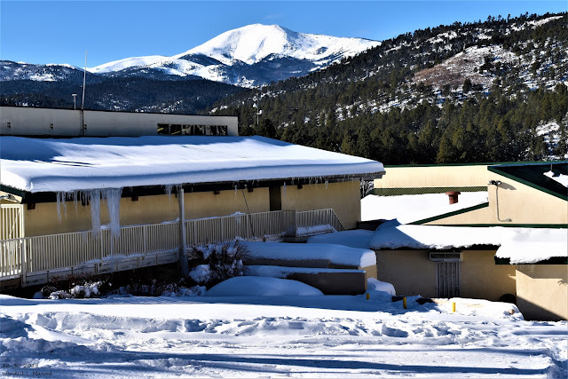
I was mesmerized by the sharp contrast between the bright daylight reflecting off of the freshly fallen snow and the deep shadows at the edge of the trees. Fresh animal tracks in the snow added to the beauty of it all.

The Truth Is Stranger Than Fiction - And Sometimes It Hurts!

Sunday, January 27, 2019

Mind Numbing Cold This Week In The Midwest/Great Lakes Areas.


Blog Updated At 2:16 PM MST Sunday.

January 18th, 2019
Northeast Of  Whites City, New Mexico.

Blowing dust kicked up by northerly wind gusts of around 40 mph formed along the leading edge of a fast southward moving cold front Friday, January 19th. Until we get a soaking rain or a good wet snow this trend is likely to continue into Spring. 

Brutally Cold In Canada This Morning.


Wind Chill Temperatures At 7 AM MST,


RTMA Wind Chill Temperatures At 7 AM MST.


Very cold in the Northland at 7AM this morning. Yes the map shows air temperatures not wind chill temperatures. Kabetogama General Store just reported -49. Thanks to all of our NWS Cooperative Observers.


Brutally cold arctic air has settled in across Ontario, Canada. Reported lows as of 7 AM MST this morning include -52ºF at Auden Near Foleyet, -52ºF at Peawanuck, and -51ºF at Bearskin Lake. Wind chill temperatures have dipped down as low as -63ºF. 

Interesting enough on the western (warmer) side of the arctic cold front slicing through the Canadian provinces Lethbridge in southern Alberta southwest of Medicine Hat, and just north of the U.S./Canadian border reported a high temperature so far of 50ºF since midnight MST. That's an astounding temperature difference across the arctic cold frontal boundary of 102ºF. 


Here in Southeastern New Mexico our lows this morning have ranged from 15ºF reported by a Personal Weather Station (PWS) in 16 Springs Canyon (7,367') northwest of Mayhill, to 37ºF at Guadalupe Pass (5,449'), and 39ºF at the Bat Draw Raws (4,425') at the Carlsbad Caverns National Park Visitor Center. The Roswell Airport (3,622') dipped to 19ºF, and the NMSU AGSC automated weather station 6 miles south of Artesia (3,369') reported 20ºF. 

Record Cold For The Midwest Mid-Week.


U.S. GFS Forecast High Temperature Anomalies Wednesday.


Those areas that are shaded in purple are forecast by this one model run will have high temperatures that will be some 30ºF to 55ºF below normal Wednesday. With many locations only seeing highs of -10ºF to -30ºF.

 Temperatures in some of these areas are forecast to remain below zero for several days in a row. This arctic outbreak is expected to bring the coldest temperatures seen in these areas since 1994 and 1985. Many locations will likely establish new daily record low high and record low temperatures during this outbreak.

These temperatures and wind chills won't just be an inconvenience, they will have the potential to be life threatening to anyone not properly protected when outdoors. 


Low temperatures are forecast to range from -10ºF to close to -45ºF Thursday morning. 


Wind chills will fall to dangerous levels in the Upper Midwest this week, and should be the coldest since the mid-1990s in parts of the eastern Dakotas, Minnesota, Iowa, Wisconsin and northern Illinois. Wind chills falling below -40 can cause frostbite on exposed skin in minutes.


 Valid At 5 AM MST Monday Morning.

Southeastern New Mexico and parts of West Texas will get a glancing blow from a southward moving arctic cold front Monday morning. Strong gusty northerly winds will likely kick up local areas of blowing dust as the cold front plows southward. Falling temperatures will accompany the frontal passage through the morning with our warmest temps in some locations occurring at or around midnight. 


Today.


Monday.


Tuesday.


Monday's high temperatures will occur early in the morning and depending upon the speed of the southward moving cold front, some of us may not get as warm as currently forecast. Tuesday will be cool with widespread highs in the 40's but this is nothing remarkable this time of the year. 

The Truth Is Stranger Than Fiction - And Sometimes It Hurts!

Wednesday, January 23, 2019

It Was Chilly Last Night.


Inn Of The Mountain Gods, Ruidoso, NM - Dec 30th, 2018.


It was just a tad chilly this morning with most of the valley locations reporting lows in the teens and 20's. The Arteisa Climate Co-Op Station came in with a low of 18ºF, Carlsbad Airport 21ºF, and the Roswell Airport 19ºF. Here at our home in Carlsbad I dipped down to 23ºF.

On this date in 1971 Prospect Creek, Alaska plunged to -80ºF to establish the coldest official temperature ever recorded in the United States. 

The Truth Is Stranger Than Fiction - And Sometimes It Hurts!
Tuesday, January 22, 2019

Cold Front Knocks Temps Back Down Closer To Normal.


Artesia, NM Sunset - January 19th, 2019.

Strong Cold Front Knocks Temps Down Closer To Normal.


24-Hour Temperature Change.


Wind Chill Temperatures At 4 PM MST Today.


A strong southward moving cold front blasted through the area around noontime today. Rapidly falling temperatures accompanied the frontal passage along with northerly winds gusting between 35-50 mph. Local areas of blowing dust briefly lowered the visibility in some locations as well. Wind chills dropped down into the single digits and teens across northeastern and eastern New Mexico this morning behind the front. Temperatures locally were some 25º to 35º colder compared to yesterday's readings as of 4 PM MST. 

Cold Tonight - But Closer To Normal For The Date.


NWS NDFD 7-Day Forecast High/Low Temps.


The Truth Is Stranger Than Fiction - And Sometimes It Hurts!

Sunday, January 20, 2019

SE NM Historical Climate Review Of Years With Annual Low Temps Of 0ºF Or Colder.


December 30th, 2018.
White Mountain - Old Baldy - Sierra Blanca Peak West Of Ruidoso, NM.

Years With Annual Low Temperatures 0ºF Or Colder.
(National Weather Service Climate Co-Op Station Data).


Note: Light blue shaded columns indicate years that data is being reported.
Gray shaded columns indicate years of missing data or data that is no longer being reported due to a station closure. 


Local Climate Data Summary - January 1962.


Extremely Cold Low Temperatures During January 1962.

January 11th and 12th, 1962 saw some of the coldest temperatures ever officially recorded by our local National Weather Service Climate Co-Op Stations. This bitterly event was exceeded in terms of all-time lowest temperatures that occurred on February 1905 and in February 1933. And in a few cases the February 2011 event.

 The extremely cold record low temperatures recorded in Southeastern New Mexico on February 8th, 1933 still stand as most of the local areas coldest ever official readings. This includes the following:

February 8, 1933.

Artesia -35ºF
Hagerman -34ºF
Tatum -32ºF
Pearl (West Of Hobbs) -30ºF
Richland (Roosevelt County) -29ºF
Portales -28ºF
Lovington -27ºF
Mayhill Ranger Station -27ºF
Roswell -24ºF
Fort Sumner -23ºF
Fort Statnton -23ºF
Hope -22ºF
Carlsbad -17ºF

Stations That Recorded Their Lowest Ever Readings January 11,12 1962:

Fort Stanton -28ºF
Elk -24ºF
Bitter Lakes Wildlife Refuge -22ºF
Cloudcroft -21ºF
Carlsbad Airport -18ºF (Coldest For Carlsbad)
Hondo/Picacho/Tinnie -17ºF
Alamogordo -14ºF

February 2011 Record Cold Lowest Temperatures:

Fort Stanton Raws -31ºF
Inn Of The Mountain Gods - West Of Ruidoso -30ºF
Mescalero -30ºF

Ruidoso -27ºF (Coldest Ever)
Dry Canyon PWS Near Cloudcroft -27ºF
Alto PWS -26ºF
Aspendale PWS South Of Cloudcroft -24ºF
Elk -24ºF (Ties 1962 For Coldest Ever)
Silver Springs PWS NE Cloudcroft -22ºF
Capitan -22ºF
Mayhill Raws -21ºF
East Alamogordo PWS -21ºF
Cloudcroft -20ºF
Wimsatt PWS -20ºF

Cloudcroft Fire Station PWS -19ºF
Sierra Blanca Regional Airport -19ºF
Holloman AFB - Alamogordo -19ºF
Cosmic Raws - Sunspot -18ºF
Weed PWS -16ºF
Mescalero Raws -15ºF
Hondo/Picacho/Tinnie -14ºF
Alamogordo Airport -13ºF
Haynes Canyon - High Rolls PWS -12ºF
Bitter Lakes Wildlife Refuge -12ºF
Roswell Airport -11ºF
Artesia -9ºF
Carlsbad Airport -4ºF
Tatum -4ºF
Hobbs 1ºF

Note: PWS stands for Personal Weather Station or a Home Weather Station.

What I find really interesting is that it was colder in the Tularosa Basin during the February 2011 record cold outbreak than it was in the Pecos Valley. The Bitter Lakes Wildlife Climate Co-Op Station recorded the coldest low temperature in the Pecos Valley during that event with a reading of -12ºF. Followed closely by Roswell's -11ºF, and Artesia's -9ºF. A Personal Weather Station (PWS) in east Alamogordo recorded an amazing morning low of -21ºF.

Overall Coldest Years On Record:

1895
1905
1913
1933
1962
1963
1966
1976
1978
1983
1987
2011

One thing is very apparent when looking at the spreadsheets above. Except for the extremely record cold low temperatures recorded during the first week of February 2011, our lowest annual temperatures across Southeastern New Mexico, the Sacramento Mountains, and the Tularosa Basin haven't been nearly as cold as years prior to 1997. And more so prior to 1987.

 If you are thinking this is due to Global Warming, Climate Change, or Climate Disruption then I disagree with you since I don't believe in this politically driven agenda. I have (I'm 60 years old for the record) always believed that our planets climate is driven by the interaction of the following; the Solar Sunspot Cycles, the Oceanic Cycles with their periods of warming and cooling both short and long term, Volcanic Eruptions, and the earths tilt and rotation around the sun. 

Our planets climate had been warming since we climbed up out of the Last Little Ice (1300-1850). This compromised the following Solar Minimums: The Maunder Minimum and the Dalton Solar Minimum. The Centennial Solar Minimum occurred from 1875-1935 and many believe we have entered the Eddy Minimum which began in 2007. Many believe that the planets temperatures peaked or paused in the upward climb around 1997 and have begun a slow drop.

 Its interesting to note that during the Centennial Solar Minimum we saw some of our coldest temperatures ever recorded locally (1895, 1905, 1913, and 1933). I find it equally as interesting that with the Eddy Solar Minimum underway we endured some of the coldest temperatures on record during the arctic record cold outbreak of February 2011. If this follows the trend of historical record cold outbreaks in conjunction with the Solar Sunspot Minimum Cycles the trend towards colder winters has already started. I think it has and I also believe we may be headed for another Little Ice Age but that will have to be another blog discussion some day.

History is said to repeat itself and too many times humanity fails to learn or even remember the lessons of the past. If the record cold of February 2011 is a precursor of what is to come in the years ahead then I seriously doubt that many will be prepared for the kind of cold that happened in 1962, 1951, 1933, 1905, and 1895.

 Artesia's official reading of -35ºF recorded in town on Main Street where the present day Artesia Daily Press Office is located is just hard to wrap my head around. Even more astonishing is the fact that the local newspaper accounts from Artesia state that local farmers reported temperatures as low as -43ºF near the Pecos River east and south of town. 

Similar accounts are noted in the Roswell newspaper surrounding the -29ºF that was recorded in town on February 13th, 1905. Local accounts note that temperatures in the negative 30's were observed both inside and outside of the city.

When looking at the spreadsheets above that I have created and posted please keep in mind that the data I have used is from the local historical climatology records provided by the National Climate Data Center (NCDC). These are considered official National Weather Service records. I will be the first to admit that these temperature records may not adequately cover some of our past historical cold outbreaks. This is especially true going back in time before the 1980's when automated and remote weather stations were added to the normal climate station networks. Some of these local Co-Op Station records were available prior to the 1950's and only a few were around before the 1900's. 

Personal Weather Stations (PWS) have aided somewhat in filling the temperature gaps but for the most part these stations are not considered as official temperature readings. Some or sited or located better than others and provide a sampling of local temperatures...those more so that are not located above rooftops of buildings. 

I have spent my lifetime researching, recording, observing, and photographing our local weather here in Southeastern New Mexico. Growing up in Artesia I listened intently as a young child to the farmers and ranchers who would shop with us at the family owned grocery store (Batie's Grocery) owned and operated on north first street in Artesia. I asked those older farmers and ranchers a million questions it seemed. I listened intently to their stories of the droughts, heat waves, flash floods and heavy rains, the hail storms and blinding dust storms. I was especially interested in their stories of the snow storms of past and the bitter cold in the 1960's and earlier. These stories are priceless in my opinion.

 My grandparents were a young married couple living on the farm just outside of Artesia in the winter of 1933. Their account of unbelievable cold of the morning of February 8th was fascinating to listen too. They like many in the Pecos Valley awoke to the sound of trees exploding at daybreak. The winter had been rather uneventful and rather mind until arctic air infiltrated the area drove the thermometer down nearly out of the glass. With an afternoon high temperature of only 7ºF the afternoon before and morning low of -35ºF and colder the sap in the trees rapidly froze, expanded, and caused the tree limbs to literally explode. Thus the source of what sounded like gunshots that morning.

The official temperature records provided in the spreadsheets give us an overview of just how cold it has been in the past locally. But I fully realize that many of the older generations before me experienced temperatures colder than what has been noted above. Case in point is the 1933 cold. The official record low for Artesia on January 11, 1962 is -20ºF. However the thermometer at the NMSU AG Science Center located six miles south-southeast of town noted a morning low of -24ºF. Carlsbad recorded its lowest reading ever on that morning at the airport with a low of -18ºF. Many local Carlsbad residents remembering their thermometers dipping as low as -25ºF that morning. 

Elk's official low that morning in January 1962 was -24ºF. More than one person has told me that they saw their thermometers dive below -30ºF. I have no trouble believing these stories. Cold air always settles in the valleys and low spots and many times these areas are much colder than the hills, mountain tops, or even flat lands. Old timers have often stated that one of the coldest places around locally is Artesia and parts of the Pecos Valley. I agree but I also note that the high mountain valleys such as; the Penasco valley, Cox canyon, Russia canyon, the Hondo valley, and others can get far colder than nearby areas in the dead of winter especially when there is deep snow cover involved. 

The brutal cold of February 2011 was a shock to many in New Mexico. Locally it was the coldest we had dropped down to since the three day blizzard of 1997 and the snow and cold of December 1987 when Artesia and Lakewood both dipped to -13ºF. Prior to 1987 the next cold outbreak was noted in the late 1970's and prior to that 1966, 1963, and 1962. 1951 was very cold for New Mexico and then we have 1933, 1913, 1905, and 1895.

During that week long brutal cold outbreak of February 2011 the Oilfield Industry locally took a beating with widespread equipment failures due to freeze ups and shutdowns from the cold. Not only were the low temperatures cold but our daytime highs for several days in a row were only in the single digits and teens. Wind chill readings dropped to an astonishing -30ºF to -40ºF locally. Gas plants and refineries shut down all over not only in Southeastern New Mexico and West Texas, but also across the rest of New Mexico, Texas and Oklahoma.The local dairy industry wasn't spared either with some loss of cows and calves.

Climate Data Is Courtesy Of:


My Other Blogs Of Local Historic Record Cold Outbreaks.


The Truth Is Stranger Than Fiction - And Sometimes It Hurts!

Friday, January 18, 2019

Peak Wind Gusts Reported - Friday Jan 18, 2019.


Ruidoso, New Mexico - December 30th, 2018.


At 1:55 PM MST Friday afternoon the Artesia Airport AWOS clocked a peak wind gust of 62 mph. The Guadalupe Pass ASOS clocked a peak gust of 67 mph at 3:51 PM MST.


PUBLIC INFORMATION STATEMENT
NATIONAL WEATHER SERVICE ALBUQUERQUE NM
454 PM MST FRI JAN 18 2019

PRELIMINARY PEAK NON-THUNDERSTORM WIND GUST REPORTS ACROSS NORTH AND CENTRAL NEW
MEXICO FOR THE LAST 18 HOURS.

...COUNTY...                      PEAK GUST    TIME/DATE OF
   LOCATION                         /MPH/       MEASUREMENT

...BERNALILLO COUNTY...
   ALBUQUERQUE 5 S                    52        148 PM  1/18
      - KABQ ASOS.
   ALBUQUERQUE 10 WNW                 44        347 PM  1/18
      - KAEG AWOS.

...CHAVES COUNTY...
   ROSWELL                            61       1232 PM  1/18
   BITTER LAKE WILDLIFE REF 14 NNE    56       1137 AM  1/18
   ROSWELL 4 SSE                      56       1256 PM  1/18
      - KROW ASOS.

...CIBOLA COUNTY...
   MESITA 9 ESE                       51        830 AM  1/18
   MILAN 2 SSW                        41        815 AM  1/18
      - KGNT AWOS.

...COLFAX COUNTY...
   RATON CREWS AIRPORT                33        910 AM  1/18
      - KRTN ASOS.
   ANGEL FIRE 2 NNW                   33        735 AM  1/18
      - KAXX AWOS.

...CURRY COUNTY...
   CANNON AFB 1 N                     46        958 AM  1/18
      - KCVS ASOS.
   TEXICO 3 NNW                       45        956 AM  1/18
      - KCVN AWOS.

...DE BACA COUNTY...
   FORT SUMNER 1 E                    54        250 PM  1/18

...GUADALUPE COUNTY...
   SANTA ROSA 2 ESE                   54        235 PM  1/18
      - KSXU AWOS.

...LINCOLN COUNTY...
   OSCURO 17 WNW                      63       1135 AM  1/18
   OSCURO 18 WSW                      55       1150 AM  1/18
   FORT STANTON 2 SSW                 38        915 AM  1/18
      - KSRR AWOS.

...LOS ALAMOS COUNTY...
   LOS ALAMOS 1 SE                    51        215 PM  1/18
      - KLAM AWOS.

...QUAY COUNTY...
   TUCUMCARI 7 ENE                    54       1131 AM  1/18
      - KTCC ASOS.

...ROOSEVELT COUNTY...
   DORA 2 SW                          55        245 PM  1/18
   TOLAR 13 SE                        52        216 PM  1/18
      - K4MR AWOS.
   TOLAR 13 SE                        48        314 PM  1/18
      - MELROSE RANGE RAWS.

...SAN MIGUEL COUNTY...
   LAS VEGAS 6 NE                     46        905 AM  1/18
      - KLVS ASOS.

...SANDOVAL COUNTY...
   FRIJOLES                           51        245 PM  1/18
      - TOWER RAWS.

...SOCORRO COUNTY...
   BINGHAM 20 S                       65        255 PM  1/18
   BINGHAM 19 S                       56       1130 AM  1/18
   BOSQUE DEL APACHE REFUGE 21 SE     51        330 PM  1/18
   BOSQUE DEL APACHE REFUGE 28 SE     51        300 PM  1/18
   SOCORRO 2 S                        37        955 AM  1/18
      - KONM AWOS.

...TORRANCE COUNTY...
   CLINES CORNERS 1 SSE               63        200 PM  1/18
      - KCQC ASOS.

$$

Public Information Statement National Weather Service El Paso Tx/Santa Teresa NM 815 PM MST Fri Jan 18 2019 ...PUBLIC INFORMATION STATEMENT... The following are unofficial peak gust observations taken over the last 12 hours. Appreciation is extended to Skywarn spotters, news media, White Sands Missile Range, and mesonet operators including the West Texas Mesonet and the Dona Ana County Flood Commission. ...MAXIMUM OBSERVED WINDS SORTED BY LOCATION... LOCATION MAX WIND COMMENTS MPH 6 NE Afton NM 41 107 PM 1/18/2019 3 NNE Capitol Peak NM 50 345 PM 1/18/2019 2 E Chaparral NM 47 1200 PM 1/18/2019 2 E Clint TX 44 149 PM 1/18/2019 Condron Field NM 44 825 AM 1/18/2019 2 SE Deming NM 45 500 PM 1/18/2019 Dripping Springs NM 42 726 PM 1/18/2019 El Paso Airport 52 1156 AM 1/18/2019 6 NE El Paso TX 54 302 PM 1/18/2019 5 ESE El Paso TX 50 1100 AM 1/18/2019 10 NNE El Paso TX 57 1100 AM 1/18/2019 1 NW El Paso TX 40 300 PM 1/18/2019 3 E El Paso TX 45 417 PM 1/18/2019 5 ENE El Paso TX 46 1100 AM 1/18/2019 7 NNE El Paso TX 43 323 PM 1/18/2019 9 SW El Paso TX 41 200 PM 1/18/2019 2 WNW El Paso TX 45 1100 AM 1/18/2019 26 NE Engle NM 41 1235 PM 1/18/2019 24 N Fort Hancock TX 40 1243 PM 1/18/2019 15 SSW Hachita NM 45 540 PM 1/18/2019 1 SW High Rolls NM 45 1255 PM 1/18/2019 1 N Horizon City TX 40 1124 AM 1/18/2019 KALM NM 43 115 PM 1/18/2019 KLRU NM 51 215 PM 1/18/2019 KSVC NM 47 1215 PM 1/18/2019 3 SE La Union NM 41 200 PM 1/18/2019 12 WSW Las Cruces NM 46 122 PM 1/18/2019 4 NNE Las Cruces NM 40 1205 PM 1/18/2019 6 WSW Las Cruces NM 51 100 PM 1/18/2019 Mescalero NM 43 1241 PM 1/18/2019 2 E Montana Vista TX 50 153 PM 1/18/2019 Northrup Strip NM 57 115 PM 1/18/2019 11 SW Northrup Strip NM 41 525 PM 1/18/2019 7 SW Northrup Strip NM 48 110 PM 1/18/2019 16 NNW Northrup Strip NM 54 215 PM 1/18/2019 28 ENE Orogrande NM 48 737 PM 1/18/2019 1 SSW Pinos Altos NM 45 516 AM 1/18/2019 12 E Redrock NM 46 159 PM 1/18/2019 San Augustin Pass NM 74 815 AM 1/18/2019 5 NE San Augustin Pass NM 56 740 AM 1/18/2019 5 WNW Santa Teresa NM 47 1258 PM 1/18/2019 5 WNW Santa Teresa NM 43 1237 PM 1/18/2019 2 NW Santa Teresa NM 44 127 PM 1/18/2019 1 N Socorro TX 41 200 PM 1/18/2019 Spaceport America NM 50 233 PM 1/18/2019 1 S Sunspot NM 51 115 PM 1/18/2019 Sunspot NM 41 115 PM 1/18/2019 1 S Sunspot NM 49 515 PM 1/18/2019 22 NW Tularosa NM 53 205 PM 1/18/2019 9 W Tularosa NM 48 410 PM 1/18/2019 20 WNW Tularosa NM 55 225 PM 1/18/2019 19 WNW Tularosa NM 47 1235 PM 1/18/2019 10 NW Tularosa NM 42 1225 PM 1/18/2019 Twin Peaks NM 55 731 PM 1/18/2019 8 NNW White Sands Nat Mon NM 42 110 PM 1/18/2019 5 ENE WSMR Main Post NM 44 655 PM 1/18/2019 1 NW WSMR Main Post NM 55 821 AM 1/18/2019 1 SE WSMR Main Post NM 62 830 AM 1/18/2019 1 SE WSMR Main Post NM 56 615 AM 1/18/2019 6 ESE WSMR Main Post NM 41 740 PM 1/18/2019 JAR

The Truth Is Stranger Than Fiction - And Sometimes It Hurts!

Current NWS Watches/Warnings In Effect

New Mexico

Eddy County

Chaves County Plains & Mtn's

Culberson County

Lea County

Lincoln County

Otero County

Current US Temps

Current US Wind Chill/Heat Index Temperatures

NWS Midland Forecast

NWS Midland Forecast

NWS Albuquerque Forecast

NWS Albuquerque Forecast

NWS Albuquerque Forecast

NWS El Paso Forecast

NWS El Paso Forecast

NWS El Paso Forecast

NWS El Paso

NWS Lubbock Forecast

NWS Lubbock Forecast

NWS Lubbock Forecast

My Blog Archive List

Average Daily High/Low Temperatures & Rainfall/Snowfall

Average Daily High/Low Temperatures & Rainfall/Snowfall