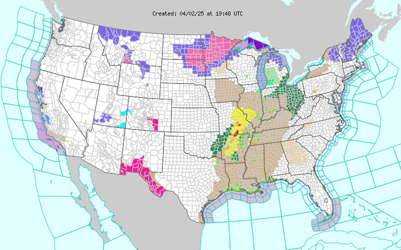
Current National Weather Service Watches/Warnings In Effect.

My Current Weather

Ruidoso Live Web Cam

Cloudcroft Live Web Cam

Friday, July 31, 2020

Another Round Of T-Storms This Afternoon Into Tonight. Some May Be Severe.

July 28, 2020.
I Took This Near The Argo/Hidalgo Gas Plant 18 Miles West Of Orla, TX.
Overshooting Top On A Thunderstorm Northwest Of Roswell, New Mexico 130 Miles From Me.

Tank Battery Fire Red Rd. & Hwy 128.
(Lightning Caused).


Overnight T-Storms In SE NM.


     Late-night thunderstorms developed to our north and northeast overnight and then moved southward into the local area early this morning. Most of this activity is decreasing just before sunrise this morning. A few spots picked up moderate to locally heavy rainfall (yellow shades) in the 1" - 2" range. 

(As Of 6 AM MDT Friday, July 31, 2020).


(Midnight - 6 AM MDT Friday, July 31, 2020).


Updated at 7:42 AM MDT This Morning.


Scattered T-Storms Today Into Monday.

     Overnight thunderstorms dropped moderate to locally heavy rain over Southeastern New Mexico. These storms are winding down at sunrise this morning. Skies will clear this morning with another round of storms developing this afternoon.

     Late afternoon thunderstorms will develop over the mountains and to our north and then move southward into the evening and overnight hours. Some of these storms like this morning's activity will continue overnight until around sunrise Saturday.

     A few of these storms will become severe and produce severe sized hail (1" in diameter or greater) and damaging thunderstorm wind gusts. Slightly larger than dime size hail was reported by the public in Artesia around 3:45 AM this Friday morning. 

     Locally heavy rainfall will occur with the strongest thunderstorms with some spots seeing rainfall totals of 1" - 3". 

     Highs today will range from the low 90's to the mid 90's behind a weak cold front that entered the local area overnight. Back up to the upper 90's for Saturday, Sunday, and Monday. 

The Truth Is Stranger Than Fiction!

Saturday, July 25, 2020

Roswell T-Storm Wind Damage & Hurricane Hanna.

July 22, 2020.
Carlsbad, New Mexico.
Morning Thunderstorm Approaching From The East.

Severe T-Storm In Roswell Friday Evening.


Photos Are Courtesy Of Chaves County Skywarn Coordinator Jim Tucker.
Last night's storm damage along Hobson Rd. between U.S. 285 and Old Dexter Hwy.


Friday evening at 7:38 PM MDT a Severe Thunderstorm produced a peak wind gust at the Roswell Airport of 68 mph. Power line and pole damage were noted on Hobson Rd. south of town along with some shed and barn roof damage. Trees were also reported to be blown down in the city on Richardson and in north Roswell.

(And Radar/Satellite Estimated Totals). 


New Mexico CoCoRaHS 24-Hour Rainfall Totals Exceeding 1.00".


Hurricane Hana.


At 9:01 AM MDT Saturday, July 25, 2020.


At 8:16 AM MDT Saturday, July 25, 2020.

National Hurricane Center (NHC) Latest Advisory/Forecast.


Hanna Will Dump Heavy Rains On South Texas.


Valid Today Through 6 AM MDT Tuesday, July 28, 2020.

Hurricane Hanna was located 80 miles southeast of Corpus Christi, Texas as of 10 AM MDT this Saturday morning. She continues to move to the west at 7 mph. Hanna has sustained winds of 80 mph with gusts near 100 mph. Her central pressure is down to 28.88 inches of mercury or 978 millibars. Hanna is forecast to make landfall south of Corpus Christi late this afternoon or early this evening then continue on a west-southwest track into central Mexico by Monday morning.

Heavy rains upwards of 10"-15" are forecast to fall across the extreme southern tip of Texas in the Harlingen, McAllen, and Brownsville areas by Monday. Locally up to 18" could fall in a few areas.

Hit & Miss T-Storms Continue.


Hit and miss monsoonal thunderstorms are forecast to continue across the local area into the middle of next week. Our afternoon high temps in Southeastern New Mexico are forecast to be in the mid to upper 90's. Our chances for rain are in the 20% to 30% range.

In the Sacramento mountains, highs will range from the low 80's to near 70. As is typical with our annual monsoon pattern the mountains will have the best shot at getting wet with rainfall chances generally in the 30% to 80% range.

Most of us won't get wet in the valley but should any thunderstorm drift over your area there is the potential for an inch or more of rain to fall as happened in Roswell last night.

The Truth Is Stranger Than Fiction!

Thursday, July 23, 2020

Hit & Miss T-Storms To Continue Into The Weekend.


Captured At 2:23 PM MDT Thursday, July 23, 2020.


(As Of 6 PM MDT Thursday, July 23, 2020).


Hit & Miss T-Storms To Continue Into The Weekend.

     Those of you who have been lucky enough to get "hit" with one the stronger thunderstorms over the past week may have gotten upwards of an inch or more of rain. Meanwhile, the rest of us are still holding our hats out "begging" for something measurable so to speak. Not much change in the overall thinking going forward into the weekend. Hit and miss thunderstorms each afternoon will continue with some lasting well into the overnight hours. Some of us will get lucky and get a decent rain while most won't. The mountains are still favored to have the best chances of getting wet. 

     Depending upon the eventual track of Tropical Depression #8 we could possibly see an increase in our summer monsoon activity next week as it's remnants die over central Mexico.

The Truth Is Stranger Than Fiction!

NWS Midland Forecast

NWS Midland Forecast

NWS Albuquerque Forecast

NWS Albuquerque Forecast

NWS Albuquerque Forecast

NWS Albuquerque Forecast

NWS El Paso Forecast

NWS El Paso Forecast

NWS Lubbock Forecast

NWS Lubbock Forecast

NWS Lubbock Forecast

Average Daily High/Low Temperatures & Rainfall/Snowfall