Roswell T-Storm Wind Damage & Hurricane Hanna.
Carlsbad, New Mexico.
Morning Thunderstorm Approaching From The East.
Severe T-Storm In Roswell Friday Evening.
Photos Are Courtesy Of Chaves County Skywarn Coordinator Jim Tucker.
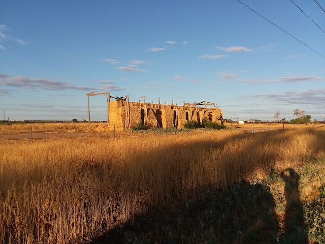
Last night's storm damage along Hobson Rd. between U.S. 285 and Old Dexter Hwy. Friday evening at 7:38 PM MDT a Severe Thunderstorm produced a peak wind gust at the Roswell Airport of 68 mph. Power line and pole damage were noted on Hobson Rd. south of town along with some shed and barn roof damage. Trees were also reported to be blown down in the city on Richardson and in north Roswell.
(And Radar/Satellite Estimated Totals).
New Mexico CoCoRaHS 24-Hour Rainfall Totals Exceeding 1.00".
At 9:01 AM MDT Saturday, July 25, 2020.
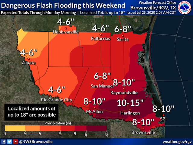
Hanna Will Dump Heavy Rains On South Texas.
Hurricane Hanna was located 80 miles southeast of Corpus Christi, Texas as of 10 AM MDT this Saturday morning. She continues to move to the west at 7 mph. Hanna has sustained winds of 80 mph with gusts near 100 mph. Her central pressure is down to 28.88 inches of mercury or 978 millibars. Hanna is forecast to make landfall south of Corpus Christi late this afternoon or early this evening then continue on a west-southwest track into central Mexico by Monday morning.
Heavy rains upwards of 10"-15" are forecast to fall across the extreme southern tip of Texas in the Harlingen, McAllen, and Brownsville areas by Monday. Locally up to 18" could fall in a few areas.
Hit & Miss T-Storms Continue.
Hit and miss monsoonal thunderstorms are forecast to continue across the local area into the middle of next week. Our afternoon high temps in Southeastern New Mexico are forecast to be in the mid to upper 90's. Our chances for rain are in the 20% to 30% range.
In the Sacramento mountains, highs will range from the low 80's to near 70. As is typical with our annual monsoon pattern the mountains will have the best shot at getting wet with rainfall chances generally in the 30% to 80% range.
Most of us won't get wet in the valley but should any thunderstorm drift over your area there is the potential for an inch or more of rain to fall as happened in Roswell last night.
The Truth Is Stranger Than Fiction!


Comments
Post a Comment
Your comments, questions, and feedback on this post/web page are welcome.