My Current Weather

Sunday, September 27, 2020

Cold Front This Afternoon - 30-Degrees Cooler Monday.


Valid At 12:30 PM MDT Sunday, Sept 27, 2020.

RTMA 24-Hour Temperature Difference.
Valid At 12:30 PM MDT Sunday, Sept 27, 2020.


Noon MDT, Sunday, Sept 27, 2020.

U.S. Wind Chill Temperatures.

Noon MDT, Sunday, Sept 27, 2020.


Valid At 9 AM MDT Sunday, Sept 27, 2020.

Update at 2:42 PM MDT Sunday, Sept 27, 2020.

A Wind Advisory is in effect for Eddy, Lea, Chaves, Roosevelt, and Curry Counties as well as all much of West Texas and Southern New Mexico for tonight into Monday morning. Northerly winds sustained at 25 to 35 mph with gusts near 50 mph are forecast.

As of noontime, we had already reached 100º here at our home in Carlsbad. While further to the north in eastern Colorado they have fallen into the mid 40's behind the cold front. This represents a change in temperature of some 35º colder than 24-hours ago.

The cold front was located near the Clovis and Portales area this morning and is currently moving southward a little faster than the model's forecast. It will arrive in Southeastern New Mexico later this afternoon and early this evening. Strong gusty northerly winds of around 30 mph gusting to 40-50 mph will accompany the front passage. Along with areas of blowing dust and possibly another haboob. Watch for sudden drops in the visibility with little to no advanced warning especially in those normally dust prone locations such as: freshly plowed or exposed farmlands, open lots and fields, and construction sites. 

A High Wind Warning is in effect for the Guadalupe Pass area from 11 PM tonight through 11 AM MDT Monday for northeasterly winds sustained at around 40 to 60 mph with gusts near 70 mph.

Highs this afternoon will range from near 90º in the eastern plains to the low 100's across the Southeastern Plains. Highs on Monday will range in the 60's and 70's. Lows Tuesday morning are still forecast to be in the upper 30's to low 40's locally with many of the mountain communities dropping down close to freezing or slightly below.

The Truth Is Stranger Than Fiction!

Saturday, September 26, 2020

Near Record To Record Highs Today & Sunday - Next Cold Front Arrives Sunday Night.

9-22-2020.
Sunrise On The NM/TX State Line.

Blog Updated 8:17 AM MDT Sunday, Sept 27, 2020.

Next Fall Cold Front Arrives Sunday Night.


Valid At 6 AM MDT.
Monday, September 28, 2020.

A strong short wave trough of low pressure at the mid-levels of the atmosphere is forecast to slide eastward across the northern U.S. states today into Sunday, then it will shift southeast into the central plains Monday into Tuesday. By sunrise Monday morning this mid-level trough of low pressure will have moved into the northeastern and eastern plains of New Mexico.


Valid At 6 PM MDT.
 Sunday, September 27, 2020.

As the mid-level short wave trough swings across areas to our north, it will drive a cold front southward and westward into New Mexico Sunday afternoon into Monday. The surface front is forecast to arrive in Southeastern New Mexico between sunset Sunday and midnight. After seeing near-record to record high temperatures locally today and Sunday a much cooler air mass will overspread the area behind the front Monday and Tuesday.


Today.


NWS NDFD Forecast High Temp Sunday.


NWS NDFD High Temp Anomaly Sunday.


Local high temperatures today and Sunday will average some 10º-15º above average today and Sunday ahead of the approaching cold front. Highs across the Southeastern Plains will range from the upper 90's to the low 100's.

NWS NDFD High Temp Forecast Monday.


NWS NDFD High Temp Anomaly Monday.


Local high temperatures on Monday will be some 15º-20º below average on Monday which will be about 20º-30º cooler than Saturday and Sunday's highs. Highs generally will range in the 60's and 70's across the Southeastern Plains.

NWS NDFD Forecast Low Temperatures Tuesday Morning.


Forecast low temperatures Tuesday morning are expected to be in the upper 30's to low 40's across the Southeastern Plains. Most of the mountain areas should see low temperatures just above or slightly below freezing.

(2.1 NNW Downtown Carlsbad, NM).


While the next approaching bout of cooler weather is forecast to knock our temperatures back down closer to normal it will not be nearly as strong as the Sept 9th cold front which dropped our temperatures 40º-50º in less than 24-hours.

Strong Northerly Winds With The Frontal Passage.
(Areas Of Blowing Dust).


Valid At Midnight MDT Sunday Night.

Northerly winds sustained at around 30 mph with gusts to 40-50 mph will accompany the frontal passage. The strongest winds are forecast during the overnight hours and will subside  Monday afternoon.

Blowing dust will accompany these strong winds gusts and don't be surprised if another Haboob develops. Blinding clouds of blowing dust may reduce the visibility down to near zero along and just after the frontal passage. Normally dust prone areas such as freshly plowed or exposed farmland, fields, lots, and construction sites will experience the worst dust problems with the lowest visibilities. 


(January 1st - September 26th, 2020).


New Mexico Year-To-Date Rainfall Anomalies - % Of Normal.
(January 1st - September 26th, 2020).


Extreme drought conditions continue to plague the region with a few areas experiencing exceptional drought conditions. Most of the reporting stations across the Southeastern Plains are reporting year-to-date rainfall totals of 4-5". This compared to the long term average year-to-date totals of 10" in the Pecos Valley to 14" in the Hobbs area. 

Moderate to severe drought conditions continue to be observed in the Capitan, Sacramento, and the Guadalupe Mountains. The highest elevations of the Sacramento Mountains are reporting year-to-date precipitation totals of 16" to 22" while the lower elevations are reporting totals in the 10" to 15" range. Long-range forecasts offer no relief in sight with area drought conditions continuing to worsen with time.

The Truth Is Stranger Than Fiction!

Wednesday, September 16, 2020

Hit & Miss T-Storms Tonight Into Thursday Night.

Sept 15, 2020.
Sunrise Whites City, NM.

Scattered T-Storms.

NWS Midland Dual Pol Doppler Radar.

Scattered thunderstorms dot the area as of 4 PM MDT this Wednesday afternoon. Some are moving to the southeast, some to the southwest, and some of them to the south. We have a 20% chance of getting wet tonight into Thursday night. 


Our nights are cooling off making for some pleasant mornings. High mountain valleys in New Mexico are starting to drop down below freezing. Fall is coming early to New Mexico this year.

NWS NDFD Forecast High/Low Temps.


The Truth Is Stranger Than Fiction!

Monday, September 14, 2020

Hurricane Sally Rapidly Strengthens & Slows Down.

(2 PM MDT Monday, Sept 14, 2020).


NHC Hurricane Sally Updates.


Local National Weather Service Office Products.

Local Statements are prepared by National Weather Service Weather Forecast Offices (WFO) giving specific details for their County Warning Area (CWA) on weather conditions, evacuation decisions made by local officials, and other precautions necessary to protect life and property.

On this page are links to the Local Statements that have been released within the last 8 hours, as well as links to the homepages of the issuing Weather Forecast Offices.

Issuing WFO HomepageLocal ImpactsLocal Statement
New Orleans / Baton Rouge, LAThreats and Impacts152 PM CDT Mon Sep 14
Tallahassee, FLThreats and Impacts507 PM EDT Mon Sep 14 2020 /407 PM CDT Mon Sep 14
Jackson, MSThreats and Impacts411 PM CDT Mon Sep 14
Lake Charles, LAThreats and Impacts413 PM CDT Mon Sep 14
Mobile, AL / Pensacola, FLThreats and Impacts419 PM CDT Mon Sep 14

These statements are also available at weather.gov.


Latest Public Advisories.

BULLETIN
Hurricane Sally Advisory Number  14
NWS National Hurricane Center Miami FL       AL192020
400 PM CDT Mon Sep 14 2020

...SALLY A LITTLE STRONGER, ADDITIONAL STRENGTHENING EXPECTED 
TONIGHT...
...LIFE-THREATENING STORM SURGE, HURRICANE-FORCE WINDS, AND FLASH 
FLOODING LIKELY ALONG PORTIONS OF THE NORTHERN GULF COAST STARTING 
TONIGHT AND TUESDAY...


SUMMARY OF 400 PM CDT...2100 UTC...INFORMATION
----------------------------------------------
LOCATION...28.8N 87.4W
ABOUT 105 MI...170 KM E OF THE MOUTH OF THE MISSISSIPPI RIVER
ABOUT 145 MI...230 KM SE OF BILOXI MISSISSIPPI
MAXIMUM SUSTAINED WINDS...100 MPH...155 KM/H
PRESENT MOVEMENT...WNW OR 300 DEGREES AT 6 MPH...9 KM/H
MINIMUM CENTRAL PRESSURE...987 MB...29.15 INCHES
Read the rest of the advisory via the link above.

Sunday, September 13, 2020

New Mexico Smoke -T-Storms - T.S. Sally.

6:35 PM MDT
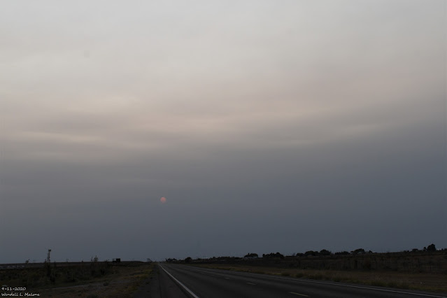
Friday, Sept 11, 2020.
US Hwy 82 Just West Of Artesia.


Many Californians, Radical Leftist Politicians, and the Far Left Liberal Media are blaming President Trump for the disaster unfolding across the Western U.S. with the massive outbreak of forest fires. Which is absolutely absurd. Decades of failed mismanagement of the Forests by many of these Western States due to radical Environmental Policies have caused this, not President Trump.


Valid At 6 AM MDT Sunday, Sept 13, 2020.


8:41 AM MDT Sunday, Sept 13, 2020.
RAMMB/CIRA GeoColor Satellite Image.

8:41 AM MDT Sunday, Sept 13, 2020.
RAMMB/CIRA Water Vapor Satellite Image.

Sunday, Sept 13, 2020.


This Sunday morning's satellite images show that mid-level smoke from the West Coast Forest Fires continues to stream across the southern one half of New Mexico. Smoke from these fires is forecast to continue obscuring our skies today and Monday. Tropical Storm Sally is located off the southwestern coast of Florida. 

T-Storms Back In Our Local Forecast.


Valid Today Through 6 PM MDT Monday.

An upper-level low has formed southwest of us in northern Old Mexico. A plume of mid-level moisture is being conveyed northeastward into southern New Mexico by the southwesterly flow aloft around this low. This combined with a weak frontal passage early this morning will boost our chances for scattered thunderstorms today into Monday. The models aren't handling this feature very well either. Isolated locally heavy rainfall will be possible with a few of these storms but overall a widespread soaking rainfall event does not appear in the cards.

Long-Range Forecasts.


Our record-breaking cold snap last week was a pattern breaker for us. I'll post more on the temperature records that were shattered later when more data is available. For now, anyway, the models indicate that our endless days of 100º has ended. This isn't to say that we still can't or won't reach 100º again before our first freeze, but in the near-term, this isn't forecast. By all accounts our fall this year is shaping up to be gorgeous...a long time coming too. 

 
Fall Freeze Data for Cities Across New Mexico
(Probabilistic charts are available for sites with links)


Central Valleys
32°F Average
32°F Earliest 
28°F Average
28°F Earliest
Elevation 
Albuquerque SunportNovember 4September 18, 1912November 15September 22, 19125310'
Albuquerque South ValleyOctober 23October 6, 2013November 1October 8, 19224955'
Albuquerque FoothillsOctober 26September 25, 2000November 5October 5, 19956270'
CorralesOctober 12September 18, 2006October 23October 6, 19955026'
Los Lunas 3 SSWOctober 16September 19, 2006October 26October 5, 19614840'
Carrizozo 1 SWOctober 17September 18, 2006October 26October 8, 20075405'
Elephant ButteNovember 14October 21, 1910November 27October 22, 19964571'
SocorroOctober 20September 27, 1924October 30September 27, 19084585'
Northwest Plateau
32°F Average
32°F Earliest 
28°F Average
28°F Earliest
Elevation
Aztec RuinsOctober 9September 9, 1989October 19September 13, 19775644'
Chaco CanyonSeptember 23August 23, 2001October 2August 24, 19686177'
El MorroSeptember 24September 4, 1961October 2September 4, 19617223'
FarmingtonOctober 16September 19, 1996October 27September 29, 19995625'
GallupSeptember 27September 3, 1973October 5September 9, 20016471'
ZuniSeptember 21August 9, 2011September 30September 11, 20106611'
Northern Mountains
32°F Average
32°F Earliest 
28°F Average
28°F Earliest
Elevation 
AlcaldeOctober 3September 10, 1962October 14September 21, 19715680'
ChamaSeptember 10August 1, 1949September 24August 1, 19497850'
Cimarron 4 SWOctober 2September 9, 2001October 10September 18, 19716540'
CubaSeptember 18August 13, 1985September 26September 8, 20016908'
DulceSeptember 15August 9, 2009September 28August 25, 19626793'
Eagle NestSeptember 7August 1, 1936September 19August 13, 19298260'
GasconSeptember 23August 13, 1967October 2September 9, 20018250'
Jemez SpringsOctober 10September 19, 1996October 22September 29, 19996262'
Las VegasOctober 5September 9, 2001October 15September 18, 19716874'
Los AlamosOctober 10September 18, 1971October 21September 19, 19967424'
PecosOctober 3August 26, 2017October 13August 26, 20176878'
RatonOctober 7September 4, 1961October 17September 18, 19716932'
Red RiverSeptember 5August 2, 1915September 18August 19, 19388676'
Santa Fe AirportOctober 15September 19, 2006October 25October 10, 20176344'
TaosOctober 1September 3, 1973October 10September 9, 19416965'
ValmoraSeptember 30September 5, 1971October 8September 10, 19626312'
Eastern / Northeast Plains
32°F Average
32°F Earliest 
28°F Average
28°F Earliest
Elevation 
Amistad 5 SSWOctober 25September 19, 1971October 15October 5, 19854445'
ClaytonOctober 17September 17, 1971October 27September 27, 19274960'
Clovis 13 NOctober 19September 21, 1983October 28September 21, 19834435'
Conchas DamNovember 2October 8, 1976November 13October 13, 20014244'
MelroseOctober 25September 16, 1951November 4October 8, 19924599'
Mosquero 1 NEOctober 11September 18, 1971October 20September 25, 20005465'
PortalesOctober 24September 21, 1983November 2October 8, 19924010'
Ragland 3 SSWOctober 21September 21, 1983November 1October 8, 19925060'
RoyOctober 12September 4, 1961October 22September 25, 19705890'
San JonOctober 24September 20, 1942November 3October 8, 19704230'
Santa RosaOctober 21September 25, 2000November 1October 8, 19764610'
TucumcariOctober 24October 2, 2009November 2October 8, 19764065'
Western / Southwest Mountains
32°F Average
32°F Earliest 
28°F Average
28°F Earliest
Elevation 
CuberoOctober 4September 9, 2001October 14September 18, 20066195'
GrantsOctober 5September 4, 1961October 15September 18, 20066520'
AugustineOctober 1September 8, 1932October 9September 11, 19867000'
QuemadoSeptember 27August 17, 1985October 5September 4, 19616878'
GlenwoodOctober 21October 4, 2002October 31October 10, 19494725'
HillsboroOctober 24October 1, 1900November 2October 8, 19765267'
Central Mountains
32°F Average
32°F Earliest 
28°F Average
28°F Earliest
Elevation 
Clines CornersOctober 8September 18, 1971October 19September 21, 19837086'
CloudcroftSeptember 29September 6, 1988October 11September 20, 20068679'
Estancia 4 NSeptember 29September 7, 1944October 7September 14, 19596140'
Gran QuiviraOctober 14September 18, 1971October 24September 25, 20006600'
MountainairOctober 6September 4, 1961October 14September 16, 19516520'
RuidosoOctober 6August 6, 1978October 18September 11, 19566930'
Southeast
32°F Average
32°F Earliest 
28°F Average
28°F Earliest
Elevation 
Artesia 6 SOctober 27September 28, 1968November 5October 8, 19763366'
CarlsbadNovember 6September 29, 1909November 16October 23, 19963120'
ElkOctober 8September 19, 2006October 20September 25, 20005934'
Fort SumnerOctober 5September 21, 1983November 3October 8, 19924025'
PicachoOctober 21September 29, 1999November 1October 14, 19974990'
HobbsNovember 8October 8, 1976November 18October 19, 19173660'
RoswellNovember 3September 27, 1901November 13October 3, 19613649'
TatumOctober 24September 20, 1971November 2September 28, 19734012'
Southern Deserts
32°F Average
32°F Earliest 
28°F Average
28°F Earliest
Elevation 
AlamogordoNovember 7October 15, 1966November 16October 22, 19964350'
Animas 3 ESENovember 5October 8, 1992November 15October 8, 19924501'
ColumbusNovember 9October 8, 1976November 21October 26, 19564065'
DemingNovember 1October 4, 1908November 11October 9, 19174300'
Lordsburg 4SEOctober 24October 8, 2011November 1October 9, 19824244'
NMSUNovember 9September 30, 1945November 21October 17, 18983886'
OrograndeNovember 2October 8, 1976November 14October 8, 19764182'
Truth or ConsequencesNovember 10October 8, 1976November 22October 28, 19704850'


Tropical Storm Sally.

Sunday, Sept 13, 2020.

NHC Tropical Storm Sally Forecast Track.


Model Forecast Tracks Of Sally.


(Rainfall Forecast Updated At 1:04 PM MDT Sunday, Sept 13, 2020).

Valid Today - Through 6 AM MDT Wednesday, Sept 23, 2020.


Tropical Storm Sally is forecast to strengthen to a hurricane within 24-hours as she continues moving to the west-northwest across the very warm waters of the Gulf of Mexico...headed for Lousiana.

Concerns are high that she may slow down in her forward movement and strengthen into a Major Hurricane before making landfall. The models are shifting her forecast track ever so slightly to the west with each new run. For now, the southern Lousiana Coastline and New Orleans are in trouble...ground zero. Current model forecasts indicate 10" to 20" of rainfall from Sally which will cause widespread significant flooding and flash flooding.

All of this may change so make sure you click on the links provided and get the very latest updated information from the National Hurricane Center and the local National Weather Service Forecast Offices

BULLETIN
Tropical Storm Sally Advisory Number   8
NWS National Hurricane Center Miami FL       AL192020
1100 AM EDT Sun Sep 13 2020

...SALLY EXPECTED TO STRENGTHEN TONIGHT AND MONDAY...
...LIFE-THREATENING STORM SURGE, HURRICANE-FORCE WINDS AND HEAVY
RAINFALL EXPECTED ALONG PORTIONS OF THE NORTHERN GULF COAST
STARTING ON MONDAY...


SUMMARY OF 1100 AM EDT...1500 UTC...INFORMATION
-----------------------------------------------
LOCATION...27.5N 84.9W
ABOUT 135 MI...220 KM W OF ST. PETERSBURG FLORIDA
ABOUT 280 MI...450 KM ESE OF THE MOUTH OF THE MISSISSIPPI RIVER
MAXIMUM SUSTAINED WINDS...60 MPH...95 KM/H
PRESENT MOVEMENT...WNW OR 295 DEGREES AT 12 MPH...19 KM/H
MINIMUM CENTRAL PRESSURE...998 MB...29.48 INCHES.
----------------------------------------------------------------------------------------------------------------------
TROPICAL STORM SALLY FORECAST/ADVISORY NUMBER   8
NWS NATIONAL HURRICANE CENTER MIAMI FL       AL192020
1500 UTC SUN SEP 13 2020

CHANGES IN WATCHES AND WARNINGS WITH THIS ADVISORY...

THE HURRICANE WARNING ALONG THE COAST OF LOUISIANA HAS BEEN
EXTENDED WESTWARD TO MORGAN CITY.

A TROPICAL STORM WARNING HAS BEEN ISSUED FOR THE COAST OF LOUISIANA
FROM WEST OF MORGAN CITY TO INTRACOASTAL CITY.

SUMMARY OF WATCHES AND WARNINGS IN EFFECT...

A STORM SURGE WARNING IS IN EFFECT FOR...
* PORT FOURCHON LOUISIANA TO THE MISSISSIPPI/ALABAMA BORDER
* LAKE PONTCHARTRAIN...LAKE MAUREPAS...AND LAKE BORGNE

A HURRICANE WARNING IS IN EFFECT FOR...
* MORGAN CITY LOUISIANA TO OCEAN SPRINGS MISSISSIPPI
* LAKE PONTCHARTRAIN AND LAKE MAUREPAS INCLUDING METROPOLITAN NEW
ORLEANS

A STORM SURGE WATCH IS IN EFFECT FOR...
* MISSISSIPPI/ALABAMA BORDER TO THE ALABAMA/FLORIDA BORDER

A HURRICANE WATCH IS IN EFFECT FOR...
* EAST OF OCEAN SPRINGS TO THE ALABAMA/FLORIDA BORDER

A TROPICAL STORM WARNING IS IN EFFECT FOR...
* EAST OF OCEAN SPRINGS TO INDIAN PASS
* INTRACOASTAL CITY LOUISIANA TO WEST OF MORGAN CITY

A TROPICAL STORM WATCH IS IN EFFECT FOR...
* INDIAN PASS TO OCHLOCKONEE RIVER FLORIDA

A STORM SURGE WARNING MEANS THERE IS A DANGER OF LIFE-THREATENING
INUNDATION...FROM RISING WATER MOVING INLAND FROM THE
COASTLINE...DURING THE NEXT 36 HOURS IN THE INDICATED LOCATIONS.
FOR A DEPICTION OF AREAS AT RISK...PLEASE SEE THE NATIONAL WEATHER 
SERVICE STORM SURGE WATCH/WARNING GRAPHIC...AVAILABLE AT 
HURRICANES.GOV.  THIS IS A LIFE-THREATENING SITUATION.  PERSONS 
LOCATED WITHIN THESE AREAS SHOULD TAKE ALL NECESSARY ACTIONS TO 
PROTECT LIFE AND PROPERTY FROM RISING WATER AND THE POTENTIAL FOR 
OTHER DANGEROUS CONDITIONS. PROMPTLY FOLLOW EVACUATION AND OTHER 
INSTRUCTIONS FROM LOCAL OFFICIALS.

A HURRICANE WARNING MEANS THAT HURRICANE CONDITIONS ARE EXPECTED
SOMEWHERE WITHIN THE WARNING AREA.  A WARNING IS TYPICALLY ISSUED
36 HOURS BEFORE THE ANTICIPATED FIRST OCCURRENCE OF
TROPICAL-STORM-FORCE WINDS...CONDITIONS THAT MAKE OUTSIDE
PREPARATIONS DIFFICULT OR DANGEROUS.  PREPARATIONS TO PROTECT LIFE
AND PROPERTY SHOULD BE RUSHED TO COMPLETION.

A TROPICAL STORM WARNING MEANS THAT TROPICAL STORM CONDITIONS ARE
EXPECTED SOMEWHERE WITHIN THE WARNING AREA WITHIN 36 HOURS.

A STORM SURGE WATCH MEANS THERE IS A POSSIBILITY OF LIFE-
THREATENING INUNDATION...FROM RISING WATER MOVING INLAND FROM THE
COASTLINE...IN THE INDICATED LOCATIONS DURING THE NEXT 48 HOURS.
FOR A DEPICTION OF AREAS AT RISK...PLEASE SEE THE NATIONAL WEATHER
SERVICE STORM SURGE WATCH/WARNING GRAPHIC...AVAILABLE AT
HURRICANES.GOV.

A HURRICANE WATCH MEANS THAT HURRICANE CONDITIONS ARE POSSIBLE
WITHIN THE WATCH AREA.

A TROPICAL STORM WATCH MEANS THAT TROPICAL STORM CONDITIONS ARE
POSSIBLE WITHIN THE WATCH AREA...IN THIS CASE WITHIN 12 TO 24 HOURS.

TROPICAL STORM CENTER LOCATED NEAR 27.5N  84.9W AT 13/1500Z
POSITION ACCURATE WITHIN  25 NM

PRESENT MOVEMENT TOWARD THE WEST-NORTHWEST OR 295 DEGREES AT  10 KT

ESTIMATED MINIMUM CENTRAL PRESSURE  998 MB
MAX SUSTAINED WINDS  50 KT WITH GUSTS TO  60 KT.
50 KT....... 30NE  30SE   0SW   0NW.
34 KT....... 60NE  80SE   0SW  20NW.
12 FT SEAS.. 30NE  30SE   0SW  30NW.
WINDS AND SEAS VARY GREATLY IN EACH QUADRANT.  RADII IN NAUTICAL
MILES ARE THE LARGEST RADII EXPECTED ANYWHERE IN THAT QUADRANT.

REPEAT...CENTER LOCATED NEAR 27.5N  84.9W AT 13/1500Z
AT 13/1200Z CENTER WAS LOCATED NEAR 27.3N  84.6W

FORECAST VALID 14/0000Z 28.0N  86.6W
MAX WIND  55 KT...GUSTS  65 KT.
50 KT... 30NE  30SE   0SW   0NW.
34 KT... 90NE  80SE   0SW  40NW.

FORECAST VALID 14/1200Z 28.5N  88.2W
MAX WIND  65 KT...GUSTS  80 KT.
64 KT... 20NE   0SE   0SW   0NW.
50 KT... 40NE  20SE   0SW  20NW.
34 KT... 90NE  80SE  20SW  70NW.

FORECAST VALID 15/0000Z 28.9N  89.4W
MAX WIND  80 KT...GUSTS 100 KT.
64 KT... 20NE  10SE  10SW  15NW.
50 KT... 40NE  20SE  20SW  30NW.
34 KT...100NE  80SE  50SW  70NW.

FORECAST VALID 15/1200Z 29.7N  90.2W...INLAND
MAX WIND  65 KT...GUSTS  80 KT.
64 KT... 20NE  10SE   0SW  10NW.
50 KT... 40NE  30SE  20SW  30NW.
34 KT...100NE  80SE  50SW  60NW.

FORECAST VALID 16/0000Z 30.3N  90.5W...INLAND
MAX WIND  50 KT...GUSTS  60 KT.
50 KT... 20NE  20SE   0SW   0NW.
34 KT... 60NE  90SE  20SW  40NW.

FORECAST VALID 16/1200Z 31.5N  90.3W...INLAND
MAX WIND  35 KT...GUSTS  45 KT.
34 KT... 30NE  60SE  20SW  20NW.

EXTENDED OUTLOOK. NOTE...ERRORS FOR TRACK HAVE AVERAGED NEAR 150 NM
ON DAY 4 AND 175 NM ON DAY 5...AND FOR INTENSITY NEAR 15 KT EACH DAY

OUTLOOK VALID 17/1200Z 33.6N  88.3W...INLAND
MAX WIND  25 KT...GUSTS  35 KT.

OUTLOOK VALID 18/1200Z 34.8N  83.8W...POST-TROP/REMNT LOW
MAX WIND  20 KT...GUSTS  30 KT.

REQUEST FOR 3 HOURLY SHIP REPORTS WITHIN 300 MILES OF 27.5N  84.9W

INTERMEDIATE PUBLIC ADVISORY...WTNT34 KNHC/MIATCPAT4...AT 13/1800Z

NEXT ADVISORY AT 13/2100Z

$$
FORECASTER BROWN

The Truth Is Stranger Than Fiction!

NWS Albuquerque Burn Scar Matrix Forecast

Current NWS Watches/Warnings In Effect

New Mexico

Eddy County

Chaves County Plains & Mtn's

Culberson County

Lea County

Lincoln County

Otero County

Current US Temps

Current US Wind Chill/Heat Index Temperatures

NWS Midland Forecast

NWS Albuquerque Forecast

NWS Albuquerque Forecast

NWS El Paso Forecast

NWS Lubbock Forecast

NWS Lubbock Forecast

Average Daily High/Low Temperatures & Rainfall

Average Daily High/Low Temperatures & Rainfall