Near Record To Record Highs Today & Sunday - Next Cold Front Arrives Sunday Night.
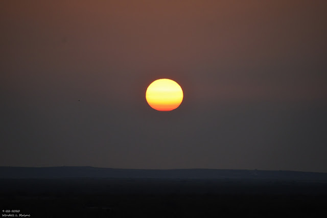
Sunrise On The NM/TX State Line.
Blog Updated 8:17 AM MDT Sunday, Sept 27, 2020.
Next Fall Cold Front Arrives Sunday Night.
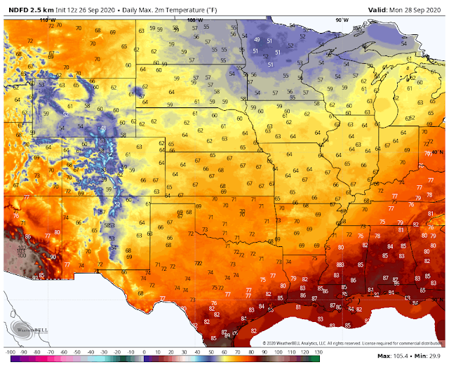
Monday, September 28, 2020.
Valid At 6 PM MDT.
A strong short wave trough of low pressure at the mid-levels of the atmosphere is forecast to slide eastward across the northern U.S. states today into Sunday, then it will shift southeast into the central plains Monday into Tuesday. By sunrise Monday morning this mid-level trough of low pressure will have moved into the northeastern and eastern plains of New Mexico.
Sunday, September 27, 2020.
As the mid-level short wave trough swings across areas to our north, it will drive a cold front southward and westward into New Mexico Sunday afternoon into Monday. The surface front is forecast to arrive in Southeastern New Mexico between sunset Sunday and midnight. After seeing near-record to record high temperatures locally today and Sunday a much cooler air mass will overspread the area behind the front Monday and Tuesday.
Today.
NWS NDFD High Temp Anomaly Sunday.
Local high temperatures today and Sunday will average some 10º-15º above average today and Sunday ahead of the approaching cold front. Highs across the Southeastern Plains will range from the upper 90's to the low 100's.
NWS NDFD High Temp Anomaly Monday.
Local high temperatures on Monday will be some 15º-20º below average on Monday which will be about 20º-30º cooler than Saturday and Sunday's highs. Highs generally will range in the 60's and 70's across the Southeastern Plains.
NWS NDFD Forecast Low Temperatures Tuesday Morning.
Forecast low temperatures Tuesday morning are expected to be in the upper 30's to low 40's across the Southeastern Plains. Most of the mountain areas should see low temperatures just above or slightly below freezing.
(2.1 NNW Downtown Carlsbad, NM).
Strong Northerly Winds With The Frontal Passage.
(Areas Of Blowing Dust).
Northerly winds sustained at around 30 mph with gusts to 40-50 mph will accompany the frontal passage. The strongest winds are forecast during the overnight hours and will subside Monday afternoon.
Blowing dust will accompany these strong winds gusts and don't be surprised if another Haboob develops. Blinding clouds of blowing dust may reduce the visibility down to near zero along and just after the frontal passage. Normally dust prone areas such as freshly plowed or exposed farmland, fields, lots, and construction sites will experience the worst dust problems with the lowest visibilities.
(January 1st - September 26th, 2020).
(January 1st - September 26th, 2020).
Extreme drought conditions continue to plague the region with a few areas experiencing exceptional drought conditions. Most of the reporting stations across the Southeastern Plains are reporting year-to-date rainfall totals of 4-5". This compared to the long term average year-to-date totals of 10" in the Pecos Valley to 14" in the Hobbs area.
Moderate to severe drought conditions continue to be observed in the Capitan, Sacramento, and the Guadalupe Mountains. The highest elevations of the Sacramento Mountains are reporting year-to-date precipitation totals of 16" to 22" while the lower elevations are reporting totals in the 10" to 15" range. Long-range forecasts offer no relief in sight with area drought conditions continuing to worsen with time.
The Truth Is Stranger Than Fiction!


Comments
Post a Comment
Your comments, questions, and feedback on this post/web page are welcome.