My Current Weather

Friday, November 30, 2012

Local Climate Data Records For The Last Day Of November.


 Climate Data For November 30th.

Roswell Area  (ThreadEx Station)
Daily Almanac
Date: Nov 30, 2012

Daily Values         Observed    Normal       Record/Year    Prev Year
Max Temperature           -         58         81 in 2003          64
Min Temperature           -         29          9 in 1918          23
Avg Temperature           -         44       60.0 in 1970        43.5
Precipitation             -       0.02       0.86 in 1906        0.00
New Snowfall              -        0.1        1.5 in 2006         0.0
Snow Depth                -          -          5 in 2006           0
 
ARTESIA 6S (290600)
Daily Almanac
Date: Nov 30, 2012

Daily Values         Observed    Normal       Record/Year    Prev Year
Max Temperature           -         61         80 in 1917          56
Min Temperature           -         25        -10 in 1976          18
Avg Temperature           -         43       57.5 in 1970        37.0
Precipitation             -       0.02       0.50 in 1971        0.00
New Snowfall              -        0.1        1.0 in 2006         0.0
Snow Depth                -          -          1 in 1976           0

CARLSBAD (291469)
Daily Almanac
Date: Nov 30, 2012

Daily Values         Observed    Normal       Record/Year    Prev Year
Max Temperature           -         61         87 in 1901          57
Min Temperature           -         31          4 in 1918          25
Avg Temperature           -         46       65.5 in 1927        41.0
Precipitation             -       0.02       0.27 in 1902        0.00
New Snowfall              -        0.0        2.7 in 1902         0.0
Snow Depth                -          -          3 in 1918           0

CARLSBAD CAVERN CITY AP (291475)
Daily Almanac
Date: Nov 30, 2012

Daily Values         Observed    Normal       Record/Year    Prev Year
Max Temperature           -         61         80 in 1970          67
Min Temperature           -         31         12 in 1976          25
Avg Temperature           -         46       67.0 in 1933        46.0
Precipitation             -       0.02       1.05 in 1931        0.00
New Snowfall              -        0.0       15.0 in 1931         0.0
Snow Depth                -          -         12 in 1931           0

HOBBS (294026)
Daily Almanac
Date: Nov 30, 2012

Daily Values         Observed    Normal       Record/Year    Prev Year
Max Temperature           -         61         79 in 1970          54
Min Temperature           -         32          9 in 1918          28
Avg Temperature           -         46       66.0 in 1970        41.0
Precipitation             -       0.03       0.75 in 1996        0.00
New Snowfall              -        0.0        0.0 in 2011+        0.0
Snow Depth                -          -          3 in 1918           0

TATUM (298713)
Daily Almanac
Date: Nov 30, 2012

Daily Values         Observed    Normal       Record/Year    Prev Year
Max Temperature           -         58         78 in 1950          53
Min Temperature           -         25          9 in 1976+         26
Avg Temperature           -         41       58.5 in 1970        39.5
Precipitation             -       0.02       0.60 in 1931        0.00
New Snowfall              -        0.0        6.0 in 1931         0.0
Snow Depth                -          -          6 in 1931           0

RUIDOSO (297649)
Daily Almanac
Date: Nov 30, 2012

Daily Values         Observed    Normal       Record/Year    Prev Year
Max Temperature           -         51         70 in 2003+         59
Min Temperature           -         23        -11 in 1976          20
Avg Temperature           -         37       49.5 in 1954        39.5
Precipitation             -       0.03       0.40 in 2007        0.00
New Snowfall              -        0.1        3.0 in 2006         0.0
Snow Depth                -          -          3 in 2006           0

CLOUDCROFT (291931)
Daily Almanac
Date: Nov 30, 2012

Daily Values         Observed    Normal       Record/Year    Prev Year
Max Temperature           -         45         62 in 2003          52
Min Temperature           -         21          1 in 2010+         20
Avg Temperature           -         33       42.5 in 2007        36.0
Precipitation             -       0.05       0.75 in 1996           -
New Snowfall              -        0.4       10.0 in 1996           -
Snow Depth                -          -         13 in 2009           -
 
Climate Data Is Courtesy Of-
 
The Midland NWS Climate Page
The Albuquerque NWS Climate Page
The El Paso NWS Climate Page   
 
The Truth Is Stranger Than Fiction!

 My Web Page Is Best Viewed With Google Chrome.

Thursday, November 29, 2012

November Will End Very Warm & Dry.


 One of my favorite photos. I shot this one at the Indian Basin
 Gas Plant six years ago.

 Another one of my favorites that I took along State Hwy 137
northwest of Carlsbad, NM back in 2010.

Today Into Early Next Week.


November is going to end with above normal temperatures for southeastern New Mexico and nearby areas, and December is going to start out on the same path. Our afternoon highs today are forecast to rise up into the mid - upper 70's. Friday's highs will be a few degrees warmer with most of us seeing highs close to 80. A repeat of these temps will occur Saturday into Monday with highs ranging from the mid 70's to near 80.

Valid At 5 PM MST Today.

ECMWF Temp Anomaly Forecast.
Valid At 5 PM MST Friday.

ECMWF Temp Anomaly Forecast.
Valid At 5 PM MST Saturday.

ECMWF Temp Anomaly Forecast.
Valid At 5 PM MST Sunday.

ECMWF Temp Anomaly Forecast.
Valid At 5 PM MST Monday.

Changes Late Next Week?

We may see a pattern change beginning to take shape late next week according to the European (ECMWF) model forecasts below. A shot of cold air may be headed our way in about a week.

Valid At 5 PM MST Friday December 7, 2012.

 ECMWF Temp Forecast.
Valid At 11 AM MST Friday December 7, 2012.

ECMWF Temp Anomaly Forecast.
Valid At 11 AM MST Saturday December 8, 2012.

What goes up, will in time, come back down. And the reverse of this is also true. In the weather world nothing ever stays the same for long. Our atmosphere is constantly in motion, and this motion dictates change. Trying to figure out when that change is coming, and how much change will occur when it comes is the challenge. 

November has pretty much seen above normal temperatures here in New Mexico. No doubt the Ski industry is getting a little nervous about the possibility of a warmer and drier than normal winter. That's the million dollar question, what will our winter be like? If the current trends continue then we may very well be looking at a very warm and dry winter. I doubt that they will.

I'm not one to try and speculate much on long-range forecasting. To me it just doesn't make much sense because most of the time you will end up being wrong when you do. Last winter was a classic case in point. I for one, would never have dreamed that we would have seen a foot of snow (more photos here, and here) on the ground Christmas morning in Carlsbad, New Mexico. But it happened. 

There are some indicators that we may begin to see the current pattern change as we head into December. If these indicators are correct, then December may end up being pretty darn cold, and snowy for much of the U.S. east of the Rockies. I wouldn't bet the farm on this though. 

Graphic Is Courtesy Of US NWS Alaska.

Chicken, Alaska drops down to -52F this morning. Brrrrrrr.

Some of the coldest air that we have seen in ten years has been locked up in Alaska and Northwestern Canada this month. Remember, a couple of weeks ago the temps in interior Alaska dropped down to below -40F. This is nothing unusual for January and February, but its very unusual to see these temps in the middle of November. Is this one of those indicators of what is to come south into the U.S. later? Maybe...we will just have to wait and see.

The Truth Is Stranger Than Fiction! 

My Web Page Is Best Viewed With Google Chrome.

Wednesday, November 28, 2012

We Are Stuck In A Very Warm And Dry Pattern.


 There simply isn't much to say except that we are going to see another stretch of warmer than normal temperatures starting today, and continuing into at least the first of next week. A few daily record high temperature records may be threatened in parts of the area over the next five days.

Our high temps are forecast to be in the low 70's today, and the mid to upper 70's Thursday into next Monday. A few of us may even see 80-degree readings a couple of times. 

Long-Range Temperature & Rainfall Outlooks.


Current Drought Status & Outlook.


The Truth Is Stranger Than Fiction!

 My Web Page Is Best Viewed With Google Chrome.

Tuesday, November 27, 2012

Seemingly Never Ending Warmth & Dry Weather To Continue.


06Z/11 PM MST GFS 500 MB Analysis.


A complex and potent upper-level storm located off the Pacific Northwest Coast (see the GFS 500 MB map above) will send a series of powerful storm into that region this week. Five day rainfall totals at the lower elevations of the Pacific Northwest are forecast to range from 10" - 15" in some spots. What these folks will get over the next five days (rainfall totals) is about what we get here in southeastern New Mexico all year long. That's impressive stuff!


A weak dry cold front moved into southeastern New Mexico and west Texas yesterday afternoon. Cooler temperatures have overspread the area behind the front. Forecast high temps today for most of the lower elevations of southeastern New Mexico are expected to be in the upper 50's to low 60's. 


Our afternoon high temperatures will be close to seasonal averages today.

Above Normal Temperatures Wednesday - Next Monday.

 GFS Temp Anomaly Forecast At 5 PM MST Wednesday.

GFS Temp Anomaly Forecast At 5 PM MST Thursday.

GFS Temp Anomaly Forecast At 5 PM MST Friday.  

GFS Temp Anomaly Forecast At 5 PM MST Saturday.

GFS Temp Anomaly Forecast At 5 PM MST Sunday.

 GFS Temp Anomaly Forecast At 5 PM MST Next Monday.

If you are looking for more seasonal-like temperatures and some of that white stuff falling from our skies...sorry, its not happening, at least in the next week to ten days here locally. Our afternoon temperatures are forecast to remain above normal into early next week.

 Most of us will see highs in the low 70's tomorrow, and the low to upper 70's into next Monday. I suspect that a few spots are going to flirt with 80-degree temps during this period also. The ECMWF forecast model is trending even warmer than the GFS model. Bad news for New Mexico's Ski Resorts.

Warm & Windy Early Next Week?

Valid At 5 PM MST Monday Dec 3, 2012.

Valid At 5 PM MST Monday Dec 3, 2012.

Really about the only thing significant to disrupt our local stretch of weather tranquility will be the passage of a mid-level trough of low pressure over northern New Mexico early next week. This will likely cause an increase in our westerly winds and some minor cooling behind the system.

The Truth Is Stranger Than Fiction! 

My Web Page Is Best Viewed With Google Chrome.

Saturday, November 24, 2012

Ridiculously Warm Sunday.


Valid At 5 PM MST Sunday Nov 25, 2012.

Valid At 5 PM MST Sunday Nov 25, 2012.

Sunday will be ridiculously warm across our neck of the woods. Most of southeastern New Mexico is expecting to see afternoon high temperatures in the upper 70's to near 80. These temps will be some 10 to 15 degrees above normal for the end of November. A few of us may see our daily record high temps tied or broken tomorrow. 

Normal Daily High - Low Temps.

Roswell (1883-2012) 62 - 31
Artesia (1905-2012) 63 - 29
Carlsbad (1900-2012) 64 - 33
Carlsbad Airport (1942-2012) 6534
Hobbs (11912-2012) 63 - 35
Tatum (1919-2012) 61 - 28

Valid At 5 PM MST Monday November 26, 2012.

A weak cold front will enter the area Monday afternoon. Cooler air will overspread the area behind the front, knocking our daytime highs back down into the 60's on Tuesday and Wednesday. Long-range models continue to keep southeastern New Mexico high and dry through next weekend. Above normal temps will return by the end of next week. 

The Truth Is Stranger Than Fiction! 

 My Web Page Is Best Viewed With Google Chrome.

Friday, November 23, 2012

Cooler Today - 80-Degrees By Sunday.

Blog updated at 11:35 AM MST.
NWS Mesonet High Temperatures.
Reported On Thanksgiving Day.

You could not have asked for a better Thanksgiving as far as our local weather was concerned. That is of course if you are not a snow lover. Widespread high temperatures in the 70's were recorded across the area, with a few 80's noted too.

Today Into The Weekend.


A dry cold front has moved southward and out of the local area early this morning. A cooler airmass will overspread southeastern New Mexico and west Texas today. Most of the lower elevations of southeastern New Mexico will see high temperatures in the mid to upper 50's. Tonight will be seasonably cold with low temperatures in the 20's to near 30. 

Strong gap winds from the northeast will continue in the Guadalupe Pass area this morning. A High Wind Warning continues in effect until 11 AM MST for northeasterly winds sustained at around 35 - 45 mph with gusts near 60 mph.

Another sunny and very warm weekend is expected. Our afternoon high temps on Saturday are forecast to climb up into the upper 60's. Sunday will see highs in the upper 70's to near 80.

Long-Range Outlook.

Last week it was looking like the seasons first invasion of arctic air was headed our way next week. Well now it appears that isn't going to happen now. I'm rather frustrated with the computer forecast models lately, they are just all over the place with their forecasts. My confidence in the models at this point in time is pretty low. So don't be surprised if we see some more flip flopping with their forecasts over the next week. 

 Like me you are probably beginning to wonder when our temperatures are going to drop down to cooler (more normal) levels. No doubt the folks looking for snow in the mountains have got to be getting a little anxious by now too. Lets take a look at what is in store for the next week to ten days.


Valid At 5 PM MST Sat Dec 1, 2012.

Valid At 5 PM MST Sunday Dec 2, 2012.

Valid At 5 PM MST Sun Dec 2, 2012.

After a significant warm-up late this weekend, another dry cold front will enter the local area on Monday. This front will knock our high temps back down into the 50's and 60's on Tuesday. No significant (at least not at this time) appears in store for the area for the rest of the week.

If the models are to be believed, then our next potential storm will approach the state late next weekend. This one looks more like a wind maker for us than anything else given its forecast track to our north. But as noted above, this could change.

There is plenty of cold arctic air locked up in Alaska and Canada, but until the flow aloft buckles, favoring a deeper trough over the Western U.S., our chances of seeing colder arctic air work its way southward into southeastern New Mexico doesn't appear too likely anytime soon.

The Truth Is Stranger Than Fiction!

 My Web Page Is Best Viewed With Google Chrome.

NWS Albuquerque Burn Scar Matrix Forecast

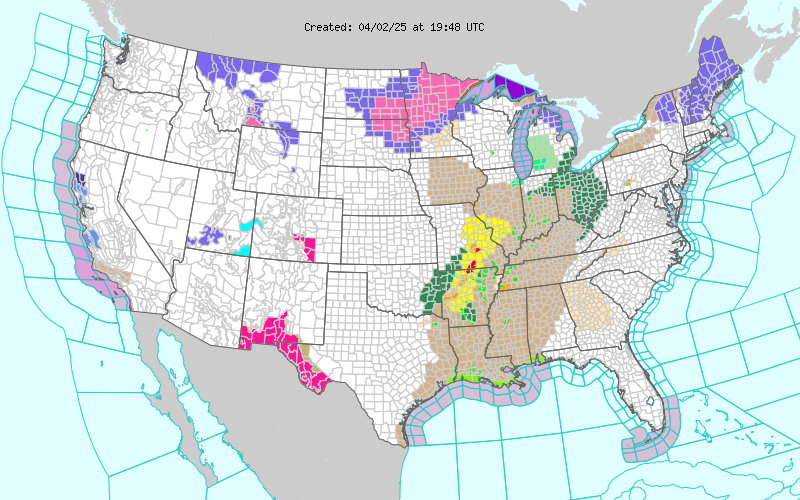
Current NWS Watches/Warnings In Effect

New Mexico

Eddy County

Chaves County Plains & Mtn's

Culberson County

Lea County

Lincoln County

Otero County

Current US Temps

Current US Wind Chill/Heat Index Temperatures

NWS Midland Forecast

NWS Albuquerque Forecast

NWS Albuquerque Forecast

NWS El Paso Forecast

NWS Lubbock Forecast

NWS Lubbock Forecast

Average Daily High/Low Temperatures & Rainfall

Average Daily High/Low Temperatures & Rainfall