My Current Weather

Saturday, December 31, 2022

2022 Ends On A Warm & Windy Note.

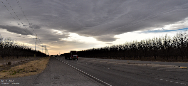
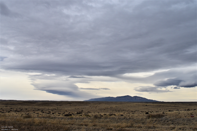
December 28, 2022.
US Hwy 285 South Of Artesia.
Altocumulus Standing Lenticular Clouds.

Blog Updated At 3:40 PM MST New Years Eve. 

A Parade of Pacific Storms Headed Our Way.


Valid At 5 PM MST Monday, January 2, 2023.


Valid At 5 PM MST Sunday, January 1st, 2023.

Valid At 5 AM MST Monday, January 2nd, 2023.

Three mid-level short wave troughs of low pressure (circled in red on the GFS 500 Millibar forecast map above) are forecast to impact our regional weather today into mid-week of the first week of the New Year.

Storm #1 will be approaching New Mexico from northern California tonight through Monday. By sunset Monday it is forecast to be centered over northeastern Colorado. 

Storm #2 is forecast to impact our weather Tuesday into Wednesday morning. The third storm is forecast to arrive late next week.

A Pacific cold front will race across the state New Years night through Monday morning. 


Today.

Thursday, December 29, 2022

Storm Summary - Thursday, December 29, 2022.

December 28, 2022.
Altocumulus Standing Lenticular Clouds.
Looking Northwest At Capitan Mountain.


My wife got me the new Go Pro Hero Black 11 camera for Christmas. So I took off towards Ruidoso, New Mexico on Wednesday, December 28, 2022 to try it out for the first time. I've died and gone to heaven. I love this camera and can't wait to play with all of it's new features. Storm chasing with this camera is a must. Primary I shot a series of time-lapse videos of altocumulus standing lenticular clouds forming near Capitan mountain northwest of Roswell and east of Sierra Blanca Peak west of Ruidoso, New Mexico. Check out the directional wind shear activity via the different cloud levels. The public reported a peak wind gust to 83 mph on a Personal Weather Station (PWS) in Alto, north of Ruidoso. The Smokey Bear Remote Weather Station (Raws) located 1 mile northwest of Ruidoso reported a peak gust of 74 mph Wednesday afternoon.

Blog Updated At 7:00 AM MST Friday, Dec 30, 2022.

Reported Peak Wind Gusts.
(Tuesday Night-Early Wednesday Morning).

Pine Springs Mesonet Station in the Guadalupe Mtn's Natl Park 95 MPH at 2:41 AM MST.
The Bowl Raws Just North of Guadalupe Peak 87 MPH at 2:37 PM MST.

3 Cross PWS Northeast of Elk 54 MPH at 2:00 AM MST.
Queen Raws 53 MPH at 4:13 AM MST.
Dunken Raws 51 MPH at 1:36 AM MST.

Wednesday - Wednesday Night.

Nogal, New Mexico.
North Of Ruidoso.

A Facebook friend sent me this photo of a Personal Weather Station peak wind gust in Nogal on Wednesday. I don't know the owners name so I can't give them the proper credit for this photo.

Nogal PWS 94 MPH.
Guadalupe Pass ASOS 89 MPH.
The Bowl Raws Located Just N of Guadalupe Peak 85 MPH.
Alto PWS - High Country Landscapes and Nursery 83 MPH.

3 Cross PWS Located NE of Elk 78 MPH.
Smokey Bear Raws 1 Mile NW of Ruidoso 74 MPH.

Dunken Raws 66 MPH.
Nogal PWS - Mesa Cedar Crest Rd 178 66 MPH.
Alto PWS - House 64 MPH.
Sierra Blanca Regional Airport AWOS NE of Ruidoso 60 MPH.

Mayhill PWS - DW7680 59 MPH. Carlsbad KOA PWS - Seven Rivers 58 MPH. Alto PWS - Hwy 37 @ Cherry Creek 56 MPH.
High Rolls PWS - CW5738 53 MPH. Artesia Airport AWOS 58 MPH.
Caprock Raws 53 MPH.
Carlsbad Airport ASOS 53 MPH.
Bat Draw Raws - Carlsbad Caverns Visitor Center 50 MPH.
Queen Raws 50 MPH.

Wind Damage In The Ruidoso Area.

What was not disappointing sadly so was the high winds. Damage to power lines, utility lines, outbuildings and trees was reported yesterday in the Ruidoso area.
@NWSAlbuquerque it’s a little windy up here in Ruidoso pic.twitter.com/V26xIC2SB2
Disappointing Storm Snowfall-wise.

Wednesday, December 28, 2022

High Winds - Blowing Dust-Heavy Mountain Snows Today Into Thursday.

December 27, 2022.
Artesia, New Mexico Sunset.


URGENT - WINTER WEATHER MESSAGE
National Weather Service El Paso Tx/Santa Teresa NM
256 AM MST Wed Dec 28 2022

NMZ415-282300-
/O.CON.KEPZ.WS.W.0004.221228T2100Z-221229T0900Z/
Sacramento Mountains Above 7500 Feet-
Including the cities of Cloudcroft, Sunspot, and Apache Summit
256 AM MST Wed Dec 28 2022

...WINTER STORM WARNING REMAINS IN EFFECT FROM 2 PM THIS
AFTERNOON TO 2 AM MST THURSDAY...

* WHAT...Heavy snow expected. Total snow accumulations of 6 to 10
  inches. Winds gusting as high as 60 to 70 mph.

* WHERE...Sacramento Mountains Above 7500 Feet.

* WHEN...From 2 PM this afternoon to 2 AM MST Thursday.

* IMPACTS...Travel could be very difficult. Areas of blowing snow
  could significantly reduce visibility. Very strong winds and
  heavy wet snow on trees and power lines could cause extensive
  tree damage and power outages. Heavy snow and drifting could
  close highways to traffic.

* ADDITIONAL DETAILS...Snowfall forecast 2 PM Wednesday through 2
  AM Thursday: Sierra Blanca Peak 10 to 12 inches, Cloudcroft and
  Sunspot 6 to 10 inches, Apache Summit 5 to 8 inches. Snowfall
  totals could be higher along ridge line and west/southwest
  facing slopes.

PRECAUTIONARY/PREPAREDNESS ACTIONS...

If you must travel, keep an extra flashlight, food, and water in
your vehicle in case of an emergency.

The latest road conditions for the state you are calling from can
be obtained by calling 5 1 1 or visit http://nmroads.com.
High Wind Warning For The Guadalupe Mountains.

Tuesday, December 27, 2022

A Parade Of Winter Storms Tonight Into The New Years Holiday Weekend.

November 26, 2022.
Dark Canyon Rd West Of Carlsbad, NM.

Parade Of Winter Storms Lining Up.


Valid 11 PM MST Wednesday, December 28, 2022.

Between today and next Monday (Jan 2nd, 2023) four different winter storms are forecast to line up in the strong zonal jet stream flow aloft and move across New Mexico. The strongest of these will likely be the New Years Eve and New Years Day storm. Last nights 5 PM MST (00Z or 00 GMT) run of the US GFS computer forecast model depicts a strong zonal flow aloft with the jet stream stretching from west to east across the northern Pacific Basin. It forecasts a wind speed maximum in the jet stream out over the north-central Pacific Ocean of 226 knots or 260 mph Wednesday night around midnight. That's a lot of energy helping to drive these winter storms eastward into the Western and Southwestern US.


Valid At 11 AM MST Monday, Jan 2nd, 2023.


Valid Tonight - 5 AM MST Friday, December 30, 2022.


Wednesday, December 21, 2022

Here Comes The Arctic Plunge!


Valid At 8 AM MST Thursday, Dec 22, 2022.


At 2 AM MST Wednesday Morning.


Valid At 5 AM MST Thursday.


Valid At 5 AM MST Wednesday Morning.

Northern US RTMA Temperatures.
Valid At 5 AM MST Wednesday Morning.

RTMA Apparent Temperatures.

Valid At 5 AM MST Wednesday Morning.


Valid At 6:30 AM MST Wednesday Morning.

Brutal Cold Behind Strong Arctic Cold Front.

Monday, December 19, 2022

Dangerous/Brutal Arctic Invasion - Wednesday Night Into Thursday Night!

December 17, 2022.
West Of Mayhill, New Mexico.

Blog Updated At 12:49 PM MST Monday, Dec 19, 2022.

Dangerous/Brutal Arctic Invasion.
 Wednesday Night Into Thursday.


Valid At 5 PM MST Thursday.


Valid Thursday, December 22, 2022.

Canadian (GEM) Mean Sea Level Forecast Map.

Valid At 5 PM MST Thursday.

For days now all eyes have been on the massive invasion of arctic air slated to spread south and southeast into the Continental US this week. This brutally cold air mass is currently forecast to enter far northeastern New Mexico Wednesday night. Then bulldoze it's way southward into the eastern and southeastern plains late Wednesday night into Thursday morning. Note the Canadian models forecast (above) of a surface high over northwestern Wyoming around sunset with a central pressure of 1055 millibars or 31.15 inches of mercury! 

As of this Monday morning there still remains some question as to the timing of the arrival of the arctic front in Southeastern New Mexico. I've chose the Canadian (GEM) forecast model to use because historically it handles these brutally cold air masses fairly well. Best guess at this time (Monday morning) is that the front will arrive early Thursday morning. This will have a huge impact upon our local high temperature forecast Thursday. 

If the front arrives sooner than currently is forecast we may not get above freezing. If it arrives later then we will be warmer. It is very possible that our daytime highs over most of the local area will be set between midnight and sunrise Thursday. Our highs in Southeastern New Mexico could range from the 50's to near 60Āŗ with a later frontal passage or only in the 20's and 30's with a faster arrival of the front. 

Thursday, December 15, 2022

Seasonably Chilly Friday Into The Weekend - First Look At Next Weeks Arctic Outbreak.

December 14, 2022.
Near Seminole, Texas.
Beautiful Christmas Lights With A Sunset Background.


Forecast Low Temperatures Friday Morning.


Forecast Apparent Temperatures Friday Morning.


Forecast High Temperatures Friday.


Forecast Low Temperatures Saturday Morning.


Forecast Apparent Temperatures Saturday Morning.


Forecast High Temperatures Saturday.


Forecast High Temperatures Sunday.


A reinforcing shot of cold air will accompany a southward moving cold front tonight as it passes through the state and local area. This mornings reported local low temperatures ranged from the low 20's to near 30 across the Southeastern Plains. 

Lows this morning in the Sacramento mountains were mostly in the teens. A Personal Weather Station (PWS) in Bell Canyon northwest of Mayhill reported a low of 7Āŗ as did a station in Hay Canyon. And the Mescal Raws near Mescalero reported a low of 10Āŗ. A PWS in Timberon reported a low of 10Āŗ.

Forecast lows temperatures tonight will be close to this mornings lows. Saturday mornings lows will be about 5-10-degrees colder across the Southeastern Plains and a few degrees colder in the mountains. 

Apparent temperatures Friday and Saturday mornings will range from the single digits in the Clovis and Portales areas, the teens across the Southeastern Plains, to around 0Āŗ to -10Āŗ in the mountains. 

Long Range Forecast Problems.


Valid At 5 AM MST Thursday, Dec 22, 2022.

Canadian (GEM) Forecast Apparent Temperatures.

Valid At 5 AM MST Thursday, Dec 22, 2022.

For the past three days I've been pouring through the model forecasts, discussions, and comments centered around next weeks impending arctic airmass invasion. One thing is for certain is that the models are struggling, daily, with how to handle this brutally cold airmass that will be spilling south out of the Yukon mid to late next week.

The Canadian model forecast won the away this morning for being the coldest over the Euro and US GFS. Will it actually get this cold locally next week? Not sure yet. 

Some of the analog years being tossed around in comparison to how cold this airmass potentially may be are 1977, 1983, 1985, 1989, 2013, and 2021. Yet all of this is subject to change as the event gets closer and the models settle down and try and iron out the details.

There is a lot of daily variability within their forecasts but overall they do agree that an invasion of very cold arctic air is headed south into our neck of the woods. Question is how cold for how long. And will there be any snow with it? All of this will be addressed in the coming days so be sure and check back and see my latest blog posts over the next week.

There Are None So Blind As Those Who "Will - Not" To See...107.

Tuesday, December 13, 2022

Tim Canova: Supreme Court Considers Case Seeking to Overturn 2020 Presidential Election.

December 13, 2022.

Quote:
"While there has been much public attention on the U.S. Supreme Court’s present consideration of the “independent state legislature” theory in Moore v. Harper involving North Carolina’s redistricting, that case would not immediately upend the 2020 Presidential Election.
In contrast, a little-known case that appeared recently on the Court docket could do just that. The case of Brunson v. Adams, not even reported in the mainstream media, was filed pro se by ordinary American citizens – four brothers from Utah — seeking the removal of President Biden and Vice President Harris, along with 291 U.S. Representatives and 94 U.S. Senators who voted to certify the Electors to the Electoral College on January 6, 2021 without first investigating serious allegations of election fraud in half a dozen states and foreign election interference and breach of national security in the 2020 Presidential Election.
The outcome of such relief would presumably be to restore Donald Trump to the presidency.
The important national security interests implicated in this case allowed the Brunsons to bypass an appeal that was frozen at the U.S. Court of Appeals for the 10th Circuit and get the case to the Supreme Court which has now scheduled a hearing for January 6, 2023. The Brunson Petition for a Writ of Certiorari would require the votes of only four Justices to move the case forward.
It seems astounding that the Court would wade into such waters two years to the day after the Congressional vote to install Joe Biden as President. But these are not normal times. Democrats may well push legislation in this month’s lame duck session of Congress to impose term limits and a mandatory retirement age for Justices, and thereby open the door to packing the Court. Such a course would seem to be clear violations of Article III, Section 1 of the Constitution which provides that Justices “shall hold their Offices during good Behavior.” In addition to such institutional threats to the Supreme Court, several Justices and their families have been living under constant threats to their personal security since the overturning of Roe v. Wade.
Perhaps these institutional and security threats have provided powerful incentives for the Court to put Brunson v. Adams on its dockets as a shield to deter any efforts by the lame duck Congress to infringe on the Court’s independence. Or perhaps conservatives on the Court are serious about using the Brunson case as a sword to remove public officials who they believe have violated their constitutional Oaths of office by rubber-stamping Electors on Jan. 6th without first conducting any investigation of serious allegations of election fraud and foreign election interference.
Moreover, recent weeks have brought a cascade of news suggesting the likelihood of an impending constitutional crisis that could be difficult to resolve without the Court’s intervention. It is now clear that the Federal Bureau of Investigation (FBI) was colluding with social media giants Twitter and Facebook to censor news of Hunter Biden’s laptop in the weeks leading up to the 2020 election – a most egregious First Amendment violation intended to rig the election outcome and perhaps to install an unaccountable and criminal puppet government. Meanwhile, the January 6th committee may soon send a criminal referral to the Justice Department to arrest President Trump even though his reinstated tweets are a reminder that he was not calling for insurrection but for peaceful protest on January 6th. More recently, the Department of Homeland Security’s Cybersecurity and Infrastructure Security Agency (CISA) was reportedly working with Big Tech to censor election critics.

Your letter of support must arrive at the SCOTUS before Jan 6th, 2023. That is when they are scheduled to rule on this case. See my comments before for the address and PDF file.
Help us please! Send these two letters. Everything is at stake.
Juan O Savin: Did you send your letters? Step-by-step instructions.
1. Get 2 envelopes, 2 stamps, 2 pieces of paper.
2. On each piece of paper write attention to the “9 Supreme Court Justices”. Express support of Brunson vs Alma S Adams et al, No.: 22-380. Sign your name and date it. You can write more. It’s that simple.
Here’s a link to a template letter to personalize/print:
3. You now have either 2 handwritten copies or 2 printed copies.
4. One copy goes into a stamped envelope addressed to: Supreme Court of the United States, 1 First Street, NE, Washington, DC 20543.
5. One copy goes into a stamped envelope addressed to: Loy & Raland Brunson, 4287 South Harrison Blvd., Apt. 132, Ogden, Utah 84403. They’re counting your letters! *Add $1 dollar to say thanks.
6. URGENT, the case is slated for JANUARY 6th. Mail your letters!
7. Share with friends & family.

There Are None So Blind As Those Who "Will - Not" To See...107.

Storm Summary - Tuesday, December 13, 2022.

11:24 AM MST.
Tuesday, Dec 13, 2022.


Monday, December 12, 2022

Goodbye Mild Fall-Like Weather - Hello Winter!

December 11, 2022.
Carlsbad, NM Public Library.


Valid At 11 PM MST Sunday Night.


At 5:41 AM MST Monday, December 12, 2022.

As has been the case for the past several mornings dense fog and low clouds with visibilities less than a quarter of a mile cover just about all of the eastern and Southeastern Plains of New Mexico and much of West Texas early this morning. This will quickly burn off this morning as strong southwesterly downsloping winds kick in ahead of our approaching winter storm.


Valid At 5 PM MST This Monday Afternoon.


Sunday, December 11, 2022

Incoming Winter Storm & The Trend Towards Stormier/Colder/Wetter Weather.

December 6, 2022.
Northeast Of Dunken, NM.
Cirrocumulus Standing Lenticular Cloud.


At 5 AM MST Sunday, December 11, 2022.

GFS 500 MB (18,000') Forecast.

Valid At 5 PM MST Monday, December 12, 2022.

GFS 500 MB (18,000') Forecast.

Valid At 5 PM MST Tuesday, December 13, 2022.

Surface Map Forecast.

Valid At 5 PM MST Monday, December 12, 2022.


NWS Albuquerque Burn Scar Matrix Forecast

Current NWS Watches/Warnings In Effect

New Mexico

Eddy County

Chaves County Plains & Mtn's

Culberson County

Lea County

Lincoln County

Otero County

Current US Temps

Current US Wind Chill/Heat Index Temperatures

NWS Midland Forecast

NWS Albuquerque Forecast

NWS Albuquerque Forecast

NWS El Paso Forecast

NWS Lubbock Forecast

NWS Lubbock Forecast

Average Daily High/Low Temperatures & Rainfall

Average Daily High/Low Temperatures & Rainfall