

High Winds - Blowing Dust-Heavy Mountain Snows Today Into Thursday.
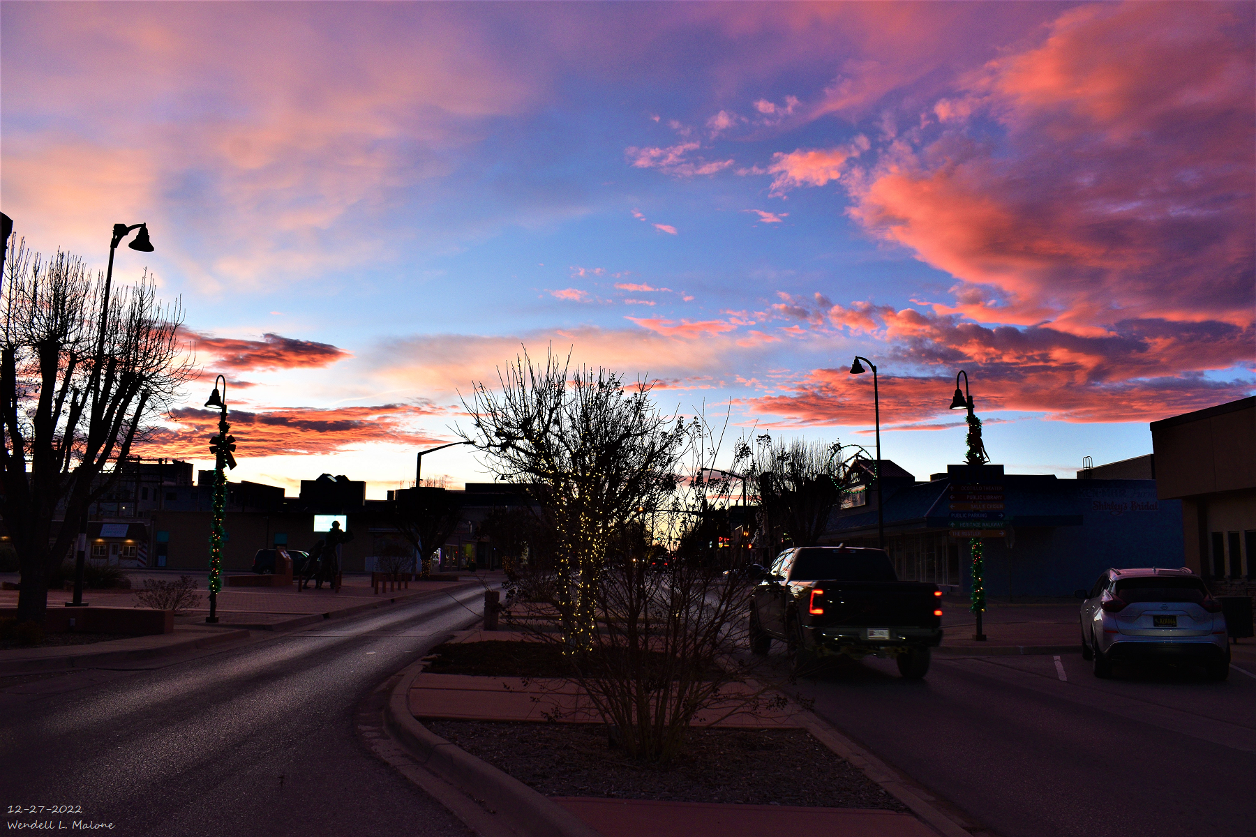
Artesia, New Mexico Sunset.
URGENT - WINTER WEATHER MESSAGE
National Weather Service El Paso Tx/Santa Teresa NM
256 AM MST Wed Dec 28 2022

NMZ415-282300-
/O.CON.KEPZ.WS.W.0004.221228T2100Z-221229T0900Z/
Sacramento Mountains Above 7500 Feet-
Including the cities of Cloudcroft, Sunspot, and Apache Summit
256 AM MST Wed Dec 28 2022

...WINTER STORM WARNING REMAINS IN EFFECT FROM 2 PM THIS
AFTERNOON TO 2 AM MST THURSDAY...

* WHAT...Heavy snow expected. Total snow accumulations of 6 to 10
  inches. Winds gusting as high as 60 to 70 mph.

* WHERE...Sacramento Mountains Above 7500 Feet.

* WHEN...From 2 PM this afternoon to 2 AM MST Thursday.

* IMPACTS...Travel could be very difficult. Areas of blowing snow
  could significantly reduce visibility. Very strong winds and
  heavy wet snow on trees and power lines could cause extensive
  tree damage and power outages. Heavy snow and drifting could
  close highways to traffic.

* ADDITIONAL DETAILS...Snowfall forecast 2 PM Wednesday through 2
  AM Thursday: Sierra Blanca Peak 10 to 12 inches, Cloudcroft and
  Sunspot 6 to 10 inches, Apache Summit 5 to 8 inches. Snowfall
  totals could be higher along ridge line and west/southwest
  facing slopes.

PRECAUTIONARY/PREPAREDNESS ACTIONS...

If you must travel, keep an extra flashlight, food, and water in
your vehicle in case of an emergency.

The latest road conditions for the state you are calling from can
be obtained by calling 5 1 1 or visit http://nmroads.com.
High Wind Warning For The Guadalupe Mountains.URGENT - WEATHER MESSAGE National Weather Service Midland/Odessa TX 229 AM CST Wed Dec 28 2022 NMZ027-TXZ270-271-282115- /O.CON.KMAF.HW.W.0051.000000T0000Z-221229T1000Z/ Guadalupe Mountains of Eddy County- Guadalupe Mountains Above 7000 Feet- Guadalupe and Delaware Mountains- Including the cities of Queen, Guadalupe Mountains NP, and Pine Springs 229 AM CST Wed Dec 28 2022 /129 AM MST Wed Dec 28 2022/ ...HIGH WIND WARNING REMAINS IN EFFECT UNTIL 4 AM CST /3 AM MST/ THURSDAY... * WHAT...West winds 45 to 65 mph with gusts up to 85 mph. * WHERE...Guadalupe and Delaware Mountains. * WHEN...Until 4 AM CST /3 AM MST/ Thursday. * IMPACTS...High winds could make driving difficult for motorists driving high profile vehicles such as campers, vans, and tractor trailers. Severe turbulence near the mountains will be hazardous for low flying light aircraft. PRECAUTIONARY/PREPAREDNESS ACTIONS... People should avoid being outside in forested areas and around trees and branches. If possible, remain in the lower levels of your home during the windstorm, and avoid windows. Use caution if you must drive.
High Wind Warning Northern Sacramento Mountains.URGENT - WEATHER MESSAGE
National Weather Service Albuquerque NM
216 AM MST Wed Dec 28 2022

NMZ226-240-281915-
/O.CON.KABQ.HW.W.0030.000000T0000Z-221229T0700Z/
South Central Mountains-Southwest Chaves County-
216 AM MST Wed Dec 28 2022

...HIGH WIND WARNING REMAINS IN EFFECT UNTIL MIDNIGHT MST TONIGHT...

* WHAT...Southwest winds 30 to 50 mph with gusts up to 70 mph.

* WHERE...South Central Mountains and Southwest Chaves County.

* WHEN...Until Midnight MST tonight.

* IMPACTS...Damaging winds will blow down trees and power lines.
  Widespread power outages are expected. Travel will be difficult,
  especially for high profile vehicles.

PRECAUTIONARY/PREPAREDNESS ACTIONS...

Take action to secure trash cans, lawn furniture, and other loose or
lightweight outdoor objects. Extremely hazardous driving conditions
can be expected, especially for motorists in high profile vehicles
who should consider delaying travel.High Wind Warning Southern Sacramento Mountains.URGENT - WEATHER MESSAGE
National Weather Service El Paso Tx/Santa Teresa NM
247 AM MST Wed Dec 28 2022

NMZ402-406-414>416-282300-
/O.CON.KEPZ.HW.W.0010.221228T1200Z-221229T0600Z/
Southern Gila Highlands/Black Range-Uplands of the Bootheel-
West Slopes Sacramento Mountains Below 7500 Feet-
Sacramento Mountains Above 7500 Feet-
East Slopes Sacramento Mountains Below 7500 Feet-
Including the cities of Silver City, Lake Roberts, Kingston,
Fort Bayard, Cloverdale, Mescalero, Timberon, Mountain Park,
Cloudcroft, Sunspot, Apache Summit, Mayhill, Pinon,
and Sacramento
247 AM MST Wed Dec 28 2022

...HIGH WIND WARNING REMAINS IN EFFECT UNTIL 11 PM MST THIS
EVENING...

* WHAT...West winds 30 to 45 mph with gusts of 60 to 70 mph
  expected.

* WHERE...Southern Gila Highlands/Black Range, the Uplands of the
  Bootheel, and the Sacramento Mountains.

* WHEN...From 5 AM to 11 PM MST Wednesday.

* IMPACTS...Damaging winds will blow down trees and power lines.
  Widespread power outages are possible. Travel will be
  difficult, especially for high profile vehicles.

* ADDITIONAL DETAILS...There is high confidence for very strong
  west to southwest winds in the higher terrain of the Gila
  Region, the New Mexico Bootheel, and the Sacramento Mountains
  Wednesday. The strongest winds will most likely be during
  Wednesday afternoon and evening. Wet snow will also be falling
  at elevations above 7000 ft during this time, potentially
  reducing visibilities and closing roads.

PRECAUTIONARY/PREPAREDNESS ACTIONS...

People should avoid being outside in forested areas and around
trees and branches. If possible, remain in the lower levels of
your home during the windstorm, and avoid windows. Use caution if
you must drive.Wind Advisory For Eddy/Lea/Culberson Counties.URGENT - WEATHER MESSAGE
National Weather Service Midland/Odessa TX
229 AM CST Wed Dec 28 2022

NMZ028-029-033-034-282115-
/O.EXT.KMAF.WI.Y.0026.221228T1800Z-221229T0400Z/
Eddy County Plains-Northern Lea County-Central Lea County-
Southern Lea County-
Including the cities of Artesia, Carlsbad, Carlsbad Caverns NP,
Tatum, Hobbs, Lovington, Eunice, and Jal
129 AM MST Wed Dec 28 2022

...WIND ADVISORY NOW IN EFFECT FROM 11 AM THIS MORNING TO 9 PM
MST THIS EVENING...

* WHAT...Southwest winds 25 to 35 mph with gusts up to 55 mph
  expected.

* WHERE...Southeast New Mexico Plains.

* WHEN...From 11 AM this morning to 9 PM MST this evening.

* IMPACTS...Gusty winds could blow around unsecured objects and
  tree limbs could be blown down.

PRECAUTIONARY/PREPAREDNESS ACTIONS...

Use extra caution when driving, especially if operating a high
profile vehicle. Secure outdoor objects.Wind Advisories For Southern New Mexico.URGENT - WEATHER MESSAGE
National Weather Service El Paso Tx/Santa Teresa NM
247 AM MST Wed Dec 28 2022

NMZ405-408-417-TXZ420-421-282300-
/O.CON.KEPZ.WI.Y.0031.221228T1600Z-221229T0600Z/
Lowlands of the Bootheel-Eastern Black Range Foothills-Otero Mesa-
Northern Hudspeth Highlands/Hueco Mountains-Salt Basin-
Including the cities of Antelope Wells, Animas, Hachita,
Hillsboro, Winston, Crow Flats, Hueco Tanks, Loma Linda,
Cornudas, Dell City, and Salt Flat
247 AM MST Wed Dec 28 2022

...WIND ADVISORY REMAINS IN EFFECT FROM 9 AM THIS MORNING TO
11 PM MST THIS EVENING...

* WHAT...West winds 25 to 35 mph with gusts up to 50 mph
  expected.

* WHERE...In New Mexico, Lowlands of the Bootheel, Eastern Black
  Range Foothills and Otero Mesa. In Texas, Northern Hudspeth
  Highlands/Hueco Mountains and Salt Basin Counties.

* WHEN...From 9 AM to 11 PM MST Wednesday.

* IMPACTS...Gusty winds could blow around unsecured objects. Tree
  limbs could be blown down and a few power outages may result.
  Local blowing dust and brief poor visibilities also possible.

* ADDITIONAL DETAILS...The strongest westerly winds will be seen
  Wednesday afternoon and late evening. Winds will be strongest
  along east slopes of higher terrain.

PRECAUTIONARY/PREPAREDNESS ACTIONS...

Use extra caution when driving, especially if operating a high
profile vehicle. Secure outdoor objects.
Reported Peak Wind Gusts.
(Yesterday Afternoon - 6 AM MST This Morning).
Pine Springs Mesonet Station in the Guadalupe Mtn's Natl Park 95 MPH at 2:41 AM MST.
The Bowl Raws Just North of Guadalupe Peak 87 MPH at 2:37 PM MST.
Guadalupe Pass ASOS 84 MPH at 11:51 AM MST.
Angel Fire Airport ASOS 79 MPH at 8:15 PM MST.
Buck Mountain PWS Near Ski Apache 68 MPH.
Las Vegas Airport ASOS 64 MPH at 10:53 PM MST.
3 Cross PWS Northeast of Elk 54 MPH at 2:00 AM MST.
Queen Raws 53 MPH at 4:13 AM MST.
Dunken Raws 51 MPH at 1:36 AM MST.
There Are None So Blind As Those Who "Will - Not" To See...107.


Comments
Post a Comment
Your comments, questions, and feedback on this post/web page are welcome.