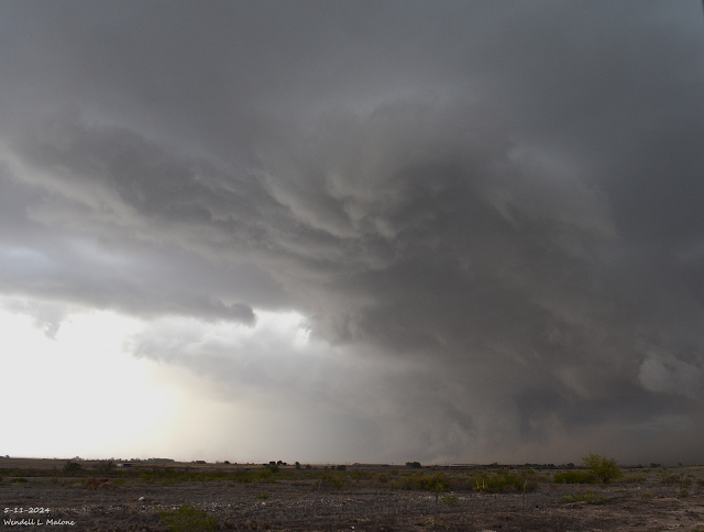
Southern Chaves County Supercell Chase - May 11, 2024.
(5:31 PM MDT, Saturday, May 11, 2024.
Base Reflectivity (BR).
Storm Relative Velocity (SRV).
Normalized Rotation (NORT).
Correlation Coefficient (CC).
Cross Section View.
(Saturday, May 11, 2024).
Southern Chaves County Supercell Chase.
A supercell thunderstorm developed southwest of Roswell, New Mexico in southern Chaves County on Saturday afternoon, May 11, 2024. This storm initially was moving off to the northeast then like so many of its predecessors began to make that famous right turn to the east and then east-southeast with time. Thus a right mover.
A couple of public reports of golf ball-sized hail were received and radar indicated that the hail may have been bigger at times. A three-body scatter strike signature (TBSS) was noted in the base reflectively of the storm which is indicative of very large hail. This happens when the radar beam is reflected off of the hail in the storm and downward onto the ground.
Rotation was noted with this storm. I watched a couple of rotating wall clouds develop and dissipate. I pulled a couple of still image captures from off of my GoPro HERO11 Black camera mounted on the dash of our truck. The resolution and clarity of the images aren't all that great since I was about 11 miles southwest of the storm at the time. Did I see a tube-shaped funnel cloud? You can't really tell in my video upload (time-lapse video). A public report of a funnel cloud was received west of Lake Arthur.
I didn't pull over and shoot photos of the storm at that time. I was distracted on the phone with my mother and stepdad who were coming up to the intersection of St. Hwy 13 and U.S. Hwy 285 south of Roswell. They were in very heavy rain and pea-sized hail headed south. I had them pull over at the intersection of these two highways and wait the storm out. I didn't want them driving further south into the core of the storm.
Anyway, this one turned into another dusty storm east of Lake Arthur as it turned to the east-southeast. Naturally, YouTube would destroy the quality and resolution of my video when I uploaded it. Never fails.
See my flash flooding blog post from this storm via this link:
There Are None So Blind As Those Who "Will - Not" To See...107.


Comments
Post a Comment
Your comments, questions, and feedback on this post/web page are welcome.